
FFH area coastal areas of the Flensburg Fjord from Flensburg to Geltinger Birk
The FFH area coastal areas of the Flensburg Fjord from Flensburg to Geltinger Birk is a NATURA 2000 protected area in Schleswig-Holstein and the northernmost part of the "Schleswig-Holstein Baltic Sea Coast landscape", which is classified as "worthy of protection" according to the landscape profile of the Federal Agency for Nature Conservation Landscape with deficits ”counts. One sub-area is the surface of the Baltic Sea . Part of the water area in front of the Geltinger Bay and the Geltinger Birk overlaps with the European project "Baltic Sea Protected Area ( HELCOM )". The agency, based in Helsinki, reports to the UN environmental database ( UNEP ). It is a cross-border project with the Kingdom of Denmark and consists of 14 protected areas. In this article reference is only made to the German part.
|
FFH area coastal areas of the Flensburg Fjord from Flensburg to Geltinger Birk
|
||
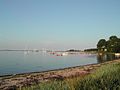
.jpg) Little Noor on the Holnis peninsula |
||
| location | Flensburg and Schleswig-Flensburg district , Schleswig-Holstein , Germany, coastline from Flensburg to Gelting | |
| surface | 10,958 ha | |
| Identifier | 1123-393 | |
| WDPA ID | 555543236 | |
| Natura 2000 ID | DE1123393 | |
| FFH area | 10,958 ha | |
| Geographical location | 54 ° 49 ' N , 9 ° 47' E | |
|
||
| Sea level | from 0 m to 52 m | |
| Setup date | 2008 | |
| administration | LLUR | |
| Legal basis | Section 32 Paragraphs 2 to 4 BNatSchG in conjunction with Section 23 LNatSchG | |

FFH conservation object
The size of the FFH area of a good 10 km² with a max. Extension of 34 km results in a variety of preservation items. 30 “habitat types of particular importance” are listed, 7 of which are priority habitat types (LRT). There are also 4 types of "special importance". The list is completed by 2 “habitat types of importance” and 1 “type of importance”. From a geological point of view, the Flensburg Fjord is a young landscape. It only got its present form 6500 years ago with the end of the Littoria Transgression , during which the previously dry fjord filled with water due to the rise of the Baltic Sea.
FFH conservation objectives
The aim is to preserve and, if necessary, restore the objects of preservation mentioned above. For the entire area, these are set out in the Official Gazette for Schleswig-Holstein, issue no. 39/40 Kiel, October 2, 2006.
Overarching goal
Preservation of the defining habitats from the coast to the water.
FFH objectives for habitat types and species of particular importance
The habitat type 1230 "Atlantic rocky coasts and Baltic Sea rocky and cliff coasts with vegetation" is an example:
Preservation and, if necessary, renewal
- the dynamics of the cliffs and cliffs with the formations characteristic of the habitat,
- of the areas above and below the cliffs to ensure natural soil erosion,
- the most natural deposit dynamics possible, flow formation on the banks of the cliffs,
- of the formations characteristic of this habitat.
This is done in the same way for all other FFH conservation objects.
FFH management plans for the sub-areas
In an FFH management plan, measures for the maintenance and development of the FFH conservation objectives are defined. In view of the size and diversity of the FFH area described, this is done at the sub-area level. The sub-areas are dealt with individually from west to east.
"Kluesries" sub-area
The “Kluesries sub-area” is located on the northern edge of the city of Flensburg in the Klues district and includes the eastern edge of the Kluesries forest (also known as the Klueser Wald) and the fjord bank of the Ostseebad . (Card 153-1123-393p). The scope of the management plan only refers to the beach section between the pier at Ostseebad and the marina Wassersleben .
Territory characteristics
The sub-area "Kluesries" is about 280 hectares, with the largest part consisting of water. On the land side, the forested area predominates, 11.2% is owned by the State of Schleswig-Holstein. The landside sub-area dealt with in this plan with a size of 14.8 hectares of land is the property of the City of Flensburg.
Area description and scope
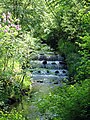
As a habitat type, the area mostly consists of woodruff beech forest with red beech, ash and sycamore maple . The ground is covered with woodruff , lesser celandine and common witchweed . Forest fescue, ivy and wood anemone can be found in some places . As a flowing water, the Moorbach crosses the southern area. A stretch of beach with a promenade and a green area begins north of the forest-covered cliff.
Protection status
The FFH area is subject to the prohibition of deterioration in accordance with Section 33 (1) BNatSchG. Within the FFH area there are legally protected biotopes in the form of spring areas and natural and near-natural streams. Actions that can lead to the destruction or other significant impairment of these legally protected biotopes are prohibited (Section 30 (2) sentence 1 BNatSchG in conjunction with Section 21 LNatSchG). V. m. According to Section 35 of the LNatSchG, there is a 150 m wide protective strip along the coastline inland, in which no structures may be erected or significantly changed. The sub-area is located in the landscape protection area of the city of Flensburg - part of the landscape "Kluesrieser Gehölz mit Fördeufer Wassersleben-Ostseebad" (ordinance of March 14, 2001) and lies in the focus area of the state-wide biotope network system No. 529 "Forests north of Flensburg (Kluesries, Riesholz)" (landscape framework plan As of January 2020).
FFH conservation object
Three FFH habitat types have been found in the area:
- 1220 Perennial vegetation on the pebble beaches
- 9130 Woodruff beech forests
- 2119 primary dunes
All FHH habitat types have an unfavorable conservation status. There are no animal species according to Annex II and IV Habitats Directive.
FFH conservation goal
All three of the above-mentioned FFH conservation objects have been adopted as FFH conservation objectives:
9130 Woodruff beech forest
The management plan describes 7 goals for the preservation of the habitat "Waldmeister-Buchenwald".
1220 Perennial vegetation on the pebble beaches
The management plan describes 6 goals for the preservation of the habitat “Perennial vegetation of the pebble beaches”.
2119 primary dunes
The management plan describes 5 goals for the preservation of the habitat “primary dunes”.
Measures to achieve the conservation and development goals
The measures are recorded in an action plan and an action map and constantly updated. The priority here is to maintain the current status despite the high level of recreational use, to combat invasive species and, in the long term, to replace the remaining conifers with deciduous trees.
Responsibilities
Competence and responsibility lie with the Technical Operations Center (TBZ) of the City of Flensburg and the Federal Waterway Administration. The responsible nature conservation authority is the Lower Nature Conservation Authority Flensburg.
Picture gallery

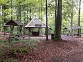
Forest house Kluesries
Wasserleben recreational forest near Kluesries
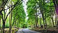
The Apenrader Straße leads through the Kluesries in Flensburg.

Beach at the Ostseebad, Flensburg
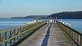
Pier at the Ostseebad, Flensburg

Black-headed gulls on the pier in the Baltic Sea resort, Flensburg


.jpg)
.jpg)
.jpg)
Sub-area NSG Twedter Feld
The Twedter Feld nature reserve has an area of 90 hectares. It is located entirely within the Flensburg city area
Territory characteristics
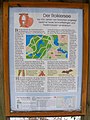
A good 50% of the area consists of forest with beech, English oak, maple, alder and birch. The other half consists mainly of grassland, hedgerows and small stagnant bodies of water. The area is accessible by footpaths, riding trails and bike paths. There are information boards at the 10 entrances and within the area, as well as dispensers for the “Twedter Feld” leaflet from the visitor information system (BIS) of the State Office for Agriculture, Environment and Rural Areas (LLUR) of Schleswig-Holstein.
Influences and uses
The NSG Twedter Feld was a restricted military area until the 1990s. Now it is used as a recreational area for the Flensburg population.
Protection status
Like all FFH areas in Germany, the FFH area “coastal areas of the Flensburg Fjord from Flensburg to Geltinger Birk” is subject to the prohibition of deterioration in accordance with Section 33 (1) BNatSchG (see section 1.1). The sub-area dealt with in this plan is congruent with the boundaries of the NSG "Twedter Feld". According to § 23 BNatSchG, " all actions that lead to the destruction, damage or modification of the nature reserve or its components or to a lasting disruption are prohibited in accordance with more detailed provisions ". Some biotope types in the sub-area are subject to the statutory biotope protection according to § 30 BNatSchG i. V. m. Section 21 LNatSchG. The natural waters are subject to statutory biotope protection in accordance with Section 30, Paragraph 2, No. 1 of the BNatSchG. Wet grassland and moors are protected by law in accordance with Section 30 (2) No. 2 BNatSchG. The alder and birch quarries on the banks of the waters are protected according to Paragraph 2, No. 4 BNatSchG. Existing heathland is protected in accordance with Section 30 (2) No. 3 BNatSchG. The kinks typical for the fishing landscape are protected according to § 21 LNatSchG.
FFH conservation object
In the field there are:
- 9 FFH habitat types according to Annex I of the Habitats Directive
- 1 FFH species according to Annex II and IV of the FFH Directive
as "other species and biotopes" within the meaning of the guideline were found:
- 4 species of amphibian (including frogs and snakes)
- 1 butterfly
- 69 plants
FFH conservation objectives
In the management plan, conservation goals for the FFH area are set for 10 habitat types.
Analysis, evaluation and action
Each of these goals was analyzed and evaluated in detail and a separate catalog of measures was drawn up. For the sake of clarity and as a working paper, an action sheet was created for each of the 18 individual measures and recorded in an action map.
- Measure sheet no. 6.2.1: Care and development of heather and bristle grass lawns
- Measure sheet no. 6.2.2: Maintenance of transitional and swinging lawn bogs by mowing or grazing
- Measure sheet no. 6.2.3: Maintaining the non-use of forest stands
- Measure sheet no. 6.2.4: Cutting back trees
- Measure sheet No. 6.2.5: No lowering of water levels
- Measures sheet no. 6.2.6: Strips of the waters edge
- Measure sheet no. 6.3.1: Review of the crested newt occurrence
- Measures sheet no. 6.3.2: Creation of buffer zones for transitional and vibrating turf bogs
- Measure sheet no. 6.3.3: Maintaining extensive use of grassland
- Action sheet no. 6.3.4: Restoring a natural water regime
- Measures sheet no. 6.3.5: Optimization / rehabilitation of existing bodies of water / water system
- Measures sheet no. 6.3.6: Curling of softwood
- Measures sheet no. 6.3.7: River renaturation
- Measure sheet no. 6.3.8: Extensification of grassland use
- Measures sheet no. 6.4.1: Setting up information boards
- Measure sheet no. 6.4.2: Creation of a quiet forest zone
- Measure sheet no. 6.4.3: Cat and dog safe fences
- Measures sheet no. 6.4.4: Making the weir passable
Picture gallery

NSG "Twedter Feld"; River Mühlenbek
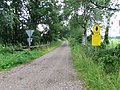
NSG "Twedter Feld"; Parking lot entrance at B199 in Weesries

NSG "Twedter Feld"; Sheep as nature conservationists

FFH sub-area Twedter Feld: natural meadow with small bodies of water
.jpg)
,_Bild_01.JPG)
.jpg)
.jpg)
"Holnis" sub-area
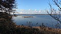
The Holnis sub-area has a size of 187 hectares and is located in the municipality of Glücksburg . The Holnis is a peninsula and divides the Flensburg Fjord into an inner and outer fjord. The northern tip is the northernmost point of the German mainland on the Baltic Sea.
Territory characteristics
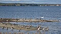
The area consists of extensively used grassland in the south with the drained Great Noor. To the north is the rewetted Little Noor, which has become an important resting area for 130 species of migratory birds. The northern tip contains a bird sanctuary on a spit hook in the northwest. The rest is characterized by cliffs , beach lakes, beach walls and salt marshes. The latter are extensively grazed all year round by robust cattle breeds. The Naturschutzbund maintains an almost permanently manned hut for bird counting near the Kleiner Noor. A large number of archaeological finds have proven early settlement in the area.
FFH conservation object
For the FFH area, 7 habitat types were named in accordance with the IFFH directive as well as one FFH species in accordance with Annex II and IV FFH directive. In addition, in the management plan under the heading "Other species and biotopes" there are 4 non-endangered breeding bird species, 30 plant species with different endangerment status, as well as 12 biotopes, which according to §30 BNatSchG i. V. m. Enjoy protection according to §21 LNatSchG.
FFH conservation objectives
7 conservation objectives for FHH habitat types of community interest and one FHH species of community interest have been set in the management plan.
Analysis and evaluation
Habitat type "lagoons of the coastal area (beach lakes)"
In the management plan, the Great Noor has been certified as "C" (medium to bad). Due to the constant drainage of this area, it is of no interest to sea birds. The Little Noor is also given the conservation status "C" (medium to poor expression), as the bank vegetation has not yet developed typical of a beach lake. A natural spit hook has formed in the bird sanctuary in the northwest of the peninsula. A beach lake will develop in this area in the future. Therefore, this area was given the conservation status "B" (good expression). There is a lagoon between Holnis Kliff and the Spit Hook, which is flooded when the water is high. This is rated with the conservation status “B” (good value) because it has developed into an important breeding and resting area for waders and water birds.
Habitat type "Annual flushing lines"
In the management plan, the flushing lines in publicly accessible areas are only given a bad status "C". Only the closed beach sections, especially in the bird sanctuary, are rated as good “B”.
Habitat type "Perennial vegetation on pebble beaches"
The predominantly natural beach areas with gravel, scree and sand substrates are in a favorable state of preservation, especially in the closed and unaffected sections.
Habitat type "Baltic Sea rocks and cliffs with vegetation"
The cliffs of the Holnis peninsula in the northern part of the sub-area are mostly in a good or favorable state of preservation.
Habitat type "Pioneer vegetation with Salicornia and other annual species on mud and sand (Quellerwatt)"
In the bird sanctuary, a Quellerwatt has built up naturally and is in a good state of conservation.
Habitat type "Atlantic salt marshes"
Salt marshes have developed in several places in the area that are flooded during floods.
Habitat type "Natural eutrophic lakes with magnopotamion or hydrocharition vegetation"
To the north-east of “Holnishof” and south of the “Zur Salzwiese” road there is a small eutrophic still water without tributaries in a depression, which was rated as “C”. The outflow leads over a ditch into the Kleine Noor.
Type of community interest "crested newt"
n / a
Legally protected biotopes
n / a
Catalog of measures
The catalog of measures for the Holnis sub-area lists 25 measures to achieve the conservation objectives. These are listed in action sheets for each conservation goal. The spatial allocation of the measures is recorded on a map. One measure is to put additional areas under protection by exchanging or buying them. The ownership structure on the peninsula is important for this. Most of the land is owned by the City of Glücksburg.
Success control and monitoring of the measures
Monitoring takes place in Schleswig-Holstein every 6 years.
Picture gallery

NSG "Holnis"; Holnis cliff

NSG "Holnis Kliff"; Cliff

NSG "Holnis"; Little noor

Large Holnisser Noor around 1910
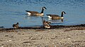
Canada geese and wigeons on the spit hook in front of the Schausende pumping station

Bay with spit hooks east of Schausende
Gray geese on spit hooks east of the show end
Spit hook east of Schausende
.jpg)


.jpg)
.jpg)
.jpg)
.jpg)
"Langballigautal" sub-area
Territory characteristics
The sub-area "Langballigautal" lies between the sub-area " Höftland Bockholmwik and adjacent cliffs " in the west and the sub-area " Dollerup " in the east. However, they are not directly adjacent to one another on the land side. Its limits correspond to the nature reserve " Tal der Langballigau ". The sub-area consists of three individual areas. The southernmost is the valley of the upper Langballigau beginning on the Auweg in Terkelstoft and ending at the Buttermühle in Unewatt . After approx. 100 m the largest single area begins in the continuation of the Langballigau. On their way to the Baltic Sea, the Schulau and the Schiebek flow into their course. The largest single area ends at the K97 district road. The third individual area between the campsites in Langballigau and Westerholz finally begins north of the district road and ends at the beach. The Munkbrarupau has a water catchment area of 34 km² and is one of the larger rivers of the Schlei / Trave river basin district. On its lower reaches, it is a barrier-free flowing water for migratory fish and is classified there as a “natural flowing water” according to the assessment according to the Water Framework Directive.
Conservation item
The area contains 10 FFH habitat types in accordance with Annex I FFH Directive, 4 FFH species in accordance with Annex II and IV FFH Directive, 4 bird species in accordance with Annex I and Art. 4 (2) Bird Protection Directive, 6 more in the FFH sub-area " Fauna species occurring in Langballigautal ", 14 other flora species occurring in the FFH sub-area" Langballigautal ":
Conservation goals
10 FFH habitat types and 4 FFH types of community interest were defined as conservation objectives.
Analysis and evaluation
The management plan contains an extensive analysis and assessment of the sub-area.
Catalog of measures
The action catalog for the sub-area is documented in 51 action sheets and an overview map.
Success control and monitoring of the measures
In Schleswig-Holstein, monitoring is carried out every 6 years.
Picture gallery

NSG "Langballigau"; The river flows into the Baltic Sea
NSG "Langballigau"; Langballigau valley

NSG "Langballigau"; Meandering meadows in the reed


Sub-area "Höftland Bockholmwik and adjacent cliffs"
Territory characteristics
The sub-area "Höftland Bockholmwik and the adjacent cliffs" is divided into two parts by a campsite. The western part consists of wooded cliffs, the eastern part of the Höftland with beach ridges and moist grassland, which then also merges into a wooded cliff that ends in Langballigau.
Conservation item
13 FFH habitat types according to Annex I FFH Directive and 2 FFH species according to Annex II and IV FFH Directive as well as 27 other species and biotopes have been specified as objects of conservation. Map 2 in the appendix to the management plan shows 12 FFH habitat types and 26 other species and biotopes. The habitat types mentioned in the text of the management plan Code 1110 "Sandbanks with only weak permanent overflow by sea water" and Code 1160 "Flat large inlets and bays (shallow water zones and sea grass meadows)" are missing in map 2. The management plan contains for the two FFH species according to Annex II and IV Habitats Directive "tree frog" and "crested newch" neither information about the population size nor about its conservation status.
Conservation goals
For the sub-area “Höftland Bockholmwik and adjacent cliffs”, 10 conservation objectives for FFH habitat types and 2 FFH types of community interest were defined .
Analysis and evaluation
The management plan contains an extensive analysis and assessment of the sub-area.
Catalog of measures
A catalog of measures was developed from the analysis and evaluation of the conservation objectives.
Success control and monitoring of the measures
Monitoring takes place in Schleswig-Holstein every 6 years.
Picture gallery
NSG "Höftland Bockholmwik"; Bockholmwik Bay

Sub-area "Habernisser Au and Stürsholz and surroundings"
Territory characteristics
The Habernisser Au sub-area consists of a small wooded area with beech trees surrounded by marshy terrain with ash trees, the Stürsholz and the Auental of the Habernisser Au, which flows from the south through salt marshes into the Baltic Sea. The Habernisser Au is a flowing body of water in the Schlei / Trave river basin district and, according to the assessment in accordance with the Water Framework Directive, is considered a "heavily modified waterbody (HMWB)".
Conservation item
9 FFH habitat types in accordance with Annex I of the Habitats Directive and 1 FFH species in accordance with Annex II and IV of the Habitats Directive as well as 4 other species and biotopes have been defined as objects of conservation. The management plan for one of the Habitats in accordance with Annex II and IV Habitats Directive “Crested Newt” contains neither information on the size of the population nor on its conservation status.
Conservation goals
For the sub-area “Habernisser Au and Stürsholz and the surrounding area”, 8 FFH habitat types and 2 FFH types of community interest were defined as conservation goals.
Analysis and evaluation
The management plan contains an extensive analysis and assessment of the sub-area
Catalog of measures
A catalog of measures was developed from the analysis and evaluation of the conservation objectives, in which measures carried out so far, necessary conservation measures and further development measures are dealt with. In addition, each measure is systematically recorded in 10 measure sheets.
Success control and monitoring of the measures
Monitoring takes place in Schleswig-Holstein every 6 years.
Picture gallery
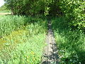
NSG "Habernisser Au and Surroundings"; Boardwalk in the Habernisser Moor

NSG "Habernisser Au and Surroundings"; Habernisser Lowlands


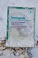
Sub-area "Gräverdiek-Hunhoi"
Territory characteristics and nature conservation environment
.jpg)
The FFH sub-area has an area of 18 ha and extends along the Geltinger Bucht in the municipality of Niesgrau between the districts of Gräverdiek in the west and Gelting Mole in the east over a length of approx. 750 m. Towards the south it quickly narrows to a narrow strip of banks to the right and left of the Hunau until just before the B199. The scope of the management plan extends beyond the FFH sub-area to the underpass of the Hunau under the B199. In front of the dike, the beach and the mouth of the Hunau are part of it. According to §61 BNatSchG i. V. m. According to Section 35 of the LNatSchG, there is a protective strip at least 150 m wide along the entire coastline. On the top of the dike there is a water-bound footpath and cycle path that is part of the Baltic Sea cycle path . The 7.5 hectare grassland strip south of the coastal dike between Gräverdiek and the Hunau belongs to the Schleswig-Holstein Nature Conservation Foundation . The FFH sub-area lies entirely in a main axis of the state-wide biotope network and in the landscape protection area No. 59-SL-13 Flensburg Fjord . The management note for the FFH sub-area was created on June 8, 2018 by the integrated station Geltinger Birk.
Conservation item
The sole subject of conservation of the sub-area is the FHH habitat type 1220 “Perennial vegetation on gravel beaches” of particular importance in the sense of Annex I of the Habitats Directive.
Conservation goals
The sole conservation goal is the conservation of the FHH habitat type of perennial vegetation on the pebble beaches
Analysis and evaluation
According to the FFH habitat type mapping (LRT) from 2008, the beach area is in an unfavorable state of conservation.
Catalog of measures
The necessary maintenance measures are recorded in a catalog of measures.
Success control and monitoring of the measures
The management plan for this sub-area does not make any statements on monitoring.
Picture gallery

The Hunau flows into the Baltic Sea

The Hunau flows into the Baltic Sea
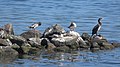
Goosander and a cormorant taking care of their plumage at the mouth of the Hunau in the Baltic Sea
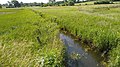
The Hunau shortly before it flows into the Baltic Sea
.jpg)
.jpg)
.jpg)
.jpg)
"Geltinger Birk" sub-area
Territory characteristics
The FFH area stretches from the Nordschauwald in the southeast over the Geltinger Noor to the lagoon at the Toten Kliff to the Birk-Nack in the far north, to the east along the coast to the state protection dike with a swing to the west over Nieby Maas, past Nieby-Westerfeld with pan to the south to Basrotter Graben along the Geltinger Noor back to the Nordschauwald. The area essentially corresponds to the boundaries of the “Geltinger Birk” nature reserve. Maps from the end of the 18th century show that the birch was once surrounded by water on three sides. The former Noor south of the Birk was separated from the sea by a dam in the 19th century and drained by a wind-powered pumping station. As part of the renaturation of the Birk in 2014, part of the former Noor was rewetted.
Conservation item
In the "Geltinger Birk" sub-area, 15 FFH habitat types were identified in accordance with Annex I of the Habitats Directive and 4 FFH species in accordance with Annex II and IV of the Habitats Directive, 18 bird species in accordance with Annex I and Art. 4 (2) of the Birds Directive, 46 Relevant breeding bird species with information on breeding success in 2017, 7 plant species threatened with extinction, 10 highly endangered plant species, 18 endangered plant species and 2 plant species from the pre-selection list. 27 species of butterflies were sighted between 2005 and 2014. 26 dragonfly species were counted between 2006 and 2014. In the sub-area 10 come according to § 30 Abs. 2 BNatSchG i. V. m. § 21 Abs. 1 LNatschG provides legally protected biotopes.
Conservation goals
From the conservation objectives for the entire area, general objectives apply to 8 FFH habitat types and species for the “Geltinger Birk” sub-area. Objectives of particular importance according to Annex I of the Habitats Directive are 15 FFH habitat types and 2 FFH species in accordance with Annex II and IV of the Habitats Directive. An objective of importance according to Annex I of the Habitats Directive is a Habitat Type.
Analysis and evaluation
Every conservation goal has been subjected to an in-depth analysis and evaluation.
Catalog of measures
33 individual measures were specified in the management plan for the 15 FFH habitat types and FHH species.
Success control and monitoring of the measures
Monitoring takes place in Schleswig-Holstein every 6 years
Picture gallery

NSG "Geltinger Birk"; Cormorant colony

NSG "Geltinger Birk"; Big Noor
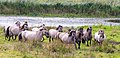
NSG "Geltinger Birk"; Koniks in the Great Noor

NSG "Geltinger Birk"; Mill Charlotte at the Geltinger Noor


Sub-area "Dollerup"
Territory characteristics
The “Dollerup” sub-area comprises an approx. 150 m wide and 3.7 km long coastline made of gravel and rubble on the Flensburg Fjord between the “Zu den Lücken” road in Westerholz in the west and the “Mühlendamm” road in Mühlendamm in the east. The coast consists almost entirely of up to 37 m high cliffs, which are interrupted by three valley cuts with landslides. 21 biotope types were found and mapped in the FFH sub-area.
Conservation item
In the "Dollerup" sub-area, 5 FFH habitat types were found in accordance with Annex I of the Habitats Directive, 4 are good and one is medium to bad. A FFH species according to Annex II and IV FFH Directive has been identified. One species of bird, 9 plants, 6 amphibians and reptiles and 7 protected biotopes were found in other species and biotopes.
Conservation goals
5 FHH habitat types and one FFH type of community interest are defined as conservation objectives for the “Dollerup” sub-area.
Analysis and evaluation
The sub-area was analyzed and assessed in detail.
Catalog of measures
The analysis and evaluation was followed by a comprehensive catalog of measures with a map overview. and was documented in 13 action sheets. The implementation of the measures turns out to be difficult, as almost the entire FFH sub-area is privately owned and the consent of the owner must be obtained.
Success control and monitoring of the measures
Monitoring takes place in Schleswig-Holstein every 6 years.
Picture gallery

Westerholz, Schleswig-Flensburg district in SH

Sub-area "Schleswig-Holsteinische Landesforsten A.ö.R."
Territory characteristics
The proportion of Schleswig-Holstein state forests in the FHH area is 6.1% and consists of 4 locally separated sub-areas:
Section 1, Kluesries (31.6 ha)
Section 2, Süderholz and Tremmerup (307.4 ha)
In the woods of Süderholz and Tremmerup you will find the Roikier See and the Westerwerk See.
Part 3, Friedeholz enclosure and Pugumer See NSG (262.1ha)
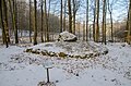
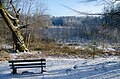
The Friedeholz enclosure houses 10 burial mounds from the Neolithic to the Bronze Age. A well-developed hiking trail leads past the hills, see picture gallery below.
Section 4, Horstkoppel near Dollerup (74 ha)
With around 181 ha, of which around 150 ha with 26 individual plots from 0.38 to 75.85 ha in size within the FFH area, the Glücksburg Forestry Department has a relatively high proportion of natural forest, which is used as a reference area for certification according to the Forest Stewardship Council ( FSC) is no longer managed on a voluntary basis.
Conservation item
In the sub-area "Schleswig-Holsteinische Landesforsten" 10 FFH habitat types according to Annex I FFH Directive, one FFH type according to Annex II and IV FFH Directive were sighted.
Conservation goals
Habitat types and species named under "Conservation subject" are considered as habitat goals.
Analysis and evaluation
The sub-area was analyzed and assessed in detail.
Catalog of measures
The analysis and evaluation was followed by a comprehensive catalog of measures. The measures are recorded in maps for sub-area 2, Süderholz and Tremmerup, sub-area 3, enclosure Friedeholz and NSG Pugumer See, as well as sub-area 4, Horstkoppel near Dollerup.
Success control and monitoring of the measures
Monitoring takes place in Schleswig-Holstein every 6 years.
Picture gallery section 2 Süderholz and Tremmerup
Information board at the Roikier lake in Tremmerup forest

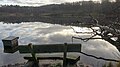
Roikier lake in winter

At the Roikier lake in the Tremmerup forest

At the Roikier lake in the Tremmerup forest
At the overflow shaft on Lake Roikier in the Tremmerup forest
Drainage of the Roikier lake into the Tremmerup forest

Fungi on dead wood in the southern wood

Mushrooms in the southern wood

Mushrooms in the southern wood
.jpg)
.jpg)
.jpg)
.jpg)
.jpg)
.jpg)
.jpg)
.jpg)
.jpg)
Picture gallery section 3 Friedeholz enclosure and NSG Pugumer See

Glücksburg archaeological hiking trail

Glücksburg archaeological hiking trail

Sign to the Stone Age burial mound

Stone age burial mound

Sign for the Bronze Age burial mound

Bronze Age burial mound
Note on Urdolmen in round hill no.4
Urdolmen in round hill no.4
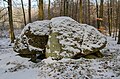
Urdolmen No. 4

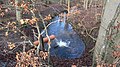
At the transition moor Elfenwiese in Friedeholz
At the transition moor Elfenwiese in Friedeholz

At the transition moor Elfenwiese in Friedeholz

Name stone at the transition moor Elfenwiese in Friedeholz
.jpg)
.jpg)
.jpg)
.jpg)
.jpg)
.jpg)
.jpg)
.jpg)
.jpg)
.jpg)
.jpg)
.jpg)
.jpg)
"Baltic Sea" sub-area
The management plan of the Ministry for Energy Turnaround, Agriculture, Environment and Rural Areas of the State of Schleswig-Holstein contains the partial management plans for the Baltic Sea areas of the Fauna-Flora-Habitat area "DE-1123-393 coastal areas of the Flensburg Fjord from Flensburg to Geltinger Birk" and for the Baltic Sea areas of the European bird sanctuary "DE 1123-491 Flensburg Fjord". In the following only the aspects of the FFH area DE-1123-393 of the sub-area "Baltic Sea" will be dealt with. The partial management plan relates exclusively to the water surface in the Baltic Sea.
Territory characteristics
The FFH sub-area "Baltic Sea" covers an area of 9052 ha. A large number of national and international ordinances, regulations and laws apply.
Conservation item
For the FFH sub-area "Baltic Sea", the following 4 relevant habitat types have been determined in accordance with Annex I of the FFH Directive.
The Institute for Geosciences at the Christian-Albrecht-Universität Kiel started mapping the FHH sub-area "Baltic Sea" in 2014 with high resolution and area-wide mapping. According to this, 611.7 ha of habitat type 1110 “sandbanks with only weak permanent flooding by seawater” and 418.4 ha of habitat type 1170 “reefs” were determined. Both are good to excellent representative of the sub-area and in a good to very good state of preservation.
For the “Baltic Sea” sub-area, the harbor porpoise was identified as a relevant FFH species in accordance with Annex II and IV FFH Directive.
For the German Baltic Sea as a whole, the initial assessment according to the MSFD comes to the conclusion that u. a. the harbor porpoise is not in a good environmental condition and refers to the poor condition of the harbor porpoise according to the current HELCOM assessment and the unfavorable-poor condition as per the FFH-RL assessment. The harbor porpoise is also classified as endangered in the current national “Red List”.
Conservation goals
For the scope of the sub-plan for the FFH area, the overarching objectives include, in particular, the "preservation of representative coastal habitats with largely natural coastal dynamics including the open water areas of the fjord as well as transitions from land to aquatic habitats" and the description of the corresponding habitat types and species from the individual objectives significant.
Analysis and evaluation
The analysis and evaluation is available in tabular form.
Catalog of measures
See table 9.1 of the MP under column "Measures" and MP "6.2. Necessary protection and conservation measures ".
Success control and monitoring of the measures
Monitoring takes place in Schleswig-Holstein every 6 years.
Web links
- Species and habitat protection in Natura 2000 state forests, September 2009 , Schleswig-Holstein State Forests
- Reading instructions for standard data sheets for the transmission of information on Natura 2000 areas (2011/484 / EU) (PDF; 588 KB), State Office for Agriculture, Environment and Rural Areas of Schleswig-Holstein
- Habitat types and species (protected objects) of the Habitats and Birds Protection Directive , Federal Agency for Nature Conservation, October 24, 2019 (HTML)
- Leaflet B-5908 "Driving ban and exclusion zone in the Geltinger Birk nature reserve", April 2017
- Leaflet B-59155 Driving ban and exclusion zone in the nature reserve "Peninsula Holnis", April 2017
- Leaflet “Natural Forest in Schleswig-Holstein”, February 2016
- Leaflet 01 186 "Twedter Feld" FFH DE-1123-393, December 2015
- Leaflet 59-8 "Geltinger Birk", December 2015
- Leaflet 59-137 "Langballigau Valley", July 2017
Individual evidence
- ↑ landscape profile 70101 Schleswig-Holstein Baltic Coast. Federal Agency for Nature Conservation, March 1, 2012, accessed on July 9, 2020 .
- ↑ Natural assessment of the landscapes in Germany. (PDF; 1.51 MB) Federal Agency for Nature Conservation, November 2011, accessed on July 9, 2020 .
- ↑ Coastal areas of Flensburg Fjord from Flensburg to Geltinger Birk in Germany. Data sheet. In: protected planet. UN Environment Agency, 2009, accessed April 30, 2020 .
- ↑ Conservation goals for the legally protected area of community importance DE-1123-393 "Coastal areas Flensburg Fjord from Flensburg to Geltinger Birk". (PDF; 201 KB) 1. Subject of preservation. In: Schleswig-Holstein state portal. Ministry for Energy Transition, Agriculture, Environment, Nature and Digitization of the State of Schleswig-Holstein, July 11, 2016, pp. 1–2 , accessed on March 30, 2020 (reference: Official Journal for Schleswig Holstein. - Issue No. 47, page 1033 ).
- ↑ Dirk Heinrich, Werner Barkemeyer: Animal bone finds and antler remains as well as antler artefacts from the Flensburg harbor. (PDF) Volume 75. In: Writings of the Natural Science Association for Schleswig-Holstein. Natural Science Association for Schleswig-Holstein, March 2020, p. 28 , accessed on July 18, 2020 : "With the penetration of the sea into the lowlands of today's western Baltic Sea and thus also into the valley of the fjord as a result of the Littorina transgression"
- ↑ Conservation objectives for the area DE-1123-393 “Coastal area of the Flensburg Fjord from Flensburg to Geltinger Birk”, which is designated as an Area of Community Importance. (PDF; 192 KB) Official Journal for Schleswig-Holstein Issue No. 39/40 Kiel, October 2, 2006. In: Landesportal Schleswig-Holstein. Ministry for Energy Transition, Agriculture, Environment and Rural Areas of the State of Schleswig-Holstein, October 2, 2006, pp. 1–8 , accessed on April 6, 2020 .
- ↑ Conservation goals for the legally protected area of community importance DE-1123-393 "Coastal areas Flensburg Fjord from Flensburg to Geltinger Birk". (PDF; 201 KB) 2. Conservation goals. In: Schleswig-Holstein state portal. Ministry for Energy Transition, Agriculture, Environment, Nature and Digitalization of the State of Schleswig-Holstein, July 11, 2016, p. 2 , accessed on March 30, 2020 (overarching goals and goals for habitat types and species of particular importance).
- ↑ Conservation goals for the legally protected area of community importance DE-1123-393 "Coastal areas Flensburg Fjord from Flensburg to Geltinger Birk". (PDF; 201 kB) 1230 Atlantic rocky coasts and Baltic Sea rocky and steep coasts with vegetation. In: Schleswig-Holstein state portal. Ministry for Energy Transition, Agriculture, Environment, Nature and Digitization of the State of Schleswig-Holstein, July 11, 2016, p. 3 , accessed on March 30, 2020 (conservation objectives for a conservation object).
- ↑ a b see map (152-1123-393o.pdf) Map collection of the FHH area 1123-390. (ZIP, 16 maps in PDF; 8693 KB) In: Landesportal Schleswig-Holstein. LANIS-SH, State Office for Agriculture, Environment and Rural Areas of the State of Schleswig-Holstein, April 2015, accessed on April 1, 2020 .
- ↑ a b Management plan FFH 1123-393 "Coastal areas of Flensburg Fjord from Flensburg to Geltinger Birk". (PDF; 938 kB) Kluesries sub-area - Map 1 - overview-. In: Schleswig-Holstein state portal. Ministry for Energy Transition, Agriculture, Environment, Nature and Digitization of the State of Schleswig-Holstein, September 8, 2017, accessed on March 30, 2020 (scope of the management plan in yellow).
- ↑ Management plan for the Fauna-Flora-Habitat-Area DE-1123-393 "Coastal areas of the Flensburg Fjord from Flensburg to Geltinger Birk" sub-area "Kluesries". (PDF; 1330 KB) In: Schleswig-Holstein state portal. Ministry for Energy Transition, Agriculture, Environment, Nature and Digitization of the State of Schleswig-Holstein, November 22, 2017, pp. 1–22 , accessed on March 30, 2020 .
- ↑ Management plan for the Fauna-Flora-Habitat-Area DE-1123-393 "Coastal areas of the Flensburg Fjord from Flensburg to Geltinger Birk" sub-area "Kluesries". (PDF; 1330 KB) 2 Area characteristics 2.1 Introduction. In: Schleswig-Holstein state portal. Ministry for Energy Transition, Agriculture, Environment, Nature and Digitization of the State of Schleswig-Holstein, November 22, 2017, p. 5 , accessed on March 31, 2020 .
- ↑ Management plan FFH 1123-393 "Coastal areas of Flensburg Fjord from Flensburg to Geltinger Birk - Kluesries sub-area -. Map 2a - Biotope types. In: Schleswig-Holstein State Portal . Ministry for Energy Transition, Agriculture, Environment, Nature and Digitization of the State of Schleswig-Holstein, 8 September 2017, accessed on March 31, 2020 (dotted line = scope of the management plan).
- ↑ a b Act on Nature Conservation and Landscape Management (Federal Nature Conservation Act - BNatSchG) § 33 General Protection Regulations. Section 1. In: Laws on the Internet. Federal Ministry of Justice and Consumer Protection, July 29, 2009, accessed on March 30, 2020 .
- ↑ a b c d e f g Law on Nature Conservation and Landscape Management (Federal Nature Conservation Act - BNatSchG) § 30 Legally protected biotopes. Paragraph 2, sentence 1. In: Laws on the Internet. Federal Ministry of Justice and Consumer Protection, July 29, 2009, accessed on March 31, 2020 .
- ↑ a b c d e Law for the Protection of Nature (State Nature Conservation Act - LNatSchG) of February 24, 2010 *) § 21 Legally protected biotopes. (to § 30 BNatSchG). In: Laws on the Internet. Federal Ministry of Justice and Consumer Protection, February 24, 2010, accessed on March 30, 2020 .
- ↑ Law on Nature Conservation and Landscape Management (Federal Nature Conservation Act - BNatSchG) § 61 Keeping bodies of water and riparian zones free. In: Laws on the Internet. Federal Ministry of Justice and Consumer Protection, July 22, 2009, accessed on March 31, 2020 .
- ↑ Law for the Protection of Nature (State Nature Conservation Act - LNatSchG) of February 24, 2010 *) § 35 protective strips on waters of the state of Schleswig-Holstein. (to § 61 BNatSchG). In: Laws on the Internet. Federal Ministry of Justice and Consumer Protection, February 4, 2010, accessed on March 31, 2020 .
- ↑ Part of the landscape Kluesrieser Gehölz with Fördeufer Wassersleben-Ostseebad in Germany. In: protected planet. United Nations Environment World Conservation Monitoring Center (UNEP-WCMC), 2009, accessed March 31, 2020 .
- ↑ City ordinance on the landscape protection area in the city of Flensburg of March 14, 2001. (PDF) § 2 Protected subject, paragraph 1 "The Kluesrieser wood with the fjord bank of the water life-Ostseebad". In: Internet portal. City of Flensburg, March 14, 2001, accessed on March 31, 2020 .
- ↑ Landscape framework plan for planning area I district-free city of Flensburg, districts of North Friesland and Schleswig-Flensburg explanations. (PDF; 4000 KB) Luus fishing focus areas No. 529 forests north of Flensburg (Kluesries, Riesholz). In: Schleswig-Holstein state portal. Ministry for Energy Transition, Agriculture, Environment, Nature and Digitization of the State of Schleswig-Holstein, January 2020, p. 119 , accessed on March 31, 2020 .
- ↑ Criteria for assessing the conservation status of the habitat type. (PDF) 1220 Perennial vegetation on the pebble beaches. Federal Agency for Nature Conservation, June 27, 2008, pp. 29–30 , accessed on July 3, 2020 (- evaluation scheme -).
- ↑ Criteria for assessing the conservation status of the habitat type. (PDF) 9130 Woodruff beech forests. Federal Agency for Nature Conservation, October 2017, pp. 187–190 , accessed on July 3, 2020 (- evaluation scheme -).
- ↑ Criteria for assessing the conservation status of the habitat type. (PDF) 2110 primary dunes. Federal Agency for Nature Conservation, June 27, 2008, pp. 42–43 , accessed on July 3, 2020 (- evaluation scheme -).
- ↑ Management plan for the Fauna-Flora-Habitat-Area DE-1123-393 "Coastal areas of the Flensburg Fjord from Flensburg to Geltinger Birk" sub-area "Kluesries". (PDF; 1330 KB) 3 Subject of preservation. In: Schleswig-Holstein state portal. Ministry for Energy Transition, Agriculture, Environment, Nature and Digitization of the State of Schleswig-Holstein, November 22, 2017, pp. 7–8 , accessed on April 1, 2020 .
- ↑ Management plan FFH 1123-393 "Coastal areas of Flensburg Fjord from Flensburg to Geltinger Birk, sub-area" Klueries ". (PDF; 1297 KB) Map 2b - Habitat types -. In: State portal Schleswig-Holstein. Ministry for the energy transition, agriculture, environment, nature and digitization of the State of Schleswig-Holstein, September 8, 2017, accessed on April 1, 2020 .
- ↑ a b c Management plan for the fauna-flora-habitat area DE-1123-393 "Coastal areas of the Flensburg Fjord from Flensburg to Geltinger Birk", sub-area "Kluesries". (PDF) 4 conservation goals. In: State portal of the State of Schleswig-Holstein. Ministry for Energy Transition, Agriculture, Environment, Nature and Digitization of the State of Schleswig-Holstein, November 22, 2017, pp. 8–9 , accessed on April 17, 2020 .
- ↑ a b Management plan for the fauna-flora-habitat area DE-1123-393 “Coastal areas of the Flensburg Fjord from Flensburg to Geltinger Birk”, sub-area “Kluesries”. (PDF; 1330 KB) In: Schleswig-Holstein state portal. Ministry for Energy Transition, Agriculture, Environment, Nature and Digitization of the State of Schleswig-Holstein, November 22, 2017, pp. 10–12 , accessed on April 1, 2020 .
- ↑ Management plan FFH 1123-393 "Coastal areas of Flensburg Fjord from Flensburg to Geltinger Birk, sub-area" Kluesries "- Map 3 - Measures. (PDF; 968 KB) In: Schleswig-Holstein State Portal. Ministry for Energy Transition, Agriculture, Environment, Nature and Digitization of the State of Schleswig-Holstein, September 12, 2017, accessed on March 31, 2020 .
- ↑ Management plan for the fauna-flora-habitat area DE-1123-393 "Coastal areas of the Flensburg Fjord from Flensburg to Geltinger Birk" sub-area "NSG Twedter Feld". (PDF; 1330 KB) In: Schleswig-Holstein state portal. Ministry for Energy Transition, Agriculture, Environment, Nature and Digitization of the State of Schleswig-Holstein, December 15, 2017, pp. 5–6 , accessed on April 1, 2020 .
- ^ Twedter field. (PDF) 01-186 FHH DE 1123-393. In: Schleswig-Holstein state portal. Ministry of Energy Transition, Agriculture. Environment and rural areas of Schleswig-Holstein, December 2015, accessed on July 8, 2020 .
- ↑ Management plan for the fauna-flora-habitat area DE-1123-393 "Coastal areas of the Flensburg Fjord from Flensburg to Geltinger Birk" sub-area "NSG Twedter Feld". Influences and uses. In: Schleswig-Holstein state portal. Ministry for Energy Transition, Agriculture, Environment, Nature and Digitization of the State of Schleswig-Holstein, December 15, 2017, pp. 6–8 , accessed on April 1, 2020 .
- ↑ Management plan for the fauna-flora-habitat area DE-1123-393 "Coastal areas of the Flensburg Fjord from Flensburg to Geltinger Birk" sub-area "Twedter Feld". (PDF; 1330 KB) Subject of preservation. In: Schleswig-Holstein state portal. Ministry for Energy Transition, Agriculture, Environment, Nature and Digitization of the State of Schleswig-Holstein, December 15, 2017, pp. 9–11 , accessed on April 2, 2020 .
- ↑ a b Habitats Directive (92/43 / EEC). (PDF) Appendix I "NATURAL LIVING SPACE TYPES OF COMMUNITY INTEREST, FOR THE PRESERVATION OF WHICH SPECIAL PROTECTED AREAS MUST BE DESIGNATED". In: Internet portal of the European Union. Council of the European Union, May 21, 1992, pp. 16–23 , accessed on April 2, 2020 .
- ↑ a b Habitats Directive (92/43 / EEC). (PDF) Annex II "ANIMAL AND PLANT SPECIES OF COMMUNITY INTEREST, FOR THE PRESERVATION OF WHICH SPECIAL PROTECTED AREAS MUST BE DESIGNATED". In: Internet portal of the European Union. Council of the European Union, May 21, 1992, pp. 24–49 , accessed on April 2, 2020 .
- ↑ a b Habitats Directive (92/43 / EEC). (PDF) ANNEX IV "ANIMAL AND PLANT SPECIES OF COMMUNITY INTEREST THAT ARE STRICTLY PROTECTED". In: Internet portal of the European Union. Council of the European Union, May 21, 1992, pp. 52–63 , accessed on April 2, 2020 .
- ↑ Management plan for the fauna-flora-habitat area DE-1123-393 "Coastal areas of the Flensburg Fjord from Flensburg to Geltinger Birk" sub-area "Twedter Feld". (PDF; 1790 KB) Conservation goals. In: Schleswig-Holstein state portal. Ministry for Energy Transition, Agriculture, Environment, Nature and Digitization of the State of Schleswig-Holstein, December 15, 2017, p. 12 , accessed on April 2, 2020 .
- ↑ Management plan for the fauna-flora-habitat area / bird sanctuary DE-1123-393 “Coastal areas of the Flensburg Fjord from Flensburg to Geltinger Birk” sub-area “NSG Twedter Feld”. (PDF; 1790 KB) In: Schleswig-Holstein state portal. Ministry for Energy Transition, Agriculture, Environment, Nature and Digitization of the State of Schleswig-Holstein, December 15, 2017, pp. 29–39 , accessed on July 5, 2020 .
- ↑ Management plan for the fauna-flora-habitat area DE-1123-393 "Coastal areas of the Flensburg Fjord from Flensburg to Geltinger Birk" sub-area "Twedter Feld". Map 1 - Actions -. In: Schleswig-Holstein state portal. Ministry of Energy Transition, Agriculture, Environment, Nature and Digitization of the State of Schleswig-Holstein, December 5, 2017, accessed on April 2, 2020 .
- ↑ Measure sheet No. 6.2.1: Care and development of heather and bristle grass lawns. (PDF; 28 KB) on DE-1123-393 “Coastal areas of the Flensburg Fjord from Flensburg to Geltinger Birk”. In: Schleswig-Holstein state portal. Ministry for Energy Transition, Agriculture, Environment, Nature and Digitization of the State of Schleswig-Holstein, December 2017, pp. 1–2 , accessed on July 5, 2020 .
- ↑ Measure sheet No. 6.2.2: Maintenance of transitional and swinging lawn bogs by mowing or grazing. (PDF; 27 KB) DE-1123-393 “Coastal areas of the Flensburg Fjord from Flensburg to Geltinger Birk”. In: Schleswig-Holstein state portal. Ministry for Energy Transition, Agriculture, Environment, Nature and Digitization of the State of Schleswig-Holstein, December 2017, pp. 1–2 , accessed on July 5, 2020 .
- ↑ Measure sheet No. 6.2.3: Maintaining the non-use of forest stands. (PDF; 25 KB) DE-1123-393 “Coastal areas of the Flensburg Fjord from Flensburg to Geltinger Birk”. In: Landesportal SChleswig-Holstein. Ministry for Energy Transition, Agriculture, Environment, Nature and Digitization of the State of Schleswig-Holstein, December 2017, p. 1 , accessed on July 5, 2020 .
- ↑ Measures sheet no. 6.2.4. (PDF; 25 KB) DE-1123-393 “Coastal areas of the Flensburg Fjord from Flensburg to Geltinger Birk”. In: Schleswig-Holstein state portal. Ministry for Energy Transition, Agriculture, Environment, Nature and Digitization of the State of Schleswig-Holstein, December 2017, p. 1 , accessed on July 5, 2020 .
- ↑ Measure sheet No. 6.2.5: No lowering of water levels. (PDF; 29 KB) DE-1123-393 “Coastal areas of the Flensburg Fjord from Flensburg to Geltinger Birk”. In: Schleswig-Holstein state portal. Ministry for Energy Transition, Agriculture, Environment, Nature and Digitization of the State of Schleswig-Holstein, December 2017, pp. 1–2 , accessed on July 5, 2020 .
- ↑ Measures sheet no. 6.2.6: Strips of the waters edge. (PDF; 24 KB) DE-1123-393 “Coastal areas of the Flensburg Fjord from Flensburg to Geltinger Birk”. In: Schleswig-Holstein state portal. Ministry for Energy Transition, Agriculture, Environment, Nature and Digitization of the State of Schleswig-Holstein, December 2017, p. 1 , accessed on July 5, 2020 .
- ↑ Measure sheet no. 6.3.1: Review of the crested newt occurrence. (PDF; 25 KB) DE-1123-393 “Coastal areas of the Flensburg Fjord from Flensburg to Geltinger Birk”. In: Schleswig-Holstein state portal. Ministry for Energy Transition, Agriculture, Environment, Nature and Digitization of the State of Schleswig-Holstein, December 2017, p. 1 , accessed on July 5, 2020 .
- ↑ Measure sheet no. 6.3.2: Creation of buffer zones for transitional and vibrating lawn moor. (PDF; 26 KB) DE-1123-393 “Coastal areas of the Flensburg Fjord from Flensburg to Geltinger Birk”. In: Schleswig-Holstein state portal. Ministry for Energy Transition, Agriculture, Environment, Nature and Digitization of the State of Schleswig-Holstein, December 2017, p. 1 , accessed on July 5, 2020 .
- ↑ Measure sheet no. 6.3.3: Maintaining extensive grassland use. (PDF; 27 KB) DE-1123-393 “Coastal areas of the Flensburg Fjord from Flensburg to Geltinger Birk”. In: Schleswig-Holstein state portal. Ministry for Energy Transition, Agriculture, Environment, Nature and Digitization of the State of Schleswig-Holstein, December 2017, p. 1 , accessed on July 5, 2020 .
- ↑ Measure sheet No. 6.3.4: Restoring a natural water regime. (PDF; 26 KB) DE-1123-393 “Coastal areas of the Flensburg Fjord from Flensburg to Geltinger Birk”. In: Schleswig-Holstein state portal. Ministry for Energy Transition, Agriculture, Environment, Nature and Digitization of the State of Schleswig-Holstein, December 2017, p. 1 , accessed on July 5, 2020 .
- ↑ Measure sheet no. 6.3.5: Optimization / rehabilitation of existing bodies of water / water system. (PDF; 29 KB) DE-1123-393 “Coastal areas of the Flensburg Fjord from Flensburg to Geltinger Birk”. In: Schleswig-Holstein state portal. Ministry for Energy Transition, Agriculture, Environment, Nature and Digitization of the State of Schleswig-Holstein, December 2017, pp. 1–2 , accessed on July 5, 2020 .
- ↑ Measure sheet No. 6.3.6 Curling of softwood. (PDF; 24 KB) DE-1123-393 “Coastal areas of the Flensburg Fjord from Flensburg to Geltinger Birk”. In: Schleswig-Holstein state portal. Ministry for Energy Transition, Agriculture, Environment, Nature and Digitization of the State of Schleswig-Holstein, December 2017, p. 1 , accessed on July 5, 2020 .
- ↑ Measure sheet No. 6.3.7: River renaturation. (PDF; 25 KB) DE-1123-393 “Coastal areas of the Flensburg Fjord from Flensburg to Geltinger Birk”. In: Schleswig-Holstein state portal. Ministry for Energy Transition, Agriculture, Environment, Nature and Digitization of the State of Schleswig-Holstein, December 2017, p. 1 , accessed on July 5, 2020 .
- ↑ Measure sheet No. 6.3.8: Extensification of grassland use. (PDF; 25 KB) DE-1123-393 “Coastal areas of the Flensburg Fjord from Flensburg to Geltinger Birk”. In: Schleswig-Holstein state portal. Ministry for Energy Transition, Agriculture, Environment, Nature and Digitization of the State of Schleswig-Holstein, December 2017, p. 1 , accessed on July 5, 2020 .
- ↑ Measure sheet No. 6.4.1 Set up information boards. (PDF; 24 KB) DE-1123-393 “Coastal areas of the Flensburg Fjord from Flensburg to Geltinger Birk”. In: Schleswig-Holstein state portal. Ministry for Energy Transition, Agriculture, Environment, Nature and Digitization of the State of Schleswig-Holstein, December 2017, p. 1 , accessed on July 5, 2020 .
- ↑ Measure sheet No. 6.4.2: Creation of a quiet forest zone. (PDF; 25 KB) DE-1123-393 “Coastal areas of the Flensburg Fjord from Flensburg to Geltinger Birk”. In: Schleswig-Holstein state portal. Ministry for Energy Transition, Agriculture, Environment, Nature and Digitization of the State of Schleswig-Holstein, December 2017, p. 1 , accessed on July 5, 2020 .
- ↑ Measures sheet No. 6.4.3 Cat and dog safe fences. (PDF; 22 KB) DE-1123-393 “Coastal areas of the Flensburg Fjord from Flensburg to Geltinger Birk”. In: Schleswig-Holstein state portal. Ministry for Energy Transition, Agriculture, Environment, Nature and Digitization of the State of Schleswig-Holstein, December 2017, p. 1 , accessed on July 5, 2020 .
- ↑ Measures sheet no. 6.4.4 Making the weir passable. (PDF; 24 KB) DE-1123-393 “Coastal areas of the Flensburg Fjord from Flensburg to Geltinger Birk”. In: Schleswig-Holstein state portal. Ministry for Energy Transition, Agriculture, Environment, Nature and Digitization of the State of Schleswig-Holstein, December 2017, p. 1 , accessed on July 5, 2020 .
- ↑ Management plan for the Fauna-Flora-Habitat-Area DE-1123-393 “Coastal areas of the Flensburg Fjord from Flensburg to Geltinger Birk” sub-area Holnis. (PDF; 1787 kB) In: Schleswig-Holstein state portal. Ministry for Energy Transition, Agriculture, Environment, Nature and Digitization of the State of Schleswig-Holstein, February 28, 2019, pp. 1–54 , accessed on April 2, 2020 .
- ↑ Management plan FFH 1123-393 "Coastal areas of the Flensburg Fjord from Flensburg to Geltinger Birk - Holnis sub-area -. (PDF; 801 kB) Map 1 - overview -. In: Schleswig-Holstein State Portal. Ministry for Energy Transition, Agriculture, Environment, Nature and Digitization of the State of Schleswig-Holstein, July 26, 2017, accessed on April 2, 2020 .
- ↑ Northeastern natural treasure in Germany - Peninsula Holnis -. In: NABU Schleswig-Holstein website. NABU Schleswig-Holstein, accessed on April 2, 2020 (130 species of birds).
- ↑ Management plan for the Fauna-Flora-Habitat-Area DE-1123-393 "Coastal areas of the Flensburg Fjord from Flensburg to Geltinger Birk" sub-area "Holnis". (PDF; 5800 kB) Map 3 - digital elevation model -. In: Schleswig-Holstein state portal. Ministry for Energy Transition, Agriculture, Environment, Nature and Digitization of the State of Schleswig-Holstein, January 10, 2018, accessed on April 2, 2020 .
- ↑ Management plan for the Fauna-Flora-Habitat-Area DE-1123-393 "Coastal areas of the Flensburg Fjord from Flensburg to Geltinger Birk" sub-area "Holnis". (PDF; 1787 kB) In: Schleswig-Holstein state portal. Ministry of Energy Transition, Agriculture, Environment, Nature and Digitization of the State of Schleswig-Holstein, February 28, 2019, pp. 6–7 , accessed on April 2, 2020 (area characteristics).
- ↑ Management plan for the Fauna-Flora-Habitat-Area DE-1123-393 "Coastal areas of the Flensburg Fjord from Flensburg to Geltinger Birk" sub-area "Holnis". (PDF; 2021 kB) Map 1a - simplified overview. In: Schleswig-Holstein state portal. Ministry for Energy Transition, Agriculture, Environment, Nature and Digitization of the State of Schleswig-Holstein, July 27, 2017, accessed on April 2, 2020 .
- ↑ a b c d e f g h Management plan for the Fauna-Flora-Habitat-Area DE-1123-393 “Coastal areas of the Flensburg Fjord from Flensburg to Geltinger Birk” sub-area “Holnis”. (PDF; 1997 kB) Map 2 - Habitat types -. In: Schleswig-Holstein state portal. Ministry for Energy Transition, Agriculture, Environment, Nature and Digitization of the State of Schleswig-Holstein, July 27, 2017, accessed on April 2, 2020 .
- ↑ Management plan for the Fauna-Flora-Habitat-Area DE-1123-393 "Coastal areas of the Flensburg Fjord from Flensburg to Geltinger Birk" sub-area "Holnis". (PDF; 1787 kB) Other species and biotopes. In: Schleswig-Holstein state portal. Ministry for Energy Transition, Agriculture, Environment, Nature and Digitization of the State of Schleswig-Holstein, February 28, 2019, pp. 23–24 , accessed on April 4, 2020 .
- ↑ Management plan for the Fauna-Flora-Habitat-Area DE-1123-393 "Coastal areas of the Flensburg Fjord from Flensburg to Geltinger Birk" sub-area "Holnis". (PDF; 1896 kB) Map 4 - Legally protected biotopes -. In: Schleswig-Holstein state portal. Ministry for Energy Transition, Agriculture, Environment, Nature and Digitization of the State of Schleswig-Holstein, July 27, 2017, accessed on April 4, 2020 .
- ↑ Management plan for the fauna-flora-habitat area DE-1123-393 "Coastal areas of the Flensburg Fjord from Flensburg to Geltinger Birk" and the European bird sanctuary DE-1123-491 "Flensburg Fjord" sub-area "Holnis". (PDF; 1277 kB) Conservation goals. In: Schleswig-Holstein state portal. Ministry for Energy Transition, Agriculture, Environment and Rural Areas of the State of Schleswig-Holstein, December 29, 2015, pp. 24–26 , accessed on April 17, 2020 .
- ↑ Management plan for the Fauna-Flora-Habitat-Area DE-1123-393 "Coastal areas of the Flensburg Fjord from Flensburg to Geltinger Birk" sub-area "Holnis". (PDF; 1787 kB) Coastal lagoons (beach lakes). In: Schleswig-Holstein state portal. Ministry for Energy Transition, Agriculture, Environment, Nature and Digitization of the State of Schleswig-Holstein, February 28, 2019, pp. 30–32 , accessed on April 3, 2020 .
- ↑ Criteria for evaluating the conservation status of habitat type 1150 * lagoons in the coastal area (beach lakes) - evaluation scheme -. In: Assessment schemes for the marine and coastal habitat types of the Habitats Directive. Federal Agency for Nature Conservation, June 27, 2008, pp. 16-18 , accessed on June 27, 2020 .
- ↑ a b Management plan for the fauna-flora-habitat area DE-1123-393 "Coastal areas of the Flensburg Fjord from Flensburg to Geltinger Birk", sub-area "Holnis". (PDF; 1787) Analysis a. Evaluation: Annual flushing hem. In: Schleswig-Holstein state portal. Ministry for Energy Transition, Agriculture, Environment, Nature and Digitization of the State of Schleswig-Holstein, February 28, 2019, p. 32 , accessed on April 4, 2020 .
- ↑ Criteria for assessing the conservation status of habitat type 1210 Annual flushing areas - assessment scheme -. (PDF) In: Assessment schemes for marine and coastal habitat types in the Habitats Directive. Federal Agency for Nature Conservation, June 27, 2008, pp. 27–28 , accessed on April 4, 2020 .
- ↑ Criteria for assessing the conservation status of habitat type 1220 Perennial vegetation on gravel beaches - assessment scheme -. (PDF; 1662 kB) In: Assessment schemes for marine and coastal habitat types in the Habitats Directive. Federal Agency for Nature Conservation, Germany, June 27, 2008, pp. 29–30 , accessed on April 4, 2020 .
- ↑ Management plan for the Fauna-Flora-Habitat-Area DE-1123-393 "Coastal areas of the Flensburg Fjord from Flensburg to Geltinger Birk" sub-area "Holnis". (PDF; 1787 kB) Analysis and evaluation - Baltic Sea cliffs and cliffs with vegetation. In: Schleswig-Holstein state portal. Ministry for Energy Transition, Agriculture, Environment, Nature and Digitization of the State of Schleswig-Holstein, February 28, 2019, p. 33 , accessed on April 4, 2020 .
- ↑ Criteria for evaluating the conservation status of habitat type 1230 Atlantic rocky coasts and Baltic Sea rocky and steep coasts with vegetation - evaluation scheme -. (PDF; 1662 kB) In: Assessment schemes for marine and coastal habitat types in the Habitats Directive. German Federal Agency for Nature Conservation, June 27, 2008, pp. 31–32 , accessed on April 4, 2020 .
- ↑ Management plan for the Fauna-Flora-Habitat-Area DE-1123-393 "Coastal areas of the Flensburg Fjord from Flensburg to Geltinger Birk" sub-area "Holnis". (PDF; 1787 kB) Pioneer vegetation with Salicornia and other annual species on mud and sand (Quellerwatt). In: Schleswig-Holstein state portal. Ministry for Energy Transition, Agriculture, Environment, Nature and Digitization of the State of Schleswig-Holstein, February 28, 2019, p. 34 , accessed on April 4, 2020 .
- ↑ Criteria for evaluating the conservation status of habitat type 1310 pioneer vegetation with Salicornia and other annual species on mud and sand (Quellerwatt) - evaluation scheme -. (PDF; 1662 kB) In: Assessment schemes for marine and coastal habitat types in the Habitats Directive. German Federal Agency for Nature Conservation, June 27, 2008, pp. 35–36 , accessed on April 4, 2020 .
- ↑ Management plan for the Fauna-Flora-Habitat-Area DE-1123-393 "Coastal areas of the Flensburg Fjord from Flensburg to Geltinger Birk" sub-area "Holnis". (PDF; 1787 kB) Habitat type "Atlantic salt marshes". In: Schleswig-Holstein state portal. Ministry for Energy Transition, Agriculture, Environment, Nature and Digitization of the State of Schleswig-Holstein, February 28, 2019, pp. 34–36 , accessed on April 4, 2020 (analysis and evaluation).
- ↑ Criteria for assessing the conservation status of habitat type 1330 Atlantic salt marshes (Glauco-Puccinellietalia maritimae) - assessment scheme -. (PDF; 1662 kB) In: Assessment schemes for marine and coastal habitat types in the Habitats Directive. German Federal Agency for Nature Conservation, June 27, 2008, pp. 39–40 , accessed on April 4, 2020 .
- ↑ Management plan for the Fauna-Flora-Habitat-Area DE-1123-393 "Coastal areas of the Flensburg Fjord from Flensburg to Geltinger Birk" sub-area "Holnis". (PDF; 1787 kB) Natural eutrophic lakes with magnopotamion or hydrocharition vegetation. In: Schleswig-Holstein state portal. Ministry for Energy Transition, Agriculture, Environment, Nature and Digitization of the State of Schleswig-Holstein, February 28, 2019, p. 37 , accessed on April 4, 2020 (analysis and evaluation).
- ↑ 3150 Natural and near-natural, nutrient-rich still waters with pondweed or frog-bite communities. (PDF) In: Assessment schemes for assessing the degree of conservation of species and habitat types as the basis for nationwide FFH monitoring Part II: Habitat types according to Annex I of the Habitats Directive (with the exception of marine and coastal habitats). Federal Agency for Nature Conservation (BfN) and Federal-State Working Group (BLAK) FFH monitoring and reporting, October 2017, pp. 34–35 , accessed on April 4, 2020 .
- ↑ Management plan for the Fauna-Flora-Habitat-Area DE-1123-393 "Coastal areas of the Flensburg Fjord from Flensburg to Geltinger Birk" sub-area "Holnis". (PDF; 220 kB) Action sheets. In: Schleswig-Holstein state portal. Ministry for Energy Transition, Agriculture, Environment, Nature and Digitization of the State of Schleswig-Holstein, February 28, 2019, pp. 1–36 , accessed on April 4, 2020 .
- ↑ Management plan for the Fauna-Flora-Habitat-Area DE-1123-393 "Coastal areas of the Flensburg Fjord from Flensburg to Geltinger Birk" sub-area "Holnis". (PDF; 2509 kB) Map 8 - Measures-. In: Schleswig-Holstein state portal. Ministry for Energy Transition, Agriculture, Environment, Nature and Digitization of the State of Schleswig-Holstein, July 13, 2018, accessed on April 4, 2020 .
- ↑ Management plan for the Fauna-Flora-Habitat-Area DE-1123-393 "Coastal areas of the Flensburg Fjord from Flensburg to Geltinger Birk" sub-area "Holnis". (PDF; 1871 kB) Card 6 - owner (anonymous). In: Schleswig-Holstein state portal. Ministry for Energy Transition, Agriculture, Environment, Nature and Digitization of the State of Schleswig-Holstein, July 27, 2017, accessed on April 4, 2020 .
- ↑ Habitats Directive (92/43 / EEC) Annex I. (PDF) Article 11. In: Internet portal of the European Union. Council of the European Union, May 21, 1992, p. 10 , accessed on April 4, 2020 : "The Member States monitor the conservation status of the species and habitats referred to in Article 2"
- ↑ Management plan for the Fauna-Flora-Habitat-Area DE-1123-393 "Coastal areas of the Flensburg Fjord from Flensburg to Geltinger Birk" sub-area "Holnis". (PDF; 1787 kB) Success control and monitoring of the measures. In: Schleswig-Holstein state portal. Ministry for Energy Transition, Agriculture, Environment, Nature and Digitization of the State of Schleswig-Holstein, February 28, 2019, p. 53 , accessed on April 4, 2020 .
- ↑ Management plan for the Fauna-Flora-Habitat-Area DE-1123-393 “Coastal areas of the Flensburg Fjord from Flensburg to Geltinger Birk” sub-area “Langballigau”. (PDF; 1450) Map 1 - overview -. In: Schleswig-Holstein state portal. Ministry for Energy Transition, Agriculture, Environment, Nature and Digitization of the State of Schleswig-Holstein, May 18, 2017, accessed on April 5, 2020 .
- ↑ Management plan for the Fauna-Flora-Habitat-Area DE-1123-393 “Coastal areas of the Flensburg Fjord from Flensburg to Geltinger Birk” sub-area “Langballigau”. (PDF; 687 kB) Area characteristics. In: Schleswig-Holstein state portal. Ministry of Energy Transition, Agriculture, Environment, Nature and Digitization of the State of Schleswig-Holstein, February 5, 2018, pp. 7-13 , accessed on April 5, 2020 .
- ↑ Management plan according to Art. 13 of Directive 2000/60 / EC for the Schlei / Trave river basin district. Tab. 1–3: Rivers in the Schlei / Trave river basin district. In: Schleswig-Holstein state portal. Ministry of Agriculture, Environment and Rural Areas Schleswig-Holstein, p. 24 , accessed on May 1, 2020 .
- ↑ Management plan according to Art. 13 of Directive 2000/60 / EC for the Schlei / Trave river basin district. Fig. 5.1.2.3-3: Migratory fish waters. In: Schleswig-Holstein state portal. Ministry of Agriculture, Environment and Rural Areas Schleswig-Holstein, p. 100 , accessed on May 1, 2020 .
- ↑ a b Management plan according to Art. 13 of Directive 2000/60 / EC for the Schlei / Trave river basin district. (PDF) Appendix A5: List of environmental goals and justifications. In: Schleswig-Holstein state portal. Ministry of Agriculture, Environment and Rural Areas Schleswig-Holstein, p. 246 , accessed on May 1, 2020 .
- ↑ a b c Management plan for the fauna-flora-habitat area DE-1123-393 "Coastal areas of the Flensburg Fjord from Flensburg to Geltinger Birk", sub-area "Langballigau". (PDF; 687 kB) Subject of preservation. In: Schleswig-Holstein state portal. Ministry for Energy Transition, Agriculture, Environment, Nature and Digitization of the State of Schleswig-Holstein, February 5, 2018, p. 14 , accessed on April 5, 2020 .
- ↑ a b Management plan for the fauna-flora-habitat area DE-1123-393 "Coastal areas of the Flensburg Fjord from Flensburg to Geltinger Birk", sub-area "Langballigau". (PDF; 687 kB) Subject of preservation. In: Schleswig-Holstein state portal. Ministry for Energy Transition, Agriculture, Environment, Nature and Digitization of the State of Schleswig-Holstein, February 5, 2018, p. 15 , accessed on April 5, 2020 .
- ↑ Management plan for the Fauna-Flora-Habitat-Area DE-1123-393 “Coastal areas of the Flensburg Fjord from Flensburg to Geltinger Birk” sub-area “Langballigau”. (PDF; 687 kB) Conservation goals. In: Schleswig-Holstein state portal. Ministry for Energy Transition, Agriculture, Environment, Nature and Digitization of the State of Schleswig-Holstein, February 5, 2018, p. 16 , accessed on April 4, 2020 .
- ↑ Management plan for the Fauna-Flora-Habitat-Area DE-1123-393 “Coastal areas of the Flensburg Fjord from Flensburg to Geltinger Birk” sub-area “Langballigau”. (PDF; 687 kB) Analysis and evaluation. In: Schleswig-Holstein state portal. Ministry for Energy Transition, Agriculture, Environment, Nature and Digitization of the State of Schleswig-Holstein, February 5, 2018, pp. 17–32 , accessed on April 5, 2020 .
- ↑ Management plan for the Fauna-Flora-Habitat-Area DE-1123-393 “Coastal areas of the Flensburg Fjord from Flensburg to Geltinger Birk” sub-area “Langballigau”. (PDF; 252 kB) Measure sheets. In: Schleswig-Holstein state portal. Ministry for Energy Transition, Agriculture, Environment, Nature and Digitization of the State of Schleswig-Holstein, February 5, 2018, pp. 1–51 , accessed on April 5, 2020 .
- ↑ Management plan for the Fauna-Flora-Habitat-Area DE-1123-393 “Coastal areas of the Flensburg Fjord from Flensburg to Geltinger Birk” sub-area “Langballigau”. (PDF; 2567 kB) Map 3 - Measures -. In: Schleswig-Holstein state portal. Ministry for Energy Transition, Agriculture, Environment, Nature and Digitization of the State of Schleswig-Holstein, February 20, 2018, accessed on April 5, 2020 .
- ↑ Management plan for the Fauna-Flora-Habitat-Area DE-1123-393 “Coastal areas of the Flensburg Fjord from Flensburg to Geltinger Birk” sub-area “Langballigau”. (PDF; 687 kB) 7 Success control and monitoring of the measures. In: Schleswig-Holstein state portal. Ministry for Energy Transition, Agriculture, Environment, Nature and Digitization of the State of Schleswig-Holstein, February 5, 2018, p. 45 , accessed on April 5, 2020 .
- ↑ Management plan for the Fauna-Flora-Habitat-Area DE-1123-393 "Coastal areas of the Flensburg Fjord from Flensburg to Geltinger Birk", sub-area "Höftland Bockholmwik and adjacent cliffs". (PDF; 1059 kB) 2.1. Area description. In: Schleswig-Holstein state portal. Ministry for Energy Transition, Agriculture, Environment and Rural Areas of the State of Schleswig-Holstein, February 4, 2013, pp. 5–6 , accessed on April 5, 2020 .
- ↑ Management plan for the Fauna-Flora-Habitat-Area DE-1123-393 "Coastal areas of the Flensburg Fjord from Flensburg to Geltinger Birk", sub-area "Höftland Bockholmwik and adjacent cliffs". (PDF; 1560 kB) Map 1 - overview-. In: Schleswig-Holstein state portal. Ministry for Energy Transition, Agriculture, Environment and Rural Areas of the State of Schleswig-Holstein, November 30, 2012, accessed on April 5, 2020 .
- ↑ Management plan for the Fauna-Flora-Habitat-Area DE-1123-393 "Coastal areas of the Flensburg Fjord from Flensburg to Geltinger Birk", sub-area "Höftland Bockholmwik and adjacent cliffs". (PDF; 1059 kB) 3. Subject of preservation. In: Schleswig-Holstein state portal. Ministry of Energy Transition, Agriculture, Environment and Rural Areas of the State of Schleswig-Holstein, February 4, 2013, pp. 9–11 , accessed on April 5, 2020 .
- ↑ Management plan for the Fauna-Flora-Habitat-Area DE-1123-393 "Coastal areas of the Flensburg Fjord from Flensburg to Geltinger Birk", sub-area "Höftland Bockholmwik and adjacent cliffs". (PDF; 3942 kB) Map 3 -stock-. In: Schleswig-Holstein state portal. Ministry for Energy Transition, Agriculture, Environment and Rural Areas of the State of Schleswig-Holstein, January 6, 2011, accessed on April 5, 2020 .
- ↑ Management plan for the Fauna-Flora-Habitat-Area DE-1123-393 "Coastal areas of the Flensburg Fjord from Flensburg to Geltinger Birk", sub-area "Höftland Bockholmwik and adjacent cliffs". (PDF; 1059 kB) 4.1. Conservation and restoration goals. In: Schleswig-Holstein state portal. Ministry of Energy Transition, Agriculture, Environment and Rural Areas of the State of Schleswig-Holstein, February 4, 2013, pp. 11–12 , accessed on April 6, 2020 .
- ↑ Management plan for the Fauna-Flora-Habitat-Area DE-1123-393 "Coastal areas of the Flensburg Fjord from Flensburg to Geltinger Birk", sub-area "Höftland Bockholmwik and adjacent cliffs". (PDF; 1059 kB) 5. Analysis and evaluation. In: Schleswig-Holstein state portal. Ministry for Energy Transition, Agriculture, Environment, and Rural Areas of the State of Schleswig-Holstein, February 4, 2013, pp. 12–15 , accessed on April 6, 2020 .
- ↑ Management plan for the Fauna-Flora-Habitat-Area DE-1123-393 "Coastal areas of the Flensburg Fjord from Flensburg to Geltinger Birk", sub-area "Höftland Bockholmwik and adjacent cliffs". (PDF; 1059 kB) 6. Catalog of measures. In: Schleswig-Holstein state portal. Ministry for the Energy Transition, Agriculture, Environment and Rural Areas of the State of Schleswig-Holstein, February 4, 2013, pp. 15–19 , accessed on April 6, 2020 .
- ↑ Management plan for the Fauna-Flora-Habitat-Area DE-1123-393 "Coastal areas of the Flensburg Fjord from Flensburg to Geltinger Birk", sub-area "Höftland Bockholmwik and adjacent cliffs". (PDF; 1834 kB) Map 3 -Measures-. In: Schleswig-Holstein state portal. Ministry for Energy Transition, Agriculture, Environment and Rural Areas of the State of Schleswig-Holstein, December 6, 2012, accessed on April 6, 2020 .
- ↑ Management plan for the Fauna-Flora-Habitat-Area DE-1123-393 "Coastal areas of the Flensburg Fjord from Flensburg to Geltinger Birk", sub-area "Höftland Bockholmwik and adjacent cliffs". (PDF; 1059 kB) 7. Success control and monitoring of the measures. In: Schleswig-Holstein state portal. Ministry for Energy Transition, Agriculture, Environment and Rural Areas of the State of Schleswig-Holstein, February 4, 2013, p. 19 , accessed on April 6, 2020 .
- ↑ Management plan for the Fauna-Flora-Habitat-Area DE-1123-393 "Coastal areas of the Flensburg Fjord from Flensburg to Geltinger Birk" sub-area "Habernisser Au and Stürsholz and surroundings". (PDF; 487 kB) 2.1. Area description. In: Schleswig-Holstein state portal. Ministry for Energy Transition, Agriculture, Environment and Rural Areas of the State of Schleswig-Holstein, March 1, 2017, p. 6 , accessed on April 6, 2020 .
- ↑ Management plan for the Fauna-Flora-Habitat-Area DE-1123-393 "Coastal areas of the Flensburg Fjord from Flensburg to Geltinger Birk" sub-area "Habernisser Au and Stürsholz and surroundings". (PDF; 949 kB) -overview map-. In: Schleswig-Holstein state portal. Ministry for Energy Transition, Agriculture, Environment and Rural Areas of the State of Schleswig-Holstein, December 2010, accessed on April 6, 2020 .
- ↑ Management plan for the Fauna-Flora-Habitat-Area DE-1123-393 "Coastal areas of the Flensburg Fjord from Flensburg to Geltinger Birk" sub-area "Habernisser Au and Stürsholz and surroundings". (PDF; 889 kB) Map 2a -Biotopypes-. In: Schleswig-Holstein state portal. Ministry for Energy Transition, Agriculture, Environment and Rural Areas of the State of Schleswig-Holstein, October 2015, accessed on April 6, 2020 .
- ↑ Management plan for the Fauna-Flora-Habitat-Area DE-1123-393 "Coastal areas of the Flensburg Fjord from Flensburg to Geltinger Birk" sub-area "Habernisser Au and Stürsholz and surroundings". (PDF; 1582 kB) Map 2b - habitat types-. In: Schleswig-Holstein state portal. Ministry for Energy Transition, Agriculture, Environment and Rural Areas of the State of Schleswig-Holstein, October 2015, accessed on April 6, 2020 .
- ↑ Management plan for the Fauna-Flora-Habitat-Area DE-1123-393 "Coastal areas of the Flensburg Fjord from Flensburg to Geltinger Birk" sub-area "Habernisser Au and Stürsholz and surroundings". (PDF; 487 kB) 3. Subject of preservation. In: Schleswig-Holstein state portal. Ministry for Energy Transition, Agriculture, Environment and Rural Areas of the State of Schleswig-Holstein, March 1, 2017, pp. 8–9 , accessed on April 6, 2020 .
- ↑ Management plan for the Fauna-Flora-Habitat-Area DE-1123-393 "Coastal areas of the Flensburg Fjord from Flensburg to Geltinger Birk" sub-area "Habernisser Au and Stürsholz and surroundings". (PDF; 487 kB) 4.1. Conservation and restoration goals. In: Schleswig-Holstein state portal. Ministry for Energy Transition, Agriculture, Environment and Rural Areas of the State of Schleswig-Holstein, March 1, 2017, p. 9 , accessed on April 6, 2020 .
- ↑ Management plan for the Fauna-Flora-Habitat-Area DE-1123-393 "Coastal areas of the Flensburg Fjord from Flensburg to Geltinger Birk" sub-area "Habernisser Au and Stürsholz and surroundings". (PDF; 487 kB) 5.1. Current situation analysis and overall assessment. In: Schleswig-Holstein state portal. Ministry for Energy Transition, Agriculture, Environment and Rural Areas of the State of Schleswig-Holstein, March 1, 2017, pp. 10–11 , accessed on April 6, 2020 .
- ↑ Management plan for the Fauna-Flora-Habitat-Area DE-1123-393 "Coastal areas of the Flensburg Fjord from Flensburg to Geltinger Birk" sub-area "Habernisser Au and Stürsholz and surroundings". (PDF; 487 kB) 6. Catalog of measures. In: Schleswig-Holstein state portal. Ministry for Energy Transition, Agriculture, Environment and Rural Areas of the State of Schleswig-Holstein, March 1, 2017, pp. 11–15 , accessed on April 6, 2020 .
- ↑ Management plan for the Fauna-Flora-Habitat-Area DE-1123-393 "Coastal areas of the Flensburg Fjord from Flensburg to Geltinger Birk" sub-area "Habernisser Au and Stürsholz and surroundings". (PDF; 165 kB) Measure sheets. In: Schleswig-Holstein state portal. Ministry for Energy Transition, Agriculture, Environment and Rural Areas of the State of Schleswig-Holstein, March 1, 2017, pp. 1–12 , accessed on April 6, 2020 .
- ↑ Management plan for the Fauna-Flora-Habitat-Area DE-1123-393 "Coastal areas of the Flensburg Fjord from Flensburg to Geltinger Birk" sub-area "Habernisser Au and Stürsholz and surroundings". (PDF; 487 kB) 7. Success control and monitoring of the measures. In: Schleswig-Holstein state portal. Ministry for Energy Transition, Agriculture, Environment and Rural Areas of the State of Schleswig-Holstein, March 1, 2017, p. 15 , accessed on April 6, 2020 .
- ↑ a b management note FFH 1123-393 "Coastal areas of Flensburg Fjord from Flensburg to Geltinger Birk". (PDF; 736 KB) Sub-area "Gräverdiek-Hunhoi" Map 1 - overview. In: Schleswig-Holstein state portal. Ministry of Energy Transition, Agriculture. Environment and rural areas of Schleswig-Holstein, November 30, 2016, accessed on July 5, 2020 .
- ↑ Law on Nature Conservation and Landscape Management (Federal Nature Conservation Act - BNatSchG) § 61 Keeping bodies of water and riparian zones free. In: Laws on the Internet. Federal Ministry of Justice and Consumer Protection, July 29, 2009, accessed on April 7, 2020 .
- ↑ Law for the protection of nature (State Nature Conservation Act - LNatSchG) of February 24, 2010 *) § 35 protective strips on waters. In: Laws on the Net. Federal Ministry of Justice, February 24, 2010, accessed April 7, 2020 .
- ↑ Management plan for the Fauna-Flora-Habitat-Area DE-1123-393 “Coastal areas of the Flensburg Fjord from Flensburg to Geltinger Birk” sub-area “Gräverdiek-Hunhoi”. (PDF; 955 kB) area description. In: Schleswig-Holstein state portal. Ministry for Energy Transition, Agriculture, Environment, Nature and Digitization of the State of Schleswig-Holstein, June 8, 2018, pp. 3–5 , accessed on April 7, 2020 .
- ↑ Management plan for the Fauna-Flora-Habitat-Area DE-1123-393 “Coastal areas of the Flensburg Fjord from Flensburg to Geltinger Birk” sub-area “Gräverdiek-Hunhoi”. (PDF; 955 kB) Preliminary remarks. In: Schleswig-Holstein state portal. Ministry for Energy Transition, Agriculture, Environment, Nature and Digitization of the State of Schleswig-Holstein, June 8, 2018, p. 3 , accessed on April 6, 2020 .
- ↑ Management plan for the Fauna-Flora-Habitat-Area DE-1123-393 “Coastal areas of the Flensburg Fjord from Flensburg to Geltinger Birk” sub-area “Gräverdiek-Hunhoi”. (PDF: 946 kB) Card 4 - Ownership (anonymous) -. In: Schleswig-Holstein state portal. Ministry for Energy Transition, Agriculture, Environment, Nature and Digitization of the State of Schleswig-Holstein, July 27, 2017, accessed on April 6, 2020 .
- ↑ Management note for the fauna-flora-habitat area DE-1123-393 "Coastal areas of the Flensburg Fjord from Flensburg to Geltinger Birk" sub-area "Gräverdiek-Hunhoi". (PDF; 955 KB) In: Schleswig-Holstein state portal. Ministry for Energy Transition, Agriculture, Environment, Nature and Digitization of the State of Schleswig-Holstein, June 8, 2018, pp. 1–16 , accessed on July 5, 2020 .
- ↑ a b Management plan for the fauna-flora-habitat area DE-1123-393 "Coastal areas of the Flensburg Fjord from Flensburg to Geltinger Birk" sub-area "Gräverdiek-Hunhoi". (PDF; 955 kB) Appendix 1 - Conservation Item-. In: Schleswig-Holstein state portal. Ministry for Energy Transition, Agriculture, Environment, Nature and Digitization of the State of Schleswig-Holstein, June 8, 2018, p. 16 , accessed on April 7, 2020 .
- ↑ a b Management plan for the fauna-flora-habitat area DE-1123-393 "Coastal areas of the Flensburg Fjord from Flensburg to Geltinger Birk" sub-area "Gräverdiek-Hunhoi". (PDF; 1032 kB) Map 2b - Stock- habitat types-. In: Schleswig-Holstein state portal. Ministry for the Energy Transition, Agriculture, Environment, Nature and Digitization of the State of Schleswig-Holstein, accessed on April 7, 2020 .
- ↑ Management plan for the Fauna-Flora-Habitat-Area DE-1123-393 “Coastal areas of the Flensburg Fjord from Flensburg to Geltinger Birk” sub-area “Gräverdiek-Hunhoi”. (PDF; 955 kB) -evaluation-. In: Schleswig-Holstein state portal. Ministry of Energy Transition, Agriculture, Environment, Nature and Digitization of the State of Schleswig-Holstein, June 8, 2018, pp. 6–10 , accessed on April 7, 2020 .
- ↑ Management plan for the Fauna-Flora-Habitat-Area DE-1123-393 “Coastal areas of the Flensburg Fjord from Flensburg to Geltinger Birk” sub-area “Gräverdiek-Hunhoi”. (PDF; 955 kB) Necessary maintenance, if necessary, restoration measures. In: Schleswig-Holstein state portal. Ministry of Energy Transition, Agriculture, Environment, Nature and Digitization of the State of Schleswig-Holstein, June 8, 2018, pp. 11-14 , accessed on April 7, 2020 .
- ↑ Management plan for the fauna-flora-habitat area DE-1123-393 "Coastal areas of the Flensburg Fjord from Flensburg to Geltinger Birk", sub-area "Geltinger Birk". (PDF; 1040 kB) Map -Place names-. In: Schleswig-Holstein state portal. Ministry for Energy Transition, Agriculture, Environment, Nature and Digitization of the State of Schleswig-Holstein, June 29, 2017, accessed on April 7, 2020 .
- ↑ Management plan for the fauna-flora-habitat area DE-1123-393 "Coastal areas of the Flensburg Fjord from Flensburg to Geltinger Birk", sub-area "Geltinger Birk". (PDF; 1962 kB) Map from 1793. In: Landesportal Schleswig-Holstein. Ministry for Energy Transition, Agriculture, Environment, Nature and Digitization of the State of Schleswig-Holstein, January 25, 2018, p. 8 , accessed on April 7, 2020 .
- ↑ Management plan for the fauna-flora-habitat area DE-1123-393 "Coastal areas of the Flensburg Fjord from Flensburg to Geltinger Birk", sub-area "Geltinger Birk". (PDF; 1962 kB) 2.1. Area description. In: Schleswig-Holstein state portal. Ministry for Energy Transition, Agriculture, Environment, Nature and Digitization of the State of Schleswig-Holstein, January 25, 2018, pp. 7-14 , accessed on April 7, 2020 .
- ↑ Management plan for the fauna-flora-habitat area DE-1123-393 "Coastal areas of the Flensburg Fjord from Flensburg to Geltinger Birk", sub-area "Geltinger Birk". (PDF; 998 kB) Map 1 -overview-. In: Schleswig-Holstein state portal. Ministry for Energy Transition, Agriculture, Environment, Nature and Digitization of the State of Schleswig-Holstein, June 29, 2017, accessed on April 7, 2020 .
- ↑ Management plan for the fauna-flora-habitat area DE-1123-393 "Coastal areas of the Flensburg Fjord from Flensburg to Geltinger Birk", sub-area "Geltinger Birk". (PDF; 1962 kB) 3. Subject of preservation. In: Schleswig-Holstein state portal. Ministry for Energy Transition, Agriculture, Environment, Nature and Digitization of the State of Schleswig-Holstein, January 25, 2018, pp. 15–22 , accessed on April 8, 2020 .
- ↑ Management plan for the fauna-flora-habitat area DE-1123-393 "Coastal areas of the Flensburg Fjord from Flensburg to Geltinger Birk", sub-area "Geltinger Birk". (PDF; 1962 kB) 4. Conservation goals. In: Schleswig-Holstein state portal. Ministry for Energy Transition, Agriculture, Environment, Nature and Digitization of the State of Schleswig-Holstein, January 25, 2018, pp. 22-24 , accessed on April 9, 2020 .
- ↑ Management plan for the fauna-flora-habitat area DE-1123-393 "Coastal areas of the Flensburg Fjord from Flensburg to Geltinger Birk", sub-area "Geltinger Birk". (PDF; 1962 kB) 5.2. Analysis and assessment of the FFH sub-area. In: Schleswig-Holstein state portal. Ministry for Energy Transition, Agriculture, Environment, Nature and Digitization of the State of Schleswig-Holstein, January 25, 2018, pp. 25–35 , accessed on April 9, 2020 .
- ↑ Management plan for the fauna-flora-habitat area DE-1123-393 "Coastal areas of the Flensburg Fjord from Flensburg to Geltinger Birk", sub-area "Geltinger Birk". (PDF; 1962 kB) 6.2 Necessary maintenance and, if necessary, restoration measures. In: Schleswig-Holstein state portal. Ministry of Energy Transition, Agriculture, Environment, Nature and Digitization of the State of Schleswig-Holstein, January 25, 2018, pp. 48–50 , accessed on April 9, 2020 .
- ↑ Management plan for the fauna-flora-habitat area DE-1123-393 "Coastal areas of the Flensburg Fjord from Flensburg to Geltinger Birk", sub-area "Geltinger Birk". (PDF; 3314 kB) Map 3 - Measures -. In: Schleswig-Holstein state portal. Ministry for Energy Transition, Agriculture, Environment, Nature and Digitization of the State of Schleswig-Holstein, January 25, 2018, accessed on April 9, 2020 (title block in drawing contains no. 1123-391 instead of 393).
- ↑ a b c Management plan for the fauna-flora-habitat area DE-1123-393 "Coastal areas of the Flensburg Fjord from Flensburg to Geltinger Birk" sub-area "Dollerup". (PDF; 1359 kB) - Success control and monitoring of the measures -. In: Schleswig-Holstein state portal. Ministry for Energy Transition, Agriculture, Environment, Nature and Digitization of the State of Schleswig-Holstein, July 25, 2017, p. 26 , accessed on April 10, 2020 .
- ↑ Management plan for the Fauna-Flora-Habitat-Area DE-1123-393 “Coastal areas of the Flensburg Fjord from Flensburg to Geltinger Birk” sub-area “Dollerup”. (PDF; 1236) - Map 1a - overview (simple) -. In: Schleswig-Holstein state portal. Ministry for Energy Transition, Agriculture, Environment, Nature and Digitization of the State of Schleswig-Holstein, March 2, 2017, accessed on April 10, 2020 .
- ↑ Management plan for the Fauna-Flora-Habitat-Area DE-1123-393 “Coastal areas of the Flensburg Fjord from Flensburg to Geltinger Birk” sub-area “Dollerup”. 2.1. Area description and scope. In: Schleswig-Holstein state portal. Ministry for Energy Transition, Agriculture, Environment, Nature and Digitization of the State of Schleswig-Holstein, July 25, 2017, pp. 5–10 , accessed on April 9, 2020 .
- ↑ Management plan for the Fauna-Flora-Habitat-Area DE-1123-393 “Coastal areas of the Flensburg Fjord from Flensburg to Geltinger Birk” sub-area “Dollerup”. (PDF; 1433 kB) Map 1 -overview-. In: Schleswig-Holstein state portal. Ministry for Energy Transition, Agriculture, Environment, Nature and Digitization of the State of Schleswig-Holstein, March 2, 2017, accessed on April 9, 2020 .
- ↑ Management plan for the Fauna-Flora-Habitat-Area DE-1123-393 “Coastal areas of the Flensburg Fjord from Flensburg to Geltinger Birk” sub-area “Dollerup”. (PDF; 2161) - Map 2 - Biotope types -. In: Schleswig-Holstein state portal. Ministry for Energy Transition, Agriculture, Environment, Nature and Digitization of the State of Schleswig-Holstein, March 2, 2017, accessed on April 10, 2020 .
- ↑ Management plan for the Fauna-Flora-Habitat-Area DE-1123-393 “Coastal areas of the Flensburg Fjord from Flensburg to Geltinger Birk” sub-area “Dollerup”. (PDF; 1688 kB) - Map 3 - Habitat types with conservation statuses -. In: Schleswig-Holstein state portal. Ministry for Energy Transition, Agriculture, Environment, Nature and Digitization of the State of Schleswig-Holstein, March 2, 2017, accessed on April 10, 2020 .
- ↑ Management plan for the Fauna-Flora-Habitat-Area DE-1123-393 “Coastal areas of the Flensburg Fjord from Flensburg to Geltinger Birk” sub-area “Dollerup”. (PDF; 1316 kB) - Map 4 - statutory. protected biotopes -. In: Schleswig-Holstein state portal. Ministry for Energy Transition, Agriculture, Environment, Nature and Digitization of the State of Schleswig-Holstein, March 2, 2017, accessed on April 10, 2020 .
- ↑ Management plan for the Fauna-Flora-Habitat-Area DE-1123-393 “Coastal areas of the Flensburg Fjord from Flensburg to Geltinger Birk” sub-area “Dollerup”. Conservation item. In: Schleswig-Holstein state portal. Ministry for Energy Transition, Agriculture, Environment, Nature and Digitization of the State of Schleswig-Holstein, July 25, 2017, pp. 11-13 , accessed on April 10, 2020 .
- ↑ Management plan for the Fauna-Flora-Habitat-Area DE-1123-393 “Coastal areas of the Flensburg Fjord from Flensburg to Geltinger Birk” sub-area “Dollerup”. (PDF; 1359 kB) - Subject of conservation -. In: Schleswig-Holstein state portal. Ministry for Energy Transition, Agriculture, Environment, Nature and Digitization of the State of Schleswig-Holstein, July 25, 2017, p. 14 , accessed on April 10, 2020 .
- ↑ Management plan for the Fauna-Flora-Habitat-Area DE-1123-393 “Coastal areas of the Flensburg Fjord from Flensburg to Geltinger Birk” sub-area “Dollerup”. (PDF; 1359 kB) - Analysis and evaluation -. In: Schleswig-Holstein state portal. Ministry for Energy Transition, Agriculture, Environment, Nature and Digitization of the State of Schleswig-Holstein, July 25, 2017, pp. 14-20 , accessed on April 10, 2020 .
- ↑ Management plan for the Fauna-Flora-Habitat-Area DE-1123-393 “Coastal areas of the Flensburg Fjord from Flensburg to Geltinger Birk” sub-area “Dollerup”. (PDF; 1359 kB) - Catalog of measures -. In: Schleswig-Holstein state portal. Ministry for Energy Transition, Agriculture, Environment, Nature and Digitization of the State of Schleswig-Holstein, July 25, 2017, pp. 20–26 , accessed on April 10, 2020 .
- ↑ Management plan for the Fauna-Flora-Habitat-Area DE-1123-393 “Coastal areas of the Flensburg Fjord from Flensburg to Geltinger Birk” sub-area “Dollerup”. (PDF; 2152 kB) - Map 5 - Measures -. In: Schleswig-Holstein state portal. Ministry for Energy Transition, Agriculture, Environment, Nature and Digitization of the State of Schleswig-Holstein, June 6, 2017, accessed on April 10, 2020 .
- ↑ Management plan for the Fauna-Flora-Habitat-Area DE-1123-393 “Coastal areas of the Flensburg Fjord from Flensburg to Geltinger Birk” sub-area “Dollerup”. (PDF; 175 kB) - Sheets of measures -. In: Schleswig-Holstein state portal. Ministry for Energy Transition, Agriculture, Environment, Nature and Digitization of the State of Schleswig-Holstein, 2017, pp. 1–19 , accessed on April 10, 2020 .
- ↑ Management plan for the Fauna-Flora-Habitat-Area DE-1123-393 “Coastal areas of the Flensburg Fjord from Flensburg to Geltinger Birk” sub-area “Dollerup”. (PDF; 2152 kB) - Card 6 - owner anonymous -. In: Schleswig-Holstein state portal. Ministry for Energy Transition, Agriculture, Environment, Nature and Digitization of the State of Schleswig-Holstein, March 2, 2017, accessed on April 10, 2020 .
- ↑ Management plan for the Fauna-Flora-Habitat-Area DE-1123-393 "Coastal areas of the Flensburg Fjord from Flensburg to Geltinger Birk" sub-area "Sub-area Schleswig-Holsteinische Landesforsten A.ö.R." (PDF; 737 kB) Map 2.2: Overview 1: 25,000. In: Schleswig-Holstein state portal. Ministry of Agriculture, Environment and Rural Areas of the State of Schleswig-Holstein, May 10, 2012, accessed on April 10, 2020 .
- ↑ Management plan for the Fauna-Flora-Habitat-Area DE-1123-393 "Coastal areas of the Flensburg Fjord from Flensburg to Geltinger Birk" sub-area " Sub- area Schleswig-Holsteinische Landesforsten A.ö.R." (PDF; 382 kB) -Living space- and biotope types -Kluesries-. In: Schleswig-Holstein state portal. Ministry of Agriculture, Environment and Rural Areas of the State of Schleswig-Holstein, October 2011, accessed on April 11, 2020 .
- ↑ Management plan for the Fauna-Flora-Habitat-Area DE-1123-393 “Coastal areas of the Flensburg Fjord from Flensburg to Geltinger Birk” sub-area “Subarea Schleswig-Holsteinische Landesforsten A.ö.R.” (PDF; 1074 kB) - Map 4.1 Legally protected biotopes -Kluesries-. In: Schleswig-Holstein state portal. Ministry of Agriculture, Environment and Rural Areas of the State of Schleswig-Holstein, November 2011, accessed on April 11, 2020 .
- ↑ Management plan for the Fauna-Flora-Habitat-Area DE-1123-393 “Coastal areas of the Flensburg Fjord from Flensburg to Geltinger Birk” sub-area “Subarea Schleswig-Holsteinische Landesforsten A.ö.R.” (PDF; 2559 kB) - Map 3.2 Habitat and biotope types -Tremmerup-. In: Schleswig-Holstein state portal. Ministry of Agriculture, Environment and Rural Areas of the State of Schleswig-Holstein, September 2011, accessed on April 11, 2020 .
- ↑ Management plan for the Fauna-Flora-Habitat-Area DE-1123-393 “Coastal areas of the Flensburg Fjord from Flensburg to Geltinger Birk” Sub-area “Subarea Schleswig-Holsteinische Landesforsten A.ö.R.” (PDF; 1765 kB) - Map 4.2 Legally protected biotopes -Tremmerup-. In: Schleswig-Holstein state portal. Ministry of Agriculture, Environment and Rural Areas of the State of Schleswig-Holstein, November 2011, accessed on April 11, 2020 .
- ↑ Management plan for the Fauna-Flora-Habitat-Area DE-1123-393 “Coastal areas of the Flensburg Fjord from Flensburg to Geltinger Birk” sub-area “Subarea Schleswig-Holsteinische Landesforsten A.ö.R.” (PDF; 485) - Map 3.3 a Biotope types-Friedeholz-. In: Schleswig-Holstein state portal. Ministry of Agriculture, Environment and Rural Areas of the State of Schleswig-Holstein, September 2011, accessed on April 11, 2020 .
- ↑ Management plan for the Fauna-Flora-Habitat-Area DE-1123-393 “Coastal areas of the Flensburg Fjord from Flensburg to Geltinger Birk” sub-area “Subarea Schleswig-Holsteinische Landesforsten A.ö.R.” (PDF; 1764 kB) - Map 3.3 : Habitat types Friedeholz-. In: Schleswig-Holstein state portal. Ministry of Agriculture, Environment and Rural Areas of the State of Schleswig-Holstein, November 2011, accessed on April 11, 2020 .
- ↑ Management plan for the Fauna-Flora-Habitat-Area DE-1123-393 “Coastal areas of the Flensburg Fjord from Flensburg to Geltinger Birk” sub-area “Subarea Schleswig-Holsteinische Landesforsten A.ö.R.” (PDF; 1857 kB) Map 4.3 Legal Protected biotopes - Friedeholz-. In: Schleswig-Holstein state portal. Ministry of Agriculture, Environment and Rural Areas of the State of Schleswig-Holstein, November 2011, accessed on April 11, 2020 .
- ↑ Management plan for the Fauna-Flora-Habitat-Area DE-1123-393 “Coastal areas of the Flensburg Fjord from Flensburg to Geltinger Birk” sub-area “Subarea Schleswig-Holsteinische Landesforsten A.ö.R.” (PDF; 1189 kB) - Map 3.4 LRT and biotope types Horstkoppel -. In: Schleswig-Holstein state portal. Ministry of Agriculture, Environment and Rural Areas of the State of Schleswig-Holstein, October 2011, accessed on April 11, 2020 .
- ↑ Management plan for the Fauna-Flora-Habitat-Area DE-1123-393 “Coastal areas of the Flensburg Fjord from Flensburg to Geltinger Birk” sub-area “Subarea Schleswig-Holsteinische Landesforsten A.ö.R.” (PDF; 984 kB) Map 4.4 Legally protected biotopes -Horstkoppel-. In: Schleswig-Holstein state portal. Ministry of Agriculture, Environment and Rural Areas of the State of Schleswig-Holstein, November 2011, accessed on April 11, 2020 .
- ↑ Management plan for the Fauna-Flora-Habitat-Area DE-1123-393 "Coastal areas of the Flensburg Fjord from Flensburg to Geltinger Birk" Sub-area "Subarea Schleswig-Holsteinische Landesforsten A.ö.R." (PDF; 737 kB) - Area characteristics - . In: Schleswig-Holstein state portal. Ministry of Agriculture, Environment and Rural Areas of the State of Schleswig-Holstein, May 10, 2012, pp. 5–12 , accessed on April 10, 2020 .
- ↑ Management plan for the Fauna-Flora-Habitat-Area DE-1123-393 "Coastal areas of the Flensburg Fjord from Flensburg to Geltinger Birk" sub-area "Sub-area Schleswig-Holsteinische Landesforsten A.ö.R." (PDF; 737 kB) - Subject of preservation - . In: Schleswig-Holstein state portal. Ministry of Agriculture, Environment and Rural Areas of the State of Schleswig-Holstein, May 10, 2012, pp. 12–15 , accessed on April 11, 2020 .
- ↑ Management plan for the Fauna-Flora-Habitat-Area DE-1123-393 “Coastal areas of the Flensburg Fjord from Flensburg to Geltinger Birk” sub-area “Subarea Schleswig-Holsteinische Landesforsten A.ö.R.” (2012-05-10) - Conservation goals -. In: Schleswig-Holstein state portal. Ministry of Agriculture, Environment and Rural Areas of the State of Schleswig-Holstein, May 10, 2012, p. 15 , accessed on April 11, 2020 .
- ↑ Management plan for the Fauna-Flora-Habitat-Area DE-1123-393 “Coastal areas of the Flensburg Fjord from Flensburg to Geltinger Birk” sub-area “Subarea Schleswig-Holsteinische Landesforsten A.ö.R.” (PDF; 737 kB) - Analysis and Rating -. In: Schleswig-Holstein state portal. Ministry of Agriculture, Environment and Rural Areas of the State of Schleswig-Holstein, May 10, 2012, pp. 15-18 , accessed on April 11, 2020 .
- ↑ Management plan for the Fauna-Flora-Habitat-Area DE-1123-393 "Coastal areas of the Flensburg Fjord from Flensburg to Geltinger Birk" sub-area "Sub-area Schleswig-Holsteinische Landesforsten A.ö.R." (PDF; 737 kB) -Measure catalog- . In: Schleswig-Holstein state portal. Ministry of Agriculture, Environment and Rural Areas of the State of Schleswig-Holstein, May 10, 2012, pp. 18–20 , accessed on April 11, 2020 .
- ↑ Management plan for the Fauna-Flora-Habitat-Area DE-1123-393 “Coastal areas of the Flensburg Fjord from Flensburg to Geltinger Birk” sub-area “Subarea Schleswig-Holsteinische Landesforsten A.ö.R.” (PDF; 1507 kB) - Map 5.1 Previous measures - Tremmerup-. In: Schleswig-Holstein state portal. Ministry of Agriculture, Environment and Rural Areas of the State of Schleswig-Holstein, March 2010, accessed on April 12, 2020 .
- ↑ Management plan for the Fauna-Flora-Habitat-Area DE-1123-393 “Coastal areas of the Flensburg Fjord from Flensburg to Geltinger Birk” sub-area “Subarea Schleswig-Holsteinische Landesforsten A.ö.R.” (PDF; 1759 kB) - Map 5.1 Measures - Tremmerup -. In: Schleswig-Holstein state portal. Ministry of Agriculture, Environment and Rural Areas of the State of Schleswig-Holstein, November 2011, accessed on April 12, 2020 .
- ↑ Management plan for the Fauna-Flora-Habitat-Area DE-1123-393 “Coastal areas of the Flensburg Fjord from Flensburg to Geltinger Birk” sub-area “Subarea Schleswig-Holsteinische Landesforsten A.ö.R.” (PDF; 1759 kB) - Map 5.2 Measures - Friedeholz -. In: Schleswig-Holstein state portal. Ministry of Agriculture, Environment and Rural Areas of the State of Schleswig-Holstein, November 2011, accessed on April 12, 2020 .
- ↑ Management plan for the Fauna-Flora-Habitat-Area DE-1123-393 “Coastal areas of the Flensburg Fjord from Flensburg to Geltinger Birk” sub-area “Subarea Schleswig-Holsteinische Landesforsten A.ö.R.” (PDF; 953 kB) - Map 5.3 Measures - Horstkoppel -. In: Schleswig-Holstein state portal. Ministry of Agriculture, Environment and Rural Areas of the State of Schleswig-Holstein, January 2012, accessed on April 12, 2020 .
- ↑ Partial management plans for the Baltic Sea areas of the Fauna-Flora-Habitat Area "DE-1123-393 coastal areas of the Flensburg Fjord from Flensburg to Geltinger Birk", as well as for the Baltic Sea areas of the European bird sanctuary "DE 1123-491 Flensburg Fjord". (PDF; 1277 kB) In: Schleswig-Holstein state portal. Ministry of Energy Transition, Agriculture, Environment and Rural Areas of the State of Schleswig-Holstein, December 29, 2015, pp. 1-47 , accessed on April 12, 2020 .
- ↑ Partial management plans for the Baltic Sea areas of the Fauna-Flora-Habitat Area "DE-1123-393 coastal areas of the Flensburg Fjord from Flensburg to Geltinger Birk", as well as for the Baltic Sea areas of the European bird sanctuary "DE 1123-491 Flensburg Fjord". (PDF; 1277 kB) 2.1.1. Size and location: In: Schleswig-Holstein state portal. Ministry for Energy Transition, Agriculture, Environment and Rural Areas of the State of Schleswig-Holstein, December 29, 2015, p. 9 , accessed on April 12, 2020 .
- ↑ State ordinance on the "Peninsula Holnis" nature reserve of April 30, 1993. Section 5 Permissible actions. In: State regulations and state case law. State government of Schleswig-Holstein, April 30, 1993, accessed on April 12, 2020 (paragraph 3): "Correct practice of fishing ... with the exception of mussel and trawling fishing,"
- ^ Map of restricted areas NSG Holnis. (PDF; 408 kB) In: Schleswig-Holstein state portal. State government of Schleswig-Holstein, accessed on April 12, 2020 .
- ↑ Evaluation schemes for the marine and coastal habitat types of the Habitats Directive. (PDF; 1662 kB) 1110 sandbanks with only weak permanent flooding by sea water. German Federal Agency for Nature Conservation, June 27, 2008, pp. 6–8 , accessed on April 13, 2020 .
- ↑ Evaluation schemes for the marine and coastal habitat types of the Habitats Directive. (PDF; 1662 kB) 1140 vegetation-free silt, sand and mixed mud flats. German Federal Agency for Nature Conservation, June 27, 2008, pp. 13–15 , accessed on April 13, 2020 .
- ↑ Evaluation schemes for the marine and coastal habitat types of the Habitats Directive. (PDF; 1662 kB) 1160 flat large inlets and bays (shallow water zones and sea grass meadows). German Federal Agency for Nature Conservation, June 27, 2008, pp. 19–22 , accessed on April 13, 2020 .
- ↑ Evaluation schemes for the marine and coastal habitat types of the Habitats Directive. (PDF; 1662 kB) 1170 reefs. German Federal Agency for Nature Conservation, June 27, 2008, pp. 23-25 , accessed on April 13, 2020 .
- ↑ Partial management plans for the Baltic Sea areas of the Fauna-Flora-Habitat Area "DE-1123-393 coastal areas of the Flensburg Fjord from Flensburg to Geltinger Birk", as well as for the Baltic Sea areas of the European bird sanctuary "DE 1123-491 Flensburg Fjord". (PDF; 1277 kB) 3.1. Habitat types according to Annex I of the Habitats Directive. In: Schleswig-Holstein state portal. Ministry of Energy Transition, Agriculture, Environment and Rural Areas of the State of Schleswig-Holstein, December 29, 2015, pp. 26–29 , accessed on April 13, 2020 .
- ↑ Partial management plans for the Baltic Sea areas of the Fauna-Flora-Habitat Area "DE-1123-393 coastal areas of the Flensburg Fjord from Flensburg to Geltinger Birk", as well as for the Baltic Sea areas of the European bird sanctuary "DE 1123-491 Flensburg Fjord". (PDF; 1277 kB) 3.2. Species according to the Annexes of the Habitats Directive. In: Schleswig-Holstein state portal. Ministry for Energy Transition, Agriculture, Environment and Rural Areas of the State of Schleswig-Holstein, December 29, 2015, pp. 29–30 , accessed on April 13, 2020 .
- ↑ Partial management plans for the Baltic Sea areas of the Fauna-Flora-Habitat Area "DE-1123-393 coastal areas of the Flensburg Fjord from Flensburg to Geltinger Birk", as well as for the Baltic Sea areas of the European bird sanctuary "DE 1123-491 Flensburg Fjord". (PDF; 1277 kB) 4.1. Conservation and restoration goals according to FFH-RL. In: Schleswig-Holstein state portal. Ministry for Energy Transition, Agriculture, Environment and Rural Areas of the State of Schleswig-Holstein, December 29, 2015, p. 33 , accessed on April 13, 2020 .
- ↑ a b Partial management plans for the Baltic Sea areas of the Fauna-Flora-Habitat Area “DE-1123-393 coastal areas of the Flensburg Fjord from Flensburg to Geltinger Birk”, as well as for the Baltic Sea areas of the European bird sanctuary “DE 1123-491 Flensburg Fjord”. (PDF; 1277 kB) Annex 9.3. Analysis and evaluation of the necessary conservation measures. In: Schleswig-Holstein state portal. Ministry of Energy Transition, Agriculture, Environment and Rural Areas of the State of Schleswig-Holstein, December 29, 2015, pp. 16–20 , accessed on April 13, 2020 .
- ↑ Partial management plans for the Baltic Sea areas of the Fauna-Flora-Habitat Area "DE-1123-393 coastal areas of the Flensburg Fjord from Flensburg to Geltinger Birk", as well as for the Baltic Sea areas of the European bird sanctuary "DE 1123-491 Flensburg Fjord". (PDF; 1277 kB) 6.2. Necessary protection and conservation measures. In: Schleswig-Holstein state portal. Ministry for Energy Transition, Agriculture, Environment and Rural Areas of the State of Schleswig-Holstein, December 29, 2015, pp. 39–40 , accessed on April 13, 2020 .
- ↑ Partial management plans for the Baltic Sea areas of the Fauna-Flora-Habitat Area "DE-1123-393 coastal areas of the Flensburg Fjord from Flensburg to Geltinger Birk", as well as for the Baltic Sea areas of the European bird sanctuary "DE 1123-491 Flensburg Fjord". (PDF; 1277 kB) 7. Success control and monitoring of the measures. In: Schleswig-Holstein state portal. Ministry for Energy Transition, Agriculture, Environment and Rural Areas of the State of Schleswig-Holstein, December 29, 2015, pp. 42–43 , accessed on April 13, 2020 .