Kaiser-Franz-Josefs-Höhe
The Kaiser-Franz-Josefs-Höhe (often just Franz-Josefs-Höhe ) is part of the Grossglockner High Alpine Road . The end point of a cul-de-sac and lookout point is in Austria in the Glockner group in Carinthia at an altitude of 2369 m above sea level. A. The Kaiser-Franz-Josefs-Höhe can only be reached via the toll Grossglockner High Alpine Road from Salzburg and Carinthia .
history
| Glacier road in Austria | |||||||||||||||||||||||||
| Basic data | |||||||||||||||||||||||||
| Operator: | Großglockner High Alpine Roads AG | ||||||||||||||||||||||||
| Start of the street: | 47 ° 4 ' N , 12 ° 49' E | ||||||||||||||||||||||||
| End of street: | Kaiser-Franz-Josephs-Höhe ( 47 ° 5 ′ N , 12 ° 45 ′ E ) |
||||||||||||||||||||||||
| Overall length: | 8.5 km (approx.) | ||||||||||||||||||||||||
|
State : |
|||||||||||||||||||||||||
| Requirement for use: | Toll (via Glocknerstrasse) | ||||||||||||||||||||||||
|
Course of the road
|
|||||||||||||||||||||||||
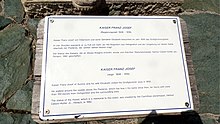
This viewpoint in the Hohe Tauern is named after the visit of the imperial couple Franz Joseph I and Elisabeth , Sisi, in 1856. The 26-year-old monarch wanted to see the Pasterze and hiked from Heiligenblut for four hours with his entourage up the 1,100 meters to the point where this event can be seen carved in stone to this day. It is the Kaiserstein on the Kaiser-Franz-Josefs-Höhe .
At that time, the Pasterze was just as close as it is today to the Freiwandeck car park and further down than the Margaritze storage facility today .
Empress Elisabeth contented herself with a ride from Heiligenblut over a good 800 meters up to the wooden floor , which was then called Elizabeth's rest after her visit . In 1876 the Klagenfurt Alpine Club section built the Glocknerhaus on this site with space for 40 people.
In the course of the construction of the Grossglockner High Alpine Road , a cul-de-sac was also built by 1932, and the road led around the next Riedel directly to the Pasterze. There the actual Franz-Josefs-Höhe was built.
Particularly since the establishment of the Hohe Tauern National Park in 1981, the Franz-Josefs-Höhe has been expanded into an extensive visitor center with parking lots and garages, restaurants and show facilities on the history and nature of the mountain area.
Visitor center on the Kaiser-Franz-Josefs-Höhe
From the viewing terrace you can see the longest glacier in the Eastern Alps , the Pasterze , and on the opposite side of the valley, the Großglockner , the north-west adjoining Glocknerwand and at the end of the valley the Johannisberg . In 1963, a funicular about 150 meters in length was built near the glacier stand at the time, from there a footpath leads down to the Pasterze, which is now more distant.
In the visitor center, an exhibition on several floors deals with the topic of the Großglockner. Impressions of the Grossglockner by the universe filmmaker Georg Riha are impressive in the Glockner cinema . The visitor center is complemented by the special show "Water Life" as well as the harmony room and a weight room, where the various energy fields of the region around Austria's highest mountain are examined.
Several parking spaces, a multi-storey car park and several restaurants are available to visitors.
At Panorama Kaiserdenkmal is the Wilhelm Swarovski Observatory .
Huts on the glacier road
hikes

-
Gamsgrubenweg : This path, known as the Alpine Panorama Trail, can be hiked in 30 minutes. It leads above the Pasterze along to a rest area and on to the former Hofmannshütte and offers views of the Großglockner and the surrounding peaks.
- From the former Hofmannshütte there is a high alpine trail, only for experienced mountaineers, to the Oberwalderhütte on the Fuscherkarkopf , and over the Hofmannsweg glacier to the Adlersruhe and the Glockner
-
Pasterzen circular route from the Franzjosefshöhe over the Pasterzengrund (lake that was created in recent years), the Elisabethfelsen ( 2156 m above sea level ) and Magritze (reservoir of the Kaprun power plants) to the Glockner and Pasterzenhaus and back to the Franzjosefshöhe (3 hours ).
- From the path also branches to the Wiener Höhenweg to the Salmhütte and Glocknersüdseite, and over the Trogalm into the valley
-
Pasterze Glacier Path: This path leads directly to the glacier. A secured path leads downhill to the Pasterze in 30 minutes. You should plan an hour for the way back. There is a funicular that used to reach the edge of the ice, but now ends far above. There is a marked viewing area at the bottom of the glacier.
- From the Pasterze there is also the possibility to get to the Hofmannsweg or circular route
- Alpe Adria Trail : The visitor center is the starting point of the Alpe Adria Trail long-distance hiking trail , which leads in 38 stages through Austria, Slovenia and Italy to the Adriatic Sea in Muggia .
Web links
- Visitor center Kaiser-Franz-Josephs-Höhe , website of the Großglockner Hochalpenstraßen AG
- On the emperor's footsteps to the Glocknerhaus , orf.at, leisure tips
proof
- Großglockner Hochalpenstraßen AG: Großglockner Magazin , Spring 2006 edition.
- ↑ amap.at
- ↑ Großglockner High Alpine Road , grossglockner.at
Coordinates: 47 ° 4 ′ 30 ″ N , 12 ° 45 ′ 4 ″ E


