Gülitz coal mines
|
Gülitz coal mines
|
||
| location | Brandenburg , Germany | |
| surface | 105.5 ha | |
| Identifier | 1599 | |
| WDPA ID | 378092 | |
| Geographical location | 53 ° 12 ' N , 11 ° 56' E | |
|
|
||
| Setup date | June 27, 2006 | |
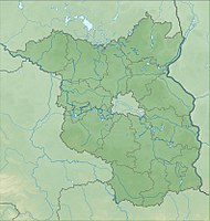
The Gülitz coal mine nature reserve is located in the Gülitz-Reetz municipality in the Prignitz district in Brandenburg .
The area with the identification number 1599, which consists of two sub-areas, was placed under nature protection by ordinance of 23 May 2006 . The approximately 105.5 hectare nature reserve extends west of Gülitz , an inhabited part of the municipality of Gülitz-Reetz, to the west and east of the L 13 state road . The L 10 runs west of the area.
meaning
The nature reserve in the Mecklenburg-Brandenburg plateau and hill country is characterized "by almost closed deciduous forest stands and numerous small bodies of water that arose from the mining of near-surface brown coal deposits ."
See also
- List of nature reserves in the Prignitz district
- List of FFH areas in Brandenburg
- Gülitz brown coal mines
Web links
Individual evidence
- ↑ Ordinance on the “ Gülitzer Coal Mines ” nature reserve from May 23, 2006 on bravors.brandenburg.de, accessed on May 10, 2020

