Gjelsvikfjella
| Gjelsvikfjella | ||
|---|---|---|
|
Eastern Gjelsvikfjella (Risemedet) seen from the northeast |
||
| Highest peak | Risemedet ( 2704 m ) | |
| location | Queen Maud Land , East Antarctica | |
| part of | Fimbulheimen | |
|
|
||
| Coordinates | 72 ° 5 ′ S , 2 ° 50 ′ E | |
The Gjelsvikfjella is a mountain range in Queen Maud Land , whose ice-free peaks and nunataks extend over an area of 48 kilometers in north-south direction and about 40 kilometers in east-west direction. The distance to the edge of the ice shelf is about 200 kilometers. The mountain group was named after the Norwegian geologist and resistance fighter Tore Gjelsvik , the long-time director of the Norsk Polar Institute .
geography
The mountain group consists of four sub-mountains, each separated by glaciers several kilometers wide .
In the north is the Mayrkette ( Norwegian Jutulsessen ). The southwest is formed by Nupskammen and Von Essenskarvet , which on the map have roughly the shape of an upside-down "T". In the south is the Sauterriegel ( Norwegian Terningskarvet ) and in the east, finally, the Risemedet .
The highest peak of Gjelsvikfjella is the highest point of the Risemedet massif at 2704 m . In the north, the mountain range dissolves into a series of individual nunataks with heights between 1,100 and 1,400 m ; in the south, individual peaks, separated by inland ice, also protrude from the glaciated polar plateau . The mountains are bounded to the west and east by wide glaciers. The Sveabreen in the west separates the Gjelsvikfjella from the H. U. Sverdrupfjella , in the east the Tønnesenbreen forms the border to the Mühlig-Hofmann Mountains . Both glaciers unite on the northern foreland of the mountains and flow out onto the Fimbulisen .
geology
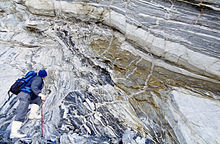
The mountain range consists of highly metamorphic , multiply folded gneisses and amphibolites , the parent rocks of which are volcanic rocks and granites of an island arc with a Mesoproterozoic age. At the turn of the Mesoproterozoic to the Neoproterozoic , these rocks were first deformed and metamorphically shaped when the arch of the island collided with the Kaapvaal craton , with the temperature exceeding the melting point for granites and local formation of migmatites . Melts with a granitic and tonalitic composition penetrated from the deeper earth's crust and the upper mantle and solidified in the form of thin ducts.
The rocks underwent a further deformation when the West and East Gondwana collided around 540 mya , which resulted in today's fold structure . The mountains have been subject to erosion since the Ordovician . In some places you can find Upper Jurassic basalt dikes , which prove that when Gondwana broke up, large amounts of lava were extracted in this region .
climate
As there was no continuously manned station in Gjelsvikfjella up to 2005, there are no long-term climatic observations. As far as we know from previous observations, temperatures are below freezing all year round. The highest temperatures are reached in January at −2 ° C. In mid-January, the soil temperature in protected locations can be between −4.5 ° C and +19 ° C and, at an average temperature of +2.5 ° C, lower plants can grow.
fauna and Flora
The fauna of Gjelsvikfjella includes one species of springtails and three species of mites , as well as three species of birds that nest in the mountains in summer. Most of the animals were registered in the Mayr chain, where there are three valleys open to the north with extensive, stable debris and moraine cover , in which the birds find suitable breeding sites. In the vicinity of these breeding sites, small organisms that feed on bird droppings and food residues also find a suitable habitat. The two most common bird species are the snow petrel ( Pagodroma nivea ) and the Antarctic petrel ( Thalassoica antarctica ) with a total of around 25,000 pairs, as well as the predatory southern polar skua (Catharacta maccormicki) .
Mites are represented by the species Eupodes angardi and Tydeus erebus , which are common in many of the mountainous areas of Dronning Maud Lands. The species of the mite Maudheimia marshalli COETZEE, which was only newly described in 1997 , has so far only been detected in Gjelsvikfjella and the immediate western and eastern neighboring mountains.
Springtails are represented by the species Cryptopygus sverdrupi , which occurs in the central Dronning Maud Land mainly in small moss or algae colonies.
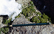
The vegetation in Gjelsvikfjella is limited to mostly north-facing, stable scree slopes and rocky surfaces, and occurrences are often close to breeding sites. There the green alga Prasiola crispa occurs in small mats a few decimeters in diameter. Further genera in a less nitrate-rich environment are Nostoc , Ulothrix and Leproloma .
The mosses Grimmia lawiana and Sacroneurum glaciale occur in two specially protected places on the Nunataks north of the Mayr range .
Frequent crusty lichens such as Rhizocarpon geographicum , Xanthoria elegans and Candelariella hattensis colonize the somewhat more weathered parts of the silicate rocks and have been detected up to an altitude of 2550 meters. About a dozen other types of lichen are also known, of which Xanthoria candelaria and Physcia caesia are restricted to the vicinity of breeding grounds.
Discovery and Exploration
On January 29, 1939, the mountain range was discovered during flights of the German Antarctic Expedition 1938/39 and documented with aerial photographs . Since most of the aerial photos were lost in the Second World War, the mountains were photographed again during the Norwegian Antarctic Expedition 1956–1960 and control points on the ground were also measured for more precise orientation . On the topographic maps published from 1966 by the Norsk Polar Institute on a scale of 1: 250,000, the area between 2 ° and 3 ° 30 ′ east was identified as an independent mountain group with the name Gjelsvikfjella . On the German overview map that was enclosed with Alfred Ritscher's expedition volume, this area formed the westernmost part of the Mühlig-Hofmann Mountains. The Russian maps of the 1960s also show the area as part of the Mühlig-Hofmann Mountains, but the Norwegian mountain structure and naming has prevailed since then.
The first geological research took place as part of the 4th Soviet Antarctic Expedition 1958-1960. The systematic mapping and exploration was continued from 1989–1990 by Norwegian expeditions that used the Troll station, which opened in 1989, for this purpose . In the southern summer of 1999/2000 a German expedition visited the area and carried out geological work.
literature
- K. Brunk: Cartographic work and German naming in Neuschwabenland, Antarctica . (PDF; 382 kB) In: German Geodetic Commission, Series E: History and Development of Geodesy . 24 / I, 1986, pp. 1-42. Retrieved April 19, 2009.
- Norsk Polarinstitutt (ed.): Blad H5 Jutulgryta (topographic map 1: 250,000) . Oslo 1961.
- Norsk Polarinstitutt (ed.): Blad H6 HU Sverdrupfjella (topographic map 1: 250,000) . Oslo 1961.
- Institute for Applied Geodesy (Ed.): Directory of German geographical names in the Antarctic Archived from the original on January 23, 2009. In: News from the mapping and surveying system . Special issue, 1993, pp. 1-30. Retrieved May 10, 2010.
- Yoshihide Ohta (Ed.): Gjelsvikfjella & Western Mühlig-Hofmannfjella Sheets 1 and 2 . Temakart 24. Norsk Polarinstitutt, Tromsø 1999, p. 1–37, 2 ct .
Web links
- Australian Antarctic Division datasheet ; Retrieved May 10, 2010
Individual evidence
- ^ J. Jacobs, W. Bauer, CM Fanning: New age constraints for Grenville-age metamorphism in western central Dronning Maud Land (East Antarctica), and implications for the palaeogeography of Kalahari in Rodinia . In: International Journal of Earth Sciences . 92, 2003, pp. 301-315.
- ↑ Yoshihide Ohta (Ed.): Gjelsvikfjella & Western Mühlig-Hofmannfjella Sheets 1 and 2 . Temakart 24. Norsk Polarinstitutt, Tromsø 1999, p. 25-26 .
- ↑ Yoshihide Ohta (Ed.): Gjelsvikfjella & Western Mühlig-Hofmannfjella Sheets 1 and 2 . Temakart 24. Norsk Polarinstitutt, Tromsø 1999, p. 33 .
- ^ L. Coetzee: The Antarctic mite genus Maudheimia (Akari, Oribatida) . In: Navorsinge van die Nasionale Myseum Bloemfontein . 13, 1997, pp. 393-425.
- ↑ Y. Gjessing & DO Øvstedal: Micro Climates and water budget of algae, lichens and moss on a handsome nunataks in Queen Maud Land . In: International Journal of Biometeorology . 33, 1989, pp. 272-281.
- ↑ Torstein Engelskjøn: Botany of two Antarctic mountain ranges: Gjelsvikfjella and Mühlig-Hofmannfjella, Dronning Maud Land . In: Polar Research . 4, 1986, pp. 205-224. Retrieved September 15, 2013.
- ↑ View of the Nupskammen and that of Essenskarvet from the north, oblique aerial image from Bildflug IV, film 26 (PDF; 893 kB)
- ^ Alfred Ritscher: Scientific and flying results of the German Antarctic Expedition 1938/39 . Koehler & Amelang, Leipzig 1942, p. Card insert .
- ^ MG Ravich, DS Soloviev: Geologiya i petrologiya central'noi chasti gor zemli Korolevy Mod . In: Trudy Naucno-Isseldovatel'skogo Instituta Geologii Arktiki . tape 141 . Nedra, Leningrad 1966 (Appendix 1 and 2).
- ↑ Joachim Jacobs, Wilfried Bauer: Gjelsvikfjella and Mühlig-Hofmann-Gebirge (E-Antarctica): Another piece of the East-Antarctic Orogen? In: Journal of the German Geological Society . tape 152 , 2001, p. 249-259 .


