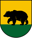
Gmina Rawicz
| Gmina Rawicz | ||
|---|---|---|

|
|
|
| Basic data | ||
| State : | Poland | |
| Voivodeship : | Greater Poland | |
| Powiat : | Rawicz | |
| Geographic location : | 51 ° 37 ' N , 16 ° 51' E | |
| Residents : | s. Gmina | |
| Postal code : | 63-900 | |
| Telephone code : | (+48) 65 | |
| License plate : | PRE | |
| Economy and Transport | ||
| Street : | Expressway S5 Poznan - Wroclaw | |
| DK36 Lubin - Ostrów | ||
| Rail route : | Wroclaw – Poznan | |
| Next international airport : | Wroclaw | |
| Gmina | ||
| Gminatype: | Urban-and-rural parish | |
| Gmina structure: | 22 school authorities | |
| Surface: | 133.64 km² | |
| Residents: | 30,339 (June 30, 2019) |
|
| Population density : | 227 inhabitants / km² | |
| Community number ( GUS ): | 3022053 | |
| Administration (as of 2014) | ||
| Mayor : | Grzegorz cubic | |
| Address: | ul. J. Piłsudskiego 21 63-900 Rawicz |
|
| Website : | www.rawicz.pl | |
The Gmina Rawicz is a town-and-country municipality in the Rawicki powiat in the Greater Poland Voivodeship in Poland . The seat of the Powiat and the municipality is the city of the same name ( German Rawicz , since 1887 Rawitsch ) with about 20,200 inhabitants.
Sarnowa (Sarne) , an independent town until 1973, belongs to the actual urban area .
geography
The municipality is located in the south of the voivodeship and borders there on the Lower Silesian Voivodeship . The voivodeship capital Poznan is located about 80 kilometers north, Leszno (Lissa) about 25 kilometers northwest and Wroclaw 50 kilometers south. Neighboring communities in the Greater Poland Voivodeship are the communities Bojanowo in the north, Miejska Górka in the northeast, Pakosław in the east, in the Lower Silesian Voivodeship the communities Milicz in the southeast, Żmigród in the south and Wąsosz in the west.
The 40-kilometer-long Dąbroczna, a tributary of the Orla (Horle) , is one of the rivers .
The community has an area of 133.6 km², 74 percent of which is used for agriculture and 17 percent for forestry.
history
Interrupted by the German occupation in the Second World War from 1919 to 1975, today's municipal area belonged to the Poznan Voivodeship, with different layouts. - The German minority was expelled after the World War .
The rural community of Rawicz was dissolved in 1954 and repeatedly transformed into different gromadas . From these the rural community Gmina Sierakowo was newly formed on January 1, 1973. At the same time the city of Sarnowa (Sarne) was incorporated into Rawicz. From 1975 to 1998 the municipality belonged to the Leszno Voivodeship . The powiat was dissolved during this time. The rural municipality of Sierakowo was renamed Rawicz in 1976. The urban and rural community of Rawicz were merged in 1990/1991 to form the urban and rural community. Since 1999 this has belonged to the Greater Poland Voivodeship and to the re-established Powiat Rawicki.
partnership
On June 1, 2019, the Rawicz community entered into a community partnership with the German Hanseatic city of Attendorn in North Rhine-Westphalia.
structure
The town itself and 22 villages (German names, official until 1945) with school offices (sołectwa) belong to the town-and-country community (gmina miejsko-wiejska) Rawicz with 30,339 inhabitants (as of June 30, 2019 ):
| Surname | German name (1815-1920) |
German name (1939-1945) |
|---|---|---|
| Dąbrówka | Dombrowka Konarzewo 1906–1920 Eichenbronn |
Eichenbronn |
| Dębno Polskie | Dams | Dams |
| Folwark | Vorwerke | Vorwerke |
| Izbice | Izbice | Parlors |
| Kąty | Lindenhof | Lindenhof |
| Konarzewo | Konarzewo | Zerbonis Rest |
| Łąkta | Lonkta | Wiesenfurt |
| Łaszczyn | Laszczyn | Gutfeld |
| Masłowo | Pig | Pig |
| Sarnówka | Sarnowko | Sarnchen |
| Sierakowo | Wilhelmsgrund | Wilhelmsgrund |
| Sikorzyn | Sikorzyn 1906–1920 Wiesenbach |
Wiesenbach |
| Słupia Kapitulna | Slupia |
1939–1943 Langenfeld 1943–1945 Langenzeile |
| Stvolno | Stvolno | Stolau |
| Szymanowo | Szymanowo 1906–1920 Friedrichsweiler |
Friedrichsweiler |
| Ugoda | Ugoda | pagan |
| Wydawy | Wydawy | Outer field |
| Załęcze | Königsdorf | Königsdorf |
| Zawady | Zawady | Weidhofen |
| Zielona Wieś | Gründorf | Gründorf |
| Żołędnica | Zolendnice | Eichelhof |
| Żylice | Zylice 1906-1920 slots |
Slots |
Smaller towns and hamlets are Folusz, Kowaliki, Krasnolipka ( Krasnolipka , (1939–1945) Linden ), Krystynki (Christiänchen) , Warszewo (Weidenhof) and Warszewko.
traffic
The expressway S5 ( E 261 ) leads from Poznan in the north via Leszno (Lissa) and Rawicz to Żmigród (Trachenberg) and Breslau as well as the national road DK5 to the Czech border at Lubawka (Liebau) . The crossing national road DK36 leads from Lubin (Lüben) in the west to Ostrów Wielkopolski (Ostrowo) in the east.
Rawicz has a train station on the railway line from Poznan to Wroclaw .
The nearest international airport is Wroclaw .
Personalities
- Honorary citizen of the community
- Anita Włodarczyk (* 1985), hammer thrower.
Web links
- City and municipality website (Polish)
Footnotes
- ↑ population. Size and Structure by Territorial Division. As of June 30, 2019. Główny Urząd Statystyczny (GUS) (PDF files; 0.99 MiB), accessed December 24, 2019 .
- ↑ bip.rawicz.pl: Sołectwa Gminy Rawicz. (accessed on May 11, 2020)
- ↑ The Historical Place Directory
- ↑ rawicz.pl: Honorowy Obywatel Gminy Rawicz. (Polish, accessed May 11, 2020)

