
Grünstädtel
|
Grünstädtel
City of Schwarzenberg / Erzgeb.
Coordinates: 50 ° 31 ′ 43 " N , 12 ° 49 ′ 1" E
|
||
|---|---|---|
| Height : | 451 m | |
| Residents : | 745 (May 9, 2011) | |
| Incorporation : | October 1, 1995 | |
| Postal code : | 08340 | |
| Area code : | 03774 | |
Location of Grünstädtel in Saxony |
||

Grünstädtel is part of the town of Schwarzenberg in the Saxon Ore Mountains .
location
Grünstädtel is located 2.6 km east-southeast of the Schwarzenberg town center and borders directly on the municipality of Raschau-Markersbach in the east . The federal highway 101 leads through the village .
history


Little is known about the early history of the place. The first documentary mention was in 1460. It bears witness to a divided settlement, because the places Stetel and Grun are mentioned. Stetel ("little town") was endowed with some privileges that actually only existed in cities. A fair, brewing and licensing rights as well as a meat bank were decisive for the name of the village. "Grun" ("The Green") was the name given to those houses that had been built in the course of time towards the neighboring village of Pöhla . The two districts will have merged into one municipality as early as the 16th century. The Turkish tax register from 1542 only mentions the place Stettel and most likely already means both places. In the course of the century, the terms Dorfstädtel and Grünstädtel alternate with no difference in meaning, the former being the difference to its large neighbor, the town of Schwarzenberg , but the latter being able to prevail.
During the GDR era there was the “Philipp Müller” children's holiday camp in Grünstädtel run by the publicly owned company Bauunion Leipzig.
Development of the population
|
|
|
Until the second half of the 19th century, the population of Grünstädtel only rose very slowly. A significant leap can be seen in the period between the 1870s and 1920s, when the population doubled in half a century. In the further course, the number of residents rose sharply again and reached its peak in the 1950s. This was followed by a population decline until around 1990. Since then, the number of inhabitants has increased again slightly, which is unusual for the region, and is currently around 900. On October 1, 1995, Grünstädtel was incorporated into Schwarzenberg.
church
In Catholic times, Stettel and Grün belonged to the Schwarzenberg parish, the former being documented as a branch church in 1460, which the residents of Grün will also have visited when going to church. In 1546 Grünstädtel was an independent church in the Breitenbrunn / Erzgeb area. (since 1559 own parish), Crandorf (since 1711/12 own parish) and Pöhla (since 1929 own parish) were parish. The origins of the church building could be in the St. Anne's Chapel, which was a stopover for a pilgrimage starting in Annaberg in Catholic times . On the site of the old Grünstadt church, about which nothing more is known, a new one was built in 1723 and 1724 and can still be seen today.
Atonement Cross
On the Gottfried-Heinrich-Stölzel-Platz below the church there is an atonement cross on a small green area , on the front side of which the remains of an incised sword can be seen. The 82 cm high granulite cross was moved here in 1993 from its previous position on today's B 101 to protect it from destruction. Why the atonement cross was erected is not documented. According to various traditions, two men, perhaps soldiers, got into an argument and one killed the other.
traffic
The Grünstädtel station is on the Annaberg-Buchholz-Schwarzenberg railway line . The narrow-gauge railway Grünstädtel – Oberrittersgrün used to branch off here . Since 2009, the Annaberg-Buchholz-Schwarzenberg route has been used on individual weekends in the summer half-year as an Ore Mountains observation train for tourist excursions. The responsible railway company is the Verein Sächsischer Eisenbahnfreunde eV
The federal road 101 runs through Grünstädtel .

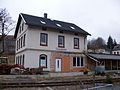
Grünstädtel station with reception building (2016)
Entrance building of the train station Grünstädtel (2016)

Grünstädtel station towards Schwarzenberg (2016)

Grünstädtel station towards Annaberg-Buchholz (2016)


Personalities
Sons and daughters of the place:
- Gottfried Heinrich Stölzel (1690–1749), conductor, composer and music theorist; the Gottfried-Heinrich-Stölzel-Platz is named after him.
- Klaus Hübschmann (1932–1991), athlete
- Rosemarie Lang (1947-2017), opera singer (mezzo-soprano)
literature
- Richard Steche : Grünstädtel. In: Descriptive representation of the older architectural and art monuments of the Kingdom of Saxony. 8th booklet: Amtshauptmannschaft Schwarzenberg . CC Meinhold, Dresden 1887, p. 14.
- Dorfstädtel, Grünstädtel . In: August Schumann : Complete State, Post and Newspaper Lexicon of Saxony. 3rd volume. Schumann, Zwickau 1816, p. 776.
- Albert Schiffner : Handbook of geography, statistics and topography of the Kingdom of Saxony . First delivery, containing the district directorate of Zwickau, Friedrich Fleischer, Leipzig 1839, p. 219
Web links
- Grünstädtel in the Digital Historical Directory of Saxony
- Literature by and about Grünstädtel in the Saxon Bibliography
Individual evidence
- ↑ Small-scale municipality sheet for Schwarzenberg / Erzgeb., City. (PDF; 0.69 MB) State Statistical Office of the Free State of Saxony , September 2014, accessed on January 31, 2015 .
- ↑ cf. Grünstädtel in the Digital Historical Directory of Saxony
- ↑ StBA: Changes in the municipalities of Germany, see 1995
- ↑ See http://www.suehnekreuz.de/sachsen/gruenstaedtel.htm
- ^ Association of Sächsischer Eisenbahnfreunde e. V .: Erzgebirgische Aussichtsbahn ( Memento of the original from March 9, 2016 in the Internet Archive ) Info: The archive link was inserted automatically and has not yet been checked. Please check the original and archive link according to the instructions and then remove this notice.
Berms green | Crandorf | Erla | Grünstädtel | Heather | Hofgarten | Hunter's House | New World | Pöhla | Sachsenfeld | Schwarzenberg | Sonnenleithe | Wildenau