Hahn (Reichshof)
|
Rooster
municipality Reichshof
Coordinates: 50 ° 58 ′ 7 ″ N , 7 ° 45 ′ 55 ″ E
|
|
|---|---|
| Height : | 413 m above sea level NHN |
| Residents : | 186 (Jan. 1, 2007) |
| Postal code : | 51580 |
| Area code : | 02297 |
|
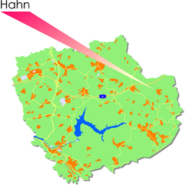
Location of Hahn in Reichshof
|
|
Hahn is one of 106 localities in the Reichshof municipality in the Oberbergischer Kreis in the North Rhine-Westphalian administrative district of Cologne in Germany .
Location and description
Hahn is located northeast of the Wiehltalsperre , the closest centers are Gummersbach (28 km northwest), Cologne (65 km west) and Siegen (37 km southeast).
history
First mention
The place was mentioned for the first time in 1541 : "Johan, Herman and their brother uf the grove are mentioned as witnesses during a border tour."
The spelling of the first mention was Hain .
leisure
Sports
- Kart track in Wildbergerhütte
- Cross-country skiing - the cross-country ski run at Hahn with its three circular courses has a total length of around 6.1 kilometers.
- Ski lift - ski and toboggan slope with a 300 meter long drag lift.
societies
- Hahn village community
Individual evidence
- ^ Klaus Pampus: First documentary naming of Oberbergischer places (= contributions to Oberbergischen history. Sonderbd. 1). Oberbergische Department 1924 eV of the Bergisches Geschichtsverein, Gummersbach 1998, ISBN 3-88265-206-3 .

