Wildbergerhütte
|
Wildbergerhütte
municipality Reichshof
Coordinates: 50 ° 56 ′ 8 ″ N , 7 ° 45 ′ 6 ″ E
|
|
|---|---|
| Height : | 322 (310-345) m above sea level NHN |
| Residents : | 1758 (Dec. 31, 2008) |
| Postal code : | 51580 |
| Primaries : | 02296, 02297/02261/02265 |
|
Location of Wildbergerhütte in Reichshof
|
|
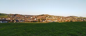
Wildbergerhütte is one of 106 localities in the Reichshof municipality in the Oberbergischer Kreis in the North Rhine-Westphalian administrative district of Cologne in Germany .
Location and description
Wildbergerhütte is located in the southeast of North Rhine-Westphalia, in the Oberbergisches Kreis. The place is located in the Bergisches Land nature park and is surrounded by the Wiehltalsperre in the west and the adjacent border with Rhineland-Palatinate with the headwaters of the Bigge in the south. Wildbergerhütte has a very good connection to the A4 motorway , which is about 10 minutes away, and thus towards Cologne and Olpe , as well as the Olpe-Süd motorway junction and the A 45 towards Frankfurt am Main and Dortmund .
history
Since there was already a smelter in Heidberg around 1600, it can be assumed that the first hut for the mining operation in Wildberg, at the place where the Wildbergerhütte is today, was built around the same time. Therefore the name Wildbergerhütte can be explained very easily. Later this hut was modernized and technically brought up to date. It was located on the site of today's Wessel-Werk company . Today's memorial for the fallen was the chimney of this hut, it is said to have been twice as high. Later it was no longer worth running this hut. The ore was smelted in strange huts. The mining operations in Wildberg were finally also closed and the site was forcibly auctioned off in 1911.
In 1866, Wildbergerhütte became a post office with daily personal mail to Eckenhagen and Wissen. The telegraph operator was established on October 1, 1878. The post office was an office until 1922, then an agency and again a post office on July 1, 1940. Since November 2004, the Post has been an agency in the Schmalenbach department store.
On October 31, 1910, the Brüchermühle – Wildbergerhütte railway line was opened and connected to the Wiehl Valley Railway. In 1910/1911 more than 6,000 tickets were sold in Wildbergerhütte, in 1940 there were already more than 16,000. The route was originally intended to continue to Rothemühle. In the local area the route went to the exit towards Nosbach, two bridges had already been built. The First World War probably prevented further construction. Towards the end of World War II , the route was often the target of air raids. The bridge near Elbach was blown up and rebuilt at short notice after the war. Nevertheless, passenger traffic on this route was finally stopped in 1953. The bridges in the local area were also removed.
The bus service began on March 2, 1925 on the route Eckenhagen - Wildbergerhütte - Waldbröl. This was followed by the Wildbergerhütte - Rothemühle route.
industrial Estate
Siegener Strasse
The commercial area on Siegener Straße is located in the eastern part of the village, away from the residential areas. In addition to the activities of companies in wholesale and catering , there are also businesses with the employment of coil winding technology located there. Furthermore, there are concrete plants and manufacturers, such as the Wessel plant .
Attractions
Natural sights
- Femlinde in the Frohnenberg district. The age is estimated at around 850 years. Court of Justice in the Middle Ages.
- Wiehltalsperre , west of Wildbergerhütte with the Krombacher Insel knownfrom the TV advertising campaign of the Krombacher brewery .
- Aubachtal hiking area , recreation and hiking area in Wildbergerhütte. Surrounded by nature reserves.
Buildings / monuments
- The old chimney of the Pochwerk am Mühlenberg was redesigned as a war memorial for those killed in the First World War.
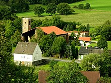
- Catholic Church of St. Bonifatius in Crottorfer Strasse.
Waters
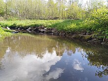
The rivers Aubach and Wiehl flow through the center of Wildbergerhütte, these feed the Wiehl dam about 1 km to the west . The Aubach reaches Wildbergerhütte on Crottorfer Straße from the south, later it swings to the left and flows along the Weiherdamm to the town center. The Wiehl flows from the northeast directly into the center of Wildbergerhütte.
Parish
- The Catholic Church of St. Bonifatius in Wildbergerhütte is an attraction not only for groups of visitors or hikers, but also as an example and teaching example for modern sacred architecture for architecture students.
Church of St. Boniface
The church of St. Bonifatius, built in the postmodern style by the Cologne architect Heinz Bienefeld in 1974–1981, is one of the most important new churches in Germany. Erected in the shape of an octagon, with a mighty roof supported by six supports, it is characterized by the masonry, which is lovingly made from local greywacke and local old bricks in Roman order. The octagonal interior is lightly lit from above, slightly sloping cobblestone paving leads to the centrally located altar.
leisure
Association
- SSV Wildbergerhütte-Odenspiel e. V.
- MGV Glückauf-Sangeslust Wildbergerhütte
- Village community Wildbergerhütte-Bergerhof e. V.
- Senior citizens' club Wildbergerhütte
- TC Wiehltal e. V.
- Musikzug-Bergerhof
- Great Elf KG Wildberg
- Judoclub Reichshof 02 e. V.
Bike paths
Two of the four themed bike tours in the Reichshof community start from Wildbergerhütte. The Tour de Wildbergerhütte is the shortest route at 16 km in length and is also suitable for beginners with an altitude difference of 250 meters. The Tour de Reichshof leads almost once around the borders of the Reichshof community and, with an altitude of 1000 meters, is also an interesting challenge for racing cyclists . The starting point for both tours is the Kreissparkasse Wildbergerhütte.
| Route name | Waymarks | Driving distance | Path length |
| Tour de Wildbergerhütte |
Nosbach - Hardt - Komp - Wiehl - Heidberg - Euel Hassel - Hamert - Wildbergerhütte |
16 km | |
| Tour de Reichshof |
Brüchermühle - Denklingen - Rölefeld - Remperg - Heikausen Pettseifen - Oberagger - Ersbach - Eckenhagen Blockhaus - Hespert - Wildbergerhütte |
50 km |
Kart track-Hahn Wildbergerhütte
The Hahn outdoor go- kart track near Wildbergerhütte, also known as the Oberberg karting ring, is 1000 m long and is one of the few karting tracks with a clear height profile.
Schools and educational institutions
- Community elementary school Wildbergerhütte - rainbow school
Infrastructure
- The place has two supermarkets ( Aldi Süd , Wildberger Str./ Rewe Markt Siegener Str.), Two doctors, a gas station and various shops for daily needs (butcher, office supplies, beverage market, wine trade)
- Bus connection to Eckenhagen and Gummersbach (towards Cologne ) and Waldbröl with line 345.
- In addition, the place has a very good connection to the A4 motorway , which is about 10 minutes away, and thus in the direction of Cologne and Olpe , as well as the Olpe-Süd motorway junction and the A 45 in the direction of Frankfurt am Main and Dortmund , which also makes the location particularly suitable for industry and wholesale attractive.
Wildbergerhütte in pictures
literature
- Oswald Gerhard: Eckenhagen and Denklingen through the ages. A home history of the former Reichshof area of Eckenhagen (the current municipalities of Eckenhagen and Denklingen) as a contribution to the history of the Oberbergisches Land. Heimatverein eV, Eckenhagen 1953.
Web links
Individual evidence
- ↑ Google Maps. Retrieved February 7, 2020 (de-US).
- ↑ Google Maps. Retrieved February 7, 2020 (de-US).


