Bigge (river)
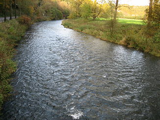
The Bigge is at least 44.5 km long, southern and orographically left tributary of the Lenne in the North Rhine-Westphalian district of Olpe and in the Rhineland-Palatinate district of Altenkirchen ( Germany ). The Bigge drains a catchment area of 369.133 km², which corresponds to almost 27.3% of that of the Lenne as a whole, and is by far its longest and most water-rich tributary.
geography
course
source
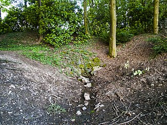
The Bigge rises in the north of the Wildenburger Land (Wildenburgisches Land) and in the western part of the Sauerland-Rothaargebirge Nature Park . Its source, the Biggequelle , is located in the Olpe district near the south-eastern outskirts of Römershagen , a district in the south of the municipality of Wenden - 120 m north of the state border of North Rhine-Westphalia and Rhineland-Palatinate. It is located at about 427 m above sea level. NHN on the western flank of a 447.2 m high elevation.
Upper course
After flowing through Römershagen, the Bigge flows for about 2.8 kilometers outside the nature park in the Rhineland-Palatinate district of Altenkirchen - near the former Wildenburg station on the disused Finnentrop – Freudenberg railway line (Biggetalbahn) - near the municipal area of Friesenhagen . Among other things, it passes the Biggerberg ( Bigger Berg ; 421.4 m ).
Then the Bigge reaches the Westphalian district of Olpe again just under 1 km south-southeast of the Heid (to Wenden), which it does not flow through , from then on to its confluence in North Rhine-Westphalia and, up to its confluence, again in the nature park in a predominantly northward direction .
The Bigge then flows through or passes through other parts of the Wenden community: Rothemühle , after which the Großmicke joins, Vahlberg , Brün and Wendenerhütte . Then it crosses the A 45 . Immediately afterwards it runs through Wenden- Gerlingen , in order to immediately pass under the A 4 .
Middle course
After approximately the district area of Olpes has been reached, the Bigge, which previously flowed in a northeastern direction, bends approximately to the north. The river then flows through or passes through several parts of the city of Olpe : At Saßmicke it is bridged twice by the A 45. Through Friedrichsthal , Dahl and Rüblinghausen , it reaches the Olpe core city, where the Olpe river flows in from the east and is fed by the Günse stream in the core city .
Below Olpes, the Bigge flows through the Biggesee reservoir , which is bridged by a joint section of the federal highways 54 and 55 , into which the Brachtpe, coming from the south-west, flows right at the beginning and where, for example, Eichhagen and Sondern are located. The only lake railway station in North Rhine-Westphalia is in Sondern.
Lower course
A little north of Sondern, the Lister, which comes from the directly adjacent Listertalsperre , flows into the Bigge from the west . Directly below the Biggeseestaudamm, which stands about 2 km southwest of the Attendorn city center, the Bigge picks up the Ihne flowing in from the west . After flowing through Attendorn, it runs through the small Ahauser reservoir , into which the Milstenau, coming from the northwest, flows. Below the Ahausen gauge near Ahausen Castle , the Bigge Heggen passes , a south-western part of Finnentrop , and then Illeschlade in the west and Altfinnentrop in the east, both of which also belong to Finnentrop.
muzzle
Shortly thereafter, the Bigge flows east of Landesstrasse 539, there called Attendorner Strasse , at around 232 m above sea level in the Lenne Ruhr tributary, which is 55.4 km long and flows from there approximately from the southeast . The Finnentrop core town lies to the northeast of its mouth.
Catchment area
The 369.13 km² catchment area of the Bigge is drained into the North Sea via the Lenne, Ruhr and Rhine .
The catchment area has the following usage structure:
- 5.9% - settlement and traffic areas
- 0.8% - industrial and commercial land
- 2.4% - water areas
- 47.5% - forest areas
- 43.4% - agricultural land
Hydrology
Through the outflow of water from Biggesee, which has an average flow rate of 8.65 m³ / s, Bigge and Lenne serve the Ruhrverband for the regulated water supply of the Ruhr area via the Ruhr , both of which are part of the river system. The catchment area of the Bigge covers 369.133 km².
Protected areas
The Bigge spring is located in the nature reserve (NSG) Bigge spring area . The Bigge flows in the area of the municipality of Wenden in sections in the NSG Biggetal and in that of the city of Attendorn partially in the NSG Auwald Biggen and in the NSG Ahauser Klippen und Stausee . In the community of Finnentrop it borders on the NSG Hohe Ley .
References and comments
- ↑ a b c d e Topographical Information Management, Cologne District Government, Department GEObasis NRW ( information )
- ↑ a b German basic map 1: 5000
- ↑ a b Water directory of the State Office for Nature, Environment and Consumer Protection NRW 2010 (XLS; 4.67 MB) ( Notes )
- ↑ a b The Bigge is at least 44.5 km long. According to the water station map from Topographical Information Management, Cologne District Government, Department GEObasis NRW ( information ), the river kilometering does not end with this length at the Biggequelle . Near the source, the river runs for about 220 m in length near the street Zur Biggequelle in the sewer system through Römershagen. Thus, the Bigge is a few meters long near the source, the sewer line and an equally short section below the sewer system longer; together about 300 m flow distance!
- ↑ Bigge: Ahausen gauge , in: Deutsches Gewässerkundliches Jahrbuch Ruhr , Ahausen 2010, on talsperrenleitzentrale-ruhr.de (PDF, 14.8 kB)
- ↑ Bigge , Ruhr Association
- ^ Olpe district: landscape plan Wenden - Drolshagen. Olpe 2006

