Hammerspitze (Stubai Alps)
| Hammer tip | ||
|---|---|---|
|
Summit of the Hammerspitze looking east. |
||
| height | 2641 m above sea level A. | |
| location | Tyrol , Austria | |
| Mountains | Stubai Alps | |
| Dominance | 1.5 km → Kirchdachspitze | |
| Notch height | 194 m ↓ Scharte to Wasenwand | |
| Coordinates | 47 ° 4 '45 " N , 11 ° 21' 9" E | |
|
|
||
| rock | Main dolomite | |
| Normal way | from the Padasterjochhaus | |
The Hammerspitze (at the summit cross is Hammerspitz 2634 m ) is a 2641 m above sea level. A. high mountain in the Stubai Alps in Tyrol , Austria .
location
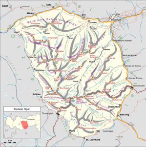
The Hammerspitze is located in the twelve kilometer long Serleskamm , which separates the Gschnitztal in the southeast from the Pinnistal ( orographically right side valley of the Stubai Valley ) in the northwest and from the Pinnisjoch over the 2692 m high Ilm and 2840 m high Kirchdachspitze (southwest) and the 2728 m high Kesselspitze (northeast) to the 2717 m high eponymous Serles .
reachability
The easiest way to get to the Hammerspitze is from the Padasterjochhaus, 400 meters to the east , via the 2528 m high notch to the north of the summit in just over an hour. You can get to this Naturfreundehaus from Trins in the Gschnitztal via the Herrensteig or the forest road in a good three hours.
The Rohrauersteig from the Pinnistal (from Issenanger in about four hours) is ideal for experienced climbers.
Both routes can also be easily combined into one crossing, as both Trins (Gschnitztal) and Neder (Stubaital) can be easily reached by public transport .
outlook
From the summit you have a panoramic view of the surrounding mountains of the Stubai Alps, but also of the Karwendel (north) and the Tux and Zillertal Alps (east). In a south-south-east direction you can even see the Dolomites with Piz Boè , Marmolata and Langkofel lying on the other side of the main Alpine ridge .
Web links
- Summit on your-berge.de (mountain & hiking portal )
- Mountain tours from the Padasterjochhaus (hut homepage)
- Description of the Rohrauersteig from Neder (private tour report)
- Transition to your-berge.de (clear tour report )
supporting documents
- ↑ a b tirisMaps , accessed on 2016-10-07
- ↑ Summit book case on the cross of the Hammerspitze
- ↑ a b AMap (BEV) no altitude information in ÖK 50


