Healing horn
|
Healing horn
City of Osterholz-Scharmbeck
|
|
|---|---|
| Coordinates: 53 ° 14 ′ 17 " N , 8 ° 42 ′ 38" E | |
| Height : | 40 m above sea level NHN |
| Area : | 6.5 km² |
| Residents : | 414 (2008) |
| Population density : | 64 inhabitants / km² |
| Incorporation : | March 1, 1974 |
| Postal code : | 27711 |
| Area code : | 04795 |
|
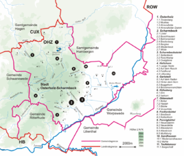
Location of Heilshorn in the city of Osterholz-Scharmbeck
|
|
|
Heilshorn and its surroundings
|
|
Heilshorn , originally a village, is a place in the urban area of Osterholz-Scharmbeck in the district of Osterholz with around 2000 inhabitants.
geography
Heilshorn is about eight kilometers west of Osterholz-Scharmbeck and on the route of the former federal highway 6 (Cuxhaven-Goslar-Leipzig-Görlitz). The village is located northwest of the Stotel forest and is surrounded by the Schönebecker Aue , a Geestrandbach. The valley of the Schönebecker Aue cuts the Osterholzer Geest in the area of Heilshorn in a north-south direction. Bremen Switzerland joins to the west and Lange Heide to the northeast . The district of the same name, Lange Heide , which today forms the most populous part of the village, is about 2 kilometers north of the village on the edge of the forest of the Osterholz-Scharmbeck state forest.
history
Heilshorn belonged to the parish of Lesum . This parish included the places Aumund (until 1871, then its own parish), "bei Lesumstotel" (old name for the later places Loge and Werschenrege), Borchshöhe (is a separate place name from around 1800), Brundorf , Burgdamm , Dunge (also divided into Kleine Dunge and Große Dunge), Eggestedt , Erve (in old entries as an inheritance), Friedrichsdorf (part of Grohn, since around 1830 as a separate place name), Grohn , Habichthorst , Hahnhorst , Hawichhorst , Holthorst , Ihlpohl , Lesum , Lesumbrok (until 1820 to Lesum, then belonged to the parish of Vegesack ), Lesumstotel , Leuchtenburg , Lobbendorf , Loge, Löhnhorst , Marßel , Neu-Lesum, Neu-Schönebeck, Neufähr , Osterhagen , Ovelgönne , Platjenwerbe , Schönebeck , St. Magnus , Stendorf , Stubben , "In front of the Burgdamm", "in front of the Vegesack", Vorwolde , Werschenrege , Wollah (or Willa, Wolda) and Wölpsche . Of these places have belonged to Bremen since 1939 : Aumund, Burgdamm, Grohn, Lesum, Lobbendorf, Marßel, Schönebeck, St. Magnus.
(This parish was then the basis of the parish of Lesum , which was renamed the parish of Osterholz-Scharmbeck in 1948. The superintendent was then relocated to Osterholz-Scharmbeck . Until 1949, the parishes of Aumund, Blumenthal , Bruch, Grohn, Hambergen , Lesum, Meyenburg , Osterholz , Ritterhude , Scharmbeck and Schwanewede to the church district .)
The formerly independent municipality of Heilshorn was incorporated into the city of Osterholz-Scharmbeck on March 1, 1974 . In particular, the settlement of US troops in Garlstedt in 1978 in the new Lucius D. Clay barracks led to a strong Americanization of the village; Petrol stations and merchants adjusted to the " American way of life ". After the withdrawal of the Americans, the barracks are now used as a logistics school for the German Armed Forces , hardly anything can be seen today.
coat of arms
The coat of arms shows a crenellated red gate on top of a golden background, in front of which a blue ribbon stretches. This stands for the manor house "derer von der Lieth" surrounded by a moat . The silver Germanic horn on a red background in the lower part of the coat of arms is supposed to symbolize the long history of the place.
economy
The Faun company has left the city center of Osterholz-Scharmbeck and has a new plant for the construction of municipal vehicles in the city's new industrial area in Heilshorn.
Several commercial operations have been relocated in the border area to the town of Brundorf , in particular a central warehouse for the food discounter Lidl , the Präwest group of companies, Booster and some smaller companies.
In 1993, the “Weißes Haus” hotel on Sandbergweg was founded in Heilshorn as the first hotel for the disabled in Germany.
In 2006, a senior citizens' shared flat was founded, which is also located in Sandbergweg. The senior citizens' flat has space for up to 12 senior citizens.
education
There is a kindergarten and a primary school at educational institutions.
Sports
The local sports club Sportfreunde Heilshorn 1971 e. V. has around 350 members. He is active in the following branches: badminton, ladies gymnastics, parent-child gymnastics, fight club, soccer, table tennis and volleyball. Furthermore, you can take the German sports badge at the Sportfreunde . The highlight of the club year is the Ascension Run , which has been held annually on Ascension Day since 1971 and attracts more than 200 runners. The ascension run offers running distances of 400 m, 800 m, 1000 m, 3 km, 5 km, 10 km and a half marathon.
traffic
Three VBN bus routes cross in Heilshorn . They connect Heilshorn with the core town of Osterholz-Scharmbeck, with the surrounding towns and with Bremen and in some cases also ensure the inner-city development. Heilshorn is connected in an east-west direction via the state road 149 with Osterholz-Scharmbeck and with the A 27 near Eggestedt (Schwanewede exit). Landesstraße 135 also leads south to the A 27 and Bremen .
Web links
Individual evidence
- ^ Federal Statistical Office (ed.): Historical municipality directory for the Federal Republic of Germany. Name, border and key number changes in municipalities, counties and administrative districts from May 27, 1970 to December 31, 1982 . W. Kohlhammer, Stuttgart / Mainz 1983, ISBN 3-17-003263-1 , p. 244 .
- ↑ Sportfreunde Heilshorn 1971 e. V. Accessed May 18, 2015.


