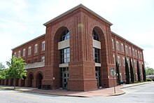
Hinesville
| Hinesville | |
|---|---|
|
County and state location
|
|
| Basic data | |
| Foundation : | 1837 |
| State : | United States |
| State : | Georgia |
| County : | Liberty County |
| Coordinates : | 31 ° 50 ′ N , 81 ° 37 ′ W |
| Time zone : | Eastern ( UTC − 5 / −4 ) |
| Residents : | 33,437 (as of 2010) |
| Population density : | 796.1 inhabitants per km 2 |
| Area : | 42.3 km 2 (approx. 16 mi 2 ) of which 42 km 2 (approx. 16 mi 2 ) are land |
| Height : | 23 m |
| Area code : | +1 912 |
| FIPS : | 13-38964 |
| GNIS ID : | 0331992 |
| Website : | www.cityofhinesville.org |
| Mayor : | Allen Brown |
Hinesville is a city and also the county seat of Liberty County in the US state of Georgia with 33,437 inhabitants (as of 2010). It is one of the major centers in the Hinesville – Fort Stewart metropolitan area .
geography
Hinesville is about 50 km southwest of Savannah and about 370 km southeast of Atlanta . Neighboring cities are Flemington in the northeast and Allenhurst and Walthourville in the south. Fort Stewart military base , a CDP , borders the city to the north.
history
Liberty County was founded in 1777. Hinesville was founded in 1837 and at the same time made a county seat , replacing Riceboro as the administrative seat. The place was named after the politician Charleton Hines.
In the first few decades, Hinesville developed enormously. The production of turpentine from pine resin and the cultivation of indigo plants , rice and cotton were economically important . William T. Sherman's March to the Sea as part of the Civil War put an abrupt end to the upswing in the winter of 1864. The population became impoverished and completely destitute, and large parts of them left the area. Looting of freed slaves and displaced soldiers was feared.
After the war, Hinesville initially only had a school for the black population. In 1870 a public school for the poor and the private Hinesville Academy opened, later renamed the Bradwell Institute after its founder . The institute quickly gained a reputation throughout Georgia. Despite this success, Hinesville remained a sleepy area. In 1920, only 315 residents were registered in the city. The county seat was everything that made Hinesville stand out from the crowd. The global economic crisis initially prevented further development.
In 1940, an area north of the city was selected to serve as a training facility for the US military. The site was named after a general in the American Revolutionary War , Daniel Stewart, at Camp Stewart . This development led to an enormous economic boom in Hinesville. Many soldiers moved into the city with their families, and traders with ties to the military found a gold mine here. The streets were full of jukeboxes , gambling dens, fast food outlets, bars, fashion stores, and two United Service Organizations (USO) clubs . By D-Day 1944, around 55,000 soldiers were stationed at Camp Stewart. During these years, Hinesville experienced modernization of the water supply, sewerage, garbage disposal and road construction. In 1956, Camp Stewart was renamed Fort Stewart.
Demographic data
According to the 2010 census, the then 33,437 inhabitants were distributed over 12,324 inhabited households, which gives an average of 2.69 people per household. There are a total of 14,653 households.
73.5% of the households were family households (consisting of married couples with or without offspring or one parent with offspring) with an average size of 3.12 persons. Children under the age of 18 lived in 45.4% of all households and persons aged 65 or over in 11.3% of all households.
33.7% of the population were younger than 20 years old, 33.0% were 20 to 39 years old, 24.6% were 40 to 59 years old, and 8.7% were at least 60 years old. The mean age was 28 years. 47.3% of the population were male and 52.7% were female.
40.0% of the population identified themselves as whites , 47.4% as African American , 0.5% as Indians and 2.6% as Asian Americans . 4.2% said they belonged to another ethnic group and 5.3% to several ethnic groups. 11.5% of the population was made up of Hispanics or Latinos .
The average annual income per household was 42,949 USD , while 15.7% of the population lived below the poverty line.
Attractions
The Bacon-Fraser House , Liberty County Courthouse, and Liberty County Jail are listed on the National Register of Historic Places .
traffic
Hinesville is crossed by US Highway 84 and Georgia State Routes 119 and 196 . In the rail freight sector, the city is served by CSX via a track branch from Allenhurst . The local, military and civilian used MidCoast Regional Airport at Wright Army Airfield is located about five kilometers northeast of the city. The nearest international airport is Savannah / Hilton Head Airport (around 60 km northeast).
crime
The crime rate in 2010 was 441 points (US average: 266 points) in the above-average range. There were five murders, nine rapes, 45 robberies, 90 assaults, 448 break-ins, 1148 thefts, 64 car thefts, and five arson.
Web links
- Website of the city (Engl.)
Individual evidence
- ↑ Hinesville. Retrieved April 3, 2018 .
- ^ Profile of General Population and Housing Characteristics: 2010 . United States Census Bureau . Retrieved April 3, 2018.
- ↑ GEORGIA - Liberty County. National Register of Historic Places , accessed April 3, 2018 .
- ↑ http://www.city-data.com/crime/crime-Hinesville-Georgia.html

