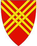
Hjelmeland
| coat of arms | map | |
|---|---|---|

|
|
|
| Basic data | ||
| Commune number : | 1133 | |
| Province (county) : | Rogaland | |
| Administrative headquarters: | Hjelmelandsvågen | |
| Coordinates : | 59 ° 13 ′ N , 6 ° 20 ′ E | |
| Surface: | 1,067.78 km² | |
| Residents: | 2,574 (Feb 27, 2020) | |
| Population density : | 2 inhabitants per km² | |
| Language form : | Nynorsk | |
| Website: | ||
| politics | ||
| Mayor : | Bjørn Laugaland ( Sp ) (2015) | |
| Location in the province of Rogaland | ||

|
||
Hjelmeland is a Norwegian municipality in the Fylke Rogaland .
location
The municipality belongs to the Ryfylke region . Hjelmeland is bordered by Suldal to the north, Bykle to the east, Sandnes and Strand to the south and Stavanger to the west . The administrative center is in Hjelmelandsvågen .
history
The largest towns are Fister and Årdal (with the building stone from Tveit ). The two previous municipalities were merged into Hjelmeland municipality in 1965.
Årdal has a renaissance church built in the 17th century, Årdal Old Church .
On January 1, 2020, the part of the island of Ombo that belonged to Hjelmeland came to Stavanger, making Hjelmeland about 24 km² smaller.
economy
The main industries are fish and fruit production.
Web links
Commons : Hjelmeland - collection of images, videos and audio files

