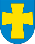
Klepp
| coat of arms | map | |
|---|---|---|

|
|
|
| Basic data | ||
| Commune number : | 1120 | |
| Province (county) : | Rogaland | |
| Administrative headquarters: | Kleppe | |
| Coordinates : | 58 ° 47 ' N , 5 ° 36' E | |
| Height : | 1 moh. | |
| Surface: | 113.49 km² | |
| Residents: | 19,588 (Feb 27, 2020) | |
| Population density : | 173 inhabitants per km² | |
| Language form : | Nynorsk | |
| Website: | ||
| traffic | ||
| Railway connection: | Jærbanen | |
| politics | ||
| Mayor : | Sigmund Rolfsen ( Sp ) (2019) | |
| Location in the province of Rogaland | ||

|
||
Klepp is a municipality in the Norwegian Fylke Rogaland about 25 km south of Stavanger . The administrative center is the town of Kleppe. Other places in the municipality are Orre , Orstad , Pollestad , Verdalen and Voll .
The municipality is located in the Jæren region . Neighboring municipalities are Hå in the south, Time in the south and east and Sola and Sandnes in the north.
The Krosshaug von Klepp is located on the 102 m high Tinghaug, south of Klepp.
Jærens Rev
At the westernmost point of the municipality, the Jærens Rev , a dangerous sandbank with changing contours for shipping, extends up to two nautical miles into the North Sea ; it had a reputation as a ship graveyard for centuries.
Sons and daughters of the commune
- Frederik Diderik Sechmann Fleischer (1783–1849), merchant
- Borgen Bøe (1908–1941) Resistance fighter against the National Socialist occupation
Web links
Commons : Klepp - collection of images, videos and audio files

