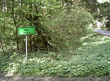
Horka (Rybník nad Radbuzou)
| Horka | ||||
|---|---|---|---|---|
|
||||
| Basic data | ||||
| State : |
|
|||
| Region : | Plzeňský kraj | |||
| District : | Domažlice | |||
| Municipality : | Rybník nad Radbuzou | |||
| Geographic location : | 49 ° 32 ' N , 12 ° 42' E | |||
| Height: | 600 m nm | |||
| Residents : | 0 (2018) | |||
Horka (German Putzbühl ) is a deserted area in the municipality of Rybník nad Radbuzou (German Waier ) in Okres Domažlice in West Bohemia in the Czech Republic .
geography
The small village of Putzbühl was about 4 km west of Muttersdorf and 2.7 km northeast of Waier. The Radbuza is about 1.5 km away in the valley west of Putzbühl. The Groß Gorschiner water rises near Putzbühl, is dammed up to a pond near Groß Gorschin and flows 750 m further west into the Radbuza.
history
Putzbühl was first mentioned in writing in 1675: Ödung der Wittibin Margareta Spörlin, lying at the Buz Pichl. It was part of Klein Gorschin and belonged to the Schwanenbrückl estate of the Lords of Wiedersperg . In the registers of 1682 Putzbühl was alternately referred to as Finkenbühl. In 1784 it got its own baptismal register. In 1788, Stefan Pechtl and Johann Hilpert were named as owners in Putzbühl. The village belonged to the municipality of Groß Gorschin. The children went to school in Waier.
Population development
| year | Residents | Remarks |
|---|---|---|
| 1784 | 11 | 2 houses |
| 1832 | 34 | 5 houses |
| 1851 | 46 | |
| 1890 | 37 | |
| 1900 | 39 | |
| 1910 | 33 | 6 houses |
| 1921 | 32 | |
| 1930 | 31 Germans | 6 houses |
See also
literature
- Franz Liebl u. a. (Ed.): Our home district Bischofteinitz with the German settlements in the district of Taus. Furth in the forest 1967.
- Zdeněk Procházka : On the trail of the disappeared villages of the Bohemian Forest - Tauser part. Translation into German: A. Vondrušová, Nakladatelství Ceského lesa Domažlice publishing house
Web links
Individual evidence
- ^ Josef Bernklau after Johann Micko: Putzbühl. In: Franz Liebl, Heimatkreis Bischofteinitz (Hrsg.): Our Heimatkreis Bischofteinitz. Brönner & Daentler KG, Eichstätt 1967, p. 351.
- ↑ http://mapire.eu/de/map/hkf_75e/?layers=osm%2C8&bbox=1407847.1591199106%2C6363677.772496137%2C1420898.7816996044%2C6369037.919104635
- ↑ Ludwig Schötterl: The waters. In: Franz Liebl, Heimatkreis Bischofteinitz (Hrsg.): Our Heimatkreis Bischofteinitz. Brönner & Daentler KG, Eichstätt 1967, p. 22.
- ^ Josef Bernklau with the assistance of Johann Richter: Schwanenbrückl. In: Franz Liebl, Heimatkreis Bischofteinitz (Hrsg.): Our Heimatkreis Bischofteinitz. Brönner & Daentler, Eichstätt 1967, pp. 358-360.
- ^ Josef Bernklau after Johann Micko: Putzbühl. In: Franz Liebl, Heimatkreis Bischofteinitz (Hrsg.): Our Heimatkreis Bischofteinitz. Brönner & Daentler KG, Eichstätt 1967, p. 351.
- ↑ http://www.bischofteinitz.de/Orte/putzbuehl.htm ( page no longer available , search in web archives ) Info: The link was automatically marked as defective. Please check the link according to the instructions and then remove this notice.
- ↑ Census results from December 1, 1930. In: Franz Liebl, Heimatkreis Bischofteinitz (Ed.): Our Heimatkreis Bischofteinitz. Brönner & Daentler KG, Eichstätt 1967, p. 882


