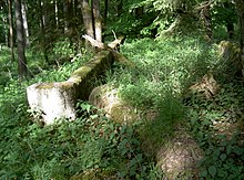
Nový mlýn (Rybník nad Radbuzou)
| Nový mlýn | ||||
|---|---|---|---|---|
|
||||
| Basic data | ||||
| State : |
|
|||
| Region : | Plzeňský kraj | |||
| District : | Domažlice | |||
| Municipality : | Rybník nad Radbuzou | |||
| Geographic location : | 49 ° 33 ' N , 12 ° 40' E | |||
| Height: | 514 m nm | |||
| Residents : | 0 (2018) | |||
Nový mlýn (German Neumühle ) is a deserted area in the municipality of Rybník nad Radbuzou (German Waier ) in Okres Domažlice in West Bohemia in the Czech Republic .
geography
Neumühle was about 500 m west of Neubäu , 4 km north of Waier, 1 km north of Schwanenbrückl , 6 km west of Muttersdorf , 5.7 km southwest of Heiligenkreuz on the east bank of the Radbuza directly on the river.
history
Neumühle is not yet shown on the map "Europe in the 18th Century". Neumühle does not appear by name on the maps from the 19th century, but as a small millwheel west of Neubäu on the banks of the Radbuza. From this one can conclude that the Neumühle was only founded at the beginning of the 19th century. The article about Neubäu mentions that it belonged to Neubäu.
See also
literature
- Franz Liebl u. a. (Ed.): Our home district Bischofteinitz with the German settlements in the district of Taus. Furth in the forest 1967.
- Zdeněk Procházka : On the trail of the disappeared villages of the Bohemian Forest - Tauser part. Translation into German: A. Vondrušová, Nakladatelství Ceského lesa Domažlice publishing house
Web links
Commons : Nový mlýn (Rybník) - collection of pictures, videos and audio files
Individual evidence
- ↑ https://mapire.eu/de/map/thirdsurvey75000/?layers=osm%2C43&bbox=1406695.4622422517%2C6367252.221108267%2C1413956.9799293433%2C6369163.146815397
- ↑ https://mapire.eu/de/map/europe-18century-firstsurvey/?layers=osm%2C163%2C165&bbox=1405757.2057783473%2C6367718.494179016%2C1413018.723465439%2C6369629.419886146
- ↑ https://mapire.eu/de/map/thirdsurvey75000/?layers=osm%2C43&bbox=1404025.910819966%2C6366730.546871395%2C1418548.9461941498%2C6370552.398285654
- ^ Josef Bernklau: Neubäu. In: Franz Liebl, Heimatkreis Bischofteinitz (Hrsg.): Our Heimatkreis Bischofteinitz. Brönner & Daentler KG, Eichstätt 1967, pp. 344-345.


