Ibaraki (Ibaraki)
| Ibaraki-machi 茨城 町 |
||
|---|---|---|
| Geographical location in Japan | ||
|
|
||
| Region : | Kanto | |
| Prefecture : | Ibaraki | |
| Coordinates : | 36 ° 17 ' N , 140 ° 25' E | |
| Basic data | ||
| Surface: | 121.58 km² | |
| Residents : | 31,906 (October 1, 2019) |
|
| Population density : | 262 inhabitants per km² | |
| Community key : | 08302-0 | |
| Symbols | ||
| Flag / coat of arms: | ||
| town hall | ||
| Address : |
Ibaraki Town Hall 1080 Ozutsumi Ibaraki- machi , Higashi-Ibaraki-gun Ibaraki 311-3192 |
|
| Website URL: | http://www.town.ibaraki.lg.jp/ | |
| Location of Ibarakis in Ibaraki Prefecture | ||
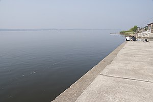
Ibaraki ( jap. 茨城町 Ibaraki-machi ) is a town (- machi ) in the district (-gun) East Ibaraki ( Higashi-Ibaraki ) of the Japanese prefecture (ken) Ibaraki . It is located in the center a little off the coast of Ibaraki on the west bank of the brackish water Hinuma ( 涸 沼 ), immediately south of the capital Mito . The Hinuma River (-gawa) flows through the city from the west and feeds the lake.
The city of Ibaraki was founded in 1955 through the amalgamation of Nagaoka City , Kawane Villages , Kaminoai from East Ibaraki County and Numasaki Village from Kashima County . In 1958, the village of Ishizaki in the northeast was incorporated, which means that the city reached its current size, apart from minor border corrections.


