Koga (Ibaraki)
| Koga-shi 古河 市 |
||
|---|---|---|
| Geographical location in Japan | ||
|
|
||
| Region : | Kanto | |
| Prefecture : | Ibaraki | |
| Coordinates : | 36 ° 11 ′ N , 139 ° 45 ′ E | |
| Basic data | ||
| Surface: | 123.58 km² | |
| Residents : | 139,274 (October 1, 2019) |
|
| Population density : | 1127 inhabitants per km² | |
| Community key : | 08204-0 | |
| Symbols | ||
| Flag / coat of arms: | ||
| town hall | ||
| Address : |
Koga City Hall in 2248 , Shimoōno Koga -shi Ibaraki 306-0291 |
|
| Website URL: | http://www.city.koga.ibaraki.jp/ | |
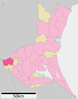
| Location Kogas in Ibaraki Prefecture | ||
Koga ( Japanese 古河 市 , -shi ) is a city in Ibaraki Prefecture in Japan .
history
Koga is an old castle town founded by Shimokobe Yukiyoshi in the 13th century. After that it was used by the Uesugi and the Oyama (1382). In 1554, Hōjō Ujiyasu took over the castle. During the Tokugawa period, Koga Castle was successively owned by the Ogasawara , Nagai , Doi , Hotta , Matsudaira , Ōkochi , Honda , Matsui and then again from 1762 to 1868 by the Doi with an income of 80,000 Koku .
On August 1, 1950, Koga was named a shi (urban district).
traffic
- Street:
- National Road 4 , to Tōkyō or Aomori
- National Road 125, to Kumagaya or Oyama
- Train:
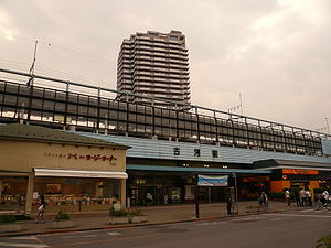
- JR Tōhoku Line to Tōkyō or Aomori
Neighboring cities and communities
literature
- E. Papinot: Historical and Geographical Dictionary of Japan. Reprint of the original 1910 edition by Tuttle, 1972. ISBN 0-8048-0996-8 .
Web links
Commons : Koga (Ibaraki) - Collection of images, videos and audio files


