Kitaibaraki
| Kitaibaraki-shi 北 茨 城市 |
||
|---|---|---|
| Geographical location in Japan | ||
|
|
||
| Region : | Kanto | |
| Prefecture : | Ibaraki | |
| Coordinates : | 36 ° 48 ' N , 140 ° 45' E | |
| Basic data | ||
| Surface: | 186.49 km² | |
| Residents : | 42,122 (October 1, 2019) |
|
| Population density : | 226 inhabitants per km² | |
| Community key : | 08215-5 | |
| Symbols | ||
| Flag / coat of arms: | ||
| Tree : | Pine trees | |
| Flower : | rhododendron | |
| Bird : | Common gull | |
| town hall | ||
| Address : |
Kitaibaraki City Hall 1630 Isoharachō-Isohara Kitaibaraki -shi Ibaraki 319-0192 |
|
| Website URL: | http://www.city-kitaibaraki.jp | |
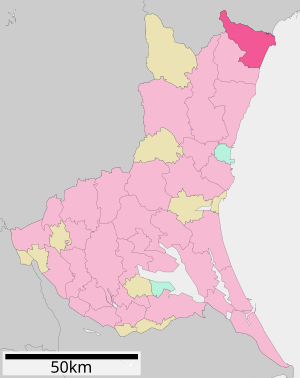
| Location Kitaibarakis in Ibaraki Prefecture | ||
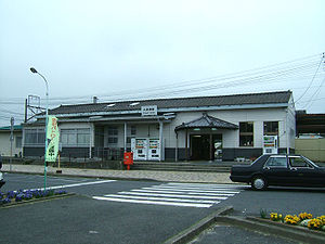
Kitaibaraki ( Japanese 北 茨 城市 , - shi , dt. "North Ibaraki") is a city in Japan in the prefecture of Ibaraki .
geography
Kitaibaraki is north of Hitachi and south of Iwaki .
history
The city of Kitaibaraki was founded on March 31, 1956 from the former parishes of Isohara, Otsu, Sekinan, Sekimoto, Hiragata, and Minaminakazato from Taga County.

a: Flood heights (triangles) and overflow heights (circles)
b: Tsunami damage
c: Traces of water on the glazed entrance door
On March 11, 2011, the city was hit by the Tōhoku earthquake and the subsequent tsunami. The number of completely destroyed residential buildings is put at 188 and that of the partially destroyed at 1,336. The fire and disaster control authority reported 10 dead and one missing person in Kitaibaraki. In the district of Hirakatacho, the fishing port and the residential area were badly damaged. The tsunami destroyed the first floor of many houses. Traces of water on the buildings indicate flood heights of 6.6–7.2 m, while traces of debris show heights of 7.9 and 8.1 m.
traffic
- Train:
- JR - Jōban Line
- Street:
- Jōban highway to Tokyo or Iwaki
- National Road 6 to Tokyo or Sendai
sons and daughters of the town
- Tatsuya Ishi , singer
Neighboring cities and communities
Individual evidence
- ↑ Yoshinobu Tsuji, Kenji Satake, Takeo Ishibe, Tomoya Harada, Akihito Nishiyama, Satoshi Kusumoto: Tsunami Heights along the Pacific Coast of Northern Honshu Recorded from the 2011 Tohoku . In: Pure and Applied Geophysics . tape 171 , no. 12 , 2014, p. 3183-3215 , doi : 10.1007 / s00024-014-0779-x . (Published online March 19, 2014). License: Creative Commons Attribution 4.0 International (CC BY 4.0). Here: p. 3193, Figure 12.
- ↑ a b 平 成 23 年 (2011 年) 東北 地方 太平洋 沖 地震 (東 日本 大 震災) に つ い て (第 157 報) ( Memento of March 18, 2018 on WebCite ) ( PDF ( Memento of March 18, 2018 on WebCite )), 総 務省 消防 庁 (Fire and Disaster Management Agency), March 7, 2018.
- ↑ Yoshinobu Tsuji, Kenji Satake, Takeo Ishibe, Tomoya Harada, Akihito Nishiyama, Satoshi Kusumoto: Tsunami Heights along the Pacific Coast of Northern Honshu Recorded from the 2011 Tohoku . In: Pure and Applied Geophysics . tape 171 , no. 12 , 2014, p. 3183-3215 , doi : 10.1007 / s00024-014-0779-x . (Published online March 19, 2014).
Web links
- Official Website (Japanese)


