Inzá
| Inzá | ||
|---|---|---|
|
Coordinates: 2 ° 33 ' N , 76 ° 4' W Inzá on the map of Colombia
|
||
|
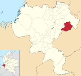
Location of the municipality of Inzá on the map of Cauca
|
||
| Basic data | ||
| Country | Colombia | |
| Department | Cauca | |
| City foundation | 1577 | |
| Residents | 32,582 (2019) | |
| City insignia | ||
| Detailed data | ||
| surface | 1258 km 2 | |
| Population density | 26 people / km 2 | |
| height | 1800 m | |
| Time zone | UTC -5 | |
| City Presidency | Gelmis Chate Rivera (2016-2019) | |
| Website | ||
| Shaft grave in Tierradentro | ||
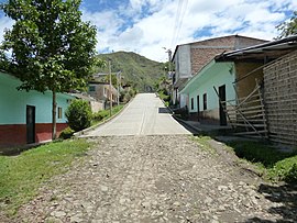
| Street in San Andrés de Psimbalá | ||
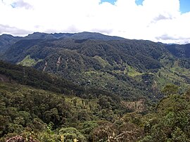
| Landscape in Inzá | ||
Inza is a municipality ( municipio ) in the department of Cauca in Colombia . In the municipality of Inzá, near the town of San Andrés de Psimbalá, there is the Tierradentro Archaeological Park , a UNESCO World Heritage Site .
geography
Inzá is located in the Provincia de Oriente in Cauca in the Tierradentro region at an altitude of 1800 m above sea level. NN , 91 km from Popayán . The municipality borders on Páez to the north, Puracé and La Plata ( Departamento del Huila ) to the south, Páez to the east and Totoró and Silvia to the west .
population
The municipality of Inzá has 32,582 inhabitants, of whom 2324 live in the urban part (cabecera municipal) of the municipality (as of 2019).
history
The place Inzá goes back to the establishment of Sancho García del Espinar in 1577 under the name of San Pedro de Guanacas . Inzá was later resettled. The present place was founded in 1783 by Jerónimo de Inzá. The region was named a municipality in 1885 with Inzá as the capital. The community in its current form has existed since 1907.
economy
Inzá's main industries are agriculture and animal husbandry .
Web links
- Alcaldia Municipal de Inzá Cauca. Alcaldía de Inzá - Cauca, accessed on June 6, 2019 (Spanish, website of the municipality of Inzá).
Individual evidence
- ↑ a b c Nuestro municipio. Alcaldía de Inzá - Cauca, accessed June 6, 2019 (Spanish, information on the municipality).
- ↑ ESTIMACIONES DE POBLACIÓN 1985 - 2005 Y PROYECCIONES DE POBLACIÓN 2005 - 2020 TOTAL DEPARTAMENTAL POR ÁREA. DANE, May 11, 2011, accessed on June 6, 2019 (Spanish, extrapolation of the population of Colombia (Excel; 1.72 MB)).


