
Kühried
|
Kühried
community Teunz
Coordinates: 49 ° 30 ′ 38 ″ N , 12 ° 24 ′ 10 ″ E
|
||
|---|---|---|
| Height : | 564 m | |
| Incorporation : | 1860 | |
| Postal code : | 92552 | |
| Area code : | 09677 | |
Location of Kühried in Bavaria |
||


Kühried was previously an independent municipality. It was joined to the Wildstein community around 1860. This was incorporated on January 1, 1972 on a voluntary basis into the municipality of Teunz in the district of Schwandorf . In the course of the territorial reform, the municipality of Teunz came to the newly established Greater Schwandorf District on July 1, 1972. Since January 1, 1974, the municipalities of Teunz, Gleiritsch , Niedermurach and Winklarn have been amalgamated in the Oberviechtach administrative community .
geography
Kühried is located in the Upper Palatinate North region in the northeastern part of the Schwandorf district south of the "Wildenstein" elevation, on which the remains of the Wildstein castle stalls are located. The place, located at an altitude of 580 m, can be reached via the district road SAD 43 Teunz - Fuchsberg - Kühried - Wildstein.
history
Kühried was first mentioned in writing in 1285 in the Duke's Surbar as the property of Duke Ludwig II of Upper Bavaria .
On March 23, 1913 (Easter), Kühried was listed as part of the Parish Pullenried , branch church Wildeppenried , with 26 houses and 135 inhabitants.
On December 31, 1990, Kühried had 165 inhabitants and belonged to the Wildeppenried branch of the Pullenried parish.
Church building
Kühried community
The Kingdom of Bavaria was divided into 15 districts in 1808. These districts were named after rivers based on the French model ( Naabkreis , Regenkreis , Unterdonaukreis , etc.). The districts were divided into district courts. The districts in turn should be divided into individual municipality areas.
The community of Kühried had been part of the Neunburg vorm Wald regional court since 1820/21 . The localities of Kühried with 23 families, Burkhardsberg with 9 families, Gutenfürst with 14 families, the Höcherlmühle, Hebermühle and Kührieder-Mühle each with one family belonged to the political municipality of Kühried.
Affiliation of the Wildstein community to Kühried
On March 20, 1830, the community of Wildstein with 31 families was incorporated into the community of Kühried with 42 families by mutual agreement. Since in the following period "the Kührieder did not want to be called Wildsteiner and the Wildsteiner did not want to be called Kührieder" , an attempt was made on the Wildsteiner side to dissolve the communal ties. In 1840 "a district court, 1st class in Oberviechtach" was formed. The Oberviechtach regional court agreed to the Wildsteiner's request; the government refused to separate the communities because of the higher administrative costs.
Dissolution of the Kühried community
By 1864 at the latest, Wildstein was again an independent municipality, to which Kühried belonged. On January 1, 1972, the Wildstein community was dissolved. Since January 1, 1974, the municipalities of Teunz , Gleiritsch , Niedermurach and Winklarn have been amalgamated in the Oberviechtach administrative community.
education

School history
With the introduction of compulsory schooling in Bavaria, a school building was built in Kühried, which the children from the Kühried community attended. Sometimes the lessons also took place in neighboring Wildeppenrieth. Due to the declining number of pupils, the Kühried school was closed in 1965. At first they refused to send the children to Teunz. Since no teacher was assigned to Kühried, the lessons were given by a private person. But the resistance was unsuccessful. Since the school year 1965/66, the Kührieder pupils have attended the elementary school in Teunz.
School situation today
Pre-school children are accommodated in the kindergarten in Teunz. The students from Kühried attend the elementary school in Teunz and the Doktor-Eisenbarth-Mittelschule in Oberviechtach. A secondary school can be found in Nabburg, a business school in Weiden and high schools in Oberviechtach, Nabburg and Weiden . The way to school can only be covered by buses.
societies
- Kühried volunteer fire department
Culture and sights
North of the village on the Wildenstein are the remains of Wildstein Castle .
The chapel of St. John the Baptist , built in 1983, stands in the direction of Kühriedermühle .
The castle path runs through Kühried. From Wildstein , 2 km to the northeast, comes the Franconian Way of St. James , which is marked with a white shell on a light blue background. The closest town on the Franconian Way of St. James is Burkhardsberg, 1 km south of Kühried .
Picture gallery
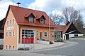
Fire station (2010)

Village chapel Kühried (2011)

Kühried (2010)

Kühriedermühle (2012)


literature
- Georg Hager: The art monuments of the Kingdom of Bavaria, Upper Palatinate and Regensburg, VII. District Office Oberviechtach , Munich 1906
- Dieter Bernd: Vohenstrauss . In: Historical Atlas of Bavaria , part of Old Bavaria . Series I, issue 39. Komm. Für Bayerische Landesgeschichte, Munich 1977, ISBN 3-7696-9900-9 ( digitized version ).
- Emma Mages: Oberviechtach . In: Historical Atlas of Bavaria , part of Old Bavaria . Series I, issue 61. Komm. Für Bayerische Landesgeschichte, Munich 1996, ISBN 3-7696-9693-X ( digitized version ).
- Joseph Heyberger, Chr. Schmitt, v. Wachter: Topographical-statistical manual of the Kingdom of Bavaria with an alphabetical local dictionary . In: K. Bayer. Statistical Bureau (Ed.): Bavaria. Regional and folklore of the Kingdom of Bavaria . tape 5 . Literary and artistic establishment of the JG Cotta'schen Buchhandlung, Munich 1867, urn : nbn: de: bvb: 12-bsb10374496-4 ( digitized version ).
- R. Alfred Hoeppner: The district of Oberviechtach in the past and present, Aßling 1970
- Fränkischer Albverein (Ed.): On the Jakobsweg from Tillyschanz via Schwandorf to Nuremberg. Verlag Seehars, 97215 Uffenheim 1997, ISBN 3-927598-22-4
Individual evidence
- ↑ Emma Mages: Oberviechtach . In: Historical Atlas of Bavaria , part of Old Bavaria . Series I, issue 61. Komm. Für Bayerische Landesgeschichte, Munich 1996, ISBN 3-7696-9693-X , p. 33 ( digitized version ).
- ^ Antonius von Henle (Ed.): Register of the Diocese of Regensburg. Verlag der Kanzlei des Bischöflichen Ordinariates Regensburg, 1916, p. 382
- ↑ Manfred Müller (Ed.): Register of the diocese of Regensburg. Verlag des Bischöflichen Ordinariats Regensburg, 1997, p. 550
- ^ Emmering, Ernst: The government of the Upper Palatinate, history of a Bavarian central authority, contributions to the history and regional studies of the Upper Palatinate, issue 20, Regensburg 1981, p. 12 ff.
- ↑ Emma Mages: Oberviechtach . In: Historical Atlas of Bavaria , part of Old Bavaria . Series I, issue 61. Komm. Für Bayerische Landesgeschichte, Munich 1996, ISBN 3-7696-9693-X , p. 205-206 ( digitized version ).
- ↑ Emma Mages: Oberviechtach . In: Historical Atlas of Bavaria , part of Old Bavaria . Series I, issue 61. Komm. Für Bayerische Landesgeschichte, Munich 1996, ISBN 3-7696-9693-X , p. 219 ( digitized version ).
- ↑ Dieter Bernd: Vohenstrauss . In: Historical Atlas of Bavaria , part of Old Bavaria . Series I, issue 39. Komm. Für Bayerische Landesgeschichte, Munich 1977, ISBN 3-7696-9900-9 , p. 200 f . ( Digitized version ).
- ^ Joseph Heyberger, Chr. Schmitt, v. Wachter: Topographical-statistical manual of the Kingdom of Bavaria with an alphabetical local dictionary . In: K. Bayer. Statistical Bureau (Ed.): Bavaria. Regional and folklore of the Kingdom of Bavaria . tape 5 . Literary and artistic establishment of the JG Cotta'schen Buchhandlung, Munich 1867, Sp. 726 , urn : nbn: de: bvb: 12-bsb10374496-4 ( digital copy ).
- ↑ http://www.teunz.de/ Homepage of the municipality of Teunz, history
- ^ R. Alfred Hoeppner: The district of Oberviechtach in the past and present, Aßling 1970, pp. 221,222
- ↑ Manfred Müller (Ed.): Register of the diocese of Regensburg. Verlag des Bischöflichen Ordinariats Regensburg, 1997, p. 551
- ^ Fränkischer Albverein (Ed.): On the Way of St. James from Tillyschanz via Schwandorf to Nuremberg. Verlag Seehars, 97215 Uffenheim 1997, ISBN 3-927598-22-4 , p. 17
Web links


Burkhardsberg | Fuchsberg | Good Prince | Haidhof | Hebermühle | Hermannsried | Höcherlmühle | Kühried | Kühriedermühle | Miesmühle | Ödmiesbach | Ödreichersried | Schömersdorf | Fir bow | Teunz | Weiherhäusl | Wildstein | Zeinried