
Niedermurach
| coat of arms | Germany map | |
|---|---|---|

|
Coordinates: 49 ° 27 ' N , 12 ° 23' E |
|
| Basic data | ||
| State : | Bavaria | |
| Administrative region : | Upper Palatinate | |
| County : | Schwandorf | |
| Management Community : | Oberviechtach | |
| Height : | 423 m above sea level NHN | |
| Area : | 29.96 km 2 | |
| Residents: | 1242 (Dec. 31, 2019) | |
| Population density : | 41 inhabitants per km 2 | |
| Postal code : | 92545 | |
| Area code : | 09671 | |
| License plate : | SAD, BUL , NAB , NEN, OVI, ROD | |
| Community key : | 09 3 76 148 | |
| Community structure: | 18 districts | |
| Association administration address: | Bezirksamtstr. 5 92526 Oberviechtach |
|
| Website : | ||
| Mayor : | Martin Prey | |
| Location of the community of Niedermurach in the district of Schwandorf | ||
  |
||


Niedermurach is a municipality in the Upper Palatinate district of Schwandorf and a member of the Oberviechtach administrative community .
geography
Niedermurach is located in the Upper Palatinate North region .
Community structure
In addition to the main town, the community of Niedermurach consists of the following 17 districts:
There are the districts of Pertolzhofen, Niedermurach, Nottersdorf, Rottendorf, Voggendorf and Wagnern.
history
Until the church is planted
Murach was first mentioned in 1110. The place was part of the Electoral Palatinate and since 1777 the Electorate of Bavaria and formed a closed Hofmark of the Barons of Murach whose seat was Schloss Niedermurach. In 1818 today's political community was established.
Incorporations
On January 1, 1972, the communities of Nottersdorf and Wagnern were incorporated. On July 1, 1972, Pertolzhofen and Rottendorf were added. At the same time, the Oberviechtach district was dissolved . Since then, the community of Niedermurach has belonged to the newly formed district of Schwandorf, which was called the district of Schwandorf in Bavaria until May 1, 1973 .
Population development
Between 1988 and 2018 the population fell from 1,342 to 1,245 by 97 inhabitants or 7.2%.
- 1961: 1449 inhabitants
- 1970: 1425 inhabitants
- 1987: 1366 inhabitants
- 1991: 1375 inhabitants
- 1995: 1369 inhabitants
- 2000: 1366 inhabitants
- 2005: 1337 inhabitants
- 2010: 1293 inhabitants
- 2015: 1254 inhabitants
politics
|
Allocation of seats in the Niedermurach municipal council (16.03.2014)
A total of 11 seats
|
Municipal council
| ABN 1 | WGP 2 | FWN 3 | BUR 4 |
|---|---|---|---|
| 5 seats | 4 seats | 1 seat | 2 seats |
1 Active citizens of Niedermurach and the surrounding area 2 Voting community Pertolzhofen and surrounding area
3 Free voter community Nottersdorf and surrounding area 4 Citizens' union Rottendorf and surrounding area
mayor
- 1946–1972: Josef Niederalt
- 1972–1996: Konrad Zeitler
- 1996-2014: Rainer Eiser (WGP)
- 2014–: Martin Prey (ABN)
tax income
The municipal tax receipts in 2014 amounted to 1.2 million euros.
coat of arms
Blazon : Split; in front a silver zigzag bar in red; at the back split five times by silver and blue.
Architectural monuments
Economy and Infrastructure
Economy including agriculture and forestry
In 1998, according to official statistics, there were 80 people in the manufacturing sector and no employees in the field of trade and transport who were subject to social insurance contributions at the place of work. In other economic areas, 26 people were employed at the place of work subject to social security contributions. There were 443 employees at the place of residence subject to social security contributions. There were none in manufacturing and five in construction. In addition, in 1999 there were 93 farms with an agriculturally used area of 1747 ha, of which 1240 ha were arable land and 505 ha were permanent green space.
traffic
The Niedermurach train station was on the now-closed Nabburg – Schönsee railway line .
education
In 1999 the following institutions existed:
- 25 kindergarten places with 46 children in the St. Marien kindergarten in Pertolzhofen
- An elementary school with four teachers and 71 students
Personalities
Sons and daughters of the church
- Alois Gillitzer (1944–2019), German folk musician
- Alois Niederalt (1911–2004), German politician ( CSU ), Member of the Bundestag , Federal Minister for Affairs of the Bundesrat and the Länder
Other personalities associated with Niedermurach
- Thomas Philipp von Murach († 1584) owner of the Hofmark Niedermurach and the Pellerschloss in Fischbach
- Christoph Gottfried von Murach (1656–1702) owner of Hofmark Niedermurach and caretaker at Obermurach Castle
- Eva Sophie von Murach (1695–1765) Countess and daughter of Christoph Gottfried, memorial stone in the church
photos
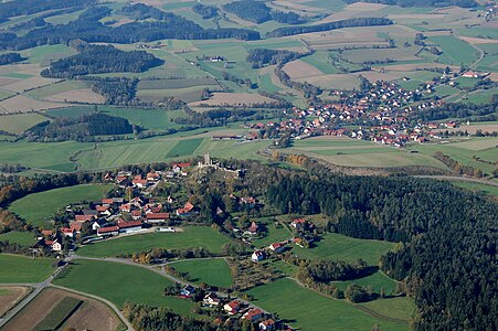
Castle ruin Haus Murach (Obermurach) with Niedermurach

Parish church in Niedermurach (2009)

Walpurgis Chapel (City of Oberviechtach)

House Murach castle ruins (Obermurach)

Rottendorf (2012)


Individual evidence
- ↑ "Data 2" sheet, Statistical Report A1200C 202041 Population of the municipalities, districts and administrative districts 1st quarter 2020 (population based on the 2011 census) ( help ).
- ↑ http://www.bayerische-landesbibliothek-online.de/orte/ortssuche_action.html ? Anzeige=voll&modus=automat&tempus=+20111210/005824&attr=OBJ&val= 1054
- ^ Wilhelm Volkert (ed.): Handbook of Bavarian offices, communities and courts 1799–1980 . CH Beck, Munich 1983, ISBN 3-406-09669-7 , p. 544 .
- ↑ https://www.vg-oberviechtach.de/index.phtml?La=1&sNavID=1741.107&mNavID=1741.7&object=tx,1741.509.1&kat=&kuo=1&text=&sub=0
literature
- Emma Mages: Oberviechtach . In: Historical Atlas of Bavaria , part of Old Bavaria . Series I, issue 61. Komm. Für Bayerische Landesgeschichte, Munich 1996, ISBN 3-7696-9693-X ( digitized version ).
- Karl-Otto Ambronn: Historical Atlas of Bavaria, Part of Old Bavaria, Series II, Issue 3, Landsassen and Landsassengüter of the Principality of the Upper Palatinate in the 16th century. Munich 1982, ISBN 3-7696-9932-7 .
- Georg Hager: The art monuments of the Kingdom of Bavaria, Upper Palatinate and Regensburg . Volume II, individual volume 7: District Office Oberviechtach . Munich 1906, reprint ISBN 3-486-50437-1 .
Web links
- Aerial photos of the place
- Entry on the coat of arms of Niedermurach in the database of the House of Bavarian History

Altendorf | Bodenwohr | Bruck in the Upper Palatinate | Burglengenfeld | Dieterskirchen | Fensterbach | Slip | Guteneck | Maxhütte-Haidhof | Nabburg | Neukirchen-Balbini | Neunburg vorm Wald | Niedermurach | Nittenau | Oberviechtach | Pfreimd | Schmidgaden | Schönsee | Schwandorf | Schwarzach near Nabburg | Schwarzenfeld | Schwarzhofen | Stadlern | Steinberg am See | Stulln | Teublitz | Teunz | Thanstein | Trausnitz | Wackersdorf | Weiding | Wernberg-Koeblitz | Winklarn
Unregulated areas: Wolferlohe
Alt Weichelau | Braunsried | Enzelsberg | Höflarn | Holmbrunn | Mantlarn | Niedermurach | Nottersdorf | Bad courtier | Pertolzhofen | Reichertsmühle | Rottendorf | Sallach | Schlotthof | Schwaighof | Voggendorf | Wagner | Quarrel village