Klauskopf
| Klauskopf | ||
|---|---|---|
|
Klauskopf, view from the Elberberg tower to the southeast (2019) |
||
| height | 413.7 m above sea level NHN | |
| location | near Riede , District of Kassel , Hesse ( Germany ) | |
| Mountains | Elberberger Heights, Ostwaldecker Randsenken | |
| Coordinates | 51 ° 12 '42 " N , 9 ° 14' 41" E | |
|
|
||
| rock | basalt | |
| particularities | - Klauskopfturm ( AT ) - Riede Castle Park |
|
The Klauskopf is a 413.7 m above sea level. NHN high and almost completely wooded basalt dome near Riede , a district of the municipality of Bad Emstal , in the northern Hessian district of Kassel , Germany .
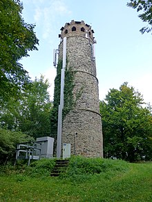
The Klauskopfturm observation tower stands on its summit and a historic landscape park, the Riede Castle Park, is located on its eastern slope .
geography
The mountain is located in the Habichtswald Nature Park about 750 m northwest of Riede. The village and Riede Castle lie on its south-eastern slope . The County Road 111 (same Strasse) runs in the long arc along its eastern and northern edge of vineyard according Elbenberg , a district of Naumburg .
The summit of the Erzeberg ( 392.8 m ) located about 600 m to the northwest is connected to that of the Klauskopf by a saddle that is only about 30 m lower than the summit of the Erzeberg, so that the latter can almost be seen as a secondary summit of the Klauskopf. The boundary between Elbenberg and Riede runs over this mountain saddle.
Other neighboring mountains are the 358.5 m high southeastern foothills, called Käsebusch, of the Kuhberg ( 403.9 m ) in the north and the Steinkopf, around 1 km away, in the south.
Along the northern flank of the Klauskopf, between this and the southeastern foothills of the Kuhberg, flows the Stellbach coming from Elbenberg, which then flows under the federal highway 450 between Merxhausen and Riede north of the Weißenthalsmühle into the Eder tributary river Ems . A small, often dry creek that rises on the saddle between Klauskopf and Erzeberg runs southwest to the Elbe, which also flows to the Eder .
Natural space
Although the Klauskopf is located in the Habichtswald Nature Park , it is not part of the Hinterhabichtswälder Kuppen , but belongs to the natural spatial main unit group West Hessian Mountain and Sink Country (No. 34) and the main unit Ostwaldecker Randsenken (341) to the Elberberger Heights (341.42) in the Subunit Ostwaldecker Randsenken # Naumburger Senken und Ridge (341.4).
Forest
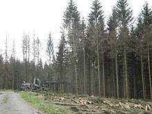
The Klauskopf is almost completely forested. It is a forest that is used intensively for forestry purposes. About 40% of it is deciduous forest, almost exclusively beech with a few old trees. And about 60% coniferous forest as spruce monocultures with a few small pine areas. Old deciduous trees of different types (oak, linden, ash, robinia) can only be found on the western edge of the forest, towards Riede, at the location of the historic landscape park.
In 2019, after the dry summer of 2018 , numerous dead trees and intensive bark beetle infestation can be found in the spruce stands, and extensive death is also visible. Large-scale clearing work was and is taking place in these stocks.
Klauskopfturm
The Klauskopfturm on the summit of the mountain is a 17.5 m high stone lookout tower built in 1857 . It can be reached on foot or by bike from the hikers' car park on the western outskirts of Riede on a largely graveled hiking trail. The path leads up the mountain to the west to the “Straw Temple” refuge, where a path branches off to the right up to the tower. The tower can be climbed when the door is open. A cast iron spiral staircase leads to the 14.4 m high viewing platform on the roofed stone upper floor, from whose windows you have a wide view of the north Hessian mountain landscape.
The tower are antennas of a mobile operator attached.
Landscape park and castle park Riede
Heinrich von Meysenbug , the owner of Schloss Riede at the time , began to create a park in the new style of the English landscape park around 1770 . This was done based on the example of the Kassel Bergpark Wilhelmshöhe , where these new ideas were taken up at the time. Landgrave architects and garden designers from Kassel such as Heinrich Christoph Jussow , Karl Steinhofer and Daniel August Schwartzkopf were also active in planning and consulting in Riede. Johann Heinrich Müntz , who came to Kassel in 1786 after spending several years in England, had a major influence on the design of the new landscape park in Riede .
The landscape park in the early romantic-sentimental style was created on the eastern slope of the Klauskopf (the Bergpark Wilhelmshöhe on the eastern slope of the Habichtswald) and stretches (as in Kassel) to the east down to the castle. Due to the connections and similarities to Kassel, the castle park in Riede is also known as the "Kleine Wilhelmshöhe". The development of the park ended with the death of Meysenbug in 1810. The Meysenbugsche Landschaftspark is no longer preserved as a complete work, but several interesting fragments on the Klauskopf remind of its existence.
- see: Schlosspark Riede
The remains of the landscape park in the forest and on the edge of the Klauskopf forest are accessible via paths, since 2016 via the two adjacent circular routes 1 and 2. The circular route 1 runs south of the Klauskopf, over the Ried'sche Tränke . The northern circular route 2 runs around the Klauskopf and along the edge of the Tiergarten , with a view of Riede Castle and the western edge of the impressive trees near the castle.
Footnotes
- ↑ Map services of the Federal Agency for Nature Conservation ( information )
- ^ Electorate of Hesse 1840-1861 - 21. Niedenstein. Historical maps. In: Landesgeschichtliches Informationssystem Hessen (LAGIS).
- ↑ Martin Bürgener: Geographical Land Survey: The natural spatial units on sheet 111 Arolsen. Federal Institute for Regional Studies, Bad Godesberg 1963. → Online map (PDF; 4.1 MB)
- ↑ a b Height information according to measurements taken privately
- ↑ Paragraph according to Maren Brechmacher-You: Gardens, parks and buildings of the castle estate Riede , in: Association for the promotion of the castle in Riede eV (Ed.): Landscape gardens - garden landscapes castle and village Riede , Bad Emstal - Riede, 2017, p. 10 -15


