Kumano (Mie)
| Kumano-shi 熊 野 市 |
||
|---|---|---|
| Geographical location in Japan | ||
|
|
||
| Region : | Kinki | |
| Prefecture : | Mie | |
| Coordinates : | 33 ° 53 ' N , 136 ° 6' E | |
| Basic data | ||
| Surface: | 373.63 km² | |
| Residents : | 16,140 (June 1, 2019) |
|
| Population density : | 43 inhabitants per km² | |
| Community key : | 24212-8 | |
| Symbols | ||
| Tree : | Kumano- Japanese cedar | |
| Flower : | Lilium japonicum | |
| Bird : | Japanese Bush Warbler | |
| town hall | ||
| Address : |
Kumano City Hall 796 Ido-chō Kumano -shi Mie 519-4392 |
|
| Website URL: | http://www.city.kumano.mie.jp | |
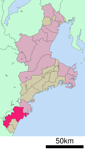
| Location Kumanos in Mie Prefecture | ||
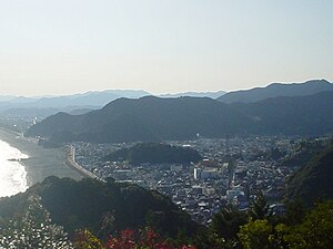
Kumano ( Japanese 熊 野 市 , -shi ; literally: Bear Field ) is a city in the Japanese prefecture of Mie .
geography
Kumano is north of Shingū and south of Tsu on the Pacific Ocean .
history
Kumano was formed on November 3, 1954 from the former community Kimoto ( 木本 町 , -chō ) and the villages Arasaka ( 荒 坂 村 , -mura ), Araka ( 新 鹿 村 , -mura ), Tomari ( 泊 村 , -mura ), Arii ( 有 井村 , -mura ), Kamikawa ( 神 川村 , -mura ), Gokyo ( 五 郷 村 , -mura ) and Asuka ( 飛鳥 村 , -mura ) of Minamimuro County.
Attractions
- Onigajō (鬼 ヶ 城)
traffic
- Street:
- National road 42, 169, 309, 311
- Train:
Town twinning
sons and daughters of the town
- Shigeru Kasamatsu (* 1947), artistic gymnast
Neighboring cities and communities
Web links
Commons : Kumano - collection of images, videos and audio files


