Toba (Mie)
| Toba-shi 鳥羽 市 |
||
|---|---|---|
| Geographical location in Japan | ||
|
|
||
| Region : | Kinki | |
| Prefecture : | Mie | |
| Coordinates : | 34 ° 29 ' N , 136 ° 51' E | |
| Basic data | ||
| Surface: | 107.92 km² | |
| Residents : | 17,907 (17907) |
|
| Population density : | 166 inhabitants per km² | |
| Community key : | 24211-0 | |
| Symbols | ||
| Tree : | Citrus tachibana | |
| Flower : | Dianthus superbus var. Longicalycinus | |
| Bird : | Common gull | |
| town hall | ||
| Address : |
Toba City Hall 3 - 1 - 1 , Toba Toba -shi Mie 517-0011 |
|
| Website URL: | http://www.city.toba.mie.jp | |
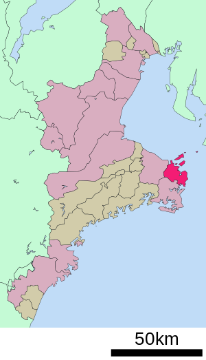
| Location Tobas in the Mie prefecture | ||
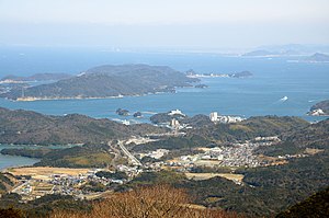
Toba ( Japanese 鳥羽 市 , - shi ) is a city in the Japanese prefecture of Mie on the Shima Peninsula .
geography
Toba is east of Ise and southeast of Tsu on the Pacific Ocean .
Attractions
- Kata-jinja (shrine)
- Toba Sea-Folk Museum
- Mikimoto Pearl Island ( Pearl Museum)
- Toba castle ruins
history
Toba is an old castle town , with a castle where the Inagaki last resided with an income of 30,000 koku .
Toba was classified as a city on November 1, 1954 after the former communities of Toba, Kamo, Nagaoka, Kagamiura, Momoroti, Sugashima, Toshi and Kamishima were merged.
traffic
- Street:
- National Road 42,167,259
- Train:
- Kintetsu Shima line
- Kintetsu Toba Line
- JR Sangu Line
Neighboring cities and communities
Town twinning
-
 Santa Barbara , United States, since 1966
 -
 Sanda , Japan, since 2011
sons and daughters of the town
- Kokichi Mikimoto (1858–1954), inventor of the cultured pearl
Web links
Commons : Toba - collection of images, videos and audio files
Individual evidence
- ^ Sister Cities. Santa Barbara, accessed June 20, 2017 .


