Kusatsu (Shiga)
| Kusatsu-shi 草津 市 |
||
|---|---|---|
| Geographical location in Japan | ||
|
|
||
| Region : | Kinki | |
| Prefecture : | Shiga | |
| Coordinates : | 35 ° 1 ' N , 135 ° 58' E | |
| Basic data | ||
| Surface: | 48.22 km² | |
| Residents : | 141,928 (October 1, 2019) |
|
| Population density : | 2943 inhabitants per km² | |
| Community key : | 25206-9 | |
| Symbols | ||
| Flag / coat of arms: | ||
| Tree : | Osmanthus fragrans var. Aurantiacus | |
| Flower : | Commelina communis var. Hortensis | |
| town hall | ||
| Address : |
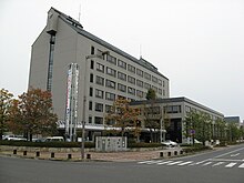
Kusatsu City Hall 3 - 13 - 30 , Kusatsu Kusatsu -shi Shiga 525-8588 |
|
| Website URL: | http://www.city.kusatsu.shiga.jp | |
| Location of Kusatsu in Shiga Prefecture | ||
Kusatsu ( Japanese 草津 市 , - shi ) is a city in Shiga Prefecture in Japan .
history
Kusatsu was a post office ( 宿 Post 町Shukuba-machi ) of the Tōkaidō and Nakasendō during the Edo period .
The Mura Kusatsu ( 草津 村 ) in Kurita-gun ( 栗 太 郡 ) became Chō Kusatsu ( 草津 町 , -chō ) on April 1, 1897 . He was appointed Shi on October 15, 1954 with the merger of Kusatsu and the Mura Oikami ( 老 上 村 , -mura ), Kasamei ( 笠 縫 村 , -mura ), Shizu ( 志 津 村 , -mura ), Tokiwa ( 常 盤 村 , -mura ) and Yamada ( 山 田村 , -mura ) in the Kurita-gun.
traffic
- Street:
- Meishin Highway , to Komaki or Nishinomiya
- National Road 1 , to Tokyo or Osaka
- National road 8
- Train:
- JR West Tōkaidō Main Line ( Biwako Line ), to Tokyo or Kobe
- JR Kusatsu Line , to Iga
Factories
education
The Biwako-Kusatsu Campus (BKC) of the Ritsumeikan University in Kyoto is located in Kusatsu .
Town twinning
Neighboring cities and communities
sons and daughters of the town
- Tomomi Abiko (* 1988), pole vaulter
Web links
Commons : Kusatsu - collection of images, videos and audio files


