Lexington, South Carolina
| Lexington | ||
|---|---|---|
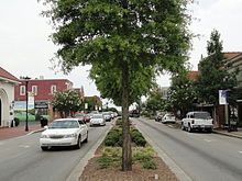
 Downtown Lexington |
||
| Location in South Carolina | ||
|
|
||
| Basic data | ||
| Foundation : | 1861 | |
| State : | United States | |
| State : | South carolina | |
| County : | Lexington County | |
| Coordinates : | 33 ° 59 ′ N , 81 ° 14 ′ W | |
| Time zone : | Eastern ( UTC − 5 / −4 ) | |
| Residents : | 17,870 (as of 2010) | |
| Population density : | 778.6 inhabitants per km 2 | |
| Area : | 22.97 km 2 (approx. 9 mi 2 ) of which 22.95 km 2 (approx. 9 mi 2 ) is land |
|
| Height : | 120 m | |
| Postcodes : | 29071, 29072, 29073 | |
| Area code : | +1 803 | |
| FIPS : | 45-41335 | |
| GNIS ID : | 1246349 | |
| Website : | www.lexsc.com | |
| Mayor : | Steve MacDougall | |
Lexington is a town ( Town ) in Lexington County in the state of South Carolina in the United States . At the last census in 2010 , the city had 17,870 residents. Lexington is the second largest city in the Columbia metropolitan area and the administrative seat of Lexington County.
location
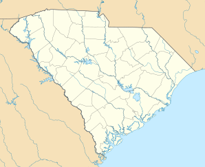
Lexington is located in central South Carolina, approximately 12 miles west of Columbia. The city is located on Lake Murray , a reservoir of the Saluda River .
history
In 1735, eleven townships were established in the center of the then British Province of South Carolina at the behest of King Charles II of England , which serve as a buffer zone between the land of the Native Americans in the northwest of the province and the South Carolina Lowcountry , which was populated by European colonists should. One of these was the Saxe Gotha Township , the center of which was on the site of the present-day city of Lexington. The township was named after Augusta von Sachsen-Gotha-Altenburg . The township was initially predominantly agricultural.
During the American Revolution , the Battle of Tarrar Springs took place just north of Lexington on November 16, 1781 . In 1785, the Saxe Gotha Township was dissolved and replaced by the congruent Lexington County , which was named in memory of the Battle of Lexington and Concord . The first administrative seat of Lexington County was the city of Granby , and due to regular flooding, the Lexington County Courthouse was relocated to its current location in 1820. Granby is now completely absorbed in the town of Cayce . The settlement around the new courthouse was finally incorporated as a town in 1861 under the name Lexington .
At the time of the official founding of the city, Lexington had two churches, several schools, a car factory, a sawmill, a forge and several other industries. During the Civil War , the original Lexington County Courthouse was destroyed in combat operations in 1865. The almost completely destroyed city was rebuilt in the following years. Between 1890 and 1900 there was a sharp increase in population with the construction of the Columbia to Augusta Railroad and the Lexington Textile Mill. In the years 1894 and 1916, the town, which at that time was still mainly built of wooden houses, was destroyed by fires, which led to today's brick buildings in the city center.
On August 16, 1994, Lexington was hit by a tornado measuring three on the Fujita scale . 40 people were injured in the city.
population
| growth of population | |||
|---|---|---|---|
| Census | Residents | ± in% | |
| 1880 | 262 | - | |
| 1890 | 342 | 30.5% | |
| 1900 | 806 | 135.7% | |
| 1910 | 709 | -12% | |
| 1920 | 894 | 26.1% | |
| 1930 | 1152 | 28.9% | |
| 1940 | 1033 | -10.3% | |
| 1950 | 1081 | 4.6% | |
| 1960 | 1127 | 4.3% | |
| 1970 | 969 | -14% | |
| 1980 | 2131 | 119.9% | |
| 1990 | 3289 | 54.3% | |
| 2000 | 9793 | 197.8% | |
| 2010 | 17,870 | 82.5% | |
| US Decennial Census | |||
At the 2010 United States Census, Lexington had 17,870 residents, spread across 8,101 households and 2,558 families. 83.88% of the population were White , 12.48% African American , 2.05% Asian, 0.18% Native American, and 0.03% Pacific Islander ; 0.67% of the population were of other races and 0.70% had two or more races. Hispanics and Latinos made up 1.91% of the total population. There were married couples living in 55.9% of households. 40.5% of households had children under the age of 18 living with them and 7.5% of households had seniors over 65 years of age.
The median age in Lexington in 2010 was 33 years. 27.1% of the residents were younger than 18 years, 7.5% were between 18 and 24, 39.6% between 25 and 44, 18.3% between 45 and 64 and 7.5% of the residents were 65 years or older older. For every 100 female residents there were 97.6 male residents.
At the time of the census, the median income in Lexington was $ 53,865 per household and $ 65,694 per family. The average per capita income was $ 23,416. 5.2% of families and 7.2% of all Lexington residents were below the poverty line , of which 7.3% were under 18 and 14.5% over 65 years of age.
Infrastructure
traffic
Interstate 20 between Augusta and Columbia , US Highways 1 and 378 from Augusta to Columbia and from Greenwood to Columbia and South Carolina Route 6 towards Charleston run through the urban area of Lexington . Interstate 26 , which also runs to Charleston, is also close to the city .
The Columbia Metropolitan Airport is located about 12 kilometers southeast of Lexington.
education
Lexington City Schools, like all Lexington County's public schools, belong to Lexington County School District One . There are five elementary schools, two middle schools and one high school in the city itself. The school district has a total of thirteen elementary schools, six middle schools and three high schools.
Web links
Individual evidence
- ^ Lexington History. In: lexsc.com , accessed November 3, 2019.
- ^ Significant Tornadoes in South Carolina 1994. South Carolina State Climatology Office, accessed November 3, 2019.
- ^ Profile of General Population and Housing Characteristics. United States Census Bureau, accessed November 3, 2019.


