Columbia, South Carolina
| Columbia | |
|---|---|
| Nickname : The Capital of Southern Hospitality (Official), The Big Friendly, Cola Town | |
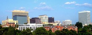
 Finlay skyline |
|
 flag |
|
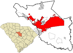
| Location in South Carolina | |
| Basic data | |
| Foundation : | 1787 |
| State : | United States |
| State : | South carolina |
| Counties : |
Richland County Lexington County |
| Coordinates : | 34 ° 0 ′ N , 81 ° 2 ′ W |
| Time zone : | Eastern ( UTC − 5 / −4 ) |
|
Inhabitants : - Metropolitan Area : |
134,385 (as of 2016) 817,488 (as of 2016) |
| Population density : | 395.1 inhabitants per km 2 |
| Area : | 346.5 km 2 (approx. 134 mi 2 ) of which 340.1 km 2 (approx. 131 mi 2 ) is land |
| Height : | 89 m |
| Postcodes : | 29201, 29203, 29204, 29205, 29206, 29209, 29210, 29212, 29223, 29229, 29225 |
| Area code : | +1 803 |
| FIPS : | 45-16000 |
| GNIS ID : | 1245051 |
| Mayor : | Stephen K. Benjamin (D) |
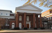
 South Carolina State House |
|
Columbia is the capital of the US state of South Carolina and the official seat of Richland County . It is located in the geographic center of the state, close to the Congaree River and had a population of around 134,000 in 2016 (estimate by the US Census Bureau).
| year | Residents¹ |
|---|---|
| 1980 | 101.208 |
| 1990 | 98.052 |
| 2000 | 118.135 |
| 2010 | 130.128 |
| 2016 | 134,309 |
¹ 1980–2010: census results; 2016: US Census Bureau estimate
Columbia is the main campus of the University of South Carolina . The largest basic training camp of the US Army, Fort Jackson, is located in the eastern part of the city .
geography
Columbia is about halfway between the Atlantic Ocean and the Blue Ridge Mountains on the Fall Line , the boundary line to the coastal plain over which rivers “fall” (hence the name). That is why this line once formed the westernmost point of shipping east of the Appalachian Mountains. Columbia was formed at the end of shipping on the Congaree River , which is created by the confluence of the Broad and Saluda Rivers . The hydropower drove the first cotton mills in the city.
According to the United States Census Bureau , the city, which is 89 m high, has an area of 346.5 km 2 , of which 340.1 km 2 is land and 6.4 km 2 (= 1.96%) is water omitted. Around two thirds of the land area belongs to the Fort Jackson Military Installation, which largely consists of uninhabited areas.
climate
| Columbia, South Carolina | ||||||||||||||||||||||||||||||||||||||||||||||||
|---|---|---|---|---|---|---|---|---|---|---|---|---|---|---|---|---|---|---|---|---|---|---|---|---|---|---|---|---|---|---|---|---|---|---|---|---|---|---|---|---|---|---|---|---|---|---|---|---|
| Climate diagram | ||||||||||||||||||||||||||||||||||||||||||||||||
| ||||||||||||||||||||||||||||||||||||||||||||||||
|
Average monthly temperatures and rainfall for Columbia, South Carolina
|
|||||||||||||||||||||||||||||||||||||||||||||||||||||||||||||||||||||||||||||||||||||||||||||||||||||||||
history
Columbia was founded by European settlers in the early 17th century. On March 26, 1786, it was expanded as a planned city to replace the old capital Charleston . The city was named after Christopher Columbus . During the Civil War , the city was captured and destroyed on February 17, 1865 by Union forces of General William Tecumseh Sherman . Among other things, the old congress house was totally destroyed. The destruction was part of Sherman's campaign which also included the conquest of Atlanta, Georgia and the conquest of Savannah, Georgia .
National Register of Historic Places

The National Park Service identifies a total of five National Historic Landmarks for Columbia (as of December 2016):
- South Carolina State House
- Robert Mills House
- First Baptist Church (Columbia)
- Chapelle Administration Building
- Mills Building, South Carolina State Hospital
A total of 127 structures and sites in Columbia are listed on the National Register of Historic Places (NRHP) as of November 12, 2018, including:
- St. Peter's Basilica
- Gervais Street Bridge
- House of Peace Synagogue
- Modjeska Monteith Simkins House
- The historic Ensor-Keenan House is located at 801 Wilwood Avenue . The building was included in the NRHP in 1979.
Attractions
- Riverbanks Zoo
- Finley Park
- South Carolina State Museum (largest museum in the southeastern United States )
- Lake Murray
- University of South Carolina
- Congaree Vista
- Five points
- Columbia Museum of Art
- Columbiana Mall
Sports
The university's teams, also known as Gamecocks, generate the greatest interest. The Football Stadium holds over 84,000 spectators and the basketball arena 18,000. The baseball and athletics teams are also very successful. The US Olympians Allen Johnson and Terrence Tremmell train here. The ECHL's Capital City Bombers (baseball) and Columbia Inferno ( ice hockey ) also play in Columbia.
sons and daughters of the town
- Cedric Adderley , composer and music educator
- Bill Anderson (born 1937), country singer and songwriter
- Aziz Ansari (* 1983), comedian and actor
- James Mark Baldwin (1861–1934), philosopher and psychologist
- Joseph Louis Bernardin (1928–1996), Archbishop of Chicago
- Kelsey Chow (born 1991), actress
- Mike Colter (born 1976), actor
- Kristin Davis (born 1965), actress
- Stanley Donen (1924–2019), director and choreographer
- Lillian Ellison (1923-2007), wrestler "The Fabulous Moolah"
- Robert Galloway (* 1992), tennis player
- Wade Hampton III. (1818–1902), Confederate general in the American Civil War
- Monique Hennagan (* 1976), sprinter
- Young Jeezy (born 1977), rapper
- Alexis Jordan (* 1992), singer and actress
- Allison Munn (born 1974), actress
- Jermaine O'Neal (born 1978), basketball player (Toronto Raptors)
- Liz J. Patterson (1939–2018), politician
- Susan Reed (1926-2010), folk singer
- Al Russell (1921–2011), singer, pianist and songwriter
- Ann Savage (1921-2008), film actress
- Angie Stone (* 1961), hip-hop, R'n'B and soul singer
- Robin Swicord (* 1952), director and screenwriter
- Frank Woodruff (1906–1983), film director and producer
- Lee Thompson Young (1984-2013), actor
Twin cities
- Columbia has four international twin cities:
-
 Kaiserslautern , Germany
-
 Cluj-Napoca , Romania
-
 Plovdiv , Bulgaria
-
 Chelyabinsk , Russia
Web links
Individual evidence
- ↑ List of NHL by State . National Park Service , accessed November 12, 2018.
- ↑ Search mask database in the National Register Information System. National Park Service , accessed November 12, 2018.
- ^ National Register of Historic Places
- ^ Website Museum of Art
- ↑ Shopping Mall website
