List of cultural monuments in Idstein
The following list contains the cultural monuments identified in the monument topography in the area of the municipality of Idstein , Rheingau-Taunus-Kreis , Hesse .
- Note: The order of the monuments in this list is based first on the districts and then on the address; alternatively, it can also be sorted according to the name, the number assigned by the State Office for Monument Preservation or the construction time.
The basis is the publication of the Hessian list of monuments, which was created for the first time on the basis of the Monument Protection Act of September 5, 1986 and has been continuously updated since then.
The presence or absence of an object in this list does not provide legally binding information as to whether it is a cultural monument or not: This list may not reflect the current status of the official monument topography. This is available for Hessen in the corresponding volumes of the monument topography of the Federal Republic of Germany and on the Internet under DenkXweb - Kulturdenkmäler in Hessen (under construction). Even though these sources are updated by the State Office for the Preservation of Monuments in Hesse , they are not always up-to-date because there are always changes in the inventory of monuments.
Only the State Office for the Preservation of Monuments in Hesse can provide binding information .
Cultural monuments according to districts
Idstein
| image | designation | location | description | construction time | Object no. |
|---|---|---|---|---|---|
 more pictures |
Highway maintenance department | A 3 corridor location : 16, parcel: 16 |
The road maintenance depot was built around 1938 on the Reichsautobahn Frankfurt-Cologne . The type of standard motorway maintenance facility was significantly shaped by the architect Paul Bonatz . | around 1938 |
13864 |
 |
Fountain | Am Börnchen location hall: 10, parcel: 252/2 |
Classicistic sandstone fountain. Originally set up on the castle's official building in Schlossgasse, the fountain was moved to its current location in 1980. |
13865 |
|
 |
Model school | Am Hexenturm 4 position hall: 10, parcel: 43/4 |
13866 |
||
 more pictures |
Jewish Cemetery | Outside location hall: 33, parcel: 29 |
1874 |
13973 |
|
 more pictures |
Bahnhofstraße 2 Location hallway: 9, parcel: 142/1 |
14594 |
|||
 |
Bahnhofstraße 37 Location hallway: 9, parcel: 64 |
13868 |
|||
 |
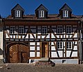
Bahnhofstraße 49 Location hallway: 9, parcel: 16 |
The house in the style of the reform architecture was built by the Idstein building contractor Heinrich Kappus III. and has been preserved largely unchanged. | 1907 |
13869 |
|
 |
Borngasse 5 position corridor 10, parcel: 254 |
around 1700 |
14595 |
||
 more pictures |
Borngasse 13 Location floor: 10, parcel: 245, 244 |
13871 |
|||
 more pictures |
Borngasse 15 Location floor: 10, parcel: 243/2, 244 |
13872 |
|||
 |
Borngasse 23 Location floor: 10, parcel: 222, 237 |
13873 |
|||
 |
Ernst-Töpfer-Straße 2 Location hall: 9, parcel: 14 |
The house in the style of the reform architecture was built by the Idstein building contractor Heinrich Kappus III. and is largely unchanged with the exception of the fencing and a garage that was added later. | 1907 |
13874 |
|
 |
Escher Straße 1 Location hall: 21, parcel: 35/7 |
14596 |
|||
 |
Lore Bauer Hall | Escher Straße 18/20 Location hall: 32, parcel: 7/1 |
Sports hall made of four eight centimeter thick, equilateral, leaning against each other and pre-tensioned hypar shells, which span a floor area of 40 m × 40 m. | 1972 |
167902 |
 |
Pumping station | Kreuzgärten 16 / Escher Straße 2 Location hall: 10, parcel: 137/6 |
14597 |
||
 |
Former Forester's farmstead | Escher Straße 12 Location floor: 29, parcel: 1/1 |
13877 |
||
 |
Hessian Forestry Office Idstein | Escher Straße 19 Location floor: 33, parcel: 6 |
15930 |
||
 more pictures |
Former synagogue | Felix-Lahnstein-Straße 1 Location floor: 10, parcel: 278 |
Built in 1793 as a residential building, later used as a Jewish school and synagogue. Destruction of the interior in the Reichspogromnacht . Since 1935 residential house again. Eaves, plastered half-timbered building with overbuilt courtyard gate. | 1793 |
14598 |
 more pictures |
Felix-Lahnstein-Straße 5 Location corridor: 10, parcel: 287/1 |
Two-zone half-timbered house from the 18th century in eaves position in corner position. Entrance stairs made of sandstone, slated gable. |
14599 |
||
 |
Felix-Lahnstein-Straße 6 Location corridor: 10, parcel: 257/2 |
14600 |
|||
 |
Felix-Lahnstein-Straße 8 Location corridor: 10, parcel: 256/1 |
14601 |
|||
 |
Felix-Lahnstein-Straße 10 Location floor: 10, parcel: 253 |
13884 |
|||
 |
Felix-Lahnstein-Straße 12 Location floor: 10, parcel: 246 |
13885 |
|||
 |
Felix-Lahnstein-Straße 14 Location corridor: 10, parcel: 240 |
13886 |
|||
 |
Hagelgans gravestones | Cemetery location |
15931 |
||
 |
Plague stone | Cemetery location |
13887 |
||
 |
Garden shed | Friedhofsweg location |
13889 |
||
 |
Former agricultural school | Friedrich-Ebert-Straße 2 location |
13890 |
||
|
more pictures |
Overall area old town location |
13860 |
|||
 more pictures |
Complete system at Bahnhofstrasse location |
13861 |
|||
| Complete system at Bahnhofstrasse / -Friedensstrasse / Wiesbadener Strasse |
location |
13862 |
|||
 more pictures |
Overall facility at Wiesbadener Strasse |
location |
13863 |
||
 more pictures |
Hofgut Gassenbach | Grunerstraße 76 location |
13891 |
||
 |
Himmelsgasse 1 position hall: 10, parcel: 270 |
14602 |
|||
 |
Gasthaus zur Peif | Himmelsgasse 2 position corridor 10, parcel: 84/3 |
14603 |
||
 |
Himmelsgasse 12 Location hallway: 10, parcel: 89/1 |
13894 |
|||
 |
Kaffeegasse 2 position corridor 10, plot: 286/1 |
14604 |
|||
 |
House Sattler | Kaffeegasse 2 a location corridor: 10, parcel: 289/2 |
14605 |
||
 |
Kaffeegasse 4 position corridor 10, plot 291 |
14606 |
|||
 |
Kaffeegasse 8 position corridor 10, plot 294 |
14607 |
|||
 |
Kaffeegasse 10 position corridor 10, plot 295 |
13899 |
|||
 |
Fountain | König-Adolf-Platz location hall: 10, parcel: 63/1 |
Fountain at the entrance to the town hall from 1937 by Carl Wilhelm Bierbrauer | 1937 |
13900 |
 |
town hall | König-Adolf-Platz 2 Corridor location : 10, parcel: 65/1 |
14608 |
||
 |
König-Adolf-Platz 3 Location hallway: 10, parcel: 355 |
14609 |
|||
 |
König-Adolf-Platz 4 Location hallway: 10, parcel: 81/1 |
14610 |
|||
 |
König-Adolf-Platz 5 Location hallway: 10, parcel: 354 |
14611 |
|||
 more pictures |
Killingerhaus | König-Adolf-Platz 7 Location hallway: 10, parcel: 353 |
14612 |
||
 |
König-Adolf-Platz 11 Location hallway: 10, parcel: 274/2 |
13906 |
|||
 |
Gasthaus zum Taunus | König-Adolf-Platz 15 Location hallway: 10, parcel: 272 |
13907 |
||
 |
Kreuzgasse 11 location |
13908 |
|||
 |
Kreuzgasse 13 location |
13909 |
|||
 |
Kreuzgasse 15 / Kreuzahlen 1 location |
13910 |
|||
 |
Building inscription | Kreuzgasse 18 location |
13911 |
||
 |
Kreuzgasse 20 location |
13912 |
|||
 |
Kreuzgasse 23 | Barn location |
13913 |
||
 |
Kreuzgasse 31 | Barn location |
13914 |
||
 |
Kreuzgasse 40 location |
13915 |
|||
 |
Kreuzgasse 42 location |
13916 |
|||
 |
Kreuzgasse 44 location |
13917 |
|||
 more pictures |
Former state building school | Limburger Straße 2 Location hall: 6, parcel: 61/1 |
The building of the former building trade school was built in 1893 according to the plans of the building trade school director Emil Hofmann and expanded in 1910 according to a design by Prof. August Nabenhauer. | 1893/1910 |
14613 |
 |
Limburger Straße 34 Location floor: 5, parcel: 15/2 |
13919 |
|||
 |
Former dry storage facility | Löherplatz 13 location |
13920 |
||
 |
Market fountain | Marketplace location |
13921 |
||
 |
Inn to the valley | Marktplatz 4 location |
13922 |
||
 |
Marktplatz 6 location |
13923 |
|||
 |
Evangelical Parish Church (Union Church) | Martin-Luther-Straße 1 location |
13924 |
||
 |
Obergasse 1 location floor: 10, parcel: 352 |
14614 |
|||
 |
Obergasse 2 Location hall: 10, parcel: 276/3 |
14615 |
|||
 |
German house | Upper Gasse 4 position corridor 10, plot: 277/1 |
14616 |
||
 |
Gasthaus zum Schwanen | Obergasse 5 position corridor 10, plot: 334/1 |
14617 |
||
 |
Obergasse 7 location floor: 10, parcel: 333 |
14618 |
|||
 |
Obergasse 9 location |
14619 |
|||
 |
Obergasse 11 location |
13931 |
|||
 |
Obergasse 14 location |
13932 |
|||
 |
Obergasse 15 location |
13933 |
|||
 more pictures |
Grandpierre printing house | Obergasse 16 location |
13935 |
||
 |
Obergasse 17/19 |
13934 |
|||
 more pictures |
Obergasse 18 location |
13936 |
|||
 more pictures |
Former Augusteum high school | Obergasse 21/23/25/27/29 location |
13937 |
||
 more pictures |
Obergasse 22 location |
13938 |
|||
 more pictures |
Obergasse 24 location |
13939 |
|||
 |
Höerhof | Obergasse 26 location |
from 1620 to 1626 |
13940 |
|
 |
Former Stockheimer Hof | Obergasse 31 location |
13941 |
||
 |
The so-called crooked house | Rodergasse 1/3 location |
14620 |
||
 |
Rodergasse 5 location |
14621 |
|||
 more pictures |
Rodergasse 7 location |
14622 |
|||
 more pictures |
Rodergasse 11 location |
13945 |
|||
 |
Schäfergasse 2 location |
14623 |
|||
 |
Schäfergasse 4 location |
14624 |
|||
 |
Schäfergasse 6 location |
14625 |
|||
 |
Schäfergasse 16 location |
13949 |
|||
 more pictures |
Witch tower | Schloßgasse location hall: 10, parcel: 51/1 |
13955 |
||
 |
Castle Bridge | Schlossgasse location |
13956 |
||
 |
Schlossgasse | Castle garden location |
13957 |
||
 |
Former tithe barn (Herrenspeicher) | Schloßgasse 8 location |
14626 |
||
 |
Former prison | Schloßgasse 12 location |
13952 |
||
 more pictures |
Castle | Schloßgasse 14/16/18/20 |
13953 |
||
 |
Gate construction | Schloßgasse 16 location |
13954 |
||
 more pictures |
lock | Schloßgasse 22 location |
13958 |
||
 more pictures |
Fire station | Schulgasse 6 location |
14627 |
||
 |
Schulgasse 13 location |
13961 |
|||
 |
State reception center | Schützenhausstraße 8 location |
13959 |
||
 |
Kalmenhof | Veitenmühlenweg 10 / Grunerstr. 2 | The building planned by the architect Ludwig Minner from Wiesbaden was built by the construction company Heinrich Kappus III. built. | 1929 |
13962 |
 |
Pond Meadow 2 position corridor 10, plot: 190/1 |
House from the early 18th century, front building on the market square |
14628 |
||
 |
Former Linden pharmacy (Lindenborn family) | Weiherwiese 16 Corridor location : 10, parcel: 178 |
Elongated, representative half-timbered building from the late 18th century. |
13964 |
|
 |
Former post office | Weiherwiese 19 Corridor location : 10, parcel: 213/1 |
13965 |
||
 |
Building inscription | Weiherwiese 25 Location hall: 10, parcel: 218 |
At the back of the barn on Borngasse: "This Bavarian was baved by master Henrich Schep Bvrger and Mavrer and Anna Margreta, his married wife in the year 1708". |
13966 |
|
 |
Weiherwiese 36 Corridor location : 10, parcel: 154 |
13967 |
|||
 |
Catholic parish church of St. Martin | Wiesbadener Straße 21 Location hall: 9, parcel: 172/3 |
1965 |
13950 |
|
 more pictures |
Residential building | Wiesbadener Straße 21 Location hall: 9, parcel: 172/3 |
13968 |
||
 more pictures |
Wiesbadener Straße 42/44 Location hallway: 9, parcel: 9 u. 11/2 |
13969 |
|||
 |
Zuckerberg 1 location corridor: 10, parcel: 297 |
13970 |
|||
 |
Zuckerberg 2 location hall: 10, parcel: 235 |
13971 |
|||
 |
Construction board | Zuckerberg 6 location floor: 10, parcel: 233 |
13972 |
Dasbach
| image | designation | location | description | construction time | Object no. |
|---|---|---|---|---|---|
 |
At the Struth 20 position hall 1, hall piece: 27 |
13814 |
|||
 more pictures |
Overall system | On Struth 13-13 (west side), 20-26 (east side), Kirchstraße, surrounding green areas location |
13813 |
||
 |
Kirchstraße 1 Location hall: 1, parcel: 42 |
14585 |
|||
 |
Kirchstraße 4 Location hall: 1, parcel: 24 |
14586 |
|||
 more pictures |
Kirchstraße 6 Location hall: 1, parcel: 25 |
14587 |
|||
 |
Evangelical chapel | Kirchstraße 8 Location floor: 1, parcel: 22 |
14588 |
||
 more pictures |
Bakehouse | Kirchstraße 8a Location hall: 1, parcel: 21 |
13819 |
Ehrenbach
| image | designation | location | description | construction time | Object no. |
|---|---|---|---|---|---|
 |
Complete system in Zugmantelstrasse | Malbachweg 1, Zugmantelstraße 13-25 (north side), 14-38 (south side) location |
13821 |
||
 |
Evangelical chapel | Malbachweg 1 location hall: 29, parcel: 113 |
13822 |
||
 |
Former school | Malbachweg 6 Location hall: 29, parcel: 109 |
13823 |
||
 |
Zugmantelstraße 13 Location floor: 29, parcel: 15 |
13824 |
|||
 |
Zugmantelstraße 15 position corridor 29, parcel: 13/1 |
13825 |
|||
 |
Zugmantelstraße 18 Location floor: 29, parcel: 88 |
13826 |
|||
 |
Zugmantelstraße 19 Location floor: 29, parcel: 8 |
13827 |
|||
 |
Zugmantelstraße 20 Location floor: 29, parcel: 91/1 |
13830 |
|||
 |
Zugmantelstraße 23 Location floor: 29, parcel: 162 |
13831 |
|||
 |
Zugmantelstraße 25, location floor: 29, parcel: 160 |
13832 |
|||
 |
barn | Zugmantelstraße 36 Location floor: 29, parcel: 106 |
13829 |
||
 |
Bakehouse | Zugmantelstraße o. No. Location floor: 29, parcel: 93 |
13828 |
Ash cock
| image | designation | location | description | construction time | Object no. |
|---|---|---|---|---|---|
 more pictures |
Overall system | Schwalbacher Strasse 9 - 27 location |
The buildings from the 18th – 19th Century Schwalbacher Straße 9-27 is a listed building as a whole . It is a part of the old village core with a more recent extension to the east. The expansion was carried out according to plan and has regular parcels with residential houses on the eaves. The houses at Schwalbacher Strasse 9 and 17 date from the early 19th century and have small hips. House number 13 was changed in the 19th century and the upper floor framework from the 18th century was exposed. Number 23 is a narrow residential building from the 18th century, the front area of which consists of sturdy half-timbering with curved struts and is characterized by male figures and threshold profiles on the eaves. Number 25 is a courtyard consisting of a dominant half-timbered barn and a residential building set back at a right angle. The four-sided courtyard area number 27 is closed off to the street by a small outbuilding. The gable fronts of the house and barn, partly plastered and clad, determine the street scene. The barn, with its lintel beam carved in the typical region, bears the date of origin 1732 as an inscription. |
13834 |
Booklet
| image | designation | location | description | construction time | Object no. |
|---|---|---|---|---|---|
 |
Altenburg market | Am Altenburger Markt location hall: 20 and 21, parcel: hall 20: 7-11, 14, 15, 17-22, 41, 42, 43/1, 45-52; Corridor 21: 1 / 1,2, 4/4, 4/3 |
13836 |
||
 |
Eckenstraße 12 Location floor: 5, parcel: 149 |
13837 |
|||
 |
Eckenstraße 14, location of hallway: 5, parcel: 148 |
13838 |
|||
 more pictures |
Eckenstraße 18 Location floor: 5, parcel: 145 |
13839 |
|||
 |
school | Gartenstraße 2 Location hallway: 5, parcel: 2/2 |
13841 |
||
 |
Georg Brunnenstrasse 1 position hallway: 5, plot: 57/1 |
14589 |
|||
 |
Georgbrunnenstraße 2 Location hall: 5, parcel: 82 |
14590 |
|||
 more pictures |
Georgbrunnenstraße 3 Location hallway: 5, parcel: 58/4 |
14591 |
|||
 more pictures |
barn | Georgbrunnenstraße 4 Location floor: 5, parcel: 81 |
14592 |
||
 more pictures |
Georgbrunnenstraße 6 Location hall: 5, parcel: 71 |
14593 |
|||
 |
Georgbrunnenstraße 16 Location hall: 5, parcel: 68 |
13847 |
|||
 more pictures |
barn | Hintergasse 1 position hallway: 5, plot: 88/1 |
13848 |
||
 |
Behind Gasse 3 position hallway: 5, plot: 79/1 |
13849 |
|||
 |
War memorials | Langgasse location hall: 4, parcel: 2 |
13840 |
||
 |
Water tank | Langgasse location hall: 4, parcel: 102 |
13857 |
||
 |
Langgasse 14 (Heftrich) | Langgasse 14 Location floor: 5, parcel: 109 |
13851 |
||
 more pictures |
Langgasse 18a Location floor: 5, parcel: 107 |
13852 |
|||
 more pictures |
Evangelical parish church | Langgasse 25 Location floor: 5, parcel: 126 |
13853 |
||
 |
Langgasse 30 Location floor: 5, parcel: 53 |
13854 |
|||
 more pictures |
Langgasse 34 Location floor: 5, parcel: 50 |
13855 |
|||
 |
Langgasse 40 Location floor: 5, parcel: 47 |
13856 |
|||
 more pictures |
Evangelical rectory | Neugasse 6 position hallway: 5, plot: 134/1 |
1848 |
53355 |
|
 |
Fountain | Wilhelmstraße location floor: 4, parcel: 35/2 |
Running fountain with a particularly large square post made of cast iron with a pyramid finish, applied ornaments and a water outlet in the form of an animal's head. The original cast iron trough was replaced by a rectangular concrete trough. The well, which may have been built in the Michelbacher Hütte at the end of the 19th century, was used to supply water to the Neugasse / Biengasse extension area south of the town wall after 1800. The urban development function as the eastern end of the school-Neugasse line of sight explains the unusual emphasis on the post as an architectural element in its still classicist form. |
13858 |
Kröftel
| image | designation | location | description | construction time | Object no. |
|---|---|---|---|---|---|
 |
Former town hall | Feldbergstrasse 2 location |
14629 |
||
 |
Former village bakery | Feldbergstrasse 3 location |
14630 |
||
 |
Feldbergstrasse 15 location |
13977 |
|||
 |
Feldbergstrasse 23 location |
13978 |
|||
 |
Fire station with cattle scale | Oberemser Strasse location |
13979 |
||
 |
Oberemser Straße 51 location |
Protestant church |
13980 |
Bilge cock
| image | designation | location | description | construction time | Object no. |
|---|---|---|---|---|---|
 more pictures |
Fountain | Local road 1 location |
13982 |
||
 more pictures |
Former council and bakery | Local road 1 location |
13983 |
Niederauroff
| image | designation | location | description | construction time | Object no. |
|---|---|---|---|---|---|
 |
Fountain | Brunnenstraße location hall: 15, parcel: 24/3 |
The cast iron running fountain from the late 19th century was probably cast in the Michelbacher Hütte. Today it is located in the valley floor directly on the overbuilt Auroffer Bach . |
13985 |
|
 |
Brunnenstraße 16 Location hall: 15, parcel: 4/2 |
Half-timbered house over a quarry stone base from the 18th century. It was originally the home of a court yard and is now free-standing after the farm buildings were demolished. |
13986 |
Nieder-Oberrod
| image | designation | location | description | construction time | Object no. |
|---|---|---|---|---|---|
 |
Dettenbach Bridge | Outside the local area, corridor: 3, parcel: 106 |
Bridge over the Dettenbach, north of Landstrasse 3023 between Heftrich and Kröftel with a vault made of Taunus slate, above it dry or exposed brickwork from the time before the mid-19th century. |
13993 |
|
 more pictures |
Overall facility in Oberrod |
location |
14363 |
||
 |
Meilbachstraße 9 Location hall: 2, parcel: 32 |
14362 |
|||
 |
Fountain | Niederemser Straße location hall: 1, parcel: 10/1 |
14364 |
||
 more pictures |
Niederemser Straße 17 Location floor: 1, parcel: 46/1 |
14365 |
|||
 |
Evangelical rectory | Niederemser Straße 21 Location hall: 1, parcel: 53 |
14366 |
||
 |
Gasthaus zur Post | Niederemser Straße 22 Location hall: 1, parcel: 4 |
13988 |
||
 |
Evangelical parish church | Rodigstraße location hall: 1, parcel: 52 |
13992 |
||
 |
Rodigstraße one location Village: 1 parcel: 41/1 |
13989 |
|||
 |
Rodigstraße 3 Location hall: 1, parcel: 40 |
13990 |
|||
 |
Former school | Rodigstraße 4 Location hall: 1, parcel: 48 |
13991 |
Oberauroff
| image | designation | location | description | construction time | Object no. |
|---|---|---|---|---|---|
 |
Fountain | At the village well able corridor: 11, parcel: 17 |
13995 |
||
 |
House and barn | Am Dorfbrunnen 5 position hall: 11, parcel: 02.15 |
13996 |
||
 |
Evangelical parish church (Liebfrauenkirche) with churchyard, retaining and surrounding walls | At the church location hall: 11, parcel: 19 |
13998 |
||
 |
Fountain | Kirchweg location hall: 11, parcel: 22/2 |
13997 |
||
 |
Rectory, former school | Kirchweg 12 Location floor: 11, parcel: 20 |
13999 |
Walsdorf
| image | designation | location | description | construction time | Object no. |
|---|---|---|---|---|---|
 more pictures |
Former school | Am Obertor 8 location |
14631 |
||
 |
Am Obertor 17 location |
14004 |
|||
 more pictures |
Am Obertor 31 location |
14005 |
|||
 more pictures |
Former Protestant parsonage | At the parish bow 2 position |
14006 |
||
 more pictures |
War memorial | Dammweg / Bruderbergstrasse location |
14007 |
||
|
|
Complete system in the town center |
location |
14001 |
||
 more pictures |
Circular wall with shell towers |
location |
14002 |
||
 |
Hat tower | Hainstrasse location |
14008 |
||
 more pictures |
Fountain | Idsteiner Straße location hall: 3, parcel: 483/3 |
Cast iron running fountain from shortly before 1900, probably from the production of the Michelbacher Hütte. Smooth column with top, spout in the shape of an animal head. Rectangular trough divided into 3/1 fields with different attached ornamentation. |
14009 |
|
 |
Klostergasse 1 location |
14010 |
|||
 more pictures |
Evangelical Christ Church | Knappegasse 2 location |
14011 |
||
 |
Untergasse 3 location |
14632 |
|||
 |
Farriers | Untergasse 5 location |
14633 |
||
 more pictures |
Untergasse 28 location |
14014 |
|||
 more pictures |
Untergasse 30 location |
14015 |
|||
 more pictures |
Untergasse 52 location |
14016 |
Woersdorf
| image | designation | location | description | construction time | Object no. |
|---|---|---|---|---|---|
 |
Evangelical parish church | Blind alley 2 position Hallway: 1 parcel: 87 |
14020 |
||
 |
Hauptstraße 4, corridor location : 1, parcel: 78/1 |
14634 |
|||
 |
Hauptstraße 6 Location hall: 1, parcel: 80/1 |
14635 |
|||
 more pictures |
Old school and town hall | Hauptstraße 21 Location hall: 1, parcel: 34 |
14021 |
||
| Henriettenthal Court |
Location corridor: 17, parcel: 83, 84, 85, 87, 88, 89 |
14026 |
|||
 |
Nebengasse 2 position hall 1, hall unit: 9 |
14022 |
|||
 |
Catholic parish church Nikolaus-von-Flüe-Friedenskirche | Nikolaus-von-Flue-Straße 2 Location floor: 44, parcel: 184 |
14024 |
||
 more pictures |
2 dead end position hall 1, hall piece: 85 |
14023 |
|||
 |
Nassauer Hof | Wallbacher Straße 2 Location hallway: 1, parcel: 149 |
14025 |
literature
- Dagmar Söder, State Office for Monument Preservation Hesse (Ed.): Monument topography Federal Republic of Germany Cultural monuments in Hesse Rheingau-Taunus District II. Altkreis Untertaunus . Ed .: State Office for Monument Preservation Hessen , Theiss-Verlag , Wiesbaden 2003, ISBN 3-8062-1649-5 .
Web links
- State Office for Monument Preservation Hessen (Hrsg.): Kulturdenkmäler in Idstein In: DenkXweb, online edition of Kulturdenkmäler in Hessen
- Geoportal Hessen with map layers for area monuments and architectural monuments
