List of cultural monuments in Aschersleben
In the list of cultural monuments in Aschersleben , all cultural monuments of the city of Aschersleben ( Salzlandkreis ) and its districts are listed. The basis is the monument register of the State of Saxony-Anhalt, which was created on the basis of the Monument Protection Act of October 21, 1991 by the State Office for Monument Preservation and Archeology of Saxony-Anhalt and has been continuously updated since then (status: December 31, 2019).
Cultural monuments according to districts
Aschersleben
| location | designation | description |
Registration |
Identification type | image |
|---|---|---|---|---|---|
| Old town (map) |
City fortifications | From the city fortifications are preserved:
|
094 10000 | monument |

|
| Old town (map) |
City plan | 094 80405 | monument | ||
| Wolfsberg (map) |
Wait | Westdorfer Warte | 094 81076 | monument |

|
| Adam-Olearius-Strasse 4, 6 Gottfried-August-Bürger-Strasse 8, 10, 12, 14, 16, 18, 20, 22, 24, 26 Worthstrasse 19, 21, 23 (map) |
settlement | 094 16214 | monument |

|
|
| Albert-Drosihn-Strasse 1, 3, 5, 7a, 7b Worthstrasse 24, 26, 28 (map) |
settlement | 094 17283 | monument |

|
|
| Am Grauen Hof 1 (map) |
Agricultural bourgeoisie | Gray yard | 094 80407 | monument |

|
| Am Grauen Hof 1, Luisenpromenade 3 (map) |
school | Luis School | 094 80888 | monument |

|
| Am Grauen Hof 2 (map) |
jail | City jail | 094 97984 | monument |

|
| Am Grauen Hof 1, 2, 4 (map) |
Street train | 094 80406 | Monument area |

|
|
| At the Westerbergen (map) |
villa | former Villa Lapp | 094 80887 | monument |

|
| At the kiln 10, 11 (map) |
Residential building | 094 95397 | monument |

|
|
| Apothekergraben 1 (map) |
school | Stephaneum House II, school, gymnasium and enclosure of the school yard | 094 80551 | monument |

|
| Askanierstrasse 10 (map) |
Residential building | 094 80897 | monument |

|
|
| Askanierstrasse 40 (map) |
Old people's home | Invalidenheim of the state insurance institute | 094 03693 | monument |

|
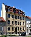
| On the trench 15 (map) |
Residential building | 094 80408 | monument |
|
|
| On the trench 33 (map) |
Residential and office building | 094 80410 | monument |

|
|
| On the ditch 72 (map) |
Residential building | 094 80411 | monument |

|
|
| On the ditch 75 (map) |
Residential building | Hostel zur Heimat, built in 1890 as the St. Elisabeth Hospice. After 25 years of vacancy, the renovation took place in 2019. | 094 80412 | monument |

|
| On the trench 91 (map) |
Residential building | 094 80413 | monument |

|
|
| At the old castle, Aschersleben zoo (map) |
Keep | Askanierburg | 094 80909 | monument |

|
| At the old castle 10 (map) |
Residential building | 094 80600 | monument |

|
|
| At the old castle 12 (map) |
Residential building | 094 80601 | monument |

|
|
| At the old castle 13 (map) |
Residential building | 094 80602 | monument |

|
|
| At the old castle 14 (map) |
Residential building | 094 80603 | monument |

|
|
| At the old castle 40 (map) |
villa | 094 80583 | monument |

|
|
| Augustapromenade 2 Breite Straße 1 to 43 (map) |
Street train | 094 80361 | Monument area |

|
|
| Augustapromenade 22, 23, 24 Hecknerstrasse 1 to 6 (map) |
Street line | 094 80332 | Monument area |

|
|
| Augustapromenade 23, Hecknerstraße 5 (map) |
Residential and commercial building | House princes | 094 80336 | monument |

|
| Augustapromenade 26 (map) |
Residential building | 094 80355 | monument |

|
|
| Augustapromenade 36 in front of house no.36 (map) |
Bank | Schillerbank | 094 80415 | monument |

|
| Augustapromenade 36 (map) |
Residential building | 094 80414 | monument |

|
|
| Badergasse 5 development along the Mühlgraben (map) |
church | New Apostolic Church | 094 80416 | monument |

|
| Badstuben 1 (map) |
Residential building | 094 80418 | monument |

|
|
| Badstuben 2 (map) |
Residential building | 094 80419 | monument |

|
|
| Badstuben 6 (map) |
Residential building | Residential building | 094 80421 | monument |

|
| Badstuben 7 (map) |
Residential building | Residential building | 094 80422 | monument |

|
| Badstuben 23 (map) |
Residential building | The building was already demolished in 2019. | 094 80430 | monument |

|
| Badstuben 31 (map) |
Residential building | 094 80435 | monument |

|
|
| Bahnhofstrasse 1 Bestehornstrasse 1, 2, (3), 4 to 8, 9 Herrenbreite (1), (2), 3 to 5, (6), (7), (8), 9 to 11, 13a, 13b, 13c , 14, 15, 16, 24 to 33 Neue Straße 2 (map) |
space | Men's width (park) | 094 90074 | Monument area |

|
| Bahnhofstrasse 2 (map) |
office building | 094 80436 | monument |

|
|
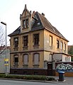
| Bahnhofstrasse 5 (map) |
Residential building | 094 80437 | monument |
|
|
| Bahnhofstrasse 15 (map) |
Residential building | 094 10002 | monument |

|
|
| Bahnhofstrasse 40 (map) |
Residential building | 094 10003 | monument |

|
|
| Baumgartenstrasse 2 (map) |
villa | 094 80598 | monument |

|
|
| Baumgartenstrasse 25 (map) |
Residential building | 094 80438 | monument |

|
|
| Berliner Strasse 7 Halberstädter Strasse 2, 4, 6, 8, 10, 12, 14, 16, 18, 20 Hellgraben 24 (map) |
Street line | 094 80927 | Monument area |

|
|
| Bestehornstraße 1 Corner development to the Bonifatiuskirchhof street (map) |
Post office | 094 80439 | monument |

|
|
| Bestehornstrasse 2 (map) |
villa | so-called "White Villa" | 094 80440 | monument |

|
| Bestehornstrasse 4, 5 (map) |
Residential and commercial building | Bestehorn villa with garden and orangery | 094 80441 | monument |

|
| Bestehornstrasse 8 (map) |
Residential building | Old rifle house, built in 1754/1755 | 094 80442 | monument |

|
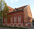
| Bestehornstrasse 11 (map) |
Residential building | 094 80907 | monument |
|
|
| Bestehornstrasse 18 (map) |
Residential building | 094 80906 | monument |

|
|
| Bonifatiuskirchhof 5 (map) |
Residential and commercial building | 094 81294 | monument |

|
|
| Bonifatiuskirchhof 14a (map) |
Residential and commercial building | 094 81295 | monument |

|
|
| Bonifatiuskirchhof 15 (map) |
Residential building | 094 81297 | monument |

|
|
| Bonifatiuskirchhof 15a (map) |
Residential and commercial building | 094 81296 | monument |

|
|
| Bonifatiuskirchhof 17, 18 (map) |
Residential and commercial building | 094 81298 | monument |

|
|
| Bonifatiuskirchhof 19 (map) |
Residential and commercial building | 094 81299 | monument |

|
|
| Bonifatiuskirchhof 20 (map) |
Residential building | 094 81300 | monument |

|
|
| Breite Strasse 3 (map) |
Commercial building | Max Quenzel department store | 094 80362 | monument |

|
| Breite Straße 9, property in the southern line of the street, courtyard to Stephanikirchhof (map) |
Residential and commercial building | 094 80363 | monument |

|
|
| Breite Strasse 12, 13 (map) |
Department store | Conitzer department store | 094 80364 | monument |

|
| Breite Strasse 14 (map) |
Residential and commercial building | 094 80365 | monument |

|
|
| Breite Strasse 15 (map) |
Residential and commercial building | 094 80366 | monument |

|
|
| Breite Straße 18 (map) |
Residential and commercial building | 094 80367 | monument |

|
|
| Breite Straße 19 (map) |
Residential and commercial building | 094 80368 | monument |

|
|
| Breite Strasse 21 (map) |
Residential and commercial building | 094 80369 | monument |

|
|
| Breite Straße 22 (map) |
Administration building | 094 80370 | monument |

|
|
| Breite Straße 25 (map) |
Residential and commercial building | 094 95161 | monument |

|
|
| Breite Straße 26 (map) |
Residential and commercial building | 094 80372 | monument |

|
|
| Breite Strasse 27 (map) |
Residential and commercial building | 094 80373 | monument |

|
|
| Breite Straße 28 (map) |
Agricultural bourgeoisie | 094 80374 | monument |

|
|
| Breite Strasse 29 (map) |
Residential and commercial building | 094 80375 | monument |

|
|
| Breite Strasse 30 (map) |
Residential and commercial building | 094 03679 | monument |

|
|
| Breite Strasse 33 (map) |
Residential and commercial building | 094 80376 | monument |

|
|
| Breite Strasse 35 (map) |
Residential and commercial building | 094 80377 | monument |

|
|
| Breite Strasse 39 (map) |
Residential and commercial building | 094 80378 | monument |

|
|
| Breite Strasse 41 (map) |
Residential and commercial building | 094 03680 | monument |

|
|
| Breite Strasse 41a (map) |
Residential and commercial building | Crohn Department Store | 094 80379 | monument |

|
| Burgplatz 2 (map) |
school | Castle School | 094 80443 | monument |

|
| Burgplatz 3 (map) |
jail | 094 14458 | monument |

|
|
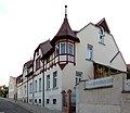
| Bäckerstieg 1, 3 (map) |
Residential building | 094 80584 | monument |
|
|
| Bäckerstieg 5 (map) |
Residential building | 094 80585 | monument |

|
|
| Bäckerstieg 23 (map) |
Residential building | 094 80586 | monument |

|
|
| Carl-von-Ossietzky-Platz 3 (map) |
Residential building | 094 15523 | monument |

|
|
| Douglasstrasse 2a (map) |
villa | 094 80444 | monument |

|
|
| Douglasstrasse 2b (map) |
Residential building | 094 80445 | monument |

|
|
| Douglasstrasse 3 (map) |
villa | 094 17185 | monument |

|
|
| Douglasstrasse 6 (map) |
villa | 094 17184 | monument |

|
|
| Dr.-Wilhelm-Feit-Strasse 28 (map) |
Mine | Schmidtmannshall potash plant Shaft I with administration buildings, central workshop, chow building, power plant, hoisting machine house, locomotive shed, kainite storage shed and salt storage | 094 97443 | monument |

|
| Dr.-Wilhelm-Külz-Platz 10 Promenadenring (map) |
villa | 094 80349 | monument |

|
|
| Dr.-Wilhelm-Külz-Platz 11 (map) |
Residential building | 094 80350 | monument |

|
|
| Dr.-Wilhelm-Külz-Platz 13 (map) |
Residential building | 094 80352 | monument |

|
|
| Dr.-Wilhelm-Külz-Platz 16 (map) |
school | Stephaneum House I, built from 1873 to 1875 as a secondary school, since 1882 secondary school. | 094 10160 | monument |

|
| Dr.-Wilhelm-Külz-Platz 17 (map) |
Residential building | 094 14482 | monument |

|
|
| Dr.-Wilhelm-Külz-Platz 26 (map) |
Residential building | 094 80353 | monument |

|
|
| Dr.-Wilhelm-Külz-Platz 29 (map) |
Residential building | 094 14479 | monument |

|
|
| Eislebener Strasse 7a (map) |
hospital | Municipal hospital on the Kirschberg | 094 03694 | monument |

|
| Ermslebener Strasse 10 (map) |
villa | Graf Douglas Villa . Erected in the 19th century by Gustav Douglas, who was mayor of Aschersleben from 1832 to 1856. From 1919, the doctor Karl Kuntzsch redesigned it into a gynecological clinic. Finally, the house was a youth Werkhof used and youth hostel. After privatization vacancy and decay. | 094 80588 | monument |

|
| Ermslebener Strasse 24 (map) |
Residential building | 094 80589 | monument |

|
|
| Ermslebener Strasse 26 (map) |
Residential building | 094 80590 | monument |

|
|
| Ermslebener Strasse 28 (map) |
Residential building | 094 17316 | monument |

|
|
| Ermslebener Strasse 30 (map) |
Residential building | 094 80591 | monument |

|
|
| Fleischhauerstraße 1 to 4, (5), 19 to 21 (map) |
Street train | 094 80446 | Monument area |

|
|
| Fleischhauerstraße 4 (map) |
Residential building | 094 80449 | monument |

|
|
| Fleischhauerstraße 19 (map) |
Inn | 094 80453 | monument |

|
|
| Fleischhauerstraße 20 (map) |
office building | so-called Realschule | 094 80454 | monument |

|
| Fleischhauerstraße 20 (map) |
Transformer station | Building by Hans Heckner | 094 97568 | monument |

|
| Froser Strasse 46 (map) |
villa | 094 80904 | monument |

|
|
| Georgstrasse 3, 5, 7, 9, 11 (map) |
Street line | 094 80455 | Monument area |

|
|
| Geschwister-Scholl-Strasse 65 (map) |
Residential building | 094 80458 | monument |

|
|
| Geschwister-Scholl-Strasse 79 (map) |
Rectory | 094 80456 | monument |

|
|
| Gottfried-August-Bürger-Strasse 2 (map) |
Residential building | 094 80358 | monument |

|
|
| Gottfried-August-Bürger-Strasse 4 (map) |
Residential building | 094 80359 | monument |

|
|
| Gottfried-August-Bürger-Strasse 6 (map) |
Residential building | 094 80360 | monument |

|
|
| Gottfried-August-Bürger-Strasse Lindenstrasse Parkstrasse (map) |
park | City park, former cemetery | 094 80893 | monument |

|
| Great Halken 2 (map) |
Residential and commercial building | Half-timbered house from the 16th century | 094 80461 | monument |

|
| Great Halken 3 (Map) |
Residential and commercial building | Residential and commercial building from around 1800 | 094 80462 | monument |

|
| Großer Halken 6 (map) |
Residential building | two-storey half-timbered house | 094 80463 | monument |

|
| Großer Halken 1 to 7, (8) (map) |
Big hawk | Street train | 094 80460 | Monument area |

|
| Halberstädter Strasse, Lauestrasse (map) |
Transformer station | Building by Hans Heckner | 094 80928 | monument |

|
| Hecklinger Strasse 1 (map) |
Residential building | 094 80898 | monument |

|
|
| Hecknerstrasse 1 (map) |
Residential and commercial building | Building by Hans Heckner | 094 80333 | monument |

|
| Hecknerstrasse 2 (map) |
Residential and commercial building | Haus von der Heyde, building by Hans Heckner | 094 80334 | monument |

|
| Hecknerstrasse 3 (map) |
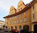
Residential and commercial building | Vollmer house | 094 80335 | monument |
|
| Hecknerstraße 6 Herrenbreite 1 corner development to the Augustapromenade (map) |
Culture house | Bestehornhaus, Volkshaus | 094 03695 | monument |

|
| Heinrichstrasse (map) |
Signal box | 094 03647 | monument |

|
|
| Heinrichstrasse 6a (map) |
factory | Former Optima factory, today Bestehornpark education center | 094 14462 | monument |

|
| Heinrichstrasse 15 (map) |
Residential building | House number 15 has already been demolished | 094 80916 | monument | |
| Heinrichstrasse 30 (map) |
Residential building | 094 80915 | monument |

|
|
| Heinrichstrasse 71 (map) |
factory | Factory hall and office building for Robert Thieme Rohrleitungsbau, built between 1925 and 1938 by Hans Heckner . Today's use as a construction yard. | 094 96333 | monument |

|
| Gentlemen width 3 (card) |
Residential building | 094 80464 | monument |

|
|
| Gentlemen width 4 (card) |
Residential building | 094 80465 | monument |

|
|
| Gentlemen's Width 9 (card) |
Residential building | 094 80466 | monument |

|
|
| Men's width 11 (card) |
Residential and commercial building | 094 80467 | monument |

|
|
| Gentlemen's Width 15 (card) |
Residential building | 094 80468 | monument |

|
|
| Men's width 31 (card) |
Residential and commercial building | 094 80469 | monument |

|
|
| Men's width 32 (card) |
Residential building | 094 80470 | monument |

|
|
| Gentlemen width 33 (card) |
villa | 094 80592 | monument |

|
|
| Heynemannstrasse 1 (map) |
villa | Villa Heynemann, built according to plans by Hans Heckner. | 094 80471 | monument |

|
| Heynemannstrasse 4, 5 (map) |
Residential building | 094 80472 | monument |

|
|
| Heynemannstrasse 6, 7 (map) |
Residential building | 094 80473 | monument |

|
|
| Behind the tower 1 to 9, 10-13 (empty area), 14 to 19 (empty area), 20 to 24, 25 (empty area), 26 to 33 (map) |
Street train | 094 15532 | Monument area |

|
|
| Behind the tower 6 (map) |
Residential building | 094 80343 | monument |

|
|
| Behind the tower 8 (map) |
Residential building | 094 03677 | monument |

|
|
| Behind the tower 20 (map) |
Residential building | 094 80344 | monument |

|
|
| Behind the tower 24 (map) |
Residential and commercial building | 094 95159 | monument |

|
|
| Rear width 2 (card) |
Agricultural bourgeoisie | 094 80341 | monument |

|
|
| Rear width 2, 3, 4, (5), (6) (7), 7 to 11, 12/13, 14/15, 16, 17 transformer house (card) |
Street line | 094 80340 | Monument area |

|
|
| Rear width 4 (card) |
Residential building | 094 80342 | monument |

|
|
| Rear width 13, 14 (card) |
Transformer station | Building by Hans Heckner | 094 97569 | monument |

|
| Hohe Straße 1 to 17, 17a, 18 to 22, Tie 29 (map) |
Street train | 094 80478 | Monument area |

|
|
| Hohe Strasse 1 (map) |
Residential and commercial building | 094 03681 | monument |

|
|
| Hohe Strasse 4 (map) |
Agricultural bourgeoisie | 094 03594 | monument |

|
|
| Hohe Strasse 5 (map) |
Residential and commercial building | 094 80479 | monument |

|
|
| Hohe Strasse 6 (map) |
Residential and commercial building | 094 95 160 | monument |

|
|
| Hohe Strasse 7 (map) |
Residential building | 094 80480 | monument |

|
|
| Hohe Strasse 9, 10 (map) |
Residential and commercial building | 094 80481 | monument |

|
|
| Hohe Strasse 13 (map) |
Residential and commercial building | 094 80482 | monument |

|
|
| Hohe Strasse 14 (map) |
Agricultural bourgeoisie | 094 15506 | monument |

|
|
| Hohe Strasse 15 (map) |
Residential and commercial building | 094 80483 | monument |

|
|
| Hohe Strasse 16 (map) |
Residential and commercial building | 094 80484 | monument |

|
|
| Hohe Strasse 17 (map) |
Residential and commercial building | 094 80485 | monument |

|
|
| Hohe Strasse 17a (map) |
Residential building | 094 80486 | monument |

|
|
| Hohe Strasse 18 (map) |
Residential and commercial building | 094 80487 | monument |

|
|
| Hohe Strasse 19 (map) |
Residential building | 094 80488 | monument |

|
|
| Hohe Strasse 20 (map) |
Residential and commercial building | 094 80489 | monument |

|
|
| Hohe Strasse 21 (map) |
Residential and commercial building | 094 03683 | monument |

|
|
| Hohe Strasse 22 (map) |
Residential and commercial building | 094 03684 | monument |

|
|
| Holzmarkt (map) |
Fountain | 094 04293 | monument |

|
|
| Holzmarkt 1, 2, 4, Taubenstrasse 7 (map) |
space | 094 80330 | Monument area |

|
|
| Holzmarkt 1 (map) |
Residential building | Residential building, declared a monument on July 14, 2016 The building was renovated in 2019. | monument |

|
|
| Holzmarkt 2 (map) |
Residential and commercial building | 094 80331 | monument |

|
|
| Hopfenmarkt 7 (map) |
Residential building | 094 80491 | monument |

|
|
| Hopfenmarkt 13 (map) |
Residential building | 094 95396 | monument |

|
|
| Hopfenmarkt 15 (map) |
Residential building | 094 80493 | monument |

|
|
| Hopfenmarkt 19 (map) |
Residential building | 094 14457 | monument |

|
|
| Hopfenmarkt 20 (map) |
Residential building | Baroque house with a mansard roof from the 18th century. Refurbished between 2016 and 2017. | 094 80495 | monument |

|
| Hopfenmarkt 25 (map) |
Residential building | 094 80496 | monument |

|
|
| Im Busch 49 (Map) |
Mill | Bushmill | 094 80886 | monument |

|
| Johannisplatz 8 (map) |
Residential and commercial building | 094 80593 | monument |

|
|
| Johannisplatz 11 (map) |
Residential building | 094 80594 | monument |

|
|
| Johannispromenade 2 (map) |
Residential and commercial building | 094 80497 | monument |

|
|
| Johannispromenade 3 (map) |
Residential and office building | 094 80498 | monument |

|
|
| Johannispromenade 41 (map) |
Residential building | 094 80890 | monument |

|
|
| Johannispromenade 43 (map) |
Residential building | 094 80889 | monument |

|
|
| Jüdendorf 12 (map) |
synagogue | Remains of the former synagogue in the courtyard of house No. 12 near the Stumpfer Turm | 094 03551 | monument |

|
| Jüdendorf 10a (map) |
Residential building | 094 80499 | monument |

|
|
| Jüdendorf 12 (map) |
Residential building | 094 96600 | monument |

|
|
| Kiethof 1 to 13 (map) |
Street train | 094 80500 | Monument area |

|
|
| Klopstockstraße 24, 26, 28, 30, 32, 34 (map) |
Street line | 094 80899 | Monument area |

|
|
| Klosterhof 5 (map) |
Residential building | 094 80505 | monument |

|
|
| Klosterhof 2, 3, 4 (map) |
space | 094 80504 | Monument area |

|
|
| Kreuzstrasse 12 (map) |
Residential building | 094 80913 | monument |

|
|
| Kreuzstrasse 14 (map) |
Residential building | 094 80914 | monument |

|
|
| Kruger Bridge 1 to 13 (map) |
Street train | 094 15525 | Monument area |

|
|
| Kruger Bridge 6 (map) |
Residential and commercial building | 094 80329 | monument |

|
|
| Kruger Bridge 11 (map) |
Residential and commercial building | 094 80328 | monument |

|
|
| Short street 1 (map) |
Residential and commercial building | 094 80506 | monument |

|
|
| Short street 3 (map) |
Residential and commercial building | 094 80507 | monument |

|
|
| Körtestrasse 14 (map) |
Residential building | 094 80882 | monument |

|
|
| Long row 1 (map) |
Residential building | 094 80508 | monument |

|
|
| Long row 3 (map) |
Agricultural bourgeoisie | 094 80509 | monument |

|
|
| Long row 15 (map) |
Residential building | 094 80510 | monument |

|
|
| Long row 23 (map) |
Residential building | 094 80476 | monument |

|
|
| Long row 23 (map) |
Customs House | Gasthaus zum Zoll | 094 03691 | monument |

|
| Long row 29 (map) |
Residential building | 094 80511 | monument |

|
|
| Long row 40 (map) |
Residential and commercial building | 094 80512 | monument |

|
|
| Long row 44 (map) |
Residential building | 094 80513 | monument |

|
|
| Long row 45 (map) |
Residential building | 094 80514 | monument |

|
|
| Long row 46 (map) |
Residential building | 094 15522 | monument |

|
|
| Leopoldstrasse 1 to 4 (map) |
Group of houses | 094 80908 | Monument area |

|
|
| Liebenwahnscher plan 9 to 12 (map) |
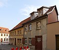
Street line | 094 80515 | Monument area |
|
|
| Lindenstrasse and Schierstedter Strasse (map) |
Transformer station | 094 97566 | monument |

|
|
| Lindenstrasse 1 (map) |
Residential building | 094 80870 | monument |

|
|
| Lindenstrasse 3 (map) |
pavilion | Flower pavilion | 094 15528 | monument |

|
| Lindenstrasse 22 (map) |
Residential building | 094 80871 | monument |

|
|
| Lindenstrasse 24 (map) |
Residential building | 094 14484 | monument |

|
|
| Lindenstrasse 25 (map) |
Residential building | 094 03709 | monument | ||
| Lindenstrasse 26 (map) |
Residential building | 094 03711 | monument |

|
|
| Lindenstrasse 27 (map) |
Residential and commercial building | 094 81075 | monument |

|
|
| Lindenstrasse 27 Worthstrasse 1, 3, 5, 7, 9, 11, 13, 15, 17 (map) |
Street line | 094 80917 | Monument area |

|
|
| Lindenstrasse 28 (map) |
Agricultural bourgeoisie | 094 80347 | monument |

|
|
| Lindenstrasse 36 Nordzeile of Lindenstrasse (map) |
Residential building | 094 15529 | monument |

|
|
| Lindenstrasse 39 (map) |
Residential building | 094 80872 | monument |

|
|
| Lindenstrasse 41 (map) |
factory | Seed factory Gustav Jaentsch & Co | 094 81071 | monument |

|
| Lindenstrasse 41 (map) |
Residential building | 094 80873 | monument |

|
|
| Lindenstrasse 49 (map) |
Residential building | 094 80874 | monument |

|
|
| Lindenstrasse 49 (map) |
cross | 094 95729 | Small monument |

|
|
| Lindenstrasse 51 (map) |
Residential building | 094 80875 | monument |

|
|
| Lindenstrasse 53 (map) |
villa | 094 80876 | monument |

|
|
| Lindenstrasse 55 (map) |
villa | 094 80878 | monument |

|
|
| Lindenstrasse 57 (map) |
villa | 094 80879 | monument |

|
|
| Lindenstrasse 59 (map) |
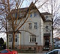
villa | 094 80880 | monument |
|
|
| Lindenstrasse 60 (map) |
villa | 094 80877 | monument |

|
|
| Lindenstrasse 73 (map) |
Mill | Kreuzmühle | 094 03644 | monument |

|
| Magdeburger Chaussee (map) |
Depot | Railway depot with turntable and water tower | 094 03643 | monument |

|
| Magdeburger Chaussee 24 junction of Wilsleber Straße (map) |
Administration building | Office building | 094 97437 | monument |

|
| Magdeburger Strasse 6 (map) |
Residential building | 094 80516 | monument |

|
|
| Magdeburger Strasse 7 (map) |
Sawmill | Gang saw | 094 03648 | monument | |
| Magdeburger Strasse 8 (map) |
Residential building | 094 80517 | monument |

|
|
| Magdeburger Strasse 10 (map) |
church | Former Catholic Church of St. Michael (1893–1979), since 1979 Michaelshaus. | 094 80518 | monument |

|
| Magdeburger Strasse 12 (map) |
Residential building | 094 80519 | monument |

|
|
| Magdeburger Strasse 14 (map) |
Residential building | 094 80520 | monument |

|
|
| Magdeburger Strasse 22, 22a, 24, 24a, 26 Area between Magdeburger Strasse and Langer Reihe (map) |
factory | Billeter & Klunz factory | 094 80521 | monument |

|
| Margarethenkirchhof (map) |
church | Margarethenkirche, Neustädter Church | 094 03685 | monument |

|
| Margarethenkirchhof 2, 3, 5 to 9 (map) |
space | 094 80522 | Monument area |

|
|
| Market (map) |
Fountain | Hen fountain | 094 80523 | monument |

|
| Market 1 to 28 (map) |
Marketplace | 094 90007 | Monument area |

|
|
| Market 1 (map) |
town hall | 094 17285 | monument |

|
|
| Market 2 (map) |
Residential and commercial building | Krugmann's house, meanwhile Schnock's house | 094 90009 | monument |

|
| Market 6 (map) |
Residential and commercial building | 094 90010 | monument |

|
|
| Market 7 (map) |
Residential and commercial building | 094 90076 | monument |

|
|
| Market 8 (map) |
Residential and commercial building | Residential building with Kruger pharmacy | 094 90077 | monument |

|
| Markt 9, 10 (map) |
Residential and commercial building | 094 90078 | monument |

|
|
| Market 11 (map) |
Residential and commercial building | 094 90079 | monument |

|
|
| Market 14 (map) |
Residential and commercial building | 094 90080 | monument |

|
|
| Markt 17, 18 (map) |
Residential and commercial building | Rahmlow and Kressmann department store | 094 80348 | monument |

|
| Markt 19 (map) |
church | Marktkirche, Holy Cross Church | 094 03667 | monument |

|
| Market 20 (map) |
movie theater | Built in 1930 by Carl Fugmann . AM-Palast (until 1942), currently the Filmpalast. AM stood for the owner Artur Mest . | 094 90082 | monument |

|
| Markt 21 (map) |
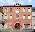
museum | Formerly built as a box house for the Freemasons, since 1995 Aschersleben City Museum. | 094 10022 | monument |
|
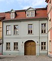
| Markt 22 (map) |
Agricultural bourgeoisie | 094 81174 | monument |
|
|
| Markt 25 (map) |
Residential and commercial building | 094 90083 | monument |

|
|
| Markt 26 (map) |
Residential and commercial building | 094 90084 | monument |

|
|
| Markt 27 (map) |
Residential and commercial building | Pear style house | 094 90085 | monument |

|
| Markt 28 (map) |
Rectory | 094 90086 | monument |

|
|
| Mauerstraße 3 (map) |
Residential building | 094 90073 | monument |

|
|
| Mauerstraße 1 to 8, (9), (10), (11), 12 to 15, 16 Weinberg 7 (map) |
Street line | 094 17284 | Monument area |

|
|
| Mehringer Landstrasse (map) |
Atonement Cross | Two atonement crosses | 094 95730 | Small monument |

|
| Neue Strasse 4 (map) |
Residential building | 094 80524 | monument |

|
|
| Oberstrasse 38 Marienplatz (map) |
chapel | Johanneskapelle | 094 80902 | monument |

|
| Oberstrasse 50 (map) |
Supermarket | The source | 094 95384 | monument |

|
| Oststrasse (map) |
Water tower | 094 80895 | monument |

|
|
| Pillar trench 2 (map) |
villa | 094 80924 | monument |

|
|
| Prof.-Dr.-Walter-Friedrich-Strasse 25 (map) |
Residential building | 094 80910 | monument |

|
|
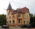
| Prof.-Dr.-Walter-Friedrich-Strasse 32, 32a (map) |
Residential building | 094 15690 | monument |
|
|
| Prof.-Dr.-Walter-Friedrich-Strasse 33, 35 (map) |
Group of houses | 094 15689 | Monument area |

|
|
| Prof.-Dr.-Walter-Friedrich-Strasse 34, 34a, 34b (map) |
Residential building | 094 15691 | monument |

|
|
| Prof.-Dr.-Walter-Friedrich-Strasse 36, 36a (map) |
Residential building | 094 15692 | monument |

|
|
| Prof.-Dr.-Walter-Friedrich-Strasse 38, 38a (map) |
Residential building | 094 15693 | monument |

|
|
| Prof.-Dr.-Walter-Friedrich-Strasse 53 (map) |
Residential building | 094 80912 | monument |

|
|
| Ramdohrstrasse 33, 35, 37, 37a (map) |
Street line | 094 80525 | Monument area |

|
|
| Ritterstrasse 1 to 5, 17, (18), 19 to 21 (map) |
Street train | 094 80526 | Monument area |

|
|
| Ritterstrasse 1 (map) |
Residential building | 094 80527 | monument |

|
|
| Ritterstrasse 2 (map) |
Residential building | 094 80528 | monument |

|
|
| Ritterstrasse 3 (map) |
Storage | 094 80529 | monument |

|
|
| Ritterstrasse 4 (map) |
Residential building | 094 80530 | monument |

|
|
| Ritterstrasse 19 (map) |
Residential building | 094 80536 | monument |

|
|
| Schmidtmannstrasse 35 (map) |
graveyard | Jewish Cemetery | 094 03552 | monument |

|
| Schmidtmannstrasse Stadtfriedhof (map) |
graveyard | Municipal cemetery with the Soviet cemetery of honor | 094 80883 | monument |

|
| Schmidtmannstrasse Stadtfriedhof (map) |
Tomb | Bestehorn tomb | 094 04295 | monument |

|
| Schmidtmannstrasse 82 (map) |
villa | 094 17178 | monument |

|
|
| Schmidtmannstrasse 80 (X) (map) |
villa | 094 17179 | monument | ||
| Schmidtstrasse 24 (map) |
villa | 094 97438 | monument | ||
| Schuhstieg (1), (2), (3), (4), (5), 6 to 10, (11), (12), (13), (14) (map) |
Street train | 094 80540 | Monument area |

|
|
| Schuhstieg 8 (map) |
Residential building | 094 14451 | monument |

|
|
| Schuhstieg 10 (map) |
Residential building | 094 80542 | monument |

|
|
| Magdeburger Chaussee 4 (Schwarzer Weg) (map) |
Wrought | Former smithy, no longer a monument after renovations. Today's address Magdeburger Chaussee 4. | 094 97439 | monument |

|
| Seegraben 4 (map) |
Old people's home | Retirement home, 2015: Vital care team | 094 80543 | monument |

|
| Staßfurter Höhe 30 (map) |
school | Staßfurter Höhe school with gym | 094 80901 | monument |

|
| Staßfurter Höhe 30 (map) |
Transformer station | 094 97570 | monument |

|
|
| Staßfurter Höhe 75 (map) |
villa | Villa has already been demolished and a supermarket has been built there. | 094 80929 | monument | |
| Stone Bridge 27 (map) |
Residential building | Albert Thiemann construction business | 094 96334 | monument |

|
| Stephanikirchhof (map) |
church | City Church of St. Stephen | 094 03674 | monument |

|
| Stephanikirchhof 1 to 4 (empty space), 5 to 16-17 (empty space), 18 to 21 (map) |
space | 094 80544 | Monument area |

|
|
| Stephanikirchhof 5 (map) |
Residential building | 094 03540 | monument |

|
|
| Stephanikirchhof 7 (map) |
school | Old Stephaneum | 094 03590 | monument |

|
| Stephanikirchhof 8 (map) |
Residential building | 094 17183 | monument |

|
|
| Stephanikirchhof 9 (map) |
Residential and office building | 094 80545 | monument |

|
|
| Stephanikirchhof 10 (map) |
Residential building | 094 80546 | monument |

|
|
| Stephanikirchhof 11 (map) |
Residential building | 094 80547 | monument |

|
|
| Stephanikirchhof 12 (map) |
Residential and commercial building | 094 80548 | monument |

|
|
| Stephanikirchhof 14 (map) |
Residential building | 094 80549 | monument |

|
|
| Stephanikirchhof 19 Scharren (map) |
Residential and commercial building | Pawing | 094 03675 | monument |

|
| Stephanikirchhof 20 Scharren (map) |
Residential building | 094 80550 | monument |

|
|
| Taubenstrasse 6 (map) |
Residential and commercial building | 094 80325 | monument |

|
|
| Taubenstrasse 8 (map) |
Residential and commercial building | 094 80326 | monument |

|
|
| Taubenstrasse 11 (map) |
Residential and commercial building | 094 80327 | monument |

|
|
| Thomas-Mann-Strasse 2 (map) |
Residential building | 094 80595 | monument |

|
|
| Thomas-Mann-Strasse 5 (map) |
Residential building | 094 80596 | monument |

|
|
| Thomas-Mann-Strasse 8 (map) |
Residential building | 094 80597 | monument |

|
|
| Tie 1 to 4, 20 to 22, 22a, 23 to 29 (card) |
Street train | 094 90001 | Monument area |

|
|
| Tie 22 (card) |
Residential and commercial building | Golden Sun | 094 90002 | monument |

|
| Tie 23 (card) |
Residential and commercial building | 094 90003 | monument |

|
|
| Tie 25 (card) |
hotel | 094 90004 | monument |

|
|
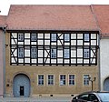
| Tie 26 (card) |
Agricultural bourgeoisie | Green Tree | 094 90005 | monument |
|
| Tie 29 (card) |
Residential and commercial building | 094 90006 | monument |

|
|
| Under the old castle 1 (map) |
Mill | School mill | 094 81072 | monument |

|
| Vogelgesang 10, 12, 14, 16, 18, 20, 22 (map) |
Street line | 094 80604 | Monument area |

|
|
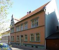
| Vogelgesang 20 (card) |
Residential building | 094 80605 | monument |
|
|
| Vogelgesang 22 (card) |
Residential building | 094 80606 | monument |

|
|
| Vogelgesang 27 (card) |
Residential building | 094 14447 | monument |

|
|
| Vogelgesang 29 (card) |
Residential building | 094 14435 | monument |

|
|
| Vogelgesang 49 (card) |
Garden shed | 094 80607 | monument |

|
|
| In front of the Johannistor 1, 3, 5, 7, 9, 11, 13, 15, 17, 19, 21, 23 (map) |
Street line | 094 80569 | Monument area |

|
|
| In front of Johannistor 9 (map) |
Residential and commercial building | 094 80891 | monument |

|
|
| In front of Johannistor 23 (map) |
Residential and commercial building | 094 80892 | monument |

|
|
| In front of the stone gate 3 (map) |
Agricultural bourgeoisie | 094 80570 | monument |

|
|
| In front of the stone gate 11 (map) |
Residential building | 094 80571 | monument |

|
|
| In front of the stone gate 15 (map) |
Residential building | Building no longer exists. | 094 80572 | monument | |
| In front of the stone gate 16 (map) |
Residential building | 094 80573 | monument |

|
|
| In front of the water gate 6 (map) |
Residential building | Villa-like house in the neo-renaissance style from 1894 | 094 80575 | monument |

|
| In front of the water gate 18, 19, 20 (map) |
Agricultural bourgeoisie | 094 80576 | monument |

|
|
| In front of the water gate 33 (map) |
Residential building | 094 80577 | monument | ||
| In front of the water gate 36, 37 (map) |
Residential building | 094 80578 | monument |

|
|
| In front of the water gate 39 (map) |
hospital | Elisabeth Hospital | 094 80579 | monument |

|
| In front of the water gate 40 (map) |
Residential and commercial building | 094 14476 | monument |

|
|
| In front of the high gate (map) |
Fountain | Kuntzebrunnen | 094 04294 | monument |

|
| In front of the high gate 3 (map) |
Residential building | 094 80568 | monument |

|
|
| In front of high gate 4 (map) |
Residential and commercial building | Locksmith Otto Vogel | 094 97446 | monument |

|
| Front width 9 to 15 (gap), 16 to 28 (map) |
Street line | 094 80337 | Monument area |

|
|
| Front width 12 (card) |
Agricultural bourgeoisie | 094 80338 | monument |

|
|
| Front width 28 (card) |
Residential and commercial building | 094 80339 | monument |

|
|
| Water plan 1 (vacant lot), 2 to 4, 4a, 4b, 5, 5a, 5b, 6 to 8, 9/10 (gap), 11 to 17 Westdorfer Straße 26 (map) |
Street train | 094 80580 | Monument area |

|
|
| Vineyard 7 (map) |
Residential building | 094 90072 | monument |

|
|
| Weinberg 13 (map) |
Residential and commercial building | 094 80582 | monument |

|
|
| Weststrasse 12 (map) |
Storage | 094 80930 | monument |

|
|
| Weststrasse 14 to 20 (map) |
factory | 094 80903 | monument |

|
|
| Weststrasse 23, 24, 25 (map) |
Transformer station | 094 97571 | monument |

|
|
| Wilhelmstrasse 11 (map) |
Residential and commercial building | 094 80925 | monument |

|
|
| Wilhelmstrasse 4, 5 (map) |
Residential building | 094 80926 | monument |

|
|
| Wilslebener Straße on the WEMA-Werk III site |
cenotaph | 094 95372 | monument | ||
| Wilslebener Strasse On the administration site of WEMA Plant III Ernst-Schiess-Strasse 1 (map) |
Planer | Column planer from Billeter & Klunz | 094 03642 | monument | |
| Wilslebener Strasse 6, 7 (map) |
Machine house | Mining house and machine center for the "Askania" and "Winningen" potash pits | 094 80881 | monument |

|
| Worthstrasse 3 (map) |
Residential building | 094 03706 | monument |

|
|
| Worthstrasse 5 (map) |
Residential building | 094 80918 | monument |

|
|
| Worthstrasse 7 (map) |
Residential building | 094 80919 | monument |

|
|
| Worthstrasse 13 (map) |
Residential building | 094 80921 | monument |

|
|
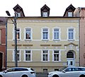
| Worthstrasse 15 (map) |
Residential building | 094 80922 | monument |
|
|
| Worthstrasse 17 (map) |
Residential building | 094 80923 | monument |

|
|
| Worthstrasse 22 (map) |
Residential building | 094 03708 | monument |

|
|
| Zippelmarkt 9 (map) |
farm | 094 15687 | monument | ||
| Zollberg 1 (map) |
Rectory | Rectory of the parish of St. Margarethen | 094 80900 | monument |

|
| Zollberg 16 (map) |
Residential building | 094 80609 | monument |

|
|
| Zollberg 4, 6, 8, 10 (map) |
farm | 094 80608 | monument |

|
|
| Above the water (1), (2), 3 to 7, (8), (9), 10 to 12, (13), 14 to 16, (17), (18), 19 to 23, (24) , (25), (26), (27), (28), 29, 30, (31), 32 to 37 (map) |
Street train | 094 15505 | Monument area |

|
|
| Above the water 4 (map) |
Residential building | 094 80552 | monument |

|
|
| Above the water 5 (map) |
Inn | Jägerheim restaurant | 094 80553 | monument |

|
| Above the water 6 (map) |
Agricultural bourgeoisie | 094 80554 | monument |

|
|
| Above the water 7 (map) |
Residential and commercial building | 094 80555 | monument |

|
|
| Above the water 11 (map) |
Residential building | 094 80556 | monument |

|
|
| Above the water 14 (map) |
Residential building | 094 14473 | monument |

|
|
| Above the water 22 (map) |
Mill | Old fulling mill, also called council mill or water tower mill | 094 03676 | monument |

|
| Above the water 29, 30 northeast side of the property, along the Eine-Ufer (map) |
Storage | 094 95395 | monument |

|
|
| Above the water 32 (map) |
Agricultural bourgeoisie | 094 80558 | monument |

|
|
| Over the bridges 3 (map) |
Residential building | 094 80599 | monument |

|
|
| Above stones 1 to 4, 5a, 5b, 6, (7), 8 to 11, (12), 13 to 15, (16), (17), (18), (19), (20), ( 21), 22, (23), 24 to 37 (map) |
Street train | 094 80645 | Monument area |

|
|
| Above the stones 1 (map) |
Residential and commercial building | 094 80559 | monument |

|
|
| Above stones 5a (map) |
Inn | 094 03687 | monument |

|
|
| Above stones 9, 9a (map) |
Residential building | 094 80560 | monument |

|
|
| Above the stones 14 (map) |
Agricultural bourgeoisie | 094 80561 | monument |

|
|
| Above the stones 22 (map) |
Residential building | 094 90069 | monument |

|
|
| Above the stones 25 (map) |
Residential and commercial building | 094 80562 | monument |

|
|
| Above the stones 28 (map) |
Residential and commercial building | 094 80563 | monument |

|
|
| Above the stones 31 (map) |
Residential and commercial building | 094 80564 | monument |

|
|
| Above the stones 34 (map) |
Agricultural bourgeoisie | 094 80566 | monument |

|
|
| Above the stones 36 (map) |
Residential building | 094 80567 | monument |

|
Drohndorf
| location | designation | description |
Registration |
Identification type | image |
|---|---|---|---|---|---|
| Am Schmiedeplatz 66 (map) |
Inn | 094 80988 | monument |

|
|
| Drohndorfer Landstrasse 106 (map) |
farm | 094 80998 | monument |

|
|
| Drohndorfer Landstrasse 116 (map) |
Residential building | 094 80999 | monument | ||
| Drohndorfer Landstrasse 126, 148, 149 (map) |
Group of houses | 094 81000 | Monument area |

|
|
| Drohndorfer Landstrasse 157 (map) |
Residential building | 094 81001 | monument | ||
| Drohndorfer Landstrasse 162 (map) |
farm | 094 81008 | monument |

|
|
| Drohndorfer Landstrasse 176 (map) |
farm | 094 81002 | monument | ||
| Drohndorfer Landstrasse 25 (map) |
farm | 094 81003 | monument |

|
|
| Drohndorfer Landstrasse 26 (map) |
Residential building | 094 81004 | monument |

|
|
| Friedhofstrasse 162a (map) |
Residential building | 094 80989 | monument | ||
| Friedhofstrasse 167 (map) |
Residential building | 094 80990 | monument |

|
|
| Friedhofstrasse 168 (map) |
Residential building | 094 80991 | monument | ||
| Gottlieb-Luther-Strasse (map) |
church | 094 80992 | monument |

|
|
| Gottlieb-Luther-Strasse 30, 31 (map) |
farm | 094 80993 | monument |

|
|
| Gottlieb-Luther-Strasse 31 (map) |
farm | 094 80994 | monument | ||
| Gottlieb-Luther-Strasse 36, 37 (map) |
farm | 094 80995 | monument | ||
| Gottlieb-Luther-Strasse 37 (map) |
farm | 094 03651 | monument | ||
| Gottlieb-Luther-Strasse 41 (map) |
farm | 094 10019 | monument | ||
| Gottlieb-Luther-Strasse 42 (map) |
Residential building | 094 10020 | monument | ||
| Gottlieb-Luther-Strasse 43 (map) |
farm | 094 10021 | monument | ||
| Gottlieb-Luther-Strasse 44 (map) |
farm | 094 80996 | monument | ||
| Hohler Graben 136 (map) |
farm | 094 80997 | monument | ||
| Oberdorf 67 (map) |
farm | Wichmann's court | 094 80310 | monument | |
| Oberdorf 68 (map) |
Residential building | 094 81006 | monument | ||
| Oberdorf 70, 71 (map) |
farm | 094 81007 | monument | ||
| Oberdorf 89 (map) |
Residential building | 094 10018 | monument | ||
| Sonnenblumenweg 18 (map) |
Pigeon tower | 094 81005 | monument |

|
Freckleben
| location | designation | description |
Registration |
Identification type | image |
|---|---|---|---|---|---|
| Course of the railway line Sandersleben – Güsten in the area of the village, extended Winzersteg (map) |
viaduct | 094 61430 | monument |

|
|
| crossing the road from Sandersleben to Freckleben (map) |
viaduct | 094 66002 | monument |

|
|
| Course of the railway line Sandersleben – Güsten in the area of the local situation, at the local exit Ri. Schackenthal (map) |
viaduct | 094 95158 | monument |

|
|
| On Dorfstrasse (9) (map) |
Residential building | 094 95147 | monument | ||
| At Dorfstrasse 7 (map) |
Wrought | 094 95146 | monument | ||
| Arnstedter Strasse 15 (map) |
Residential building | 094 95139 | monument | ||
| At the castle (map) |
Castle | 094 95140 | monument |

|
|
| Domain 16, (17) (map) |
Group of houses | 094 95152 | monument | ||
| Domain 20 (card) |
Gate system | 094 95154 | monument | ||
| Dorfplatz (map) |
church | 094 95141 | monument |

|
|
| Dorfplatz 6 (map) |
Rectory | 094 95143 | monument | ||
| Dorfplatz 13 (map) |
farm | 094 95145 | monument | ||
| Dorfplatz 5, 6 (map) |
Group of houses | 094 95142 | Monument area | ||
| District road K 1330 road between Sandersleben and Freckleben, western side of the road (map) |
Distance stone | 094 90356 | Small monument |

|
|
| Moritzkirchhof 1 to 5 (map) |
Street train | 094 95151 | Monument area | ||
| Schlossblick 10 (map) |
Residential building | 094 95 150 | monument | ||
| Friendship Road (Map) |
bridge | 094 95155 | monument | ||
| Friendship Road 1 (Map) |
Residential building | 094 95156 | monument |
Gross Schierstedt
| location | designation | description |
Registration |
Identification type | image |
|---|---|---|---|---|---|
| There the cemetery |
Tomb | Resting place of the W. Herrmann family | 094 81346 | monument | |
| Galgenberg north of the village (map) |
Place of execution | 094 03640 | monument | ||
| Am Mühlgraben 1 (map) |
barn | 094 81330 | monument | ||
| Am Mühlgraben 2 (map) |
grange | 094 81331 | monument | ||
| Am Mühlgraben 37 (map) |
Residential building | 094 81332 | monument | ||
| Am Mühlgraben 38 (map) |
Residential building | 094 81333 | monument | ||
| Auestrasse 130 (map) |
Mining building | Schmidtmannshall, former potash mine | 094 81334 | monument |

|
| Obere Dorfstrasse (map) |
church | St. Nikolai | 094 81335 | monument |

|
| Obere Dorfstrasse 51 (map) |
Mill | 094 81336 | monument | ||
| Obere Dorfstrasse 52 (map) |
Residential building | 094 81337 | monument | ||
| Obere Dorfstrasse 62 (map) |
Residential building | 094 81338 | monument |

|
|
| Obere Dorfstrasse 62a (map) |
farm | 094 81339 | monument | ||
| Obere Dorfstrasse 63 (map) |
Rectory | 094 81340 | monument |

|
|
| Obere Dorfstrasse 71 (map) |
farm | 094 81341 | monument |

|
|
| Untere Dorfstrasse 4 (map) |
Residential building | 094 81342 | monument | ||
| Untere Dorfstrasse 14 (map) |
Residential building | 094 81343 | monument | ||
| Untere Dorfstrasse 22 (map) |
Residential building | 094 81344 | monument | ||
| Untere Dorfstrasse 33 (map) |
Residential building | 094 81345 | monument |
Klein Schierstedt
| location | designation | description |
Registration |
Identification type | image |
|---|---|---|---|---|---|
| Gemeindeplatz 94 (map) |
Mansion | 094 17286 | monument | ||
| Gemeindeplatz 103, 105 (map) |
farm | 094 17287 | monument | ||
| Main street (map) |
Mercy Church | church | 094 04286 | monument |

|
| Hauptstrasse 60 (map) |
farm | 094 17290 | monument | ||
| Hauptstrasse 64 (map) |
Residential building | 094 17288 | monument | ||
| Hauptstrasse 73 (map) |
Residential building | 094 17289 | monument | ||
| Behind the Wipperbrücke 41, 42 (map) |
Pigeon tower | 094 17291 | monument | ||
| Insel 53 (map) |
farm | Farm from around 1800 | 094 17293 | monument |

|
| Island 54 (map) |
Gasthof at the old mill | Inn emerged from a four-sided courtyard | 094 17294 | monument |

|
| Insel 55 (map) |
Mill | 094 17295 | monument | ||
| Schachtstrasse 80 (map) |
farm | 094 17296 | monument |
Mehringen
| location | designation | description |
Registration |
Identification type | image |
|---|---|---|---|---|---|
| Alte Bahnhofstrasse 3 (map) |
villa | 094 17299 | monument | ||
| At the train station Near the train station (map) |
Distance stone | 094 90351 | Small monument | ||
| Am Kloster 9 (map) |
grange | 094 04268 | monument | ||
| Angerstrasse 1 (map) |
Pigeon tower | 094 03657 | monument | ||
| Angerstrasse 4 (map) |
farm | 094 17297 | monument | ||
| Angerstrasse 6 (map) |
farm | 094 17298 | monument | ||
| B 6 BW 10 10, bridge over the Selke (map) |
bridge | Möller bridge (possible error, the Wipper flows through Mehringen, not the Selke) | 094 90365 | monument | |
| Grüne Strasse 3, 5 (map) |
Group of houses | 094 17300 | Monument area | ||
| In the big angle 10 (map) |
barn | 094 17302 | monument | ||
| Kirchstrasse (map) |
St. Stephen's Church | ev. Church of St. Stephanus | 094 03665 | monument |

|
| Kirchstrasse (map) |
Memorial to the fallen of World War 1 | War memorial, designated as a memorial in 2017 | 094 03665001 | Small monument | |
| in the churchyard (map) |
Hereditary funeral of the Grosmann family | Crypt from 1869, designated as a memorial in 2017 | 094 03665002 | monument | |
| Kirchstrasse 2 (map) |
Rectory | 094 17315 | monument | ||
| Kirchstrasse 10 (map) |
farm | 094 17314 | monument | ||
| Kreisstrasse 17 (map) |
farm | 094 17303 | monument | ||
| Kreisstrasse 24 (map) |
farm | 094 17304 | monument | ||
| Kreisstrasse 30 (map) |
farm | 094 17306 | monument | ||
| Kreisstrasse 34 (map) |
farm | 094 17307 | monument | ||
| Kreisstrasse 35 (map) |
farm | 094 17308 | monument | ||
| Kreisstrasse 44 (map) |
barn | 094 17309 | monument | ||
| Kreisstrasse 58 (map) |
farm | 094 17310 | monument | ||
| Kreisstrasse 67 (map) |
farm | 094 17311 | monument | ||
| Fulling mill west of the municipality (map) |
Mill | 094 17313 | monument |
Schackenthal
| location | designation | description |
Registration |
Identification type | image |
|---|---|---|---|---|---|
| Balkendorferstrasse (map) |
church | Dr. Martin Luther Church | 094 81329 | monument |

|
| Balkendorferstrasse 1 (map) |
farm | 094 04304 | monument | ||
| Lindenstrasse 7 (map) |
Administration building | 094 81328 | monument | ||
| Schäfereiweg 1 (map) |
farm | 094 81327 | monument |

|
Schackstedt
| location | designation | description |
Registration |
Identification type | image |
|---|---|---|---|---|---|
| Im Pfarrwinkel, Kirchberg (map) |
church | St. Kilian | 094 60660 | monument |

|
| In Pfarrwinkel 1 at the foot of the Kirchberg (map) |
Rectory | 094 98078 | monument | ||
| Marktring 13 (map) |
Residential building | 094 98079 | monument | ||
| Marktring 16 (map) |
Residential building | 094 98076 | monument |
Westdorf
| location | designation | description |
Registration |
Identification type | image |
|---|---|---|---|---|---|
| Dirt road from Westdorf to Ermsleben, on the southern side of the path, approx. 1 km from the village (map) |
cross | 094 95731 | Small monument |

|
|
| Alter Gutshof 1 (map) |
grange | 094 81351 | monument | ||
| At the water 1 (map) |
Rectory | 094 81347 | monument | ||
| Way to school (map) |
church | St. George | 094 81350 | monument |

|
| Zum Einetal 11 (map) |
Residential building | German emperor | 094 81348 | monument | |
| Zum Einetal 26 (map) |
farm | 094 81349 | monument |
Wilsleben
| location | designation | description |
Registration |
Identification type | image |
|---|---|---|---|---|---|
| north of the location north of the location (map) |
Water tower | 094 81390 | monument |

|
|
| Froser Strasse (map) |
church | 094 95383 | monument | ||
| Froser Straße 4 |
farm | 094 81391 | monument | ||
| Froser Straße 10 |
Farm buildings | 094 81392 | monument | ||
| Froser Straße 14 |
Reapers barracks | 094 81393 | monument | ||
| Hauptstraße 22 |
Residential building | 094 81394 | monument | ||
| Hauptstraße 28, 29 monument |
space | 094 81395 | Monument area | ||
| Hauptstraße 29 |
farm | 094 81396 | monument | ||
| Hauptstraße 40 |
sculpture | 094 81397 | monument | ||
| In the Unterdorf 8 |
farm | Hühnscher Hof | 094 81400 | monument | |
| In the Unterdorf 11 |
farm | 094 81402 | monument | ||
| In the Unterdorf 12 |
Residential building | 094 81403 | monument | ||
| In the Unterdorf 16 |
farm | 094 81404 | monument | ||
| 17 Unterdorf |
farm | 094 81405 | monument | ||
| In the Unterdorf 28 |
Residential building | 094 81406 | monument | ||
| In the Unterdorf 29 |
Residential building | 094 81407 | monument | ||
| In Unterdorf, Mittelstrasse Mittelstrasse, corner of Im Unterdorf |
Pump house | 094 81410 | monument | ||
| Mittelstraße 11 |
Residential building | 094 81411 | monument | ||
| Pfarrwinkel 2 |
school | 094 81408 | monument | ||
| Pfarrwinkel 4 |
farm | 094 81409 | monument | ||
| To Klint 16 (map) |
lock | 094 04289 | monument |

|
Winningen
| location | designation | description |
Registration |
Identification type | image |
|---|---|---|---|---|---|
| At the Teichberg 1 to 4 |
settlement | 094 81685 | monument | ||
| Burgstraße 11, 12 |
Residential building | 094 81665 | monument | ||
| Burgstraße 13, 14 |
Residential building | 094 81666 | monument | ||
| Basic |
Transformer station | 094 81667 | monument | ||
| Uhlenwinkel green area |
War memorial | 094 81670 | monument | ||
| Uhlenwinkel 1 |
farm | 094 81671 | monument | ||
| Uhlenwinkel 3 |
farm | 094 81672 | monument | ||
| Unter den Linden 28 western edge of the village (map) |
Winningen Monastery Estate | Monastery property with St. Stephen's Chapel from 1687 and a classicist mansion from 1826 | 094 04305 | monument |

|
| Under the linden trees 30 |
barn | 094 81668 | monument | ||
| Walter-Rathenau-Straße 7 |
Residential building | 094 81673 | monument |
Former cultural monuments according to districts
The following objects were originally also listed or listed in literature as cultural monuments. However, the monuments no longer exist today, their protection status has been lifted or they are no longer regarded as monuments.
Aschersleben
| location | designation | description |
Registration |
Identification type | image |
|---|---|---|---|---|---|
| Schmidtmannstraße 35 |
Morgue | Built in 1929 by Hans Heckner on the Jewish cemetery, destroyed by arson during the Reichspogromnacht in 1938, ruins later demolished. | monument | ||
| Adam-Olearius-Straße 1 at the Rosarium (map) |
Bathing establishment | The Stadtbad Aschersleben , a swimming pool with the water of one, built in Art Nouveau style and opened in 1906 , was closed in 2002. After the building was sold, the demolition and construction of a senior citizens' residential complex began in the spring of 2010. | 094 81074 | monument | |
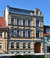
| On the trench 29 (map) |
Residential building | 094 80409 | monument |
|
|
| Badstuben 1 to 10 (map) |
Street train | Small-scale development from the 17th to 19th centuries, after buildings 3, 4, 8, 9 and 10 had been demolished in previous years without a permit, the monument area was removed from the monument register in 2017 | 094 80417 | Monument area |

|
| Badstuben 8 (map) |
Residential building | Two-storey residential building from the late 18th century, after unauthorized demolition at an unknown time, the property was removed from the monument register in 2017 | 094 80423 | monument | |
| Badstuben 9 (map) |
Residential building | Plastered house from around 1800, after unauthorized demolition at an unknown time, the property was removed from the monument register in 2017 | 094 80424 | monument | |
| Badstuben 10 (map) |
Residential building | Plastered house from around 1800, after unauthorized demolition at an unknown time, the property was removed from the monument register in 2017 | 094 80425 | monument | |
| Badstuben 14 at the Krappschen tower of the city fortifications (map) |
Residential and commercial building | Art box. The house was demolished in 2012, only the Krapp tower remained. | 094 80426 | monument |

|
| Badstuben 30 (map) |
Agricultural bourgeoisie | The house was demolished in 2012. | 094 80434 | monument |

|
| Douglasstrasse 13, Geschwister-Scholl-Strasse 66 (map) |
Residential building | The house has already been torn down. | 094 80459 | monument |

|
| Dr.-Wilhelm-Külz-Platz 12 (map) |
Residential building | The house has already been torn down. | 094 80351 | monument | |
| Fleischhauerstraße 5 (map) |
Agricultural bourgeoisie | The house has already been torn down. | 094 80450 | monument |

|
| Fleischhauerstraße 13 at the corner of Badstuben (map) |
Residential building | The building had been emergency secured for around ten years in 2012 and was later completely demolished. | 094 80451 | monument |

|
| Geschwister-Scholl-Strasse 55 (map) |
villa | The Wilhelminian style villa was demolished in 2002 and the property was rebuilt with a supermarket. | 094 80457 | monument | |
| Behind the tower 29 (map) |
Residential and commercial building | The house has already been torn down. | 094 80346 | monument | |
| Behind the customs 13, 14, 15, 16, 17, 18, 19, 19a (map) |
Street line | 094 80474 | Monument area |

|
|
| Behind the Salpeterhütte 3 (map) |
Residential building | The house has already been torn down. | 094 80477 | monument | |
| Hop market (1), (2), (3), (4) 5, 6, 7, (8), (9), (10), (11), 12, 13, 14a, 15 to 25 (map) |
Street train | Street, of the 25 parcels belonging to the monument area, up to 16 the buildings were demolished. The monument status was lost as a result. | 094 80490 | Monument area |

|
| Hopfenmarkt 12 (map) |
Residential building | Residential building, the building was demolished before 2016 and removed from the list of monuments in 2016. | 094 80492 | monument | |
| Hopfenmarkt 14 (map) |
Agricultural bourgeoisie | Bürgerschänke | 094 14459 | monument |

|
| Hopfenmarkt 16, 17, 18 (map) |
Residential building | Residential building, demolished after approval in 2015. In 2016 the building was removed from the list of monuments. | 094 80494 | monument |

|
| Kleiner Halken 1 to 4 (map) |
Street of Kleiner Halken 1 to 4 | Street with buildings from the 17th to 19th centuries, after the demolition of buildings 1, 2 and 3, the monument area was deleted from the monument register in 2017. | 094 80501 | Monument area |

|
| Kleiner Halken 2 (map) |
Residential building | Two-storey residential building, partly from the 16th century, only remnants preserved, deleted from the list of monuments in 2017 | 094 80502 | monument |

|
| Kleiner Halken 3 (map) |
Residential building | two-storey residential building, partly in half-timbered construction, from the 17th / 18th centuries. Dating back to the 14th century, only remnants have been preserved, deleted from the list of monuments in 2017 | 094 80503 | monument |

|
| Klosterhof 1 (map) |
Residential building | 094 03645 | monument |

|
|
| Marienstraße 36, 38, 40, 42, 44, 46, 48 (map) |
Street line | 094 80896 | Monument area |

|
|
| Ritterstrasse 16 (map) |
Residential building | Residential building, demolished in 2014 due to a security order from the building supervision. In 2015, it was removed from the list of monuments. | 094 80534 | monument |

|
| Ritterstrasse 18 (map) |
Residential building | The house has already been demolished. | 094 80535 | monument | |
| Ritterstrasse 21 (map) |
Residential building | 094 80537 | monument |

|
|
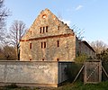
| Salzkoth 4 (map) |
Mill | Salzkothmühle | 094 80885 | monument |
|
| Under the old castle 2 (map) |
Mill | Castle mill | 094 81073 | monument | |
| Unterstrasse 41 (map) |
villa | Villa Nottrodt was built in 1894, and a number of unauthorized changes made the villa lose its monument status. The entry from the list of monuments took place in 2017. | 094 80894 | monument |

|
| In front of the water gate (map) |
memorial | 094 03545 | monument |

|
|
| In front of the water gate 5 (map) |
Residential building | 094 80574 | monument |

|
|
| Vineyard 9 (map) |
Residential building | 094 80581 | monument |

|
|
| Worthstrasse 9 (map) |
Residential building | 094 80920 | monument |

|
|
| Above the stones 33 (map) |
Agricultural bourgeoisie | Ackerbürgerhof, in 2015 the building was demolished with a fictitious permit and removed from the list of monuments. | 094 80565 | monument |

|
Freckleben
| location | designation | description |
Registration |
Identification type | image |
|---|---|---|---|---|---|
| At Dorfstrasse 25 |
farm | 094 95148 | monument | ||
| Village square (9) |
Residential building | 094 95144 | monument | ||
| Schlossblick 9 |
Residential building | 094 95149 | monument | ||
| Friendship Road (2) |
Residential building | 094 95157 | monument |
Klein Schierstedt
| location | designation | description |
Registration |
Identification type | image |
|---|---|---|---|---|---|
| Island 49 |
farm | 094 17292 | monument |
Königsaue
| location | designation | description |
Registration |
Identification type | image |
|---|---|---|---|---|---|
| North shore of the Königsauer See (map) |
Village church | Demolished in the 1960s in the course of the demolition of the village of Königsaue for open-cast lignite mining | monument |
Mehringen
| location | designation | description |
Registration |
Identification type | image |
|---|---|---|---|---|---|
| District road 26 |
farm | 094 17305 | monument | ||
| Schulstraße 16 |
farm | 094 17312 | monument |
Schackstedt
| location | designation | description |
Registration |
Identification type | image |
|---|---|---|---|---|---|
| Paradies 9 east exit, direction Alsleben |
Inn | Gasthaus zum Paradies | 094 98077 | monument |
Wilsleben
| location | designation | description |
Registration |
Identification type | image |
|---|---|---|---|---|---|
| Transformer station | 094 81389 | monument | |||
| In Unterdorf 1 |
Residential building | 094 81398 | monument | ||
| In the Unterdorf 3 |
farm | 094 81399 | monument | ||
| In the Unterdorf 9 |
farm | 094 81401 | monument |
Winningen
| location | designation | description |
Registration |
Identification type | image |
|---|---|---|---|---|---|
| Schillerstraße 4 |
Day laborer's house | 094 81669 | monument | ||
| Walter-Rathenau-Straße 18 |
Residential building | 094 81675 | monument |
Legend
The columns contain the following information:
- Location: States the street name and, if available, the house number of the cultural monument. The list is basically sorted according to this address. The link "Map" leads to various map displays and names the geographic coordinates.
Link to a map view tool to set coordinates. In the map view, monuments without coordinates are shown with a red marker and can be set on the map. Architectural monuments without a picture are marked with a blue marker, architectural monuments with a picture are marked with a blue marker. - Official designation: Provides the name, designation or type of cultural monument as noted in the source.
- Description: Provides structural and historical details of the cultural monument, preferably the characteristics of the monument.
- Registration number: A 20-digit registration number is assigned to every cultural monument in Saxony-Anhalt. Currently the last twelve digits are each 0. Therefore, the last twelve digits are not shown here. The following icon can be found in this column
 ; this leads to information on this monument at Wikidata .
 - Type of identification: The classification of the monument according to § 2 Paragraph 2 DenkmSchG LSA
- Image: A picture of the memorial and, if applicable, a link to other photos of the cultural monument in the Wikimedia Commons media archive
literature
- Götz Eckardt (Ed.): Fates of German Monuments in World War II , Volume 2, Henschel Verlag Berlin, ISBN 3-926642-24-6 , page 303
- Sabine Oszmer, Peter Seyfried: Monument Directory Saxony-Anhalt, Volume 8.1, Aschersleben-Staßfurt District (Altkreis Aschersleben) , State Office for Monument Preservation and Archeology Saxony-Anhalt, Flyhead Verlag Halle, 2000, ISBN 3-910147-67-4
- Birthe Rüdiger: Monument Directory Saxony-Anhalt , Volume 12, District Bernburg, State Office for Monument Preservation and Archeology Saxony-Anhalt, Michael Imhof Verlag, Petersberg 2003, ISBN 3-937251-06-5
swell
Individual evidence
- ↑ Detlef Anders: Auf dem Graben 75 Aschersleben: Nine apartments are being built in the single monument from 1890. In: mz-web.de. April 27, 2019, accessed April 30, 2019 .
- ↑ Kerstin Beier: Public Security: Wall of the ex-youth work yard threatened to overturn. In: mz-web.de. February 1, 2018, accessed February 2, 2018 .
- ↑ Small question and answer Olaf Meister (BÜNDNIS 90 / DIE GRÜNEN), Wolfgang Aldag (BÜNDNIS 90 / DIE GRÜNEN), State Chancellery and Ministry of Culture 22.03.2017 Printed matter 7/1157 (KA 7/628) Development of the List of Monuments Saxony-Anhalt , page 8th
- ↑ Small question and answer Olaf Meister (BÜNDNIS 90 / DIE GRÜNEN), Wolfgang Aldag (BÜNDNIS 90 / DIE GRÜNEN), State Chancellery and Ministry of Culture 02/15/2018 Printed matter 7/2453 (KA 7/1372) Development of the Saxony-Anhalt monument register in the year 2017 , page 20
- ↑ Small question and answer Olaf Meister (BÜNDNIS 90 / DIE GRÜNEN), Wolfgang Aldag (BÜNDNIS 90 / DIE GRÜNEN), State Chancellery and Ministry of Culture 02/15/2018 Printed matter 7/2453 (KA 7/1372) Development of the Saxony-Anhalt monument register in the year 2017 , page 21
- ↑ Götz Eckardt (Ed.): Fates of German Architectural Monuments in the Second World War , Volume 2, Henschel Verlag Berlin, ISBN 3-926642-24-6 , page 303
- ↑ Program Day of the Open Monument 2018 In: aschersleben.de , accessed on April 10, 2019 (PDF; 394 kB)
- ↑ Harald Vopel: Centimeters are missing from the agreement. In: mz-web.de. September 11, 2009, accessed April 10, 2019 .
- ↑ Harald Vopel: Aschersleben: Ailing Stadtbad lies in a deep slumber. In: mz-web.de. May 11, 2011, accessed April 10, 2019 .
- ↑ Small question and answer Olaf Meister (BÜNDNIS 90 / DIE GRÜNEN), Wolfgang Aldag (BÜNDNIS 90 / DIE GRÜNEN), State Chancellery and Ministry of Culture 02/15/2018 Printed matter 7/2453 (KA 7/1372) Development of the Saxony-Anhalt monument register in the year 2017 , page 32
- ↑ Small question and answer Olaf Meister (BÜNDNIS 90 / DIE GRÜNEN), Wolfgang Aldag (BÜNDNIS 90 / DIE GRÜNEN), State Chancellery and Ministry of Culture 02/15/2018 Printed matter 7/2453 (KA 7/1372) Development of the Saxony-Anhalt monument register in the year 2017 , page 32
- ↑ Small question and answer Olaf Meister (BÜNDNIS 90 / DIE GRÜNEN), Wolfgang Aldag (BÜNDNIS 90 / DIE GRÜNEN), State Chancellery and Ministry of Culture 02/15/2018 Printed matter 7/2453 (KA 7/1372) Development of the Saxony-Anhalt monument register in the year 2017 , page 32
- ↑ Small question and answer Olaf Meister (BÜNDNIS 90 / DIE GRÜNEN), Wolfgang Aldag (BÜNDNIS 90 / DIE GRÜNEN), State Chancellery and Ministry of Culture 02/15/2018 Printed matter 7/2453 (KA 7/1372) Development of the Saxony-Anhalt monument register in the year 2017 , page 32
- ^ Kerstin Beier: Historical buildings: More and more demolitions. In: mz-web.de. January 13, 2013, accessed April 10, 2019 .
- ↑ a b Harald Vopel: Aschersleben: passage through the old town is blocked again. In: mz-web.de. November 15, 2012, accessed April 10, 2019 .
- ^ Kerstin Beier: "Lidl" project in Aschersleben: new supermarket is built. In: mz-web.de. October 9, 2002, accessed April 10, 2019 .
- ↑ Small question and answer Olaf Meister (BÜNDNIS 90 / DIE GRÜNEN), Wolfgang Aldag (BÜNDNIS 90 / DIE GRÜNEN), State Chancellery and Ministry of Culture 22.03.2017 Printed matter 7/1157 (KA 7/628) Development of the List of Monuments Saxony-Anhalt , page 14th
- ↑ Small question and answer Olaf Meister (BÜNDNIS 90 / DIE GRÜNEN), Wolfgang Aldag (BÜNDNIS 90 / DIE GRÜNEN), State Chancellery and Ministry of Culture 22.03.2017 Printed matter 7/1157 (KA 7/628) Development of the List of Monuments Saxony-Anhalt , page 14th
- ↑ Small question and answer Olaf Meister (BÜNDNIS 90 / DIE GRÜNEN), Wolfgang Aldag (BÜNDNIS 90 / DIE GRÜNEN), State Chancellery and Ministry of Culture 22.03.2017 Printed matter 7/1157 (KA 7/628) Development of the List of Monuments Saxony-Anhalt , page 14th
- ↑ Small question and answer Olaf Meister (BÜNDNIS 90 / DIE GRÜNEN), Wolfgang Aldag (BÜNDNIS 90 / DIE GRÜNEN), State Chancellery and Ministry of Culture 02/15/2018 Printed matter 7/2453 (KA 7/1372) Development of the Saxony-Anhalt monument register in the year 2017 , page 32
- ↑ Small question and answer Olaf Meister (BÜNDNIS 90 / DIE GRÜNEN), Wolfgang Aldag (BÜNDNIS 90 / DIE GRÜNEN), State Chancellery and Ministry of Culture 02/15/2018 Printed matter 7/2453 (KA 7/1372) Development of the Saxony-Anhalt monument register in the year 2017 , page 32
- ↑ Small question and answer Olaf Meister (BÜNDNIS 90 / DIE GRÜNEN), Wolfgang Aldag (BÜNDNIS 90 / DIE GRÜNEN), State Chancellery and Ministry of Culture 02/15/2018 Printed matter 7/2453 (KA 7/1372) Development of the Saxony-Anhalt monument register in the year 2017 , page 32
- ↑ Small question and answer Olaf Meister (BÜNDNIS 90 / DIE GRÜNEN), Wolfgang Aldag (BÜNDNIS 90 / DIE GRÜNEN), State Chancellery and Ministry of Culture 22.03.2017 Printed matter 7/1157 (KA 7/628) Development of the List of Monuments Saxony-Anhalt , page 14th
- ↑ Small question and answer Olaf Meister (BÜNDNIS 90 / DIE GRÜNEN), Wolfgang Aldag (BÜNDNIS 90 / DIE GRÜNEN), State Chancellery and Ministry of Culture 22.03.2017 Printed matter 7/1157 (KA 7/628) Development of the List of Monuments Saxony-Anhalt , page 14th
- ↑ Small question and answer Olaf Meister (BÜNDNIS 90 / DIE GRÜNEN), Wolfgang Aldag (BÜNDNIS 90 / DIE GRÜNEN), State Chancellery and Ministry of Culture 02/15/2018 Printed matter 7/2453 (KA 7/1372) Development of the Saxony-Anhalt monument register in the year 2017 , page 32
- ↑ Small question and answer Olaf Meister (BÜNDNIS 90 / DIE GRÜNEN), Wolfgang Aldag (BÜNDNIS 90 / DIE GRÜNEN), State Chancellery and Ministry of Culture 22.03.2017 Printed matter 7/1157 (KA 7/628) Development of the List of Monuments Saxony-Anhalt , page 14th