List of bridges in Hamburg / K
K
| photo | Name, brief description | use | (First) construction | District, location |
|---|---|---|---|---|

|
Calcutta Bridge This pedestrian bridge over the Überseering is - like many of the pedestrian bridges in the City Nord - named after the Indian port city based on Hamburg's overseas trade relations. |
Footpath |
Winterhude ( 53 ° 36 ′ 15 ″ N, 10 ° 1 ′ 3 ″ E ) |
|

|
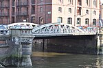
Kannengießer Bridge With this bridge, the street Am Wandrahm crosses a small canal between the Zollkanal and the Wandrahmsfleet. The bridge is a listed building. |
Street | 1885 |
HafenCity ( 53 ° 32 ′ 41 ″ N, 9 ° 59 ′ 41 ″ E ) |
|
Kannengießerortbrücke This bridge crosses the Wandrahmsfleet between the Neuer Wandrahm and the St. Annenufer. |
Street |
HafenCity ( 53 ° 32 ′ 41 ″ N, 9 ° 59 ′ 44 ″ E ) |
|

|
Karlstrasse Bridge One of the bridges that cross the Hofweg Canal from Hofweg . |
Street |
Uhlenhorst ( 53 ° 34 ′ 29 ″ N, 10 ° 0 ′ 53 ″ E ) |
|

|
Karl von Thielen Bridge (K627) A track crossing near the Wilhelmsburg S-Bahn station, which is named after the railway minister Karl von Thielen (1832–1906). |
Street | 1999 |
Wilhelmsburg ( 53 ° 30 ′ 8 ″ N, 10 ° 0 ′ 25 ″ E ) |

|
Katharinenbrücke (K099) A bridge over the Katharinenfleet near the Nikolaifleet . |
Street |
Hamburg old town ( 53 ° 32 ′ 46 ″ N, 9 ° 59 ′ 36 ″ E ) |
|

|
Käthnerort Bridge Pedestrian bridge that leads over the Osterbek Canal . |
Footpath |
Barmbek-Süd , Barmbek-Nord ( 53 ° 35 ′ 7 ″ N, 10 ° 2 ′ 19 ″ E ) |
|

|
Kattrepelsbrücke (K108) former bridge, spanned the Reichenstraßenfleet, which was filled in in 1877; today only street name |
Street |
Hamburg Old Town ( 53 ° 32 ′ 55 ″ N, 9 ° 59 ′ 58 ″ E ) |
|
|
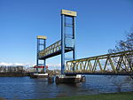
Kattwyk Bridge (K546) This steel truss bridge is the largest lift bridge in Germany, designed for both rail and road traffic and connects the districts of Wilhelmsburg and Moorburg. |
Road, railroad | 1973 |
Wilhelmsburg , Moorburg ( 53 ° 29 ′ 40 ″ N, 9 ° 57 ′ 6 ″ E ) |

|
Kedenburgstrasse Bridge With this bridge, the street of the same name crosses the Wandse . The street is named after a pastor from Wandsbeck. |
Street |
Wandsbek ( 53 ° 34 ′ 42 ″ N, 10 ° 5 ′ 12 ″ E ) |
|

|
Kehrwiedersteg A bridge that crosses the Kehrwiedersfleet in Hamburg's inland port. |
HafenCity ( 53 ° 32 ′ 36 ″ N, 9 ° 59 ′ 13 ″ E ) |
||

|
Kennedy Bridge (K133) Initially built under the name “New Lombard Bridge” , this girder bridge designed by Bernhard Hermkes was renamed “Kennedy Bridge” in 1963. The bridge is a listed building. |
Street | 1953 |
St. Georg , Rotherbaum ( 53 ° 33 ′ 28 ″ N, 9 ° 59 ′ 53 ″ E ) |

|
Kersten Miles Bridge This bridge is named after a 15th century Hamburg mayor. It leads the Seewartenstrasse over the Helgoländer Allee. The bridge is a listed building. |
Street |
Neustadt , St. Pauli ( 53 ° 32 ′ 51 ″ N, 9 ° 58 ′ 16 ″ E ) |
|

|
Kibbelstegbrücken These bridges lead over the Kehrwiederbrooksfleet and are not listed in the street directory. |
Footpath |
Hamburg-Altstadt , HafenCity ( 53 ° 32 ′ 38 ″ N, 9 ° 59 ′ 35 ″ E ) |
|

|
Kirchenheerwegbrücke This bridge leads the street of the same name over the southern Kirchwerder collecting ditch. |
Street |
Kirchwerder ( 53 ° 24 ′ 42 ″ N, 10 ° 11 ′ 29 ″ E ) |
|

|
Kirchwerder Landweg Bridge The Kirchwerder Landweg crosses the Gose Elbe with this bridge . |
Street |
Neuengamme , Kirchwerder ( 53 ° 26 ′ 43 ″ N, 10 ° 10 ′ 30 ″ E ) |
|

|
Klärchenbrücke The Klärchenbrücke leads the street of the same name in the Winterhude district over the Leinpfad Canal . |
Street |
Winterhude ( 53 ° 35 ′ 17 ″ N, 9 ° 59 ′ 56 ″ E ) |
|

|
Kleekamp Bridge With this bridge, the Kleekamp crosses the tracks near the Fuhlsbüttel underground station. |
Street |
Fuhlsbüttel ( 53 ° 37 ′ 58 ″ N, 10 ° 1 ′ 33 ″ E ) |
|

|
Small wall frame bridge A bridge over a small canal between Wandrahmfleet and Zollkanal . |
Street |
HafenCity ( 53 ° 32 ′ 45 ″ N, 9 ° 59 ′ 55 ″ E ) |
|

|
Klosteralleebrücke This bridge leads the street of the same name over the Isebek Canal to the Lehmweg. The bridge is a listed building. |
Street |
Harvestehude ( 53 ° 34 ′ 51 ″ N, 9 ° 58 ′ 47 ″ E ) |
|

|
Köhlbrand Bridge (K545) The bridge, designed by Egon Jux and standing on 75 pillars, also hangs from two 135 m high pylons, is 3.94 km long, 54 m high and connects the districts of Waltershof and Steinwerder. The bridge is a listed building. |
Street | 1974 |
Steinwerder , Waltershof , Wilhelmsburg ( 53 ° 31 ′ 18 ″ N, 9 ° 56 ′ 20 ″ E ) |

|
Körnerstraßenbrücke This bridge leads the street of the same name near Mühlenkamp over the Mühlenkamp Canal. |
Street |
Winterhude ( 53 ° 34 ′ 46 ″ N, 10 ° 0 ′ 44 ″ E ) |
|

|
Kornhausbrücke (K595) This bridge crosses the Zollkanal at the end of the Brandstwiete. The granary was a large storage facility for grain to cover bottlenecks, e.g. B. to be prepared for sieges. The bridge is a listed building. |
Street |
Hamburg-Altstadt , HafenCity ( 53 ° 32 ′ 46 ″ N, 9 ° 59 ′ 50 ″ E ) |
|
|
Kornweidenbrücke With this road the Kornweide crossed the Wilhelmsburger Reichsstraße. |
Street |
Wilhelmsburg ( 53 ° 28 ′ 54 ″ N, 9 ° 59 ′ 50 ″ E ) |
||

|
Krapphofschleusenbrücke This bridge leads the Schleusendamm over the Krapphofschleuse . |
Street |
Allermöhe ( 53 ° 28 ′ 6 ″ N, 10 ° 11 ′ 20 ″ E ) |
|

|
Krausestraßenbrücke This bridge leads the street of the same name over the Osterbek Canal . The bridge is a listed building. |
Street |
Dulsberg , Barmbek-Nord ( 53 ° 35 ′ 1 ″ N, 10 ° 3 ′ 16 ″ E ) |
|

|
Krug coupling bridge Reinforced concrete structure with three clamped arches, decorated with colored reliefs and clinker ceramics, designed by the architect Gustav Leo and built under the supervision of Fritz Schumacher . The bridge spans the estuary of the Outer Alster and connects the districts of Winterhude and Harvesterhude. The bridge is a listed building. |
Street | 1927/28 |
Harvestehude ( 53 ° 34 ′ 48 ″ N, 9 ° 59 ′ 57 ″ E ) |

|
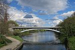
Kuhmühlenbrücke The street of the same name crosses the Mundsburg Canal with this bridge. The cow mill was a water mill that was demolished in 1874. The bridge is a listed building. |
Street |
Uhlenhorst , Hohenfelde ( 53 ° 33 ′ 57 ″ N, 10 ° 1 ′ 29 ″ E ) |
|
|
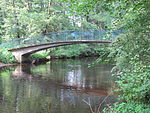
Kuhmühlenteichbrücke A railway bridge over the Kuhmühlenteich. |
Subway | 1911/12 |
Uhlenhorst , Hohenfelde ( 53 ° 33 ′ 57 ″ N, 10 ° 1 ′ 34 ″ E ) |
|
Kühnbrücke The Kühnbrücke is a pedestrian bridge that crosses the Alster and connects the districts of Hummelsbüttel and Wellingsbüttel . |
Street |
Ohlsdorf ( 53 ° 38 ′ 0 ″ N, 10 ° 2 ′ 30 ″ E ) |
|

|
Kulenstückbrücke Between the streets Twisselwsch and Grellkamp this bridge leads over the Bornbach. |
Street |
Langenhorn ( 53 ° 39 ′ 20 ″ N, 9 ° 59 ′ 52 ″ E ) |
|

|
Kupferdammbrücke The street of the same name crosses the Wandse with this bridge . |
Street |
Farmsen-Berne ( 53 ° 35 ′ 42 ″ N, 10 ° 7 ′ 9 ″ E ) |
|
|
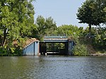
Kurfürstenbrücke The bridge crosses the Alte Schleusengraben , which flows into the Dove Elbe here . The name is probably derived from the former development. There were seven huts that were called "Electors". |
Street |
Curslack , Allermöhe ( 53 ° 28 ′ 2 ″ N, 10 ° 11 ′ 44 ″ E ) |