| image
|
Surname
|
Island, archipelago
|
province
|
Volcano type
|
Last eruption
|
Height [m]
|
Geographic coordinates
|

|
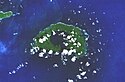
Ambitle
|
Ambitle , Feni Islands , Bismarck Archipelago
|
New Ireland
|
Stratovolcano
|
350 BC Chr. ± 100 years
|
450
|
! 653.6500005495.916667504 ° 05 ′ 00 ″ S , 153 ° 39 ′ 00 ″ E-4.0833333333333 153.65 450
|

|
Bagana
|
Bougainville , Solomon Islands
|
Bougainville
|
Lava cone
|
2010
|
1750
|
! 655.1950005493.860000506 ° 08 ′ 24 ″ S , 155 ° 11 ′ 42 ″ E-6.14 155.195 1750
|

|
Mount Balbi
|
Bougainville , Solomon Islands
|
Bougainville
|
Stratovolcano
|
unknown
|
2715
|
! 654.9833335494.083333505 ° 55 ′ 00 ″ S , 154 ° 59 ′ 00 ″ E-5.9166666666667 154.98333333333 2715
|

|
Baluan
|
Baluan , Admiralty Islands , Bismarck Archipelago
|
Manus
|
Stratovolcano
|
unknown
|
254
|
! 647.2833335497.433333502 ° 34 ′ 00 ″ S , 147 ° 17 ′ 00 ″ E-2.5666666666667 147.28333333333 254
|

|
|
Bam , Le Maire Islands , Bismarck Archipelago
|
East Sepik
|
Stratovolcano
|
1960
|
685
|
! 644.8183335496.387500503 ° 36 ′ 45 ″ S , 144 ° 49 ′ 06 ″ E-3.6125 144.81833333333 685
|
|
|
Bamus
|
New Britain , Bismarck Archipelago
|
East New Britain
|
Stratovolcano
|
1886 ± 8 years
|
2248
|
! 651.2333335494.800000505 ° 12 ′ 00 ″ S , 151 ° 14 ′ 00 ″ E-5.2 151.23333333333 2248
|
|
|
Billy Mitchell
|
Bougainville , Solomon Islands
|
Bougainville
|
Pyroclastic shield volcano
|
1580 ± 20 years
|
1544
|
! 655.2250005493.908333506 ° 05 ′ 30 ″ S , 155 ° 13 ′ 30 ″ E-6.0916666666667 155.225 1544
|
|
|
|
Blup Blup , Le Maire Islands , Bismarck Archipelago
|
East Sepik
|
Stratovolcano
|
unknown
|
402
|
! 644.6050005496.493333503 ° 30 ′ 24 ″ S , 144 ° 36 ′ 18 ″ E-3.5066666666667 144,605 402
|
|
|
|
Boisa (Aris), Bismarck Archipelago
|
Madang
|
Stratovolcano
|
unknown
|
240
|
! 644.9633335496.005556503 ° 59 ′ 40 ″ S , 144 ° 57 ′ 48 ″ E-3.9944444444444 144.96333333333 240
|

|
Bola
|
New Britain , Bismarck Archipelago
|
West New Britain
|
Stratovolcano
|
unknown
|
1155
|
! 650.0333335494.850000505 ° 09 ′ 00 ″ S , 150 ° 02 ′ 00 ″ E-5.15 150.03333333333 1155
|

|
Mount Bosavi
|
New Guinea
|
Southern Highlands
|
Caldera
|
0.5 Ma BP
|
2507
|
! 642.8563895493.405556506 ° 35 ′ 40 ″ S , 142 ° 51 ′ 23 ″ E-6.5944444444444 142.85638888889 2507
|
|
|
Crater Mountain
|
New Guinea
|
Eastern Highlands
|
Stratovolcano
|
unknown
|
3233
|
! 645.0833335493.416667506 ° 35 ′ 00 ″ S , 145 ° 05 ′ 00 ″ E-6.5833333333333 145.08333333333 3233
|
|
|
Dakataua
|
New Britain , Bismarck Archipelago
|
West New Britain
|
Caldera
|
1895 ± 5 years
|
400
|
! 650.1083335494.944444505 ° 03 ′ 20 ″ S , 150 ° 06 ′ 30 ″ E-5.0555555555556 150.10833333333 400
|
|
|
Dobu
|
D'Entrecasteaux Islands
|
Milne Bay
|
Stratovolcano
|
unknown
|
284
|
! 650.8644005490.243900509 ° 45 ′ 22 ″ S , 150 ° 51 ′ 52 ″ E-9.7561 150.8644 284
|
|
|
Doma Peaks
|
New Guinea
|
Southern Highlands
|
Stratovolcano
|
unknown
|
3568
|
! 643.1500005494.100000505 ° 54 ′ 00 ″ S , 143 ° 09 ′ 00 ″ E-5.9 143.15 3568
|

|
|
Duportail (Lolobau), Bismarck Archipelago
|
East New Britain
|
Caldera
|
1912
|
858
|
! 651.1583335495.083333504 ° 55 ′ 00 ″ S , 151 ° 09 ′ 30 ″ E-4.9166666666667 151.15833333333 858
|

|
Garbuna group
|
New Britain , Bismarck Archipelago
|
West New Britain
|
Stratovolcanoes
|
2008
|
564
|
! 650.0333335494.550000505 ° 27 ′ 00 ″ S , 150 ° 02 ′ 00 ″ E-5.45 150.03333333333 564
|
|
|
Garove , Vitu Islands , Bismarck Archipelago
|
West New Britain
|
Stratovolcano
|
unknown
|
368
|
! 649.5000005495.308333504 ° 41 ′ 30 ″ S , 149 ° 30 ′ 00 ″ E-4.6916666666667 149.5 368
|
|
|
Garua (Talasea)
|
New Britain / Garua , Bismarck Archipelago
|
West New Britain
|
Volcanic field
|
unknown
|
565
|
! 650.0666675494.700000505 ° 18 ′ 00 ″ S , 150 ° 04 ′ 00 ″ E-5.3 150.06666666667 565
|

|
Mount Giluwe
|
New Guinea
|
Southern Highlands
|
Shield volcano
|
220 ka BP
|
4368
|
! 643.8861115493.961111506 ° 02 ′ 20 ″ S , 143 ° 53 ′ 10 ″ E-6.0388888888889 143.88611111111 4368
|

|
|
Goodenough Island , D'Entrecasteaux Islands
|
Milne Bay
|
Volcanic field
|
unknown
|
2566
|
! 650.3500005490.516667509 ° 29 ′ 00 ″ S , 150 ° 21 ′ 00 ″ E-9.4833333333333 150.35 2566
|
|
|
Hargy
|
New Britain , Bismarck Archipelago
|
East New Britain
|
Stratovolcano
|
approx. 950 AD
|
1148
|
! 651.1000005494.666667505 ° 20 ′ 00 ″ S , 151 ° 06 ′ 00 ″ E-5.3333333333333 151.1 1148
|
|
|
Hydrographers Range
|
New Guinea
|
Oro
|
Stratovolcano
|
unknown
|
1915
|
! 648.3666675491.000000509 ° 00 ′ 00 ″ S , 148 ° 22 ′ 00 ″ E-9 148.36666666667 1915
|

|
Iamalele-Fagululu
|
Fergusson Island , D'Entrecasteaux Islands
|
Milne Bay
|
Volcanic field
|
unknown
|
200
|
! 650.5333335490.483333509 ° 31 ′ 00 ″ S , 150 ° 32 ′ 00 ″ E-9.5166666666667 150.53333333333 200
|
|
|
|
Kadovar , Le Maire Islands , Bismarck Archipelago
|
East Sepik
|
Stratovolcano
|
January 2018
|
365
|
! 644.6305565496.370000503 ° 37 ′ 48 ″ S , 144 ° 37 ′ 50 ″ E-3.63 144.63055555556 365
|

|
|
Karkar , Bismarck Archipelago
|
Madang
|
Stratovolcano
|
1979
|
1839
|
! 645.9638895495.351389504 ° 38 ′ 55 ″ S , 145 ° 57 ′ 50 ″ E-4.6486111111111 145.96388888889 1839
|
|
|
Koranga
|
New Guinea
|
Central Province
|
Maar
|
unknown
|
1500
|
! 646.7083335492.666667507 ° 20 ′ 00 ″ S , 146 ° 42 ′ 30 ″ E-7.3333333333333 146.70833333333 1500
|

|
Lamington
|
New Guinea
|
Oro
|
Stratovolcano
|
1956
|
1680
|
! 648.1660005491.062000508 ° 56 ′ 17 ″ S , 148 ° 09 ′ 58 ″ E-8,938 148,166 1680
|
|
|
Lamonai
|
Fergusson Island , D'Entrecasteaux Islands
|
Milne Bay
|
Stratovolcano
|
unknown
|
500
|
! 650.8833335490.383333509 ° 37 ′ 00 ″ S , 150 ° 53 ′ 00 ″ E-9.6166666666667 150.88333333333 500
|
|
|
Langila
|
New Britain , Bismarck Archipelago
|
West New Britain
|
Complex volcano
|
2009
|
1330
|
! 648.4166675494.475000505 ° 31 ′ 30 ″ S , 148 ° 25 ′ 00 ″ E-5.525 148.41666666667 1330
|

|
Lolo
|
New Britain , Bismarck Archipelago
|
West New Britain
|
Stratovolcano
|
unknown
|
805
|
! 650.5069445494.531944505 ° 28 ′ 05 ″ S , 150 ° 30 ′ 25 ″ E-5.4680555555556 150.50694444444 805
|
|
|
Loloru
|
Bougainville , Solomon Islands
|
Bougainville
|
Pyroclastic shield volcano
|
approx. 1050 BC Chr.
|
1887
|
! 655.6166675493.483333506 ° 31 ′ 00 ″ S , 155 ° 37 ′ 00 ″ E-6.5166666666667 155.61666666667 1887
|
|
|
Long Island , Bismarck Archipelago
|
Madang
|
Complex volcano
|
1993
|
1280
|
! 647.1166675494.641667505 ° 21 ′ 30 ″ S , 147 ° 07 ′ 00 ″ E-5.3583333333333 147.11666666667 1280
|
|
|
Madilogo
|
New Guinea
|
Central Province
|
Pyroclastic cone
|
unknown
|
850
|
! 647.5666675490.800000509 ° 12 ′ 00 ″ S , 147 ° 34 ′ 00 ″ E-9.2 147.56666666667 850
|
|
|
Managlase plateau
|
New Guinea
|
Oro
|
Volcanic field
|
unknown
|
1342
|
! 648.3333335490.916667509 ° 05 ′ 00 ″ S , 148 ° 20 ′ 00 ″ E-9.0833333333333 148.33333333333 1342
|

|
|
Manam , Bismarck Archipelago
|
Madang
|
Stratovolcano
|
2010
|
1807
|
! 645.0372225495.920000504 ° 04 ′ 48 ″ S , 145 ° 02 ′ 14 ″ E-4.08 145.03722222222 1807
|

|
|
Mundua Islands (Ningau), Vitu Islands , Bismarck Archipelago
|
West New Britain
|
Complex volcano
|
unknown
|
179
|
! 649.3500005495.366667504 ° 38 ′ 00 ″ S , 149 ° 21 ′ 00 ″ E-4.6333333333333 149.35 179
|
|
|
Musa River
|
New Guinea
|
Oro
|
Thermal springs
|
unknown
|
808
|
! 648.1333335490.691667509 ° 18 ′ 30 ″ S , 148 ° 08 ′ 00 ″ E-9.3083333333333 148.13333333333 808
|
|
|
Narage
|
Vitu Islands , Bismarck Archipelago
|
West New Britain
|
Stratovolcano
|
Pleistocene
|
307
|
! 649.1120005495.453000504 ° 32 ′ 49 ″ S , 149 ° 06 ′ 43 ″ E-4,547 149,112 307
|

|
|
Niolam (Lihir), Lihir Islands , Bismarck Archipelago
|
New Ireland
|
Complex volcano
|
unknown
|
700
|
! 652.6416675496.875000503 ° 07 ′ 30 ″ S , 152 ° 38 ′ 30 ″ E-3.125 152.64166666667 700
|
|
|
Oiau (Diau)
|
Fergusson Island , D'Entrecasteaux Islands
|
Milne Bay
|
Stratovolcano
|
circa 1350
|
302
|
! 650.8666675490.316667509 ° 41 ′ 00 ″ S , 150 ° 52 ′ 00 ″ E-9.6833333333333 150.86666666667 302
|

|
Pago
|
New Britain , Bismarck Archipelago
|
West New Britain
|
Caldera
|
2007
|
742
|
! 650.5166675494.416667505 ° 35 ′ 00 ″ S , 150 ° 31 ′ 00 ″ E-5.5833333333333 150.51666666667 742
|

|
Rabaul
|
New Britain , Bismarck Archipelago
|
East New Britain
|
Caldera
|
2010
|
688
|
! 652.2027785495.729167504 ° 16 ′ 15 ″ S , 152 ° 12 ′ 10 ″ E-4.2708333333333 152.20277777778 688
|
|
|
|
Knight Island , Siassi Islands , Bismarck Archipelago
|
Morobe
|
Stratovolcano
|
2007
|
140
|
! 648.1208335494.483333505 ° 31 ′ 00 ″ S , 148 ° 07 ′ 15 ″ E-5.5166666666667 148.12083333333 140
|
|
|
St. Andrew Street
|
Admiralty Islands , Bismarck Archipelago
|
Manus
|
Complex volcano
|
1957
|
270
|
! 647.3500005497.616667502 ° 23 ′ 00 ″ S , 147 ° 21 ′ 00 ″ E-2.3833333333333 147.35 270
|

|
|
Sakar , Siassi Islands , Bismarck Archipelago
|
Morobe
|
Stratovolcano
|
unknown
|
992
|
! 648.0944445494.586111505 ° 24 ′ 50 ″ S , 148 ° 05 ′ 40 ″ E-5.4138888888889 148.09444444444 992
|
|
|
Sessagara Hills
|
New Guinea
|
Oro
|
Volcanic field
|
unknown
|
370
|
! 649.1333335490.516667509 ° 29 ′ 00 ″ S , 149 ° 08 ′ 00 ″ E-9.4833333333333 149.13333333333 370
|

|
Sulu Range
|
New Britain , Bismarck Archipelago
|
West New Britain
|
Stratovolcanoes
|
unknown
|
610
|
! 650.9416675494.500000505 ° 30 ′ 00 ″ S , 150 ° 56 ′ 30 ″ E-5.5 150.94166666667 610
|
|
|
Takuan group
|
Bougainville , Solomon Islands
|
Bougainville
|
Complex volcano
|
unknown
|
2210
|
! 655.6083335493.558333506 ° 26 ′ 30 ″ S , 155 ° 36 ′ 30 ″ E-6.4416666666667 155.60833333333 2210
|
|
|
|
Tanga Islands , Bismarck Archipelago
|
New Ireland
|
Stratovolcano
|
Pleistocene
|
472
|
! 653.2166675496.500000503 ° 30 ′ 00 ″ S , 153 ° 13 ′ 00 ″ E-3.5 153.21666666667 472
|

|
Tavui
|
New Britain , Bismarck Archipelago
|
East New Britain
|
Caldera
|
5150 BC Chr. ± 1000 years
|
200
|
! 652.2000005495.883333504 ° 07 ′ 00 ″ S , 152 ° 12 ′ 00 ″ E-4.1166666666667 152.2 200
|
|
|
Gates
|
Bougainville , Solomon Islands
|
Bougainville
|
Lava cone
|
unknown
|
2200
|
! 654.9333335494.166667505 ° 50 ′ 00 ″ S , 154 ° 56 ′ 00 ″ E-5.8333333333333 154.93333333333 2200
|
|
|
Trafalgar
|
New Guinea
|
Oro
|
Stratovolcano
|
Pleistocene
|
1495
|
! 649.1538895490.861111509 ° 08 ′ 20 ″ S , 149 ° 09 ′ 14 ″ E-9.1388888888889 149.15388888889 1495
|

|
Ulawun
|
New Britain , Bismarck Archipelago
|
East New Britain
|
Stratovolcano
|
2010
|
2334
|
! 651.3333335494.950000505 ° 03 ′ 00 ″ S , 151 ° 20 ′ 00 ″ E-5.05 151.33333333333 2334
|

|
|
Umboi , Siassi Islands , Bismarck Archipelago
|
Morobe
|
Complex volcano
|
unknown
|
1548
|
! 647.8750005494.411111505 ° 35 ′ 20 ″ S , 147 ° 52 ′ 30 ″ E-5.5888888888889 147.875 1548
|
|
|
Victory
|
New Guinea
|
Oro
|
Stratovolcano
|
1935 ± 5 years
|
1925
|
! 649.0666675490.800000509 ° 12 ′ 00 ″ S , 149 ° 04 ′ 00 ″ E-9.2 149.06666666667 1925
|

|
Waiowa (Goropu)
|
New Guinea
|
Oro
|
Pyroclastic cone
|
1944
|
640
|
! 649.0750005490.433333509 ° 34 ′ 00 ″ S , 149 ° 04 ′ 30 ″ E-9.5666666666667 149.075 640
|
|
|
Mount Yelia
|
New Guinea
|
Eastern Highlands
|
Stratovolcano
|
unknown
|
3384
|
! 645.8583335492.950000507 ° 03 ′ 00 ″ S , 145 ° 51 ′ 30 ″ E-7.05 145.85833333333 3384
|
|
|
unnamed
|
Admiralty Islands , Bismarck Archipelago
|
Manus
|
Submarine volcano
|
1972
|
-1300
|
! 647.7833335496.966667503 ° 02 ′ 00 ″ S , 147 ° 47 ′ 00 ″ E-3.0333333333333 147.78333333333 -1300
|


