Ljambir
| Village
Ljambir
Лямбирь
|
||||||||||||||||||||||||||||
|
||||||||||||||||||||||||||||
|
||||||||||||||||||||||||||||
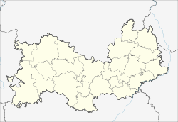
Ljambir ( Russian Ля́мбирь ) is a village (selo) in the Republic of Mordovia in Russia with 8,457 inhabitants (as of October 14, 2010).
geography
The place is about 12 km as the crow flies north of the center of the republic capital Saransk . The brook Suchaja Pensjatka ("dry Pensjatka") flows through the place, which flows further northeast into the Ljambirka, further south the Pensjatka; Ljambirka and Pensjatka are left tributaries of the Insar , which flows about 10 km to the east , a left tributary of the Alatyr in the river system of the Volga .
Ljambir is the administrative center of the Rajons Ljambirski and seat of the rural community Ljambirskoje selskoje posselenije, also includes four kilometers southwest situated village Tscheremischewo to. The place and the Rajon are the main settlements of the Tatars in Mordovia.
history
The place was founded in 1642 by Tatars from the Temnikow area in connection with the construction of the Saransk fortress. As a result, he belonged to Ujesd Saransk, from 1780 as part of the governorship of Penza , after its dissolution in 1797 briefly in the Simbirsk governorate and from the establishment of the Penza governorate in 1801 in this. The village developed into a local center and became the seat of a Volost .
On July 20, 1933, Ljambir became the administrative seat of a Rajons named after him, which at that time had almost two thirds of the Tatar population. From 1963 to 1967 the district was temporarily dissolved and its territory was divided between the neighboring districts of Romodanowski and Staroshaigowski.
Population development
| year | Residents |
|---|---|
| 1897 | 1783 |
| 1939 | 3345 |
| 1959 | 2687 |
| 1970 | 3625 |
| 1979 | 4805 |
| 1989 | 8389 |
| 2002 | 8467 |
| 2010 | 8457 |
Note: census data
traffic
The federal trunk road R158 Nizhny Novgorod - Saransk - Penza - Saratov runs past the town to the west . Between Ljambir and Saransk, the northern bypass runs around the city, in a westerly direction as part of the R158, to the east as 89K-08 to the federal trunk road R178 to Ulyanovsk (and further as a regional road to Samara ), which leads north-east from Saransk .
The closest train station is in Saransk on the Rusajewka - Romodanowo (Krasny Usel) - Kanasch route .
On the eastern edge of Ljambir there is a former military airfield , which has mainly been used for air sports since the 1990s . From the 1940s until the opening of an airport in Saransk in 1955 - which in turn was replaced in 1960 by the Saransk airport south of the city, which still exists today - it was also used by civil aviation.
Web links
Individual evidence
- ↑ a b Itogi Vserossijskoj perepisi naselenija 2010 goda. Tom 1. Čislennostʹ i razmeščenie naselenija (Results of the All-Russian Census 2010. Volume 1. Number and distribution of the population). Tables 5 , pp. 12-209; 11 , pp. 312–979 (download from the website of the Federal Service for State Statistics of the Russian Federation)

