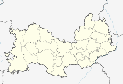
Romodanowo (Mordovia)
| settlement
Romodanowo
Ромоданово
|
||||||||||||||||||||||||||||||||
|
||||||||||||||||||||||||||||||||
|
||||||||||||||||||||||||||||||||
Romodanowo ( Russian Ромода́ново ) is a settlement (possjolok) in the Republic of Mordovia in Russia with 9410 inhabitants (as of October 14, 2010).
geography
The place is about 30 km as the crow flies north-northwest of the republic capital Saransk on both sides of the Insar , a left tributary of the Alatyr in the river system of the Volga .
Romodanowo administrative center is the Rajons Romodanovsky and seat and only town in the rural community Romodanowskoje selskoje posselenije.
history
The place Romodanowo has existed at least since the first half of the 16th century and was first mentioned in 1622 under its current name, which goes back to the then owner from the noble family Romodanowski. From 1780 the village belonged to Ujesd Schischkejew of the governorship of Penza , after its dissolution in 1797 briefly to the governorate of Simbirsk . With the establishment of the Penza governorate in 1801 Romodanowo came to their Ujesd Saransk. The village developed into a local trading center and became the seat of a Volost . With the construction of the nearby railway line ( Moscow -) Ryazan - Kazan in the 1890s and the construction of a line from there to Nizhny Novgorod from 1903 , the economic importance continued to grow.
In the 1920s, the station and the surrounding settlement were renamed Krasny Usel (“ Red Knot”) with an ideological background ; however, the village kept its old name. In 1928 it became the seat of a newly formed Rajons named after him. On September 6, 1958, the village, the station settlement Krasny Usel, the settlement MTS (" machine-tractor station ") and the village Torbejewo were combined to form the urban-type Romodanowo.
Since January 20, 2013 the place has the status of a rural settlement.
Population development
| year | Residents |
|---|---|
| 1897 | 1,549 |
| 1939 | 2,926 |
| 1959 | 7,045 |
| 1970 | 10,432 |
| 1979 | 9,292 |
| 1989 | 10,083 |
| 2002 | 9,871 |
| 2010 | 9.410 |
Note: census data (1939 village only)
traffic
The important railway junction Krasny Usel is located in Romodanowo . It is located at kilometer 57 of the Rusajewka - Kanasch railway line (part of the original connection between Moscow and Kazan opened there in 1893), from which a line that was in continuous operation in 1918 branches off via Arsamas to Nizhny Novgorod, about 350 km away. Krasny Usel is the southernmost station of the Gorkier Railway , whose lines from there in the direction of Kanasch and Arsamas are single-track and not electrified, while the section operated by the Kuibyshev Railway to Rusayevka has been expanded to double-track and has been electrified since 1997 to Krasny Usel .
The regional road 89K-12, which connects the republic capital Saransk with the Rajon centers of Kemlja and Bolshoye Ignatovo further north, runs past the town to the west . In a south-easterly direction, a local road runs to the federal trunk road R178 Saransk - Ulyanovsk, about 15 km away (and further as a regional road to Samara ).
Web links
Individual evidence
- ↑ a b Itogi Vserossijskoj perepisi naselenija 2010 goda. Tom 1. Čislennostʹ i razmeščenie naselenija (Results of the All-Russian Census 2010. Volume 1. Number and distribution of the population). Tables 5 , pp. 12-209; 11 , pp. 312–979 (download from the website of the Federal Service for State Statistics of the Russian Federation)

