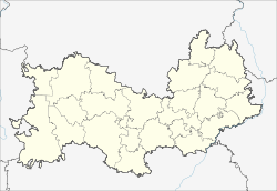
Torbejewo (Mordovia)
Urban-type settlement
|
||||||||||||||||||||||||||||||||
|
||||||||||||||||||||||||||||||||
|
||||||||||||||||||||||||||||||||
Torbejewo ( Russian Торбе́ево , Mokshan Тарбей ) is an urban-type settlement in the Republic of Mordovia in Russia with 9,373 inhabitants (as of October 14, 2010).
geography
The place is almost 130 km as the crow flies west-southwest of the republic capital Saransk, not far from the border with Penza Oblast . It is located at the source of the Windrei, a right tributary of the Parza Wad tributary .
Torbejewo is the administrative center of Torbejewski Rajons and the seat of the municipality Torbejewskoje gorodskoje posselenije, which also includes the villages of Masilug (2 km northwest) and Schukulug (2 km north).
history
The place was first mentioned in 1667 under the Russified name Tarbejewka , derived from the Turkic name Tarbei.
On July 16, 1928 Torbejewo was the administrative seat of the newly created Rajons named after him. In 1959 the place received the status of an urban-type settlement.
Population development
| year | Residents |
|---|---|
| 1939 | 3760 |
| 1959 | 4644 |
| 1970 | 7010 |
| 1979 | 7424 |
| 1989 | 8924 |
| 2002 | 9351 |
| 2010 | 9373 |
Note: census data
traffic
Torbejewo has a train station at kilometer 481 of the Moscow - Ryazan - Syzran railway line, which opened on this section in 1894 and has been electrified since 1960 . To the northwest, the place is bypassed by a connecting line (formerly R180) of the federal trunk road M5 , which branches off about 20 km southwest of the main route Moscow - Samara - Chelyabinsk and continues via Krasnoslobodsk to the republic capital Saransk.
Sons and daughters of the place
- Michail Dewjatajew (1917–2002), fighter pilot and war hero
Web links
Individual evidence
- ↑ a b Itogi Vserossijskoj perepisi naselenija 2010 goda. Tom 1. Čislennostʹ i razmeščenie naselenija (Results of the All-Russian Census 2010. Volume 1. Number and distribution of the population). Tables 5 , pp. 12-209; 11 , pp. 312–979 (download from the website of the Federal Service for State Statistics of the Russian Federation)

