Subowa Polyana
Urban-type settlement
|
||||||||||||||||||||||||||||||||
|
||||||||||||||||||||||||||||||||
|
||||||||||||||||||||||||||||||||
| List of large settlements in Russia | ||||||||||||||||||||||||||||||||
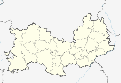
Subowa Polyana ( Russian Зу́бова Поля́на ; Mokshan Зубу , Subu ) is an urban-type settlement in the Republic of Mordovia ( Russia ) with 10,338 inhabitants (as of October 14, 2010).
geography
The place is about 150 kilometers west of the republic capital Saransk , on the eastern edge of a forested ridge that borders the Volga plateau in the west, not far from the borders of the republic to the neighboring oblasts of Penza and Ryazan . The Parza river runs through the village and flows over the Wad and Mokscha rivers to the Oka .
Subowa Poljana is the administrative center of the Subowa Poljana Rajons of the same name . The municipality (Gorodskoje posselenije) Subowa Polyana also includes the four surrounding rural settlements Yasnaja Polyana, Krutez, Schkola Traktornych Brigadirow ("School of Tractor Brigadiers ") and Subowo-Polyansky Lessoutschastok ("Subowo-Polyansk Forest District"). The place is in the center of the compact settlement area of the Mokscha-Mordwinen , who make up the majority of the population in Rajon and settlement.
history
The village of Subowa Poljana, which has been known since the end of the 17th century and was first mentioned in 1679 (according to other information 1680), developed particularly from the end of the 19th century after the railway from Ryazan to Rusajewka passed through the town in 1894 and a little later from there to Was extended towards Syzran and Kazan .
In the Soviet period, Subowa Polyana became the administrative seat of a Rajons on July 16, 1928 as part of an administrative reform. On November 30, 1959, the place received the status of an urban-type settlement.
Population development
| year | Residents |
|---|---|
| 1939 | 3,927 |
| 1959 | 8,593 |
| 1970 | 7,672 |
| 1979 | 9,672 |
| 1989 | 10,715 |
| 2002 | 10,355 |
| 2010 | 10,338 |
Note: census data
Economy and Infrastructure
Due to its location on the edge of a forest area, Subowa Poljana is characterized by forestry and wood processing. There is also a factory for electronic components.
Subowa Polyana is located on the Moscow - Ryazan - Syzran - Samara railway (route km 451) and the M5 highway from Moscow to Chelyabinsk , from which the R 180 regional road branches off about 20 kilometers southeast of the town via Krasnoslobodsk to the Mordovian capital Saransk.
Individual evidence
- ↑ a b Itogi Vserossijskoj perepisi naselenija 2010 goda. Tom 1. Čislennostʹ i razmeščenie naselenija (Results of the All-Russian Census 2010. Volume 1. Number and distribution of the population). Tables 5 , pp. 12-209; 11 , pp. 312–979 (download from the website of the Federal Service for State Statistics of the Russian Federation)
- ↑ a b Subowa Polyana on the website of the Geographical Institute of the RAN (Russian)
Web links
- Subowa Polyana Raion Official Website (Russian)
- Private historical-ethnographic website about Subowa Polyana (Russian, partly English, French, Mokshan)

