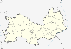
Bolshie Berezniki
Village
|
||||||||||||||||||||||||||||||
|
||||||||||||||||||||||||||||||
|
||||||||||||||||||||||||||||||
Bolshie Berezniki ( Russian Большие Березники ; ersjanisch Покш Килейбуе веле ) is a village (selo) in the Republic of Mordovia in Russia with 6393 inhabitants (as of October 14, 2010).
geography
The place is about 50 km as the crow flies east of the republic capital Saransk . The Kscha (also Great Kscha, Bolshaya Kscha) flows through the place, which flows two kilometers southeast from the left into the Sura , which in sections marks the border to the neighboring Ulyanovsk Oblast .
Bolshie Berezniki is the administrative center of the Rajons Bolscheberesnikowski and seat of the rural community Bolscheberesnikowskoje selskoje posselenije, (3 km north-northwest) which also includes the villages of Mariupol and Nikolaevka (4,5 km south-east) and the settlement (possjolok) (3 km southwest) include Prisurski. A good half of the population are members of the Mordovian sub-ethnic group of the Ersja , the others predominantly Russians .
history
The place was founded in the first half of the 17th century, possibly as early as 1624, but no later than 1648 as a guard post in the course of the Karsuner Verhaulinie , which ran in the area between the Sura and its right tributary Barysch . The name ("Groß-Berezniki") is derived from the Russian name berjosa for birch . Bolschije Beresniki initially belonged to Ujesd Saransk, from 1780 as part of the Simbirsk governorship (today Ulyanovsk ) to their newly formed Ujesd Karsun, from 1796 in the holdings of the Simbirsk governorate . The village developed into a local craft and trade center and became the seat of a Volost .
On July 16, 1928 Bolschije Berezniki joined the newly formed Tschamsinski rajon within the Mordovian Okrug (Mordowski okrug) of the Middle Volga Oblast (Srednewolschskaja oblast), from 1929 the Middle Volga Region (Srednewolschski krai). After the Mordovian Autonomous Oblast emerged from the Okrug on January 10, 1930 and finally the Mordovian ASSR on December 20, 1934 , the place became the administrative seat of a newly spun off Rajons named after him on January 26, 1935. From 1963 to 1965 the Rajon was temporarily dissolved and its territory was rejoined to the Tschamsinski rajon.
Population development
| year | Residents |
|---|---|
| 1897 | 3549 |
| 1939 | 4720 |
| 1959 | 4317 |
| 1970 | 5502 |
| 1979 | 5886 |
| 1989 | 6675 |
| 2002 | 6398 |
| 2010 | 6393 |
Note: census data
traffic
Regional road 89K-10 runs through Bolschije Berezniki and, coming from Saransk, continues to the northeastern neighboring district of Dubjonki . To the northwest, the 89N-14 branches to nearly 30 km away Tschamsinka from. The federal trunk road R178 runs through Tschamsinka and Dubjonki from Saransk to Ulyanovsk (and further as a regional road to Samara ).
In Chamsinka there is also the nearest train station on the route Rusajewka - Saransk - Romodanowo (Krasny Usel) - Kanasch .
In a south-easterly direction, a local road crosses the Sura from Bolschije Berezniki and the border to Ulyanovsk Oblast, where there is a connection to Insa and Karsun.
Web links
Individual evidence
- ↑ a b Itogi Vserossijskoj perepisi naselenija 2010 goda. Tom 1. Čislennostʹ i razmeščenie naselenija (Results of the All-Russian Census 2010. Volume 1. Number and distribution of the population). Tables 5 , pp. 12-209; 11 , pp. 312–979 (download from the website of the Federal Service for State Statistics of the Russian Federation)

