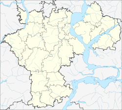
Karsun
| Urban-type settlement
Karsun
Карсун
|
||||||||||||||||||||||||||||||||
|
||||||||||||||||||||||||||||||||
|
||||||||||||||||||||||||||||||||
Karsun ( Russian Карсу́н ) is an urban-type settlement and former city in the Ulyanovsk Oblast in Russia with 7748 inhabitants (as of October 14, 2010).
geography
The place is about 90 km as the crow flies west of the Ulyanovsk Oblast Administrative Center . It is located at the confluence of the left tributary Karsunka in the right Sura tributary Barysch .
Karsun is the administrative center of the Rajons Karsunski and seat of the municipality Karsunskoje gorodskoje posselenije. In addition to the settlement, the villages of Bolshoye Stanichnoje, Krasnopolka, Malaya Ust-Urenka, Maloye Stanichnoje, Peski and Tawolschanka as well as the settlements Borok, Lugowoi and Possjolok Chulochno-nossochnoi fabriki (literally "Strictly - and sock factory ").
history
The founding year of the place is 1647, when a fortification was built there in the course of the Simbirsk-Karsuner Verhaulinie , obviously named after a settlement that already existed nearby. The fortification soon lost its military importance, as the border of the empire shifted in a south-easterly direction.
In 1780 Karsun received city rights as the administrative seat of the Ujesds of the same name in the Simbirsk governorate . In some cases, the spelling Korsun was also common until the 20th century .
In 1925 Karsun lost its town charter and was again considered a village, but in 1928 it became the administrative seat of a newly created Rajons named after him. In January 1943 the place received the status of an urban-type settlement.
Population development
| year | Residents |
|---|---|
| 1897 | 3805 |
| 1939 | 5955 |
| 1959 | 7564 |
| 1970 | 8464 |
| 1979 | 7341 |
| 1989 | 7936 |
| 2002 | 8200 |
| 2010 | 7748 |
Note: census data
traffic
In Karsun, the regional roads 73K-1430 intersect, which begins on the federal trunk road R178 Saransk - Ulyanovsk , which passes around 20 km to the northeast and continues to the small town of Insa , just under 60 km to the south-west , and 73K-1431, which also runs 20 km to the north R178 begins and continues to the south via the neighboring Rajonzentrum Weschkaima, 20 km away . The closest train station is in Weschkaima on the Insa - Ulyanovsk line.
sons and daughters of the town
- Dmitri Gusew (1894–1957), Colonel General
Web links
Individual evidence
- ↑ a b Itogi Vserossijskoj perepisi naselenija 2010 goda. Tom 1. Čislennostʹ i razmeščenie naselenija (Results of the All-Russian Census 2010. Volume 1. Number and distribution of the population). Tables 5 , pp. 12-209; 11 , pp. 312–979 (download from the website of the Federal Service for State Statistics of the Russian Federation)
- ↑ Гусев Дмитрий Николаевич , warheroes.ru (Russian)


