Staraya Maina
| Urban-type settlement
Staraya Maina
Старая Майна
|
||||||||||||||||||||||||||||||||||
|
||||||||||||||||||||||||||||||||||
|
||||||||||||||||||||||||||||||||||
Staraja Maina ( Russian Ста́рая Ма́йна ) is an urban-type settlement in the Ulyanovsk Oblast in Russia with 6521 inhabitants (as of October 14, 2010).
geography
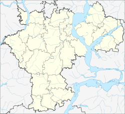
The place is about 50 km as the crow flies northeast of the Ulyanovsk Oblast Administrative Center on the left bank of the Kuibyshev reservoir of the Volga at the confluence of the Maina .
Staraya Maina is the administrative center of the Rajons Staromainski and seat and only town of the municipality Staromainskoje gorodskoje posselenije.
history
The place was first mentioned in connection with the construction of a 1,670 ostrogs documented, after the river than Mainski ostrog referred. The year is also considered the year of foundation. However, an Orthodox monastery had already been built in the period 1655–1661 , which was called Epiphany Monastery (Russian Bogojawlenski monastyr ), and the place accordingly Bogojawlenskoje. Today's name, which stands for "Old Maina", was established later, as a demarcation from Nowaja Maina ("New Maina") located 75 km south-east near today's Dimitrovgrad (formerly Melekess ). From the end of the 18th century the village belonged to the Ujesd Stavropol (today Tolyatti ) of the Samara Governorate .
In 1928 Staraja Maina was the first administrative seat of a newly created Rajon named after him (the Rajon was dissolved in 1930–1935 and 1963–1965). On April 7, 1967, it received urban-type settlement status.
Population development
| year | Residents |
|---|---|
| 1897 | 4311 |
| 1939 | 4948 |
| 1959 | 4873 |
| 1970 | 4505 |
| 1979 | 5151 |
| 1989 | 6633 |
| 2002 | 6988 |
| 2010 | 6521 |
Note: census data
traffic
The settlement is located on the regional road 73K-1428, which begins in the neighboring district of Cherdakly , about 30 km away, on the Ulyanovsk - Dimitrovgrad - Samara road and follows the eastern bank of the Kuibyshev reservoir; from Staraja Maina to the border of the Republic of Tatarstan , there in the direction of Bolgar .
The nearest train station is in Tscherdakly on the Insa - Ulyanovsk - Tschischmy (- Ufa ) line.
Individual evidence
- ↑ a b Itogi Vserossijskoj perepisi naselenija 2010 goda. Tom 1. Čislennostʹ i razmeščenie naselenija (Results of the All-Russian Census 2010. Volume 1. Number and distribution of the population). Tables 5 , pp. 12-209; 11 , pp. 312–979 (download from the website of the Federal Service for State Statistics of the Russian Federation)
- ↑ Story on an unofficial website of the place (Russian)


