Zilna
| Urban-type settlement
Zilna
Chilna
|
||||||||||||||||||||||||||||||||
|
||||||||||||||||||||||||||||||||
|
||||||||||||||||||||||||||||||||
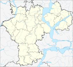
Zilna ( Russian Ци́льна ) is an urban-type settlement in the Ulyanovsk Oblast in Russia with 4119 inhabitants (as of October 14, 2010).
geography
The place is about 35 km as the crow flies north-northwest of the Ulyanovsk Oblast Administrative Center a few kilometers from the left bank of the Svijaga .
Zilna belongs to the Zilninski district . It is located just under 15 km northeast of the Bolshoye Nagatkino district administrative center and is the seat of the municipality of Zilninskoje gorodskoje posselenije, which also includes the villages of Arbusowka (7 km southeast), Kaschinka (4 km north), Marjewka (2 km northeast) and Teleschowka (3 km northeast) east) and the settlement Arbusowski (3 km southeast) belong.
history
The place arose in the 1940s in connection with the construction of the railway line Svyashsk - Ulyanovsk - Syzran , when a train station was built there and named after the left Svyaga tributary Zilna , which flows 15 km to the north . A settlement grew around the station, in which a large sugar factory and several farms, such as a large grain silo, were built. In 1962 the place received the status of an urban-type settlement.
Population development
| year | Residents |
|---|---|
| 1970 | 2989 |
| 1979 | 4497 |
| 1989 | 4720 |
| 2002 | 4165 |
| 2010 | 4119 |
Note: census data
traffic
Zilna has a station at kilometer 158 of 1942 opened railway line from Nischnije Wjasowyje (Station sviyazhsk ) in Kazan on Ulyanovsk to Syzran.
The federal highway R241 Kazan - Ulyanovsk runs through the settlement . The regional road 73K-1429 branches off in a south-westerly direction and crosses the federal highway A151 Ziwilsk - Ulyanovsk in the district center of Bolshoye Nagatkino and continues towards Maina .
Web links
Individual evidence
- ↑ a b Itogi Vserossijskoj perepisi naselenija 2010 goda. Tom 1. Čislennostʹ i razmeščenie naselenija (Results of the All-Russian Census 2010. Volume 1. Number and distribution of the population). Tables 5 , pp. 12-209; 11 , pp. 312–979 (download from the website of the Federal Service for State Statistics of the Russian Federation)

