Terenga
| Urban-type settlement
Terenga
Тереньга
|
||||||||||||||||||||||||||||||||
|
||||||||||||||||||||||||||||||||
|
||||||||||||||||||||||||||||||||
Terenga ( Russian Тереньга́ ) is an urban-type settlement in the Ulyanovsk Oblast in Russia with 5330 inhabitants (as of October 14, 2010).
geography
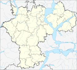
The place is about 70 km as the crow flies south of the Ulyanovsk Oblast Administrative Center, about 8 km from the border with Samara Oblast . It is located at the Terengulka, a left tributary of the right Volga -Nebenflusses Ussa .
Terenga is the administrative center of Terengulski Rajon and the seat of the municipality of Terengulskoje gorodskoje posselenije, which also includes the villages of Baidulino (5 km north), Fedkino (8 km north), Gladschikha (7 km south-west), Jasykowo (8 km south-east), Molvino (9 km northeast), Nasaikino (12 km northwest) and Tumkino (5 km northwest) as well as the settlements Gremjatschi Klyuch, Kalininski (both about 11 km east-southeast) and at the train station Molvino (9 km north-northeast) belong.
history
The place was founded in the second half of the 17th century; the year of foundation is 1682. The name is of Chuvash origin. As a result, the village belonged to the Ujesd Sengilei of the Simbirsk governorate . Until the 19th century Terenga belonged to the Golitsyn family , who founded one of the first and largest cloth manufacturers in the region there in 1769 .
On January 25, 1935, Terenga became the administrative seat of a Rajons named after him, newly created from the former Volost . In 1966 the place received the status of an urban-type settlement.
Population development
| year | Residents |
|---|---|
| 1897 | 3041 |
| 1939 | 3501 |
| 1959 | 3056 |
| 1970 | 4288 |
| 1979 | 4622 |
| 1989 | 5941 |
| 2002 | 5509 |
| 2010 | 5330 |
Note: census data
traffic
The branch line Syzran - Ulyanovsk of the federal trunk road M5 Moscow - Samara - Chelyabinsk runs past Terenga to the west . A little to the north, the regional road 73K-1441 branches off to the north-east neighboring Rajonzentrum Sengilei on the Volga and back to the M5 near Novoulyanovsk .
The nearest train stations are in the districts of the same name Molwino and Gremjatschi Kljutsch, corresponding to route kilometers 61 and 79 (from Ulyanovsk) of the ( Kazan -) Svyashsk - Ulyanovsk - Syzran line, which was opened on this section in 1944 .
Web links
Individual evidence
- ↑ a b Itogi Vserossijskoj perepisi naselenija 2010 goda. Tom 1. Čislennostʹ i razmeščenie naselenija (Results of the All-Russian Census 2010. Volume 1. Number and distribution of the population). Tables 5 , pp. 12-209; 11 , pp. 312–979 (download from the website of the Federal Service for State Statistics of the Russian Federation)


