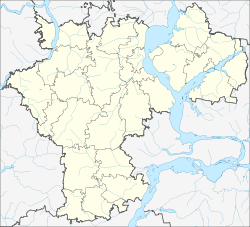
Pavlovka (Ulyanovsk, Pavlovsky)
| Urban-type settlement
Pawlowka
Павловка
|
||||||||||||||||||||||||||||||||
|
||||||||||||||||||||||||||||||||
|
||||||||||||||||||||||||||||||||
Pavlovka ( Russian Па́вловка ) is an urban-type settlement in the Ulyanovsk Oblast in Russia with 5626 inhabitants (as of October 14, 2010).
geography
The place is located about 200 km as the crow flies south-southwest of the Ulyanovsk Oblast Administrative Center , a good 10 km from the border with the Saratov and Penza oblasts . It is located not far from the source of the Isbalyk, a right tributary of the right Volga tributary Tereschka .
Pawlowka is the administrative center of the Rajons Pawlowski and seat of the municipality Pawlowskoje gorodskoje posselenije, (6 km southeast) (km southwest 9) are among the also the villages Iljuschkino (11 km south), Jewleika (8 km northeast), Kadyschewka and scarf cinema.
history
The place was founded in 1695 by farmers from Penza and named after the Isbalyk River. Later the name Dmitrijewskoje was also used, from the second half of the 19th century the current name. The village belonged to the Ujesd Chwalynsk of the Saratov governorate from the 18th century .
On May 14, 1928 Pavlovka became the administrative seat of a newly created Rajons named after him. In 1978 the place received the status of an urban-type settlement.
Population development
| year | Residents |
|---|---|
| 1897 | 4328 |
| 1939 | 4136 |
| 1959 | 3532 |
| 1970 | 3803 |
| 1979 | 4496 |
| 1989 | 5730 |
| 2002 | 5930 |
| 2010 | 5626 |
Note: census data
traffic
Pavlovka is located on the regional road 73K-1434, which comes from the central part of the oblast via the district centers of Barysch and Nikolaevka , where it crosses the federal trunk road M5 , continues to the border of the Saratov region, there in the direction of the federal trunk road R228, which is almost 70 km away Syzran - Saratov - Volgograd near Wolsk . In an easterly direction in Pavlovka the 73K-1439 branches off to the neighboring district center Staraya Kulatka .
The nearest train stations are about 50 km away in a northerly direction in Nikolayevka (station Klyuchiki ) on the route ( Moscow -) Ryashsk - Penza - Syzran and a little closer in a southerly direction - accessible via the road to Wolsk - already in Saratov Oblast Nischnjaja Tschernawka (station Tschernawka ) along the route Syzran - Saratov - Volgograd.
Sons and daughters of the place
- Fyodor Panfjorov (1896–1960), writer
Web links
Individual evidence
- ↑ a b Itogi Vserossijskoj perepisi naselenija 2010 goda. Tom 1. Čislennostʹ i razmeščenie naselenija (Results of the All-Russian Census 2010. Volume 1. Number and distribution of the population). Tables 5 , pp. 12-209; 11 , pp. 312–979 (download from the website of the Federal Service for State Statistics of the Russian Federation)

