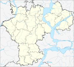
Maina (Ulyanovsk)
| Urban-type settlement
Maina
Майна
|
||||||||||||||||||||||||||||||
|
||||||||||||||||||||||||||||||
|
||||||||||||||||||||||||||||||
Maina ( Russian Ма́йна ) is an urban-type settlement in the Ulyanovsk Oblast in Russia with 7,109 inhabitants (as of October 14, 2010).
geography
The place is a good 50 km as the crow flies west-southwest of the Ulyanovsk Oblast Administrative Center on the Volga Plateau . It is located not far from the source of the Maina, a right tributary of the Sura tributary Barysch .
Maina is the administrative center of the Rajons Mainski and seat of the municipality Mainskoje gorodskoje posselenije, to which also belong within up to 13 km lying villages Abramowka, Aksakovo, Beryozovka Bolshoye Scherebjatnikowo, Kadykowka, Karzowka, Komarovka, Repjowka Kolchosnaja, Tamby and Wjasowka.
history
The place was created in 1898 during the construction of the Insa - Simbirsk railway line as a settlement around a station named after the river.
In 1924 Maina became the administrative seat of a Wolost , in 1930 a newly created Rajons named after him. In 1957 the place received the status of an urban-type settlement.
Population development
| year | Residents |
|---|---|
| 1939 | 3158 |
| 1959 | 5127 |
| 1970 | 6701 |
| 1979 | 6924 |
| 1989 | 8216 |
| 2002 | 7974 |
| 2010 | 7109 |
Note: census data
traffic
Maina has a train station at kilometer 835 of the railway line ( Moscow -) Insa - Ulyanovsk, opened in 1898 .
The regional road 73K-1429 runs through the settlement, coming from Zilna via Bolshoye Nagatkino , a good 20 km north of Maina near Tagai, crossing the federal trunk road R178 Saransk - Ulyanovsk and continuing south to the 73K-1427 towards Kusowatowo .
Sons and daughters of the place
- Yuri Afanassjew (1934–2015), historian and politician
Web links
Individual evidence
- ↑ a b Itogi Vserossijskoj perepisi naselenija 2010 goda. Tom 1. Čislennostʹ i razmeščenie naselenija (Results of the All-Russian Census 2010. Volume 1. Number and distribution of the population). Tables 5 , pp. 12-209; 11 , pp. 312–979 (download from the website of the Federal Service for State Statistics of the Russian Federation)

