Novaya Malykla
| Village
Novaya Malykla
Новая Малыкла
|
||||||||||||||||||||||||||||||
|
||||||||||||||||||||||||||||||
|
||||||||||||||||||||||||||||||
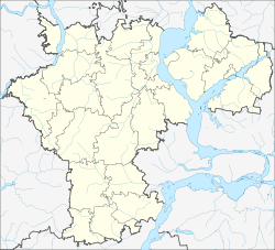
Nowaja Malykla ( Russian Но́вая Малыкла́ ) is a village (selo) in the Ulyanovsk Oblast in Russia with 3273 inhabitants (as of October 14, 2010).
geography
The place is 100 km as the crow flies east of the Ulyanovsk Oblast Administrative Center and 20 km east of the city of Dimitrovgrad . It is about 10 km away from the left bank of the river Big Cheremshan (Bolshoi Cheremshan) , which flows below Dimitrovgrad from the left into the Kuibyshev reservoir of the Volga .
Novaya Malykla is the administrative center of the Rajons Nowomalyklinski and seat of the rural community Nowomalyklinskoje selskoje posselenije, (km 12 to the southeast) which also includes the three villages Alexandrovka, Etschkajun (15 km ESE) and Staraya Kulikowka (4 km northeast) and the seven settlements (possjolok) Amirowka (15 km east-south-east), Batkak (15 km south-east), Gimranowka (13 km south-east), Nizhnyaya Tjugalbuga (17 km east), Novy Santimir (16 km east-south-east), Stanzija Jakuschka (10 km east) and at the train station (rasjesd) Amirowka (15 km east, no permanent residents) belong.
The ethnic composition of the population of the Rajon and its administrative seat is mixed: almost a third each are Russians and Tartars , almost a fifth each are Mordvins and Chuvashes .
history
The village was founded in 1744 by resettlers from the 7 km northwestern village of Malykla, whose name is derived from the Tatar name of the river there, Russified today as Malykolka. The name of the new village means "New Malykla", while the original one has since been called Staraya Malykla ("Old Malykla"). From 1780 both villages belonged to the Ujesd Stavropol (today Tolyatti ) as part of the Simbirsk governorate (today Ulyanovsk ), from 1796 of the Simbirsk governorate . In 1851 the Ujesd was given to the newly formed Samara Governorate . Novaya Malykla became the seat of a Volost in the 19th century , which came to the newly formed Ujesd Melekess (today Dimitrovgrad ) on April 16, 1919 .
In 1935 the village became the administrative seat of a Rajons named after him. On February 1, 1963, the Rajon was temporarily dissolved and its territory was annexed to the neighboring Melekesski rajon; but on January 12, 1965, he was expelled again.
Population development
| year | Residents |
|---|---|
| 1897 | 1996 |
| 1939 | 2136 |
| 1959 | 1933 |
| 1970 | 2370 |
| 1979 | 2908 |
| 1989 | 3230 |
| 2002 | 3321 |
| 2010 | 3273 |
Note: census data
traffic
Novaya Malykla is connected via the regional road 73K-1436 to the 73R-158 (formerly part of the federal trunk road R158 ), which runs 7 km to the southwest, and the Ulyanovsk via Dimitrovgrad - on the territory of the neighboring Samara Oblast as 36R-170 - with the federal trunk road M5 Urals connects Tolyatti and Samara . From the village to the northeast, the 73-227N-010 leads to 9 km from 73K-240 north to the border of the Republic of Tatarstan runs, then continue as 16K-0191 over Basarnyje Mataki after Alexejewskoje .
In the station is Malykla to railway Insa Ulyanovsk - - Chishmy (- Ufa ; kilometer in 1007, counting from Moscow ).
Web links
Individual evidence
- ↑ a b Itogi Vserossijskoj perepisi naselenija 2010 goda. Tom 1. Čislennostʹ i razmeščenie naselenija (Results of the All-Russian Census 2010. Volume 1. Number and distribution of the population). Tables 5 , pp. 12-209; 11 , pp. 312–979 (download from the website of the Federal Service for State Statistics of the Russian Federation)


