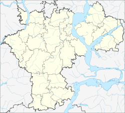
Staraya Kulatka
| Urban-type settlement
Staraja Kulatka
Старая Кулатка
|
||||||||||||||||||||||||||||||||
|
||||||||||||||||||||||||||||||||
|
||||||||||||||||||||||||||||||||
Staraja Kulatka ( Russian Ста́рая Кула́тка ) is an urban-type settlement in the Ulyanovsk Oblast in Russia with 5685 inhabitants (as of October 14, 2010).
geography
The place is about 180 km as the crow flies south-southwest of the Ulyanovsk Oblast Administrative Center on the Kulatka, a right tributary of the right Volga tributary Tereschka .
Staraya Kulatka is the administrative center of Starokulatkinski Rajon and the seat of the municipality of Starokulatnenskoje gorodskoje posselenije, which also includes the villages of Bakehievka (10 km east-southeast), Novaya Jandowka (4 km north-west), Novaya Kulatka (9 km south-west), Novyje Zimnitsy (7 km south-west) , Staraja Jandowka (12 km northwest), Tschuwaschskaja Kulatka (8 km southeast) and Ust-Kulatka (16 km southeast) and the hamlet of Kolzowka (14 km southeast) belong.
history
The place was founded at the beginning of the 18th century by Tatars - who still make up the majority of the population in the municipality and in the Rajon - and was initially only called Kulatka (from Tatar Кулаткы, Qulatqı ). As a result he belonged to the Ujesd Chwalynsk of the Saratov Governorate and became the seat of a Volost . With the emergence of the village Nowaja Kulatka ("New Kulatka") the place received its current name ("Old Kulatka").
In 1928 Staraja Kulatka became the administrative seat of a newly created Rajons named after him. In 1968 the place received the status of an urban-type settlement.
Population development
| year | Residents |
|---|---|
| 1897 | 5212 |
| 1939 | 4679 |
| 1959 | 4350 |
| 1970 | 5193 |
| 1979 | 5494 |
| 1989 | 5925 |
| 2002 | 6075 |
| 2010 | 5685 |
Note: census data
traffic
Staraya Kulatka is located on the regional road 73K-1427, which branches off south of Ulyanovsk from the Syzran - Ulyanovsk branch of the M5 federal trunk road, passing through the district centers of Kuzovatovo , Novospasskoye (on the M5 main route) and Radishchevo , continuing to the border with Saratov Oblast , there in the direction of the federal trunk road R228 Syzran - Saratov - Volgograd near Chwalynsk, about 35 km away . In a westerly direction in Staraya Kulatka the 73K-1439 branches off to the neighboring Rajon center Pavlovka .
On the road to Chwalynsk, 20 km southeast in Popovka on the Syzran - Saratov - Volgograd route, the nearest train station is located.
Web links
Individual evidence
- ↑ a b Itogi Vserossijskoj perepisi naselenija 2010 goda. Tom 1. Čislennostʹ i razmeščenie naselenija (Results of the All-Russian Census 2010. Volume 1. Number and distribution of the population). Tables 5 , pp. 12-209; 11 , pp. 312–979 (download from the website of the Federal Service for State Statistics of the Russian Federation)


