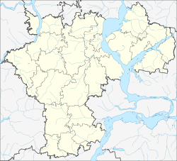
Surskoye
| Urban-type settlement
Surskoje
Сурское
|
||||||||||||||||||||||||||||||||
|
||||||||||||||||||||||||||||||||
|
||||||||||||||||||||||||||||||||
Surskoje ( Russian Су́рское ) is an urban-type settlement in the Ulyanovsk Oblast in Russia with 6,852 inhabitants (as of October 14, 2010).
geography
The place is about 110 km as the crow flies west of the Ulyanovsk Oblast Administrative Center not far from the border with the republics of Mordovia and Chuvashia . It is located on the left bank of the Volga tributary Sura , at the confluence of the Promsa.
Surskoye is the administrative center of Sursky Rajon and the seat of the municipality of Surskoye gorodskoje posselenije, which also includes the villages of Aknejewo (11 km west-southwest), Guljushevo (11 km south-west), Kirsyat (8 km south), Polyanki (7 km north-northeast), Studeni (7 km north-northeast) km northwest) and Tschernjonowo (4 km south) and the settlement Centralnya ussadba sowchosa "Surski" (7 km south, "the central branch of the state farm Surski include").
history
The place was founded in 1552 as a fortification in preparation for the campaign of Tsarist Russia under Ivan IV against the Kazan Khanate . At first it was named Promsa after the river that flows into the Sura, later Promsino Gorodishche, shortened to Promsino in the beginning of the 20th century .
In 1930 Promsino became the administrative seat of a newly created Rajons named after the Sura River; In 1931 the place was given its current name. Surskoye has had the status of an urban-type settlement since 1944.
Population development
| year | Residents |
|---|---|
| 1897 | 4373 |
| 1939 | 5978 |
| 1959 | 7484 |
| 1970 | 7427 |
| 1979 | 7455 |
| 1989 | 7716 |
| 2002 | 7389 |
| 2010 | 6852 |
Note: census data
traffic
The federal trunk road R178 runs south of Surskoye from the Mordovian capital Saransk to Ulyanovsk. In an initially north-westerly direction, the regional road 73R-231 branches off to the border of the Chuvash republic, from there as 97K-001 past Alatyr and Shumerlja to the republic capital Cheboksary .
In Alatyr, about 40 km away, there is also the closest train station on the Rusajewka - Kanasch route .
Sons and daughters of the place
- Juri Silantjew (1919–1983), conductor and composer
Web links
Individual evidence
- ↑ a b Itogi Vserossijskoj perepisi naselenija 2010 goda. Tom 1. Čislennostʹ i razmeščenie naselenija (Results of the All-Russian Census 2010. Volume 1. Number and distribution of the population). Tables 5 , pp. 12-209; 11 , pp. 312–979 (download from the website of the Federal Service for State Statistics of the Russian Federation)

