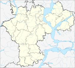
Nikolayevka (Ulyanovsk)
| Urban-type settlement
Nikolaevka
Николаевка
|
||||||||||||||||||||||||||||||
|
||||||||||||||||||||||||||||||
|
||||||||||||||||||||||||||||||
Nikolajewka ( Russian Никола́евка ) is an urban-type settlement in the Ulyanovsk Oblast in Russia with 6389 inhabitants (as of October 14, 2010).
geography
The place is about 150 km as the crow flies southwest of the Ulyanovsk Oblast Administrative Center on the Kanadeika, a right tributary of the right Volga tributary Sysranka .
Nikolayevka is the administrative center of Nikolajewski Rajons as well as the seat of the municipality Nikolajewskoje gorodskoje posselenije, to which the villages Bajewka (5 km southeast), Fyodorowka (2 km north), Jelschanka (7 km east), Novaya Petrowka (3 km west), Ponika ( 8 km northwest) and Woldatschi (2 km east) as well as the settlements Belokamenka (9 km southeast), Lugowoi (8 km east) and Nowy (11 km east) belong.
history
The place was founded on the left of the Kanadeika at the beginning of the 19th century by the landowner Nikolai Nassakin and named after his first name. He belonged to the Ujesd Syzran of the Simbirsk Governorate . After passing leadership of the railway Ryazhsk - Sysran in the 1870s and the opening of a station at the near right of Kanadeika village Kljutschiki grew Nikolaevka along with this.
On July 16, 1928, Nikolayevka became the administrative seat of a newly created Rajons named after him. In 1966 the place received the status of an urban-type settlement.
Population development
| year | Residents |
|---|---|
| 1859 | 325 |
| 1897 | 768 |
| 1939 | 1307 |
| 1959 | 3880 |
| 1970 | 4590 |
| 1979 | 5438 |
| 1989 | 6434 |
| 2002 | 6476 |
| 2010 | 6389 |
Note: census data
traffic
In Nikolayevka, the Klyuchiki station is located at kilometer 875 of the railway line ( Moscow -) Ryashsk - Penza - Syzran, which opened on this section in 1874 and has been electrified since 1964 . A narrow - gauge railway, primarily used for forestry purposes, from Klyuchiki to the village of Slavkino , just under 20 km to the south, was converted to broad gauge in the 1970s and closed around the year 2000.
The federal highway M5 Moscow - Samara - Chelyabinsk passes on the southern edge of the settlement . This is crossed in Nikolajewka by the regional road 73K-1434, which leads in a southerly direction via the neighboring Rajonzentrum Pavlovka to the border of the Saratov Oblast (from there towards Wolsk ), to the north towards Barysch .
Web links
Individual evidence
- ↑ a b Itogi Vserossijskoj perepisi naselenija 2010 goda. Tom 1. Čislennostʹ i razmeščenie naselenija (Results of the All-Russian Census 2010. Volume 1. Number and distribution of the population). Tables 5 , pp. 12-209; 11 , pp. 312–979 (download from the website of the Federal Service for State Statistics of the Russian Federation)


