Loučka (Nový Jičín)
| Loučka | ||||
|---|---|---|---|---|
|
||||
| Basic data | ||||
| State : |
|
|||
| Region : | Moravskoslezský kraj | |||
| District : | Nový Jičín | |||
| Municipality : | Nový Jičín | |||
| Area : | 654 ha | |||
| Geographic location : | 49 ° 35 ' N , 17 ° 59' E | |||
| Height: | 290 m nm | |||
| Residents : | 3,411 (2011) | |||
| Postal code : | 741 01 | |||
| License plate : | T | |||
| traffic | ||||
| Street: | Starý Jičín - Nový Jičín | |||
| administration | ||||
| Website : | www.louckanj.cz | |||
Loučka (German Ehrenberg ) is a district of the city of Nový Jičín in the Czech Republic . It connects immediately to the west of Nový Jičín and belongs to the Okres Nový Jičín .
geography
Loučka extends at the eastern foot of the Starojický kopec ( castle hill , 496 m nm) with the Starý Jičín castle ruins on both sides of the Grasmanka brook in Kuhländchen . In the lower part of the village the Baranec brook flows into the Grasmanka. State road I / 48 bypasses the village to the west and north . In the north rise the Kaní hůra (320 m nm), the Panský kopec (358 m nm) and the Salaš (364 m nm), to the east the Skalka ( Steinberg , 365 m nm), in the south the Svinec ( Schwinz , 546 m) nm) and west of the Starojický kopec.
Neighboring towns are Pod Salašem and Šenov u Nového Jičína in the north, Novy Jicin and Horní Předměstí the east, Bludovice , Čertův Mlyn and Hodslavice in the southeast, Kojetín in the south, Jičina , Žlabec and Stary Jicin in the southwest, Vlčnov and Hůrka in the west and Bernartice nad Odrou and Lesní Mlýn in the northwest.
history
The village was laid out as a typical Waldhufendorf around 1323 during the state development. Luczca was first mentioned in a document in 1374 as part of the Titschein rule . At that time the owners were the Lords of Krawarn . Later followed u. a. the lords of Boskowitz , from 1500 the lords of Zierotin , after the battle of the White Mountain the barons Hofmann von Grünbüchel, from 1706 the barons Zeno zum Danhaus and from 1772 the imperial counts von Seilern and Aspang .
At the beginning of the 16th century, the settlers in Luczka all had Czech names. German settlers moved in between the end of the 16th century and the second third of the 17th century. The name Ehrenberg came into being at this time . In 1676 the village was about half inhabited by Germans and Czechs. Since the end of the 17th century the place was again mostly inhabited by Czechs. The oldest local seal dates from the 17th century, it shows a sheaf, and on its sides a six and a ploughshare. In 1715, Anton von Zeno zum Danhaus on the border with the Neu Titschein rulership, thanked him for the liberation of his dominion from a violent outbreak of the plague. Set up statues consecrated to Sebastian and Rochus. In 1775 the place consisted of 55 houses and had 665 inhabitants. After school lessons had previously been held in the Bailiwick, the village received a schoolhouse in 1793.
In 1835 the village of Ehrenberg or Laučka , located in the Prerau district on the Kaiserstraße leading from Mährisch Weißkirchen to Galicia , consisted of 86 houses in which 645 people lived. The village was multilingual. The main source of income was agriculture. There was a trivial school and two inns in the village. The parish was Alt Titschein . Up until the middle of the 19th century, Ehrenberg remained subject to the Alt Titschein rule.
After the abolition of patrimonial Loučka / Ehrenberg formed a community in the judicial district of Neutitschein from 1849 . From 1869 Loučka belonged to the Neutitschein district. At that time the village had 628 inhabitants and consisted of 88 houses. In the same year the Pocheta brewery was founded . With the beginning of the industrialization of Neutitschein, some of the residents earned their living by working in the factories. In the 1890s Loučka became a meeting place for the Neutitscheiner Czechs and students from the area. From 1890 to 1894, the Czech library for Neutitschein with 200 volumes, founded by Česká beseda, was located in Loučka. In 1893 an ethnographic exhibition took place in the community, which, despite a ban by the district captain, ended with a Czech folk festival. In 1900 808 people lived in Loučka, in 1910 there were 985. In 1905 Friedrich Deym von Střítež acquired the Starý Jičín manor. In 1930 Loučka consisted of 121 houses and had 934 inhabitants. After the Munich Agreement , the Moravian-speaking village was added to the German Reich in 1938 and belonged to the Neu Titschein district until 1945 . In 1939, 948 people lived in Ehrenberg . During this time, the city of Neu Titschein sought to incorporate Ehrenberg. However, this failed because of the resistance of the municipality, which in 1940 became part of the network of six municipalities administered by the city of Neu Titschein. After the end of the Second World War, the community came back to Czechoslovakia . In 1950 the community had 703 inhabitants and consisted of 172 houses. After long resistance from the farmers to collectivization, the JZD Loučka was founded in 1957 . In the second half of the 20th century a change from a rural village to a suburban settlement began; the development was compacted. The church was consecrated in 1968. At the beginning of 1975 Loučka was incorporated into Nový Jičín . After the incorporation, a residential block settlement was built in 1977 in the lower part of the village on former agricultural land, which was originally designed for the builders and employees of the Blahutovice nuclear power plant and was also to receive a hospital, cultural center and supply facilities. Between 1980 and 1991 the population shot up from 647 to 2438, the number of houses grew from 158 to 204. After the power plant plans were discarded after the Velvet Revolution, the construction of the prefabricated housing estate was completed in the early 1990s. At the 2001 census, there were 3694 people in Loučka’s 246 houses. In June 2009 , a flash flood from the Grasmanka inundated the village, causing severe damage.
Local division
Loučka consists of the basic settlement units Bocheta, Hrabí, Loučka, Sídliště Loučka and Za císařskou.
The district Loučka forms the cadastral district Loučka u Nového Jičína .
Attractions
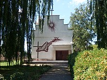
- Church of St. Agnes von Böhmen, built in 1968. It served as an archive until 1990 and was then given its actual purpose.
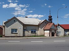
- chapel
- Starý Jičín castle ruins
- Svinec, the mountain offers a wide view of the Oder valley and the Vorbeskidenhügelland. In the southern part of the district there is a ski slope at the foot of Chata Svinec .
literature
- Historický lexikon obcí České republiky 1869–2005 , part 1, p. 724
Web links
Individual evidence
- ↑ http://www.uir.cz/katastralni-uzemi/687006/Loucka-u-Noveho-Jicina
- ^ Gregor Wolny : The Margraviate of Moravia, presented topographically, statistically and historically . Volume I: Prerauer Kreis, Brno 1835, p. 42
- ↑ http://www.uir.cz/zsj-casti-obce/087009/Cast-obce-Loucka
- ↑ http://www.uir.cz/zsj-casti-obce/087009/Cast-obce-Loucka


