Maltignano
| Maltignano | ||
|---|---|---|

|
|
|
| Country | Italy | |
| region | Brands | |
| province | Ascoli Piceno (AP) | |
| Coordinates | 42 ° 50 ′ N , 13 ° 41 ′ E | |
| height | 307 m slm | |
| surface | 8.16 km² | |
| Residents | 2,296 (Dec. 31, 2019) | |
| Population density | 281 inhabitants / km² | |
| Post Code | 63085 | |
| prefix | 0736 | |
| ISTAT number | 044027 | |
| Popular name | Maltignanesi | |
| Patron saint | Cristanziano | |
| Website | Maltignano | |
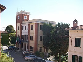
 Maltignano - The town hall |
||
Maltignano is an Italian commune ( comune ) with 2296 inhabitants (as of December 31, 2019) in the province of Ascoli Piceno in Marche . The municipality is located about 8.5 kilometers west-southwest of Ascoli Piceno and borders directly on the province of Teramo . Maltignano is bordered to the north by the Tronto .
history
The name of the community first appeared at the time of Charlemagne .
traffic
The Raccordo autostradale 11 runs through the municipality from Ascoli Piceno to the Adriatic coast. The Maltignano train station is in the municipality of Ascoli Piceno on the railway line from Ascoli Piceno to San Benedetto del Tronto .
Web links
Commons : Maltignano - Collection of images, videos and audio files
Individual evidence
- ↑ Statistiche demografiche ISTAT. Monthly population statistics of the Istituto Nazionale di Statistica , as of December 31 of 2019.

