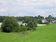
Marscheider Bach
| Marscheider Bach | ||
|
Roots washed around in the Marscheider Bach |
||
| Data | ||
| Water code | DE : 2736394 | |
| location | Wuppertal , North Rhine-Westphalia , Germany | |
| River system | Rhine | |
| Drain over | Wupper → Rhine → North Sea | |
| source | Near Remscheid - Lüttringhausen 51 ° 12 '38 " N , 7 ° 14" 46 " E |
|
| Source height | 308 m above sea level NN | |
| muzzle | At Wuppertal - Laaken in the Wupper coordinates: 51 ° 15 ′ 16 ″ N , 7 ° 15 ′ 15 ″ E 51 ° 15 ′ 16 ″ N , 7 ° 15 ′ 15 ″ E |
|
| Mouth height | 174 m above sea level NN | |
| Height difference | 134 m | |
| Bottom slope | 22 ‰ | |
| length | 6.1 km | |
| Catchment area | 6.718 km² | |
| Big cities | Remscheid , Wuppertal | |
|
Tributaries and hydraulic structures
|
||||||||||||||||||||||||||||||||||||||||||||||||||||||||||||||||||||||||||||||||||||||||||||||||||||||||||||||||||||||||||||||||||||||||||||||||
The Marscheider Bach is a left tributary of the Wupper in the east of the North Rhine-Westphalian city of Wuppertal .
Location and topography
The Marscheider Bach rises in the Garschager Heide at 309 meters above sea level. NN east of the Remscheid district of Lüttringhausen on the Wuppertal-Oberbarmen-Solingen railway line . In its upper reaches, it crosses under the Federal Highway 1 and passes the city limits to Wuppertal . The stream then flows through the Marscheider Forest or Herbringhauser Forest in a deep notch valley . In the course it feeds a few smaller fish ponds and flows into Laaken at 175 meters above sea level. NN at the level of the Kemna concentration camp memorial in the Wupper. West of the stream are the localities Have Berg , Linde , Kleinbeek , small and Großsporkert and on the Marscheider mountain of Weiler Marscheid , in the east elevation of Paul Berg places Herbringhausen and Wefelpütt .
history
Like almost all longer brooks in the Wupperviereck , water power on the Marscheider Bach has been used for several water engines since the late Middle Ages . From the source to the mouth of the were Luckhauser grinding cotta that Have Berger mill , miller Walkmühle , Dienes the hammer and the hammer moth (also Laaker hammer called). The latter was first mentioned in a document in 1800 as the “Oberster Motte-Hammer”. In 1828 one reads in old files about the "Wittib Motten-Hammer". On January 1, 1899, Franz Carl Diederichs leased the hammer and bought it two years later.
Only the buildings of the Luckhauser Kotten, the Hastberger Mühle and the residential building of the Diederichshammer are still preserved from these facilities.
Both the Barmer and the Elberfeld line of the Bergische Landwehr crossed the Marscheider Bach.
natural reserve
Two designated nature reserves cover almost the entire course of the stream. The Oberlauf Marscheider Bachtal and Marscheider Bachtal nature reserves together cover an area of 65 hectares. Protection took place
- to maintain the near-natural low mountain range and meadow stream,
- to maintain the biotope network function and to ensure the functionality of the natural balance of the brook ecosystem in the entire course of the Marscheider Bach and to avoid impairment of the biotope structures in the middle and lower reaches, which are worthy of protection,
- to preserve and secure the flowing water as a habitat for the flowing water fauna and flora, to ensure the continuity, dynamism, water quality and structural richness of the flowing water,
- to maintain, restore and secure the communities that are tied to the flowing water system of the upper reaches of the Marscheider Bach, especially the source areas and source depths,
- to maintain the grassland areas that accompany the stream a. wet and humid grasslands, hay meadows and fallow grassland,
- for the preservation of the river fauna and flora, the reed beds and high forebear meadows as well as the Großseggen- and Kammseggenriedes,
- for the maintenance and development of the valley-side habitats for aquatic and terrestrial communities,
- for the conservation of endangered animal species and their habitats, in particular bullhead , brook lamprey , kingfisher and red backed killer ,
- to maintain and restore the near-natural, indigenous, deciduous forest stands accompanying the valley, in particular the alder forests accompanying the stream, the oak-hornbeam and the beech forests on the valley slopes,
- because of the ecologically valuable wetlands ,
- because of the natural stream,
- for the conservation of near-natural oak and hornbeam stocks,
- to preserve the alder - swamp forests ,
- because of the well-educated plant society,
- because of its importance for butterflies , amphibians , ground beetles , reptiles and cave breeders ,
- for conservation especially for conservation as amphibian spawning grounds ,
- because of the special character and beauty of the area,
- because of the high structural diversity.
See also
literature
- Günther Schmidt; Hammer and Kotten research in Remscheid , Volume 5: from Blombach to Eschbach ; Publisher: Buchhandlung R. Schmitz; Remscheid; 2006; ISBN 3-9800077-6-6
- Hans Kadereit : Where there is still celebrations, reels and delights , a historical illustrated book Lüttringhausen, RGA-Buchverlag, 2009, ISBN 978-3-940491-07-7
Web links
- Nature reserve "Marscheider Bach" (RS-007) in the specialist information system of the State Office for Nature, Environment and Consumer Protection North Rhine-Westphalia (upper reaches)
- Nature reserve "Marscheider Bach" (W-005) in the specialist information system of the State Office for Nature, Environment and Consumer Protection of North Rhine-Westphalia (middle and lower reaches)
- Entry in the Wuppertal soil monument list (Kottenhammer)
- Entry in the Wuppertal monument list (Mottenhammer)
Individual evidence
- ↑ a b German basic map 1: 5000
- ↑ a b river basin geographic information system of Wupperverbandes

